close
-
Layers w
- Weather Layers
- Pro
- Pro
- Pro
- Pro
- Pro
- Pro
- More Layers
- Pro
- Pro
- Pro
- Pro
-
Upgrade to

3D
Trail Conditions
- Unknown
- Snow Groomed
- Snow Packed
- Snow Covered
- Snow Cover Partial
- Freeze/thaw Cycle
- Icy
- Prevalent Mud
- Wet
- Variable
- Ideal
- Dry
- Very Dry
Trail Flow (Ridden Direction)
Trailforks scans users ridelogs to determine the most popular direction each trail is ridden. A good flowing trail network will have most trails flowing in a single direction according to their intension.
The colour categories are based on what percentage of riders are riding a trail in its intended direction.
The colour categories are based on what percentage of riders are riding a trail in its intended direction.
- > 96%
- > 90%
- > 80%
- > 70%
- > 50%
- < 50%
- bi-directional trail
- no data
Trail Last Ridden
Trailforks scans ridelogs to determine the last time a trail was ridden.
- < 2 days
- < 1 week
- < 2 weeks
- < 1 month
- < 6 months
- > 6 months
Trail Ridden Direction
The intended direction a trail should be ridden.
- Downhill Only
- Downhill Primary
- Both Directions
- Uphill Primary
- Uphill Only
- One Direction
Contribute Details
Colors indicate trail is missing specified detail.
- Description
- Photos
- Description & Photos
- Videos
Trail Popularity ?
Trailforks scans ridelogs to determine which trails are ridden the most in the last 9 months.
Trails are compared with nearby trails in the same city region with a possible 25 colour shades.
Think of this as a heatmap, more rides = more kinetic energy = warmer colors.
- most popular
- popular
- less popular
- not popular
ATV/ORV/OHV Filter
Max Vehicle Width
inches
US Cell Coverage
Legend

Radar Time
Activity Recordings
Trailforks uses anonymized public activity data.
?
Activity Recordings
Trailforks uses anonymized public activity data.
?
Personal Heatmap
▶
Activity Types
all
/
none
▶
Options
2
Date range
month
–
Winter Trails
Warning
A routing network for winter maps does not exist. Selecting trails using the winter trails layer has been disabled.
Missing Trails
Most Popular
Least Popular
Trails are colored based on popularity. The more popular a trail is, the more red. Less popular trails trend towards green.
Jump Magnitude Heatmap
Heatmap of where riders jump on trails. Zoom in to see individual jumps, click circles to view jump details.
BC Backroad Status
![map legend]()
Service Road Atlas is a free to use, community-driven service for viewing and creating reports on the numerous back-country service roads around B.C. and Alberta.

Slope Aspect
Direction the slope faces
Trails Deemphasized
Trails are shown in grey.
Only show trails with no bike usage.
Suggested Layers
Based on selected activity type
Save the current map location and zoom level as your default home location whenever this page is loaded.
SaveThis region is Unsanctioned, Ride at your own Risk!
Logging over the last few years has affected some trails. Be sure to look before you leap and watch for operation signage.
This was the first major area for mountain biking dating back to early MTB specific trails being built around 1990. It was an area started by trials motorbikes but it was the mountain bikers that expanded the network higher and higher into the hills. By 1997, there was singletrack all the way from the Forbidden Plateau ski resort, now closed due to the collapse of the lodge roof thanks to the excessive snow of ?1998/1999? season. The remains of the lodge were later torched by vandals.
Nowadays, the network of trails have exploded and there is something for everyone Shuttles are easily accessed by Forbidden Plateau Rd. with people parking recovery vehicle below at the popular Nymph Falls Regional Park, which is an excellent place for a dip during the summer. Those wanting to ride up usually park upstream from Nymph Falls accessed on the other side of the Puntledge River via Colake Logging Main(watch for big trucks and park at the Comox Lake Dam, at the mouth of the Puntledge River. From here, most ride east on Colake Main to Boston Main(also known as Branch 21 by locals).
More trail info and maps, visit www.cvmtb.com or any of the Valley bike shops.
This was the first major area for mountain biking dating back to early MTB specific trails being built around 1990. It was an area started by trials motorbikes but it was the mountain bikers that expanded the network higher and higher into the hills. By 1997, there was singletrack all the way from the Forbidden Plateau ski resort, now closed due to the collapse of the lodge roof thanks to the excessive snow of ?1998/1999? season. The remains of the lodge were later torched by vandals.
Nowadays, the network of trails have exploded and there is something for everyone Shuttles are easily accessed by Forbidden Plateau Rd. with people parking recovery vehicle below at the popular Nymph Falls Regional Park, which is an excellent place for a dip during the summer. Those wanting to ride up usually park upstream from Nymph Falls accessed on the other side of the Puntledge River via Colake Logging Main(watch for big trucks
More trail info and maps, visit www.cvmtb.com or any of the Valley bike shops.
Primary Trail Type: All-Mountain & Downhill
Shuttleable: YES
 google parking directions
 Access Info:
Comox Lake Dam (if riding up) or Nymph Falls parking lot (shuttlers typically)
Links
Activities Click to view
- Mountain Bike
100 trails
- E-Bike
97 trails
- Hike
91 trails
- Trail Running
91 trails
Region Details
- 16
- 10
- 18
- 50
- 4
Region Status
Caution as of Jun 14, 2026Stats
- Avg Trail Rating
- Trails (view details)
- 100
- Trails Mountain Bike
- 100
- Trails E-Bike
- 97
- Trails Horse
- 1
- Trails Hike
- 91
- Trails Trail Running
- 91
- Trails Dirtbike/Moto
- 2
- Trails ATV/ORV/OHV
- 2
- Trails Backcountry Ski
- 2
- Total Distance
- 55 miles
- Total Descent
- 21,848 ft
- Total Vertical
- 3,148 ft
- Highest Trailhead
- 3,490 ft
- Reports
- 1,012
- Photos
- 365
- Ridden Counter
- 30,668
Popular Forbidden Plateau Mountain Biking Trails
• 65 ★ 3.5 • 2,938 ft • 44 ft • 1,320 •
Moderately popular green difficulty singletrack. This mountain bike primary trail can be used both directions. On average it takes 4 minutes to complete this trail.
• 20 ★ 4.0 • 1 mile • 39 ft • 835 •
Recent logging activities in area. Trails may not be fully rideable. Please ride with caution. Lower Portions of trail have been changed with logging. Track doesn't completely match new trail location. Trail is fully rideable. Roadway...
• 50 ★ 4.0 • 3,278 ft • 14 ft • 821 •
Highly rated moderately popular black diamond difficulty mixed. This mountain bike primary trail can be used downhill only and has a moderate overall physical rating. It features drop and rock face. On average it takes 8 minutes to complete this trail.
• 40 ★ 3.6 • 3,739 ft • 49 ft • 755 •
Trail starts out fast in the clearcut then enters the forest where soon after there is a steep short uphill. The the bulk of the trail is side hilling along the edge of the mountain with a creek below. Nice technical sections with rocks...
• 45 ★ 4.5 • 881 ft • 0 ft • 686 •
Highly rated moderately popular black diamond difficulty singletrack. This mountain bike primary trail can be used downhill only. On average it takes 1 minutes to complete this trail.
• 45 ★ 4.4 • 1,960 ft • 0 ft • 685 •
Moderately popular black diamond difficulty singletrack. This mountain bike primary trail can be used downhill only. On average it takes 4 minutes to complete this trail.
• 60 ★ 2.5 • 1 mile • 86 ft • 625 •
This is a crushed gravel multi use path. It's an excellent option for kids biking as it's primarily flat, with a few gentle grades, and features a winding path under the tree canopy and along the Puntledge River. This trail is signed as...
Forbidden Plateau Mountain Bike Routes
★ 4.0 • 9 miles • 2,086 ft • 7 •
Iron Horse Monkey Connector Cabin Fever
★ 4.0 • 6 miles • 1,339 ft • 9 • Loop •
biking is fun. I like biking. but I don't understand why I need to write a description for a route I do...
7 miles • 1,393 ft • 5 •
Fun intro pedal lap on Forbidden with a little bit of everything
★ 2.0 • 8 miles • 1,820 ft • 6 •
Dam, Branch 21,Cabin Fever, Dirty Jane, White Rabbit, Carousel, Dam
3 miles • 815 ft • 17 •
This section of trails leads you to the old cabin, on a route around 4km there and 4km back.
★ 5.0 • 14 miles • 1,978 ft • 20 • Race •
Frontrunners Fit Chiropractic Dodge City X Off-Road Triathlon in Cumberland, BC www.dodgecityx.ca
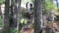
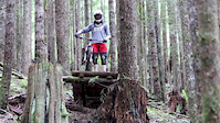
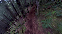
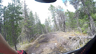
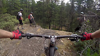
Photos of Forbidden Plateau Mountain Bike
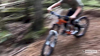
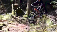
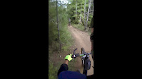
Videos of Forbidden Plateau Mountain Bike
trail: Rudy's Descent
0:09 |
|
Aug 2, 2020
0:46 |
90 |
Apr 17, 2020
0:22 |
45 |
Apr 16, 2020
trail: Cabin Fever
2:30 |
221 |
Aug 19, 2018
0:10 |
1636 |
Aug 18, 2017
0:31 |
656 |
May 12, 2017
trail: Bics
0:34 |
238 |
Aug 2, 2016
trail: Genesis
0:16 |
998 |
Aug 2, 2016
Current Trail Warnings
| status | trail | date | condition | user | info |
|---|---|---|---|---|---|
| Trever's Trail | Jun 6, 2026 @ 7:56pm (America/Vancouver) Jun 6, 2026 | Unknown | sevy7 | Hike Clossed. Logged, mid section gone. |
Recent Trail Reports
| status | trail | date | condition | info | user |
|---|---|---|---|---|---|
| Velvet Thunder | Jun 14, 2026 @ 8:54am (America/Vancouver) Jun 14, 2026 | Very Dry | photogx | ||
| Death Blade | Jun 14, 2026 @ 8:54am (America/Vancouver) Jun 14, 2026 | Very Dry | photogx | ||
| Billy Goat | Jun 14, 2026 @ 8:54am (America/Vancouver) Jun 14, 2026 | Dry | photogx | ||
| Skill Hill Climb | May 31, 2026 @ 11:46am (America/Vancouver) May 31, 2026 | Dry | Bigbird427 | ||
| Slither | May 29, 2026 @ 11:29am (America/Vancouver) May 29, 2026 | Very Dry | lawrybee | ||
| Cabin Fever Access | May 29, 2026 @ 11:29am (America/Vancouver) May 29, 2026 | Prevalent Mud | lawrybee | ||
| Genesis | May 17, 2026 @ 7:15pm (America/Vancouver) May 17, 2026 | Dry | graymanc | ||
| Gecko | May 17, 2026 @ 7:12pm (America/Vancouver) May 17, 2026 | Dry | graymanc | ||
| Upper Refaptory | May 17, 2026 @ 7:11pm (America/Vancouver) May 17, 2026 | Dry | graymanc | ||
| Cabin Fever | May 17, 2026 @ 7:11pm (America/Vancouver) May 17, 2026 | Unknown | graymanc |
Activity Feed
| username | action | type | title | date |
|---|---|---|---|---|
| getouttheretoo | wishlist | trail | activity #97580737 | Jun 22, 2026 @ 12:59pm Jun 22, 2026 |
| Cuezva | wishlist | trail | activity #97577403 | Jun 22, 2026 @ 12:06pm Jun 22, 2026 |
| turdull | ridden | trail | activity #97542297 and 4 more | Jun 21, 2026 @ 9:37pm Jun 21, 2026 |
| rob7KbHWJ | wishlist | region | activity #97515375 | Jun 21, 2026 @ 1:20pm Jun 21, 2026 |
| focorider | wishlist | route | activity #97200522 | Jun 17, 2026 @ 11:53am Jun 17, 2026 |
Recent Comments
| username | type | title | comment | date |
|---|---|---|---|---|
| trail | Nice | Dec 20, 2025 @ 7:15pm Dec 20, 2025 | ||
| trail | First part is a big hike a bike? Mid section... | Sep 23, 2025 @ 2:26pm Sep 23, 2025 | ||
| trail | Tree down about half way | Sep 23, 2025 @ 11:16am Sep 23, 2025 | ||
| report | Wchfztwi I ch g | Sep 11, 2025 @ 11:57am Sep 11, 2025 | ||
| report | AraaaqavW | Sep 5, 2025 @ 3:55pm Sep 5, 2025 |
Nearby Areas
| name | distance | ||||
|---|---|---|---|---|---|
| Nymph Falls Park | 2.3 km | ||||
| The Vortex | 10 | 41 | 8 | 2.9 km | |
| Cumberland Moto | 3.8 km | ||||
| Wildwood Interpretive Forest | 7 | 4.7 km | |||
| Cumberland trail network | 5 | 87 | 47 | 17 | 4.8 km |
Local Badges
-

Completionist0 awarded
Local Trail Supporters
- Ryder
- tsRyder
- CS/JS
- River Rats
Activity Type Stats
| activitytype | trails | distance | descent | descent distance | total vertical | rating | global rank | state rank | photos | reports | routes | ridelogs |
|---|---|---|---|---|---|---|---|---|---|---|---|---|
| Mountain Bike | 100 | 54 miles | 21,847 ft | 34 miles | 2,425 ft | #545 | #57 | 360 | 1,012 | 6 | 12,812 | |
| E-Bike | 97 | 54 miles | 21,847 ft | 34 miles | 2,425 ft | #1,592 | #63 | 1 | 907 | 690 | ||
| Horse | 1 | 442 | 2 | |||||||||
| Hike | 91 | 48 miles | 17,274 ft | 28 miles | 2,425 ft | #2,937 | #130 | 4 | 1,000 | 1 | 1,622 | |
| Trail Running | 91 | 48 miles | 17,274 ft | 28 miles | 2,425 ft | #2,084 | #61 | 1,000 | 1 | 1,824 | ||
| Dirtbike/Moto | 2 | 442 | 125 | |||||||||
| ATV/ORV/OHV | 2 | 442 | 13 | |||||||||
| Backcountry Ski | 2 | 1,726 ft | 226 ft | 88 |
Frequently Asked Questions About Forbidden Plateau
▼
What are the highest rated mountain biking trails in Forbidden Plateau?
The highest rated mountain biking trails in Forbidden Plateau are:
- Dust Witch (4.3/5)
- Upper Refaptory (4.2/5)
- Death Ditch Valley (4.2/5)
- Velvet Thunder (4.2/5)
- Lower Refaptory (4.2/5)
▼
What is the best time of the year to ride in Forbidden Plateau?
Based on ride log data, the most popular months to ride in Forbidden Plateau are:
- July (191 activities)
- August (173 activities)
- September (132 activities)
▼
Where can I park to ride in Forbidden Plateau?
There are 5 parking locations listed in Forbidden Plateau. The most popular parking spots are: View all parking and trailhead locations on the map to plan your visit.
▼
What is the longest trail in Forbidden Plateau?
The longest trail in Forbidden Plateau is Bevan Trail at 3.8 km. View all trails sorted by distance.
Activities
Trails
Points of Interest
- By primodeelux
 & contributors
 - Admins: skifreak, Trailtristan, UROC, benjohnstone, DougalB
- #489 - 58,678 views
- forbidden plateau activity log | embed map of Forbidden Plateau mountain bike trails | forbidden plateau mountain biking points of interest polygons
Downloading of trail gps tracks in kml & gpx formats is disabled for Forbidden Plateau.