close
-
Layers w
- Weather Layers
- Pro
- Pro
- Pro
- Pro
- Pro
- Pro
- More Layers
- Pro
- Pro
- Pro
- Pro
-
Upgrade to

3D
Trail Conditions
- Unknown
- Snow Groomed
- Snow Packed
- Snow Covered
- Snow Cover Partial
- Freeze/thaw Cycle
- Icy
- Prevalent Mud
- Wet
- Variable
- Ideal
- Dry
- Very Dry
Trail Flow (Ridden Direction)
Trailforks scans users ridelogs to determine the most popular direction each trail is ridden. A good flowing trail network will have most trails flowing in a single direction according to their intension.
The colour categories are based on what percentage of riders are riding a trail in its intended direction.
The colour categories are based on what percentage of riders are riding a trail in its intended direction.
- > 96%
- > 90%
- > 80%
- > 70%
- > 50%
- < 50%
- bi-directional trail
- no data
Trail Last Ridden
Trailforks scans ridelogs to determine the last time a trail was ridden.
- < 2 days
- < 1 week
- < 2 weeks
- < 1 month
- < 6 months
- > 6 months
Trail Ridden Direction
The intended direction a trail should be ridden.
- Downhill Only
- Downhill Primary
- Both Directions
- Uphill Primary
- Uphill Only
- One Direction
Contribute Details
Colors indicate trail is missing specified detail.
- Description
- Photos
- Description & Photos
- Videos
Trail Popularity ?
Trailforks scans ridelogs to determine which trails are ridden the most in the last 9 months.
Trails are compared with nearby trails in the same city region with a possible 25 colour shades.
Think of this as a heatmap, more rides = more kinetic energy = warmer colors.
- most popular
- popular
- less popular
- not popular
ATV/ORV/OHV Filter
Max Vehicle Width
inches
US Cell Coverage
Legend

Radar Time
Activity Recordings
Trailforks uses anonymized public activity data.
?
Activity Recordings
Trailforks uses anonymized public activity data.
?
Personal Heatmap
▶
Activity Types
all
/
none
▶
Options
2
Date range
month
–
Winter Trails
Warning
A routing network for winter maps does not exist. Selecting trails using the winter trails layer has been disabled.
Missing Trails
Most Popular
Least Popular
Trails are colored based on popularity. The more popular a trail is, the more red. Less popular trails trend towards green.
Jump Magnitude Heatmap
Heatmap of where riders jump on trails. Zoom in to see individual jumps, click circles to view jump details.
BC Backroad Status
![map legend]()
Service Road Atlas is a free to use, community-driven service for viewing and creating reports on the numerous back-country service roads around B.C. and Alberta.

Slope Aspect
Direction the slope faces
Trails Deemphasized
Trails are shown in grey.
Only show trails with no bike usage.
Suggested Layers
Based on selected activity type
Save the current map location and zoom level as your default home location whenever this page is loaded.
Save
No description for Forcalquier has been added yet!
Login or register to submit one.
This region uses the Uk/Euro style trail grading system.
Activities Click to view
- Mountain Bike
30 trails
- E-Bike
30 trails
- Adaptive Bike
0 trails
- Hike
30 trails
- Trail Running
30 trails
Region Details
- 9
- 1
- 12
- 8
Region Status
Caution as of May 26, 2025Stats
- Avg Trail Rating
- Trails (view details)
- 30
- Trails Mountain Bike
- 30
- Trails E-Bike
- 30
- Trails Hike
- 30
- Trails Trail Running
- 30
- Total Distance
- 14 miles
- Total Descent
- 7,056 ft
- Total Vertical
- 4,021 ft
- Highest Trailhead
- 5,502 ft
- Reports
- 20
- Ridden Counter
- 455
Sub Regions
-
Forcalquier / Montagne de Lure
- 2
- 4
Popular Forcalquier Mountain Biking Trails
• 95 ★ 4.7 • 1 mile • 8 ft • 42 •
Popular red difficulty singletrack. This mountain bike primary trail can be used downhill primary and has a hard overall physical rating. Trail visibility is always easy to follow. On average it takes 11 minutes to complete this trail.
• 100 ★ 5.0 • 2,996 ft • 18 ft • 40 •
Popular red difficulty singletrack. This mountain bike primary trail can be used downhill primary and has a hard overall physical rating. Trail visibility is always easy to follow. On average it takes 4 minutes to complete this trail.
• 90 ★ 5.0 • 2,581 ft • 0 ft • 35 •
Popular red difficulty singletrack. This mountain bike primary trail can be used downhill primary and has a hard overall physical rating. Trail visibility is always easy to follow. On average it takes 6 minutes to complete this trail.
• 85 ★ 0.0 • 2,345 ft • 0 ft • 30 •
Popular blue difficulty singletrack. This mountain bike primary trail can be used both directions and has a moderate overall physical rating. Trail visibility is always easy to follow. On average it takes 3 minutes to complete this trail.
• 50 ★ 0.0 • 3,137 ft • 7 ft • 15 •
Moderately popular green difficulty singletrack. This mountain bike primary trail can be used both directions and has a easy overall physical rating. Trail visibility is always easy to follow. On average it takes 14 minutes to complete this trail.
• 65 ★ 0.0 • 2,365 ft • 0 ft • 14 •
Moderately popular red difficulty singletrack. This mountain bike primary trail. Trail visibility is always easy to follow. On average it takes 2 minutes to complete this trail.
• 70 ★ 0.0 • 2,138 ft • 4 ft • 14 •
Popular red difficulty singletrack. This mountain bike primary trail can be used both directions and has a hard overall physical rating. Trail visibility is always easy to follow. On average it takes 2 minutes to complete this trail.
• 45 ★ 0.0 • 3,836 ft • 55 ft • 12 •
Moderately popular blue difficulty singletrack. This mountain bike primary trail can be used downhill primary and has a moderate overall physical rating. Trail visibility is always easy to follow. On average it takes 16 minutes to complete this trail.
Forcalquier Mountain Bike Routes
5 miles • 60 ft • 3 • Shuttled •
Invitation au plaisir ! Ni trop raide, no trop large, à la fois véloce et joueur, ce parcours descendant...
★ 3.0 • 13 miles • 1,989 ft • 0 • Loop •
Monter au "Clot du Melly" est une habitude pour tout bon VTTiste forcalquiéren. La piste rocailleuse qui...
4 miles • 452 ft • 0 • Loop •
Au départ du coeur de Forcalquier, où se tient le marché du lundi, cette balade vous emmène à la...
31 miles • 4,475 ft • 0 • Loop •
Sur une belle journée, de la place du Bourguet aux contreforts de Lure, pourquoi ne pas s'attaquer au...
3 miles • 405 ft • 0 • Loop •
A Saint-Etienne-les-Orgues, le bois du Défend fait partie des plus beaux massifs boisés. Il foisonne de...
7 miles • 590 ft • 0 • Loop •
Empruntant une partie du circuit vert "la balade des hameaux d'Ongles", cette version bleue plus longue...
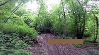
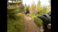
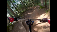
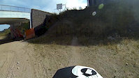
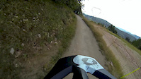
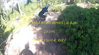
Videos of Forcalquier Mountain Bike
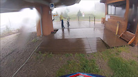
trail: La Cool
4:57 |
193 |
Dec 14, 2014
trail: La Cool
0:48 |
173 |
Jun 4, 2014
trail: La Cool
5:32 |
190 |
Oct 5, 2013
trail: La Cool
5:51 |
199 |
Oct 5, 2013
trail: La Cool
6:32 |
168 |
Oct 4, 2013
trail: La Cool
5:22 |
106 |
Aug 24, 2013
trail: La Cool
3:27 |
151 |
Aug 1, 2013

trail: Villars
6:14 |
95 |
Jan 15, 2013
Recent Trail Reports
| status | trail | date | condition | info | user |
|---|---|---|---|---|---|
| Enduro Lure SP3 | May 26, 2025 @ 11:41am May 26, 2025 | Dry | Alexair06 | ||
| Enduro Lure SP2 | May 26, 2025 @ 11:41am May 26, 2025 | Dry | Alexair06 | ||
| Enduro Lure SP1 | May 26, 2025 @ 11:41am May 26, 2025 | Dry | Alexair06 | ||
| Imbert is alive | Aug 20, 2021 @ 10:02pm Aug 20, 2021 | Dry | DD04 | ||
| Pelissier 534 | Aug 20, 2021 @ 10:02pm Aug 20, 2021 | Dry | DD04 |
National Scenic Trails & Official Routes
-
Grande Traversée VTT Alpes-Provence
- Mountain Bike
- E-Bike
Activity Feed
| username | action | type | title | date |
|---|---|---|---|---|
| Bikepiloot | wishlist | route | activity #96820432 | Jun 12, 2026 @ 12:08pm Jun 12, 2026 |
| Bikepiloot | ridden | route | activity #96819718 | Jun 12, 2026 @ 11:56am Jun 12, 2026 |
| hpman83 | update | trail | activity #84013368 | Nov 12, 2025 @ 4:13am Nov 12, 2025 |
| hpman83 | add | trail | activity #84010979 and 11 more | Nov 12, 2025 @ 2:26am Nov 12, 2025 |
| BaptisteITJs9h | wishlist | route | activity #81469000 | Oct 1, 2025 @ 1:37am Oct 1, 2025 |
Recent Comments
| username | type | title | comment | date |
|---|---|---|---|---|
| trail | A fun, open (a bit wider than singletrack)... | Oct 23, 2024 @ 8:30am Oct 23, 2024 | ||
| trail | My favourite trail in this area, a skinny and... | Oct 23, 2024 @ 8:26am Oct 23, 2024 | ||
| trail | The first third is easy blue singletrack but... | Oct 23, 2024 @ 8:22am Oct 23, 2024 | ||
| trail | A really fun trail. The first 100m or so has a... | Oct 23, 2024 @ 8:17am Oct 23, 2024 | ||
| trail | Tres joli single | Jan 31, 2023 @ 2:06pm Jan 31, 2023 |
Local Badges
-

Epic Ride Climb 2k26 awarded -

Climbing 10k Badge5 awarded -

Climbing 100k Badge0 awarded -

Epic Ride Descent 2k29 awarded -

Descent 10k Badge5 awarded -

Descent 100k Badge0 awarded
Activity Type Stats
| activitytype | trails | distance | descent | descent distance | total vertical | rating | global rank | state rank | photos | reports | routes | ridelogs |
|---|---|---|---|---|---|---|---|---|---|---|---|---|
| Mountain Bike | 30 | 14 miles | 7,057 ft | 12 miles | 4,022 ft | #6,187 | #261 | 20 | 13 | 379 | ||
| E-Bike | 30 | 14 miles | 7,057 ft | 12 miles | 4,022 ft | #4,447 | #269 | 20 | 10 | 95 | ||
| Hike | 30 | 14 miles | 7,057 ft | 12 miles | 4,022 ft | #7,194 | #273 | 20 | 13 | |||
| Trail Running | 30 | 14 miles | 7,057 ft | 12 miles | 4,022 ft | #6,619 | #250 | 20 | 26 |
Frequently Asked Questions About Forcalquier
▼
What are the best places to ride in Forcalquier?
Forcalquier has 2 areas to explore for mountain biking. The top rated areas are:
▼
What are the highest rated mountain biking trails in Forcalquier?
The highest rated mountain biking trails in Forcalquier are:
- Enduro Lure SP3 (4.2/5)
- Enduro Lure SP1 (4.2/5)
- Enduro Lure SP2 (4.2/5)
- Bocanfuzo (0/5)
- La Cara (0/5)
▼
What is the best time of the year to ride in Forcalquier?
Based on ride log data, the most popular months to ride in Forcalquier are:
- October (7 activities)
- February (6 activities)
- September (5 activities)
▼
Where can I park to ride in Forcalquier?
Check the Forcalquier trail map for trailhead and parking information. Community members regularly update access and parking details for trails in the area.
Activities
Trails
Points of Interest
- By tomzaniroli
 TRAILFORKS TFFRANCE & contributors
 - Admins: tomzaniroli, provencemb
- #26139 - 2,048 views
- forcalquier activity log | embed map of Forcalquier mountain bike trails |
Downloading of trail gps tracks in kml & gpx formats is enabled for Forcalquier.
You must login to download files.