close
-
Layers w
- Weather Layers
- Pro
- Pro
- Pro
- Pro
- Pro
- Pro
- More Layers
- Pro
- Pro
- Pro
- Pro
-
Upgrade to

3D
Trail Conditions
- Unknown
- Snow Groomed
- Snow Packed
- Snow Covered
- Snow Cover Partial
- Freeze/thaw Cycle
- Icy
- Prevalent Mud
- Wet
- Variable
- Ideal
- Dry
- Very Dry
Trail Flow (Ridden Direction)
Trailforks scans users ridelogs to determine the most popular direction each trail is ridden. A good flowing trail network will have most trails flowing in a single direction according to their intension.
The colour categories are based on what percentage of riders are riding a trail in its intended direction.
The colour categories are based on what percentage of riders are riding a trail in its intended direction.
- > 96%
- > 90%
- > 80%
- > 70%
- > 50%
- < 50%
- bi-directional trail
- no data
Trail Last Ridden
Trailforks scans ridelogs to determine the last time a trail was ridden.
- < 2 days
- < 1 week
- < 2 weeks
- < 1 month
- < 6 months
- > 6 months
Trail Ridden Direction
The intended direction a trail should be ridden.
- Downhill Only
- Downhill Primary
- Both Directions
- Uphill Primary
- Uphill Only
- One Direction
Contribute Details
Colors indicate trail is missing specified detail.
- Description
- Photos
- Description & Photos
- Videos
Trail Popularity ?
Trailforks scans ridelogs to determine which trails are ridden the most in the last 9 months.
Trails are compared with nearby trails in the same city region with a possible 25 colour shades.
Think of this as a heatmap, more rides = more kinetic energy = warmer colors.
- most popular
- popular
- less popular
- not popular
ATV/ORV/OHV Filter
Max Vehicle Width
inches
US Cell Coverage
Legend

Radar Time
Activity Recordings
Trailforks uses anonymized public activity data.
?
Activity Recordings
Trailforks uses anonymized public activity data.
?
Personal Heatmap
▶
Activity Types
all
/
none
▶
Options
2
Date range
month
–
Winter Trails
Warning
A routing network for winter maps does not exist. Selecting trails using the winter trails layer has been disabled.
Missing Trails
Most Popular
Least Popular
Trails are colored based on popularity. The more popular a trail is, the more red. Less popular trails trend towards green.
Jump Magnitude Heatmap
Heatmap of where riders jump on trails. Zoom in to see individual jumps, click circles to view jump details.
BC Backroad Status
![map legend]()
Service Road Atlas is a free to use, community-driven service for viewing and creating reports on the numerous back-country service roads around B.C. and Alberta.

Slope Aspect
Direction the slope faces
Trails Deemphasized
Trails are shown in grey.
Only show trails with no bike usage.
Suggested Layers
Based on selected activity type
Save the current map location and zoom level as your default home location whenever this page is loaded.
Save
No description for Forest Heights has been added yet!
Login or register to submit one.
 google parking directions
Primary Trail Type: Cross-Country
google parking directions Activities Click to view
- Mountain Bike
38 trails
- Hike
37 trails
- Trail Running
37 trails
Region Details
- 2
- 3
- 3
- 19
- 5
- 2
Region Status
Open as of Jun 12, 2026Stats
- Avg Trail Rating
- Trails (view details)
- 34
- Trails Mountain Bike
- 38
- Trails E-Bike
- 2
- Trails Hike
- 37
- Trails Trail Running
- 37
- Total Distance
- 9 miles
- Total Descent
- 1,302 ft
- Total Vertical
- 167 ft
- Highest Trailhead
- 2,175 ft
- Reports
- 3,599
- Photos
- 159
- Ridden Counter
- 32,371
Popular Forest Heights Mountain Biking Trails
• 100 ★ 4.6 • 2,269 ft • 117 ft • 1,954 •
A nice fast trail from west to east and an endurance challenging one from east to west. Follows Riverside golf course. Watch out for stray golf balls and gophers.
• 100 ★ 4.4 • 1,001 ft • 0 ft • 1,877 •
Flowy single track complete with berms, skinny bridge and boardwalk to make things interesting.
• 100 ★ 4.9 • 1,365 ft • 16 ft • 1,763 •
Satisfaction is guaranteed with this little gem. A slight ascent with a nice descent flowing into from ; compliments the two nicely.
• 90 ★ 4.6 • 4,075 ft • 63 ft • 1,373 •
Old school technical single track. Lots of ups, downs, twists, turns, and roots. Its a trail keeps you on your toes.
• 70 ★ 4.7 • 2,697 ft • 67 ft • 1,289 •
Grab a slice and shred this sweet piece of single track.
• 85 ★ 3.0 • 4,676 ft • 34 ft • 1,196 •
Popular white difficulty paved path. This mountain bike primary trail can be used both directions and has a easy overall physical rating with a 34 ft green climb. On average it takes 6 minutes to complete this trail.
• 95 ★ 5.0 • 420 ft • 24 ft • 1,019 •
Popular blue difficulty singletrack. This mountain bike primary trail can be used both directions and has a moderate overall physical rating with a 24 ft blue climb. Trail visibility is sometimes hard to follow. On average it takes 1 minutes to complete this trail.
• 5 ★ 5.0 • 1,644 ft • 15 ft • 996 •
Less popular blue difficulty singletrack. This mountain bike primary trail can be used both directions and has a hard overall physical rating with a 15 ft blue climb. It features berm and jump. Trail visibility is always easy to follow. On average it takes 2 minutes to complete this trail.
Forest Heights Mountain Bike Routes
5 miles • 316 ft • 4 •
Starting with a fun decent to the river, cross 98 Ave to get to the top of Camel humps, and back across 98...
★ 2.0 • 4 miles • 367 ft • 13 •
Start at Dawson parking lot. Climb Dawson Traverse, up Jasper Ave Traverse-Alt, along Jasper Ave Traverse,...
• 13 miles • 1,177 ft • 32 •
• 13 miles • 946 ft • 26 •
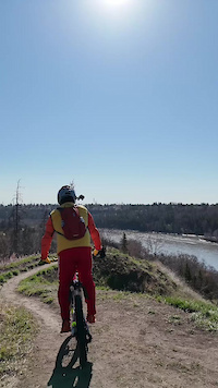
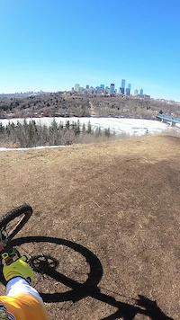
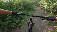
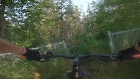
Photos of Forest Heights Mountain Bike
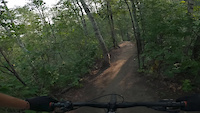
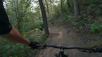
Videos of Forest Heights Mountain Bike
trail: Twist and Shout
0:36 |
13 |
May 3, 2026

trail: Prime Rib
0:34 |
8 |
May 2, 2026
trail: Twist and Shout
0:16 |
19 |
Apr 14, 2025
trail: Happy Ending
0:12 |
28 |
Jul 21, 2024
trail: Happy Ending
0:23 |
10 |
Jul 21, 2024
trail: Caddytrack
0:30 |
40 |
Jul 21, 2024

trail: Caddytrack
0:23 |
9 |
Jul 21, 2024
trail: Forest GJump
0:54 |
54 |
Jul 21, 2024
Recent Trail Reports
| status | trail | date | condition | info | user |
|---|---|---|---|---|---|
| Prime Rib | Jun 12, 2026 @ 3:07pm (America/Edmonton) Jun 12, 2026 | Dry | grapecrushr | ||
| Happy Ending | Jun 12, 2026 @ 3:07pm (America/Edmonton) Jun 12, 2026 | Ideal | grapecrushr | ||
| Caddytrack | Jun 12, 2026 @ 3:07pm (America/Edmonton) Jun 12, 2026 | Ideal | grapecrushr | ||
| Lower Ewok | Jun 12, 2026 @ 3:07pm (America/Edmonton) Jun 12, 2026 | Ideal | grapecrushr | ||
| Shooter McGavin | Jun 11, 2026 @ 6:18pm (America/Edmonton) Jun 11, 2026 | Ideal | Backpocket | ||
| McAloon R.I.P. | Jun 8, 2026 @ 8:34pm (America/Edmonton) Jun 8, 2026 | Ideal | grapecrushr | ||
| The Holy Trail | Jun 8, 2026 @ 8:34pm (America/Edmonton) Jun 8, 2026 | Ideal | grapecrushr | ||
| Ewok Connector | May 22, 2026 @ 1:33pm (America/Edmonton) May 22, 2026 | Dry | mikevanderzee | ||
| Rattlesnake | May 22, 2026 @ 1:33pm (America/Edmonton) May 22, 2026 | Dry | mikevanderzee | ||
| Andre's Trail | May 18, 2026 @ 8:30pm (America/Edmonton) May 18, 2026 | Ideal | grapecrushr |
Activity Feed
| username | action | type | title | date |
|---|---|---|---|---|
| qvncH7 | ridden | trail | activity #97049702 | Jun 15, 2026 @ 10:09am Jun 15, 2026 |
| grapecrushr | add | report | activity #96842697 and 3 more | Jun 12, 2026 @ 6:54pm Jun 12, 2026 |
| Backpocket | add | report | activity #96797299 and 2 more | Jun 12, 2026 @ 5:47am Jun 12, 2026 |
| Backpocket | add | report | activity #96670374 | Jun 10, 2026 @ 7:05am Jun 10, 2026 |
| grapecrushr | add | report | activity #96604041 and 3 more | Jun 9, 2026 @ 7:22am Jun 9, 2026 |
Recent Comments
| username | type | title | comment | date |
|---|---|---|---|---|
| report | Tree down | Jul 11, 2025 @ 4:19pm Jul 11, 2025 | ||
| report | *Ice Flows | Jan 17, 2025 @ 11:08am Jan 17, 2025 | ||
| trail | fun drop in to upper ewok | Jul 21, 2024 @ 1:40pm Jul 21, 2024 | ||
| trail | One of the best trails in Edmonton IMO.... | Oct 21, 2023 @ 1:29pm Oct 21, 2023 | ||
| report | It is an active construction site. not... | Aug 16, 2022 @ 11:01am Aug 16, 2022 |
Nearby Areas
| name | distance | ||||
|---|---|---|---|---|---|
| Kinnaird Park | 3 | 17 | 3 | 0.6 km | |
| Central Edmonton (North) | 4 | 8 | 1.3 km | ||
| Central Edmonton (South) | 11 | 58 | 6 | 1.7 km | |
| Gold Bar/Capilano Park | 5 | 12 | 3 | 1 | 2 km |
| Mill Creek Ravine | 12 | 32 | 14 | 3 | 2.1 km |
Activity Type Stats
| activitytype | trails | distance | descent | descent distance | total vertical | rating | global rank | state rank | photos | reports | routes | ridelogs |
|---|---|---|---|---|---|---|---|---|---|---|---|---|
| Mountain Bike | 38 | 9 miles | 1,302 ft | 4 miles | 167 ft | #319 | #10 | 157 | 3,599 | 4 | 16,962 | |
| E-Bike | 2 | 1,742 ft | 10 ft | 348 ft | 52 ft | 1 | 3,102 | 197 | ||||
| Hike | 37 | 9 miles | 1,302 ft | 4 miles | 167 ft | #9,176 | #81 | 3,599 | 148 | |||
| Trail Running | 37 | 9 miles | 1,302 ft | 4 miles | 167 ft | #5,960 | #63 | 3,599 | 1,703 |
Frequently Asked Questions About Forest Heights
▼
What are the highest rated mountain biking trails in Forest Heights?
The highest rated mountain biking trails in Forest Heights are:
- Happy Ending (4.7/5)
- Andre's Trail (4.5/5)
- Caddytrack (4.5/5)
- Lower Ewok (4.4/5)
- Master Yoda (4.3/5)
▼
What is the best time of the year to ride in Forest Heights?
Based on ride log data, the most popular months to ride in Forest Heights are:
- May (251 activities)
- July (198 activities)
- August (185 activities)
▼
Where can I park to ride in Forest Heights?
There are 2 parking locations listed in Forest Heights. The most popular parking spots are:
▼
What is the longest trail in Forest Heights?
The longest trail in Forest Heights is McNally Access at 4,676 ft. View all trails sorted by distance.
Activities
Trails
Points of Interest
- By pedaljunkie2000 & contributors
- Admins: EMBA, EdmontonMountainBikeAlliance, jdd4, yegmtb1
- #6410 - 12,385 views
- forest heights activity log | embed map of Forest Heights mountain bike trails | forest heights mountain biking points of interest
Downloading of trail gps tracks in kml & gpx formats is enabled for Forest Heights.
You must login to download files.