close
-
Layers w
- Weather Layers
- Pro
- Pro
- Pro
- Pro
- Pro
- Pro
- More Layers
- Pro
- Pro
- Pro
- Pro
-
Upgrade to

3D
Trail Conditions
- Unknown
- Snow Groomed
- Snow Packed
- Snow Covered
- Snow Cover Partial
- Freeze/thaw Cycle
- Icy
- Prevalent Mud
- Wet
- Variable
- Ideal
- Dry
- Very Dry
Trail Flow (Ridden Direction)
Trailforks scans users ridelogs to determine the most popular direction each trail is ridden. A good flowing trail network will have most trails flowing in a single direction according to their intension.
The colour categories are based on what percentage of riders are riding a trail in its intended direction.
The colour categories are based on what percentage of riders are riding a trail in its intended direction.
- > 96%
- > 90%
- > 80%
- > 70%
- > 50%
- < 50%
- bi-directional trail
- no data
Trail Last Ridden
Trailforks scans ridelogs to determine the last time a trail was ridden.
- < 2 days
- < 1 week
- < 2 weeks
- < 1 month
- < 6 months
- > 6 months
Trail Ridden Direction
The intended direction a trail should be ridden.
- Downhill Only
- Downhill Primary
- Both Directions
- Uphill Primary
- Uphill Only
- One Direction
Contribute Details
Colors indicate trail is missing specified detail.
- Description
- Photos
- Description & Photos
- Videos
Trail Popularity ?
Trailforks scans ridelogs to determine which trails are ridden the most in the last 9 months.
Trails are compared with nearby trails in the same city region with a possible 25 colour shades.
Think of this as a heatmap, more rides = more kinetic energy = warmer colors.
- most popular
- popular
- less popular
- not popular
ATV/ORV/OHV Filter
Max Vehicle Width
inches
US Cell Coverage
Legend

Radar Time
Activity Recordings
Trailforks uses anonymized public activity data.
?
Activity Recordings
Trailforks uses anonymized public activity data.
?
Personal Heatmap
▶
Activity Types
all
/
none
▶
Options
2
Date range
month
–
Winter Trails
Warning
A routing network for winter maps does not exist. Selecting trails using the winter trails layer has been disabled.
Missing Trails
Most Popular
Least Popular
Trails are colored based on popularity. The more popular a trail is, the more red. Less popular trails trend towards green.
Jump Magnitude Heatmap
Heatmap of where riders jump on trails. Zoom in to see individual jumps, click circles to view jump details.
BC Backroad Status
![map legend]()
Service Road Atlas is a free to use, community-driven service for viewing and creating reports on the numerous back-country service roads around B.C. and Alberta.

Slope Aspect
Direction the slope faces
Trails Deemphasized
Trails are shown in grey.
Only show trails with no bike usage.
Suggested Layers
Based on selected activity type
Save the current map location and zoom level as your default home location whenever this page is loaded.
Save
No description for Forlì e Cesena has been added yet!
Login or register to submit one.
This region uses the Uk/Euro style trail grading system.
Activities Click to view
- Mountain Bike
474 trails
- E-Bike
442 trails
- Horse
81 trails
- Hike
332 trails
- Trail Running
332 trails
- Dirtbike/Moto
28 trails
Region Details
- 105
- 20
- 109
- 162
- 2
Stats
- Avg Trail Rating
- Trails (view details)
- 433
- Trails Mountain Bike
- 474
- Trails E-Bike
- 442
- Trails Adaptive Bike
- 1
- Trails Winter Fat Bike
- 1
- Trails Horse
- 81
- Trails Hike
- 332
- Trails Trail Running
- 332
- Trails Dirtbike/Moto
- 28
- Trails Snowshoe
- 3
- Total Distance
- 568 miles
- Total Descent
- 200,260 ft
- Total Vertical
- 5,382 ft
- Highest Trailhead
- 5,396 ft
- Reports
- 3,378
- Photos
- 219
- Ridden Counter
- 13,637
Sub Regions
- Alfero (5)
- Bagno di Romagna (46)
- Bertinoro (25)
- Bocconi (4)
- Campigna (18)
- Castrocaro (2)
- Cesena (53)
- Cesenatico (1)
- Civitella Di Romagna (6)
- Forli (14)
- Galeata (95)
- Poggio La Lastra (3)
- Premilcuore (38)
- Quarto (48)
- Ranchio (29)
- Ridracoli (5)
- Roncofreddo (34)
- Sorrivoli Trail Area (14)
- San Benedetto In Alpe (2)
- Santa Sofia (23)
- Tredozio (16)
- Tramazzo (11)
- Lago di Ridracoli (19)
Popular Forlì e Cesena Mountain Biking Trails
• 90 ★ 4.0 • 2 miles • 39 ft • 119 •
Un classico di Premilcuore ,alterna parti scorrevoli a tratti un pò scavati e scassati, variato il percorso nell'estate 2023.
• 95 ★ 4.7 • 2 miles • 112 ft • 106 •
Trail vario con pezzi tecnici e scassati ed ed altri più flow. Un Must di Premilcuore.
• 100 ★ 4.6 • 2 miles • 91 ft • 101 •
Highly rated popular red difficulty singletrack. This mountain bike primary trail can be used downhill only and has a hard overall physical rating. It features rock garden. Trail visibility is always easy to follow. On average it takes 21 minutes to complete this trail.
• 80 ★ 4.8 • 3 miles • 415 ft • 83 •
Popular red difficulty singletrack. This mountain bike primary trail can be used downhill primary and has a hard overall physical rating. It features rock face and rock garden. Trail visibility is always easy to follow. On average it takes 24 minutes to complete this trail.
• 70 ★ 5.0 • 2 miles • 8 ft • 79 •
Trail molto tecnico formato da parte scassate alternata a punti in bosco. Ci sono 2 parti su roccia abbastanza tecniche, può essere pericoloso se bagnato in quanto molto scivoloso. Ci sono alcuni tornanti un pò esposti occorre fare...
• 80 ★ 4.0 • 2 miles • 326 ft • 72 •
Highly rated popular blue difficulty singletrack. This mountain bike primary trail can be used downhill only and has a hard overall physical rating. It features rock face. Trail visibility is always easy to follow. On average it takes 21 minutes to complete this trail.
Forlì e Cesena Mountain Bike Routes
58 miles • 8,469 ft • 8 • Loop •
Giro estremamente impegnativo fisicamente su percorso rinnovato.
★ 4.0 • 3 miles • 379 ft • 0 • Point to Point •
imbocco sulla forestale all'altezza del gabbiotto cacciatori sentiero 401 . primo tratto in salita fino al...
★ 4.0 • 18 miles • 3,759 ft • 0 • Loop •
Giro panoramico, alcuni tratti di salita su asfalto, saliscendi nel bosco e discesa da Zuccherodante su...
23 miles • 5,115 ft • 0 • Loop •
giro enduro-all mountain sulle montagne di Premilcuore.
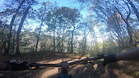
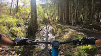
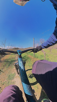
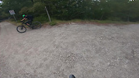
Photos of Forlì e Cesena Mountain Bike
Videos of Forlì e Cesena Mountain Bike
trail: Cà Ridolla
3:45 |
4 |
Nov 5, 2024
trail: Le Ripe Toscane
4:45 |
28 |
Nov 5, 2024
trail: Il Fagiano
3:43 |
45 |
Mar 29, 2024

trail: Il Fagiano
3:43 |
|
Mar 28, 2024
trail: Farniole
4:22 |
81 |
Mar 30, 2023
trail: Torre Montalto
0:07 |
38 |
Jan 26, 2023
trail: Torre Montalto
0:09 |
16 |
Jan 26, 2023

trail: La Valle
5:23 |
51 |
Oct 23, 2022
Current Trail Warnings
| status | trail | date | condition | user | info |
|---|---|---|---|---|---|
| Trail Sant'Antonio Dovadola | Jun 15, 2026 @ 9:31am (Europe/San_Marino) Jun 15, 2026 | Very Dry | Tedsx19 | primo pezzo sentiero poco visivibile... | |
| Cullacce Campigna | Jun 13, 2026 @ 10:02pm (Europe/Rome) Jun 13, 2026 | Unknown | cristiancacchi | E-Bike Trail chiuso alle bici, purtroppo sono... | |
| 4 Passeri Cesena | Jun 8, 2026 @ 8:42pm (Europe/Rome) Jun 8, 2026 | Dry | Nello94 | da sistemare, vegetazione invadente e... |
Recent Trail Reports
| status | trail | date | condition | info | user |
|---|---|---|---|---|---|
| Ciclovia Del Pisciatello Gambettola | Jun 14, 2026 @ 6:56am (Europe/Rome) Jun 13, 2026 | Ideal | Iiach | ||
| CAI 559 Tramazzo | Jun 13, 2026 @ 9:43am (Europe/San_Marino) Jun 13, 2026 | Dry | gpaoloconti | ||
| Acquacheta BASSA Tredozio | Jun 13, 2026 @ 9:43am (Europe/San_Marino) Jun 13, 2026 | Ideal | gpaoloconti | ||
| Acquacheta ALTA Tredozio | Jun 13, 2026 @ 9:43am (Europe/San_Marino) Jun 13, 2026 | Dry | gpaoloconti | ||
| Susinelli Trail San Benedetto In Alpe | Jun 13, 2026 @ 9:43am (Europe/San_Marino) Jun 13, 2026 | Dry | gpaoloconti | ||
| Salita tramazzo Tramazzo | Jun 13, 2026 @ 9:43am (Europe/San_Marino) Jun 13, 2026 | Ideal | gpaoloconti | ||
| Ronco Riva Sinistra Bertinoro | Jun 6, 2026 @ 8:22am (Europe/Rome) Jun 5, 2026 | Ideal | riccardolucchi-92 | ||
| Crinali di Gamogna San Benedetto In Alpe | Jun 4, 2026 @ 10:13pm (Europe/Rome) Jun 4, 2026 | Very Dry | massimomilani | ||
| CAI 587 Tramazzo | Jun 4, 2026 @ 10:11pm (Europe/Rome) Jun 4, 2026 | Dry | massimomilani | ||
| Papi Trail Quarto | Jun 2, 2026 @ 8:58am (Europe/Rome) Jun 1, 2026 | Ideal | Talebano |
Activity Feed
| username | action | type | title | date |
|---|---|---|---|---|
| Tedsx19 | add | report | activity #97032150 | Jun 15, 2026 @ 4:26am Jun 15, 2026 |
| Iiach | add | report | activity #96999462 | Jun 14, 2026 @ 1:14pm Jun 14, 2026 |
| ponaby | ridden | trail | activity #96959851 | Jun 14, 2026 @ 5:57am Jun 14, 2026 |
| cristiancacchi | add | report | activity #96909000 | Jun 13, 2026 @ 1:02pm Jun 13, 2026 |
| gpaoloconti | add | report | activity #96902352 and 1 more | Jun 13, 2026 @ 11:52am Jun 13, 2026 |
Recent Comments
| username | type | title | comment | date |
|---|---|---|---|---|
| trail | Trail chiuso | Apr 20, 2026 @ 10:15pm Apr 20, 2026 | ||
| trail | Fatto dopo un giorno di pioggia e’ comunque... | Apr 17, 2026 @ 11:51pm Apr 17, 2026 | ||
| trail | Trail no longer passable, very overgrown and... | Mar 26, 2026 @ 8:13am Mar 26, 2026 | ||
| report | .. | Mar 23, 2026 @ 2:08am Mar 23, 2026 | ||
| trail | Sentiero esilarante che corre lungo la cresta... | Jan 4, 2026 @ 2:30am Jan 4, 2026 |
Local Badges
-

Epic Ride Descent 2k4 awarded -

Descent 10k Badge4 awarded -
Epic Ride Descent 2k4 awarded -
Epic Ride Descent 2k1 awarded -
Epic Ride Descent 2k29 awarded -
Epic Ride Descent 2k11 awarded
Bike & Skill Parks
| name | type | city | rating |
|---|---|---|---|
| porcentico | skill park | Forli | |
| Marradi | skill park | Tredozio | |
| BRN Village | skill park | Forli |
Activity Type Stats
| activitytype | trails | distance | descent | descent distance | total vertical | rating | global rank | state rank | photos | reports | routes | ridelogs |
|---|---|---|---|---|---|---|---|---|---|---|---|---|
| Mountain Bike | 474 | 567 miles | 199,626 ft | 321 miles | 5,384 ft | 179 | 3,377 | 7 | 23,546 | |||
| E-Bike | 442 | 536 miles | 190,361 ft | 306 miles | 5,384 ft | 39 | 3,328 | 8 | 7,330 | |||
| Adaptive Bike | 1 | 1 | ||||||||||
| Winter Fat Bike | 1 | 3 | ||||||||||
| Horse | 81 | 138 miles | 33,809 ft | 69 miles | 5,079 ft | 93 | 1 | |||||
| Hike | 332 | 452 miles | 157,385 ft | 252 miles | 5,115 ft | 1 | 3,245 | 1 | 978 | |||
| Trail Running | 332 | 444 miles | 156,706 ft | 250 miles | 5,115 ft | 3,249 | 199 | |||||
| Dirtbike/Moto | 28 | 27 miles | 9,245 ft | 15 miles | 3,340 ft | 39 | 1 | |||||
| Snowshoe | 3 | 5 miles | 2,251 ft | 4 miles | 1,444 ft | 1 | 16 |
Frequently Asked Questions About Forlì e Cesena
▼
What are the best places to ride in Forlì e Cesena?
Forlì e Cesena has 6 areas to explore for mountain biking. The top rated areas are:
▼
What are the highest rated mountain biking trails in Forlì e Cesena?
The highest rated mountain biking trails in Forlì e Cesena are:
- Chiodo Trail (4.5/5)
- Papi Trail (4.4/5)
- Cucco (4.4/5)
- Monte Tiravento (4.3/5)
- Cà Pollare (4.3/5)
▼
What is the best time of the year to ride in Forlì e Cesena?
Based on ride log data, the most popular months to ride in Forlì e Cesena are:
- October (65 activities)
- July (60 activities)
- September (51 activities)
▼
What is the longest trail in Forlì e Cesena?
The longest trail in Forlì e Cesena is Ciclabile Del Savio (Ponte Nuovo - Via Romea Sud) at 15.1 miles. View all trails sorted by distance.
Activities
Trails
- By denitopia
 TRAILFORKS VTA & contributors
 - Admins: denitopia, marcoangeletti, cemoorelife
- #11678 - 4,518 views
- forlì e cesena activity log | embed map of Forlì e Cesena mountain bike trails | forlì e cesena mountain biking points of interest
Downloading of trail gps tracks in kml & gpx formats is enabled for Forlì e Cesena.
You must login to download files.