close
-
Layers w
- Weather Layers
- Pro
- Pro
- Pro
- Pro
- Pro
- Pro
- More Layers
- Pro
- Pro
- Pro
- Pro
-
Upgrade to

3D
Trail Conditions
- Unknown
- Snow Groomed
- Snow Packed
- Snow Covered
- Snow Cover Partial
- Freeze/thaw Cycle
- Icy
- Prevalent Mud
- Wet
- Variable
- Ideal
- Dry
- Very Dry
Trail Flow (Ridden Direction)
Trailforks scans users ridelogs to determine the most popular direction each trail is ridden. A good flowing trail network will have most trails flowing in a single direction according to their intension.
The colour categories are based on what percentage of riders are riding a trail in its intended direction.
The colour categories are based on what percentage of riders are riding a trail in its intended direction.
- > 96%
- > 90%
- > 80%
- > 70%
- > 50%
- < 50%
- bi-directional trail
- no data
Trail Last Ridden
Trailforks scans ridelogs to determine the last time a trail was ridden.
- < 2 days
- < 1 week
- < 2 weeks
- < 1 month
- < 6 months
- > 6 months
Trail Ridden Direction
The intended direction a trail should be ridden.
- Downhill Only
- Downhill Primary
- Both Directions
- Uphill Primary
- Uphill Only
- One Direction
Contribute Details
Colors indicate trail is missing specified detail.
- Description
- Photos
- Description & Photos
- Videos
Trail Popularity ?
Trailforks scans ridelogs to determine which trails are ridden the most in the last 9 months.
Trails are compared with nearby trails in the same city region with a possible 25 colour shades.
Think of this as a heatmap, more rides = more kinetic energy = warmer colors.
- most popular
- popular
- less popular
- not popular
ATV/ORV/OHV Filter
Max Vehicle Width
inches
US Cell Coverage
Legend

Radar Time
Activity Recordings
Trailforks uses anonymized public activity data.
?
Activity Recordings
Trailforks uses anonymized public activity data.
?
Personal Heatmap
▶
Activity Types
all
/
none
▶
Options
2
Date range
month
–
Winter Trails
Warning
A routing network for winter maps does not exist. Selecting trails using the winter trails layer has been disabled.
Missing Trails
Most Popular
Least Popular
Trails are colored based on popularity. The more popular a trail is, the more red. Less popular trails trend towards green.
Jump Magnitude Heatmap
Heatmap of where riders jump on trails. Zoom in to see individual jumps, click circles to view jump details.
BC Backroad Status
![map legend]()
Service Road Atlas is a free to use, community-driven service for viewing and creating reports on the numerous back-country service roads around B.C. and Alberta.

Slope Aspect
Direction the slope faces
Trails Deemphasized
Trails are shown in grey.
Only show trails with no bike usage.
Suggested Layers
Based on selected activity type
Save the current map location and zoom level as your default home location whenever this page is loaded.
SaveXC and DH Trails
Primary Trail Type: All-Mountain & Downhill
Shuttleable: YES
Land Status: Provincial Park
 google parking directions
 Access Info:
Parking Lot
Activities Click to view
- Mountain Bike
17 trails
- Hike
18 trails
- Trail Running
18 trails
Region Details
- 2
- 10
- 2
- 1
Region Status
Open as of May 5, 2026Local Trail Association
Stats
- Avg Trail Rating
- Trails (view details)
- 16
- Trails Mountain Bike
- 17
- Trails E-Bike
- 1
- Trails Hike
- 18
- Trails Trail Running
- 18
- Total Distance
- 8 miles
- Total Descent Distance
- 4 miles
- Total Descent
- 1,699 ft
- Total Vertical
- 275 ft
- Highest Trailhead
- 708 ft
- Reports
- 224
- Photos
- 37
- Ridden Counter
- 2,023
Popular Fort Duffield Mountain Biking Trails
• 80 ★ 0.0 • 1,145 ft • 108 ft • 186 •
After climbing the from the parking lot to the road, cross the road to continue onto this section of the . This continues to climb to take you up to the fort. From there, descend on the and turn left at the junction to stay on the , or...
• 70 ★ 4.5 • 4,022 ft • 13 ft • 177 •
Many jumps, drops, a wallride, and flat rocky section near bottom. Mandatory gap over ditch with alternate lines to avoid.
• 60 ★ 0.0 • 4,393 ft • 4 ft • 173 •
Moderately popular blue difficulty singletrack. This mountain bike primary trail can be used both directions and has a moderate overall physical rating with a 4 ft blue climb. On average it takes 8 minutes to complete this trail.
• 75 ★ 0.0 • 699 ft • 0 ft • 112 •
Offshoot of the . Cross the bridge at the teepee to climb up and come back down this spur to add length to your descent. Two log drops and a straight line high speed section add to the fun factor. You've climbed this far, you might as...
• 100 ★ 0.0 • 617 ft • 0 ft • 101 •
Popular blue difficulty singletrack. This multi-use trail can be used downhill primary and has a moderate overall physical rating. It features drop, jump and wallride. On average it takes minutes to complete this trail.
• 95 ★ 0.0 • 1,640 ft • 8 ft • 100 •
Popular proline difficulty machine groomed. This multi-use trail can be used downhill only and has a extreme overall physical rating. It features drop and jump. On average it takes 1 minutes to complete this trail.
Fort Duffield Mountain Bike Routes
2,283 ft • 1 • Point to Point •
This is STAGE 2 of the 2023 Bluegrass Mountain Cup Enduro course. How to commute to the stage will be...
1,558 ft • 3 ft • 1 • Point to Point •
This is STAGE 6 of the 2023 Bluegrass Mountain Cup Enduro course. How to commute to the stage will be...
3,530 ft • 6 ft • 1 • Point to Point •
This is STAGE 5 of the 2023 Bluegrass Mountain Cup Enduro course. How to commute to the stage will be...
3,967 ft • 11 ft • 0 • Point to Point •
This is STAGE 3 of the 2023 Bluegrass Mountain Cup Enduro course. How to commute to the stage will be...
2,218 ft • 23 ft • 0 • Point to Point • Race •
This is STAGE 1 of the 2023 Bluegrass Mountain Cup Enduro course. How to commute to the stage will be...
• 3 miles • 609 ft • 5 •
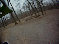
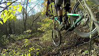
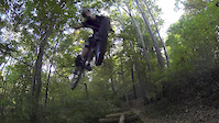
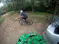
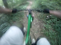
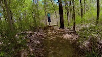
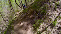
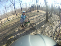
Photos of Fort Duffield Mountain Bike
Recent Trail Reports
| status | trail | date | condition | info | user |
|---|---|---|---|---|---|
| Blue Trail | Aug 21, 2025 @ 8:00am Aug 21, 2025 | Unknown | JW5enE | ||
| Flow Trail | Jul 30, 2025 @ 4:50pm Jul 30, 2025 | Ideal | FireTater | ||
| Slalom | Jul 22, 2025 @ 6:55pm Jul 22, 2025 | Ideal | Rpmarheine | ||
| Yellow Trail - Flow/Jump Trail Climb | Jul 22, 2025 @ 6:55pm Jul 22, 2025 | Variable | Rpmarheine | ||
| Red Trail | Jul 22, 2025 @ 6:55pm Jul 22, 2025 | Ideal | Rpmarheine | ||
| Honeysuckle Lane | Jul 22, 2025 @ 6:55pm Jul 22, 2025 | Ideal | Rpmarheine | ||
| Red Trail - Deadman's Spur | Jul 22, 2025 @ 6:55pm Jul 22, 2025 | Ideal | Rpmarheine | ||
| Yellow Trail - Flow/Jump Trail 2 2 | Jul 3, 2024 @ 6:51am Jul 3, 2024 | Dry | JohnStack1 | ||
| Red Trail | Apr 15, 2024 @ 7:40am Apr 15, 2024 | Dry | IndianaGirl | ||
| Red Trail | Apr 15, 2024 @ 7:40am Apr 15, 2024 | Ideal | IndianaGirl |
Activity Feed
| username | action | type | title | date |
|---|---|---|---|---|
| rysparks | wishlist | region | activity #96847286 | Jun 12, 2026 @ 9:06pm Jun 12, 2026 |
| lwndrt | wishlist | region | activity #87982541 | Jan 29, 2026 @ 4:33am Jan 29, 2026 |
| TeamShanty | wishlist | region | activity #87274190 | Jan 16, 2026 @ 4:02am Jan 16, 2026 |
| stephencurry76 | wishlist | trail | activity #84301747 | Nov 17, 2025 @ 9:09am Nov 17, 2025 |
| AstroNova | ridden | trail | activity #83619260 and 2 more | Nov 5, 2025 @ 7:46am Nov 5, 2025 |
Recent Comments
| username | type | title | comment | date |
|---|---|---|---|---|
| trail | Someone took an old school tech/ jump trail... | Dec 6, 2022 @ 7:50pm Dec 6, 2022 | ||
| report | Perfect conditions, no downed trees | Mar 14, 2022 @ 9:46am Mar 14, 2022 | ||
| report | Perfect conditions today | Mar 14, 2022 @ 9:45am Mar 14, 2022 | ||
| report | Perfect riding conditions today | Mar 14, 2022 @ 9:44am Mar 14, 2022 | ||
| trail | This weekend will be my first time mountain... | Oct 5, 2021 @ 9:22pm Oct 5, 2021 |
Nearby Areas
| name | distance | ||||
|---|---|---|---|---|---|
| Otter Creek Outdoor Recreation Area | 4 | 6.1 km | |||
| Saunders Springs | 2 | 4 | 5 | 9.5 km | |
| Tom Wallace Recreation Area | 11.1 km | ||||
| Buttermilk Falls | 1 | 11.4 km | |||
| Waverly | 4 | 12 km |
Activity Type Stats
| activitytype | trails | distance | descent | descent distance | total vertical | rating | global rank | state rank | photos | reports | routes | ridelogs |
|---|---|---|---|---|---|---|---|---|---|---|---|---|
| Mountain Bike | 17 | 8 miles | 1,699 ft | 4 miles | 276 ft | #5,720 | #2,105 | 37 | 224 | 5 | 1,152 | |
| E-Bike | 1 | 3,048 ft | 33 ft | 1,401 ft | 26 ft | 108 | 4 | 165 | ||||
| Hike | 18 | 8 miles | 1,699 ft | 4 miles | 276 ft | #12,622 | #5,250 | 224 | 50 | |||
| Trail Running | 18 | 8 miles | 1,699 ft | 4 miles | 276 ft | #12,000 | #4,738 | 224 | 5 |
Frequently Asked Questions About Fort Duffield
▼
What are the highest rated mountain biking trails in Fort Duffield?
The highest rated mountain biking trails in Fort Duffield are:
- Blue Trail (4.5/5)
- Blue Trail (4.5/5)
- Yellow Trail - Flow/Jump Trail Climb (4.3/5)
- Cross Creek Connector - Express Climb to Teepee (4.1/5)
- Slalom (4/5)
▼
What is the best time of the year to ride in Fort Duffield?
Based on ride log data, the most popular months to ride in Fort Duffield are:
- April (10 activities)
- May (10 activities)
- August (7 activities)
▼
Where can I park to ride in Fort Duffield?
There are 1 parking locations listed in Fort Duffield. The most popular parking spots are:
▼
What is the longest trail in Fort Duffield?
The longest trail in Fort Duffield is Blue Trail at 1.9 miles. View all trails sorted by distance.
Activities
Trails
Points of Interest
- By louevilcyclist & contributors
- Admins: apply
- #4033 - 7,826 views
- fort duffield activity log | embed map of Fort Duffield mountain bike trails | fort duffield mountain biking points of interest
Downloading of trail gps tracks in kml & gpx formats is enabled for Fort Duffield.
You must login to download files.