close
-
Layers w
- Weather Layers
- Pro
- Pro
- Pro
- Pro
- Pro
- Pro
- More Layers
- Pro
- Pro
- Pro
- Pro
-
Upgrade to

3D
Trail Conditions
- Unknown
- Snow Groomed
- Snow Packed
- Snow Covered
- Snow Cover Partial
- Freeze/thaw Cycle
- Icy
- Prevalent Mud
- Wet
- Variable
- Ideal
- Dry
- Very Dry
Trail Flow (Ridden Direction)
Trailforks scans users ridelogs to determine the most popular direction each trail is ridden. A good flowing trail network will have most trails flowing in a single direction according to their intension.
The colour categories are based on what percentage of riders are riding a trail in its intended direction.
The colour categories are based on what percentage of riders are riding a trail in its intended direction.
- > 96%
- > 90%
- > 80%
- > 70%
- > 50%
- < 50%
- bi-directional trail
- no data
Trail Last Ridden
Trailforks scans ridelogs to determine the last time a trail was ridden.
- < 2 days
- < 1 week
- < 2 weeks
- < 1 month
- < 6 months
- > 6 months
Trail Ridden Direction
The intended direction a trail should be ridden.
- Downhill Only
- Downhill Primary
- Both Directions
- Uphill Primary
- Uphill Only
- One Direction
Contribute Details
Colors indicate trail is missing specified detail.
- Description
- Photos
- Description & Photos
- Videos
Trail Popularity ?
Trailforks scans ridelogs to determine which trails are ridden the most in the last 9 months.
Trails are compared with nearby trails in the same city region with a possible 25 colour shades.
Think of this as a heatmap, more rides = more kinetic energy = warmer colors.
- most popular
- popular
- less popular
- not popular
ATV/ORV/OHV Filter
Max Vehicle Width
inches
US Cell Coverage
Legend

Radar Time
Activity Recordings
Trailforks uses anonymized public activity data.
?
Activity Recordings
Trailforks uses anonymized public activity data.
?
Personal Heatmap
▶
Activity Types
all
/
none
▶
Options
2
Date range
month
–
Winter Trails
Warning
A routing network for winter maps does not exist. Selecting trails using the winter trails layer has been disabled.
Missing Trails
Most Popular
Least Popular
Trails are colored based on popularity. The more popular a trail is, the more red. Less popular trails trend towards green.
Jump Magnitude Heatmap
Heatmap of where riders jump on trails. Zoom in to see individual jumps, click circles to view jump details.
BC Backroad Status
![map legend]()
Service Road Atlas is a free to use, community-driven service for viewing and creating reports on the numerous back-country service roads around B.C. and Alberta.

Slope Aspect
Direction the slope faces
Trails Deemphasized
Trails are shown in grey.
Only show trails with no bike usage.
Suggested Layers
Based on selected activity type
Save the current map location and zoom level as your default home location whenever this page is loaded.
Save"Fort Rock is the commonly known name for two separate Town Forests, the Henderson-Swasey Town Forest in Exeter and the Oakland Town Forest in Newfields. They are separated by Route 101. Joining them together is a large metal culvert that runs under the highway.
The trails here offer almost unlimited technical challenges to the rider who's willing to work a bit. It's almost impossible to ride here without dodging or climbing over a plethora of exposed rocks and roots. And the trip under Route 101 is almost unique in all of New England's riding.
Riding at Fort Rock is challenging. There are too many trails to ride in one outing, so expect to come back if you want to explore everything.
Of the two properties, Oakland Hills seems to offer the most technical challenge. While Henderson-Swasey has the majority of the more mellow trails.
Henderson-Swasey has some smooth rolling old woods roads. Many of the singletracks leading off of these are quite technical. There is a short graded dirt road and a long gas line that's located near the main parking lot and they offer the mellowest riding on the property.
From the parking area at Oakland Hills you head down a long old woods road that's turning into a singletrack. Branching off from it you'll find lots of well used singletracks and degraded forests roads. Many of these are very challenging.
While both properties abut each other and are only separated by a highway I find them to be quite a bit different. I prefer Henderson-Swasey when I want a ride that's composed of a variety of riding experiences. Oakland Hills is my choice when I want to beat myself up more consistently on challenging terrain.
The trails leading from both properties to the culvert are quite difficult, and most people will find themselves getting off and walking at least once."
NEMBA
Primary Trail Type: All-Mountain & Downhill
Land Status: Community Forest
 google parking directions
 Access Info:
"From Route 101 that the Route 85 Exit. The entrance to Henderson-Swasey is located a quarter of a mile to the south. The parking area for Oakland Hills is a quarter of a mile to the north."
NEMBA
NEMBA
Activities Click to view
- Mountain Bike
158 trails
- E-Bike
16 trails
- Hike
149 trails
- Trail Running
147 trails
- Snowmobile
11 trails
- Snowshoe
150 trails
- Backcountry Ski
5 trails
- Nordic Ski
18 trails
Region Details
- 17
- 11
- 107
- 14
- 3
- 1
Region Status
Open as of Nov 29, 2025Stats
- Avg Trail Rating
- Trails (view details)
- 154
- Trails Mountain Bike
- 159
- Trails E-Bike
- 16
- Trails Hike
- 149
- Trails Trail Running
- 147
- Trails Snowmobile
- 11
- Trails Snowshoe
- 150
- Trails Downhill Ski
- 1
- Trails Backcountry Ski
- 5
- Trails Nordic Ski
- 18
- Total Distance
- 42 miles
- Total Descent Distance
- 15 miles
- Total Descent
- 3,272 ft
- Total Vertical
- 205 ft
- Highest Trailhead
- 225 ft
- Reports
- 1,546
- Photos
- 78
- Ridden Counter
- 81,935
Popular Fort Rock Mountain Biking Trails
• 100 ★ 4.7 • 2,116 ft • 40 ft • 1,299 •
Popular blue difficulty singletrack. This mountain bike primary trail. On average it takes 4 minutes to complete this trail.
• 95 ★ 4.4 • 1,453 ft • 53 ft • 1,187 •
Popular blue difficulty singletrack. This mountain bike primary trail can be used both directions. On average it takes 3 minutes to complete this trail.
• 85 ★ 4.5 • 1 mile • 152 ft • 1,151 •
Technical, flow-y trail with many features and side hits. Several jumps and gaps, with an offshoot drop trail for something bigger. Definitely some challenging tech sections. Finishes off with a short bridge before rejoining .
• 100 ★ 0.0 • 499 ft • 0 ft • 1,062 •
Popular blue difficulty singletrack. This mountain bike primary trail. On average it takes 1 minutes to complete this trail.
• 100 ★ 5.0 • 1 mile • 67 ft • 1,057 •
Popular blue difficulty singletrack. This mountain bike primary trail can be used both directions and has a moderate overall physical rating with a 67 ft blue climb. Trail visibility is sometimes hard to follow. On average it takes 10 minutes to complete this trail.
• 90 ★ 4.0 • 1,184 ft • 22 ft • 1,033 •
Popular blue difficulty singletrack. This mountain bike primary trail can be used both directions and has a moderate overall physical rating with a 22 ft blue climb. It features rock garden. Trail visibility is always easy to follow. On average it takes 2 minutes to complete this trail.
• 90 ★ 4.0 • 1,654 ft • 39 ft • 1,024 •
Popular blue difficulty singletrack. This mountain bike primary trail can be used both directions. On average it takes 4 minutes to complete this trail.
• 90 ★ 4.0 • 856 ft • 0 ft • 1,022 •
Popular blue difficulty singletrack. This mountain bike primary trail can be used both directions. On average it takes 1 minutes to complete this trail.
Fort Rock Mountain Bike Routes
★ 4.2 • 10 miles • 769 ft • 54 • Loop •
A challenging intermediate to expert 10+ mile tour of some of the gems of the northern part of Fort Rock.
★ 3.5 • 8 miles • 678 ft • 58 •
Fort Rock route to get to and then back to the parking lot.
16 miles • 1,360 ft • 48 •
Route to hit all the big features around fort rock
6 miles • 365 ft • 18 • Loop •
Nice moderate loop starting at the Watson lot. Good single track, includes new trails built in 2021.
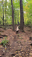
Photos of Fort Rock Mountain Bike
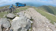
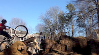
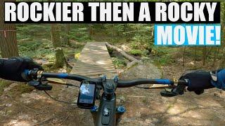
Videos of Fort Rock Mountain Bike
trail: Shadow's Skinny Log
0:06 |
412 |
Aug 25, 2022
trail: Summit
3:11 |
3121 |
Dec 19, 2019
trail: To Bog
0:12 |
276 |
Apr 1, 2014

trail: IPA
0:57 |
208 |
Oct 14, 2012

trail: Tunnel Down
1:15:15 |
308 |
Aug 23, 2022 , Exeter

trail: neB giB
1:15:15 |
234 |
Aug 23, 2022 , Exeter
trail: Lower Parliament
1:15:15 |
168 |
Aug 23, 2022 , Exeter

trail: Hamburger Hill
1:15:15 |
288 |
Aug 23, 2022 , Exeter
Recent Trail Reports
| status | trail | date | condition | info | user |
|---|---|---|---|---|---|
| Mycelium | Nov 29, 2025 @ 2:00pm (America/New_York) Nov 29, 2025 | Variable | covc | ||
| Doghouse | Nov 29, 2025 @ 2:00pm (America/New_York) Nov 29, 2025 | Variable | covc | ||
| Colt 45 | Aug 11, 2025 @ 10:06am Aug 11, 2025 | Ideal | covc | ||
| XLR8 | Aug 11, 2025 @ 10:06am Aug 11, 2025 | Ideal | covc | ||
| Trestle to Gas | Aug 11, 2025 @ 10:06am Aug 11, 2025 | Ideal | covc | ||
| Watson Lot Trail | Jul 21, 2025 @ 12:06pm Jul 21, 2025 | Dry | TIMGARLAND | ||
| Green Loop | Jul 13, 2025 @ 12:09pm Jul 13, 2025 | Unknown | klieg | ||
| Yellowgreen Loop | Apr 16, 2025 @ 11:39am Apr 16, 2025 | Variable | Hubbles83 WMNEMBA | ||
| Yellow Loop | Apr 16, 2025 @ 11:39am Apr 16, 2025 | Variable | Hubbles83 WMNEMBA | ||
| Yellow Cliffs | Apr 16, 2025 @ 11:39am Apr 16, 2025 | Variable | Hubbles83 WMNEMBA |
Activity Feed
| username | action | type | title | date |
|---|---|---|---|---|
| Mwv1987 | ridden | trail | activity #96951777 | Jun 14, 2026 @ 3:47am Jun 14, 2026 |
| Hubbles83 | update | trail | activity #96931908 | Jun 13, 2026 @ 6:31pm Jun 13, 2026 |
| gosurf1 | wishlist | route | activity #96871559 | Jun 13, 2026 @ 6:52am Jun 13, 2026 |
| RobinXPUUon | wishlist | route | activity #96871526 | Jun 13, 2026 @ 6:52am Jun 13, 2026 |
| SkyFather77 | wishlist | region | activity #96798984 | Jun 12, 2026 @ 6:23am Jun 12, 2026 |
Recent Comments
| username | type | title | comment | date |
|---|---|---|---|---|
| trail | Very muddy in usual spots. Multiple trees down. | Jun 3, 2026 @ 6:04pm Jun 3, 2026 | ||
| trail | The crew did such a nice job with this trail.... | May 21, 2026 @ 6:03pm May 21, 2026 | ||
| trail | Awesome little trail! | Jul 28, 2025 @ 7:30pm Jul 28, 2025 | ||
| trail | Surprisingly fun! | Jul 28, 2025 @ 7:30pm Jul 28, 2025 | ||
| trail | No bueno, boring, double tracky | Jul 28, 2025 @ 7:29pm Jul 28, 2025 |
Nearby Areas
| name | distance | ||||
|---|---|---|---|---|---|
| Kimball Preserve | 6 | 2.8 km | |||
| George F. Smith Woodlot | 4 | 2.8 km | |||
| Phillips Exeter Academy Woodlands Trail Network | 8 | 2.9 km | |||
| Piscassic Greenway | 4 | 1 | 3.1 km | ||
| Mast Road Natural Area | 6 | 4.3 km |
Local Badges
-

Completionist10 awarded
Activity Type Stats
| activitytype | trails | distance | descent | descent distance | total vertical | rating | global rank | state rank | photos | reports | routes | ridelogs |
|---|---|---|---|---|---|---|---|---|---|---|---|---|
| Mountain Bike | 158 | 42 miles | 3,261 ft | 15 miles | 207 ft | #58 | #23 | 78 | 1,548 | 6 | 35,945 | |
| E-Bike | 16 | 5 miles | 538 ft | 2 miles | 102 ft | #5,632 | #1,562 | 1,492 | 922 | |||
| Hike | 149 | 40 miles | 2,986 ft | 14 miles | 203 ft | #3,358 | #1,167 | 2 | 1,547 | 1 | 380 | |
| Trail Running | 147 | 40 miles | 2,949 ft | 14 miles | 203 ft | #2,559 | #628 | 1,547 | 1 | 544 | ||
| Snowmobile | 11 | 4 miles | 289 ft | 2 miles | 105 ft | #60 | #16 | 812 | 6 | |||
| Snowshoe | 150 | 41 miles | 3,133 ft | 14 miles | 203 ft | #125 | #37 | 863 | 1 | 94 | ||
| Downhill Ski | 1 | 246 ft | 69 ft | 7 ft | 7 | |||||||
| Backcountry Ski | 5 | 4,075 ft | 154 ft | 2,667 ft | 69 ft | #297 | #61 | 7 | 1 | 7 | ||
| Nordic Ski | 18 | 7 miles | 666 ft | 3 miles | 200 ft | #726 | #269 | 823 | 55 |
Frequently Asked Questions About Fort Rock
▼
What are the highest rated mountain biking trails in Fort Rock?
The highest rated mountain biking trails in Fort Rock are:
- Crank On Down (4.5/5)
- Ground On Down (4.4/5)
- Sting Ring (4.4/5)
- Cattle Dog (4.4/5)
- Parker Way (4.4/5)
▼
What is the best time of the year to ride in Fort Rock?
Based on ride log data, the most popular months to ride in Fort Rock are:
- May (857 activities)
- July (778 activities)
- June (733 activities)
▼
Where can I park to ride in Fort Rock?
There are 4 parking locations listed in Fort Rock. The most popular parking spots are: View all parking and trailhead locations on the map to plan your visit.
▼
What is the longest trail in Fort Rock?
The longest trail in Fort Rock is Olive Branch at 1.4 miles. View all trails sorted by distance.
Activities
Trails
- By benmob1898 & contributors
- Admins: FortRock, SC NEMBA-NH
- #4009 - 32,965 views
- fort rock activity log | embed map of Fort Rock mountain bike trails | fort rock mountain biking points of interest
Downloading of trail gps tracks in kml & gpx formats is enabled for Fort Rock.
You must login to download files.