close
-
Layers w
- Weather Layers
- Pro
- Pro
- Pro
- Pro
- Pro
- Pro
- More Layers
- Pro
- Pro
- Pro
- Pro
-
Upgrade to

3D
Trail Conditions
- Unknown
- Snow Groomed
- Snow Packed
- Snow Covered
- Snow Cover Partial
- Freeze/thaw Cycle
- Icy
- Prevalent Mud
- Wet
- Variable
- Ideal
- Dry
- Very Dry
Trail Flow (Ridden Direction)
Trailforks scans users ridelogs to determine the most popular direction each trail is ridden. A good flowing trail network will have most trails flowing in a single direction according to their intension.
The colour categories are based on what percentage of riders are riding a trail in its intended direction.
The colour categories are based on what percentage of riders are riding a trail in its intended direction.
- > 96%
- > 90%
- > 80%
- > 70%
- > 50%
- < 50%
- bi-directional trail
- no data
Trail Last Ridden
Trailforks scans ridelogs to determine the last time a trail was ridden.
- < 2 days
- < 1 week
- < 2 weeks
- < 1 month
- < 6 months
- > 6 months
Trail Ridden Direction
The intended direction a trail should be ridden.
- Downhill Only
- Downhill Primary
- Both Directions
- Uphill Primary
- Uphill Only
- One Direction
Contribute Details
Colors indicate trail is missing specified detail.
- Description
- Photos
- Description & Photos
- Videos
Trail Popularity ?
Trailforks scans ridelogs to determine which trails are ridden the most in the last 9 months.
Trails are compared with nearby trails in the same city region with a possible 25 colour shades.
Think of this as a heatmap, more rides = more kinetic energy = warmer colors.
- most popular
- popular
- less popular
- not popular
ATV/ORV/OHV Filter
Max Vehicle Width
inches
US Cell Coverage
Legend

Radar Time
Activity Recordings
Trailforks uses anonymized public activity data.
?
Activity Recordings
Trailforks uses anonymized public activity data.
?
Personal Heatmap
▶
Activity Types
all
/
none
▶
Options
2
Date range
month
–
Winter Trails
Warning
A routing network for winter maps does not exist. Selecting trails using the winter trails layer has been disabled.
Missing Trails
Most Popular
Least Popular
Trails are colored based on popularity. The more popular a trail is, the more red. Less popular trails trend towards green.
Jump Magnitude Heatmap
Heatmap of where riders jump on trails. Zoom in to see individual jumps, click circles to view jump details.
BC Backroad Status
![map legend]()
Service Road Atlas is a free to use, community-driven service for viewing and creating reports on the numerous back-country service roads around B.C. and Alberta.

Slope Aspect
Direction the slope faces
Trails Deemphasized
Trails are shown in grey.
Only show trails with no bike usage.
Suggested Layers
Based on selected activity type
Save the current map location and zoom level as your default home location whenever this page is loaded.
Save
No description for Fort Smith has been added yet!
Login or register to submit one.
Activities Click to view
- Mountain Bike
35 trails
- E-Bike
29 trails
- Gravel Bike
0 trails
- Adaptive Bike
0 trails
- Hike
34 trails
- Trail Running
34 trails
Region Details
- 4
- 16
- 6
- 1
Region Status
Open as of May 23, 2026Stats
- Avg Trail Rating
- Trails (view details)
- 27
- Trails Mountain Bike
- 35
- Trails E-Bike
- 29
- Trails Hike
- 34
- Trails Trail Running
- 34
- Total Distance
- 30 miles
- Total Descent
- 1,467 ft
- Total Vertical
- 260 ft
- Highest Trailhead
- 651 ft
- Reports
- 317
- Photos
- 99
- Ridden Counter
- 2,955
Sub Regions
-
Ben Geren Park
- 15
- 6
- 1
-
Spring Hill Park
- 1
Popular Fort Smith Mountain Biking Trails
• 100 ★ 5.0 • 1,647 ft • 0 ft • 178 •
Fun short trail that keeps the excitement alive at ben geren. Somewhat flowy but has some rock in it.
• 90 ★ 4.7 • 1 mile • 81 ft • 174 •
Popular green difficulty singletrack. This mountain bike primary trail can be used both directions and has a moderate overall physical rating with a 81 ft blue climb. It features jump. On average it takes 7 minutes to complete this trail.
• 95 ★ 4.5 • 1 mile • 2 ft • 160 •
Popular green difficulty singletrack. This mountain bike primary trail can be used both directions and has a easy overall physical rating with a 2 ft green climb. It features bridge, jump and skinny. On average it takes 6 minutes to complete this trail.
• 60 ★ 4.7 • 2,700 ft • 0 ft • 145 •
Highly rated moderately popular blue difficulty singletrack. This mountain bike primary trail. On average it takes 3 minutes to complete this trail.
• 55 ★ 4.4 • 8 miles • 153 ft • 125 •
Fun flat trail that is great for beginners. Also if you're fast it's fun because of how fast you can go! The faster you go the more fun it is! This place will teach you to be comfortable with drifting your bike with your feet clipped in...
• 70 ★ 5.0 • 280 ft • 4 ft • 111 •
Popular green difficulty singletrack. This mountain bike primary trail can be used both directions and has a easy overall physical rating with a 4 ft green climb. On average it takes minutes to complete this trail.
• 85 ★ 4.0 • 2,569 ft • 28 ft • 109 •
Popular green difficulty singletrack. This mountain bike primary trail can be used both directions and has a easy overall physical rating with a 28 ft green climb. It features jump. On average it takes 3 minutes to complete this trail.
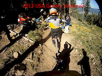
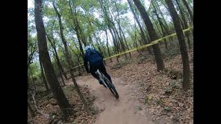
Photos of Fort Smith Mountain Bike
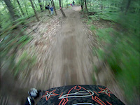
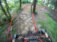
Videos of Fort Smith Mountain Bike
trail: Gravity
7:14 |
362 |
Aug 30, 2013
trail: Gravity
4:34 |
209 |
May 16, 2013
trail: Gravity
0:50 |
297 |
May 16, 2013
trail: Gravity
0:12 |
427 |
May 15, 2013
trail: Springhill Trail
14:35 |
319 |
Dec 3, 2020 , Fort Smith

8:42 |
287 |
Jul 2, 2020

trail: Elvis
11:55 |
405 |
Jul 2, 2020 , Fort Smith

trail: Zippidee Doo Dah (Lower)
12:41 |
266 |
Jul 2, 2020 , Fort Smith
Recent Trail Reports
| status | trail | date | condition | info | user |
|---|---|---|---|---|---|
| Ben Geren Paved | May 23, 2026 @ 1:46pm (America/Chicago) May 23, 2026 | Unknown | CMWharton | ||
| Water Tower Service | Jun 1, 2025 @ 9:59am Jun 1, 2025 | Variable | Brenda2720 | ||
| Zippidee Doo Dah | Apr 10, 2025 @ 5:24pm Apr 10, 2025 | Ideal | oblouky | ||
| Beaver Dam | Apr 10, 2025 @ 5:24pm Apr 10, 2025 | Variable | oblouky | ||
| Roller Coaster | Apr 10, 2025 @ 5:24pm Apr 10, 2025 | Variable | oblouky | ||
| Hobo Hill | Apr 10, 2025 @ 5:24pm Apr 10, 2025 | Variable | oblouky | ||
| GP | Apr 10, 2025 @ 5:24pm Apr 10, 2025 | Variable | oblouky | ||
| Gravity | Apr 8, 2025 @ 5:11pm Apr 8, 2025 | Variable | oblouky | ||
| Wild Hog Tracks | Apr 9, 2025 @ 5:36am Apr 9, 2025 | Prevalent Mud | oblouky | ||
| Springhill Trail | Mar 14, 2025 @ 12:25am Mar 14, 2025 | Prevalent Mud | Zaskyar |
Activity Feed
| username | action | type | title | date |
|---|---|---|---|---|
| teragambill00 | wishlist | trail | activity #95366293 | May 23, 2026 @ 4:55pm May 23, 2026 |
| CMWharton | add | report | activity #95340795 | May 23, 2026 @ 11:46am May 23, 2026 |
| CMWharton | add | report | activity #95322473 | May 23, 2026 @ 8:42am May 23, 2026 |
| bikerbikerbikerbiker | difficultyvote | trail | activity #93783776 | May 1, 2026 @ 7:57am May 1, 2026 |
| Hotrod4989 | add | trail | activity #92174905 and 1 more | Apr 8, 2026 @ 4:28am Apr 8, 2026 |
Recent Comments
| username | type | title | comment | date |
|---|---|---|---|---|
| report | One big tree down at the beginning of c trail... | Dec 7, 2024 @ 4:55pm Dec 7, 2024 | ||
| trail | Road it twice today lot of fun. Burms are... | Sep 16, 2023 @ 3:51pm Sep 16, 2023 | ||
| trail | Good warm up or cool down ride nothing fancy | Sep 13, 2023 @ 7:37am Sep 13, 2023 | ||
| trail | Nice new section added to this trail with some... | Sep 6, 2023 @ 9:54pm Sep 6, 2023 | ||
| trail | Very tough climb | Sep 6, 2023 @ 11:41am Sep 6, 2023 |
Local Badges
-

10 Green Trails61 awarded -

10 Blue Trails45 awarded -

Epic Ride Climb 2k3 awarded -

Climbing 10k Badge17 awarded -

Climbing 100k Badge0 awarded -

Epic Ride Descent 2k3 awarded
Activity Type Stats
| activitytype | trails | distance | descent | descent distance | total vertical | rating | global rank | state rank | photos | reports | routes | ridelogs |
|---|---|---|---|---|---|---|---|---|---|---|---|---|
| Mountain Bike | 35 | 30 miles | 1,467 ft | 10 miles | 259 ft | #3,238 | #1,111 | 98 | 317 | 6,816 | ||
| E-Bike | 29 | 28 miles | 1,358 ft | 10 miles | 259 ft | #4,214 | #1,382 | 3 | 281 | 407 | ||
| Hike | 34 | 29 miles | 1,388 ft | 10 miles | 259 ft | #6,953 | #2,466 | 317 | 106 | |||
| Trail Running | 34 | 29 miles | 1,388 ft | 10 miles | 259 ft | #6,324 | #2,051 | 317 | 146 |
Frequently Asked Questions About Fort Smith
▼
What are the best places to ride in Fort Smith?
Fort Smith has 2 areas to explore for mountain biking. The top rated areas are:
▼
What are the highest rated mountain biking trails in Fort Smith?
The highest rated mountain biking trails in Fort Smith are:
- Roller Coaster (4.3/5)
- Cheeseburger (4.3/5)
- EnduroFlo (4.2/5)
- Parker Loop (4.2/5)
- Pond Bank Loop (4.2/5)
▼
What is the best time of the year to ride in Fort Smith?
Based on ride log data, the most popular months to ride in Fort Smith are:
- July (27 activities)
- August (22 activities)
- October (18 activities)
▼
Where can I park to ride in Fort Smith?
There are 8 parking locations listed in Fort Smith. The most popular parking spots are: View all parking and trailhead locations on the map to plan your visit.
Activities
Trails
- By Hotrod4989 & contributors
- Admins: OORC FB, OZ TRAILS, thomcerny
- #5314 - 5,863 views
- fort smith activity log | embed map of Fort Smith mountain bike trails | fort smith mountain biking points of interest
Downloading of trail gps tracks in kml & gpx formats is enabled for Fort Smith.
You must login to download files.