close
-
Layers w
- Weather Layers
- Pro
- Pro
- Pro
- Pro
- Pro
- Pro
- More Layers
- Pro
- Pro
- Pro
- Pro
-
Upgrade to

3D
Trail Conditions
- Unknown
- Snow Groomed
- Snow Packed
- Snow Covered
- Snow Cover Partial
- Freeze/thaw Cycle
- Icy
- Prevalent Mud
- Wet
- Variable
- Ideal
- Dry
- Very Dry
Trail Flow (Ridden Direction)
Trailforks scans users ridelogs to determine the most popular direction each trail is ridden. A good flowing trail network will have most trails flowing in a single direction according to their intension.
The colour categories are based on what percentage of riders are riding a trail in its intended direction.
The colour categories are based on what percentage of riders are riding a trail in its intended direction.
- > 96%
- > 90%
- > 80%
- > 70%
- > 50%
- < 50%
- bi-directional trail
- no data
Trail Last Ridden
Trailforks scans ridelogs to determine the last time a trail was ridden.
- < 2 days
- < 1 week
- < 2 weeks
- < 1 month
- < 6 months
- > 6 months
Trail Ridden Direction
The intended direction a trail should be ridden.
- Downhill Only
- Downhill Primary
- Both Directions
- Uphill Primary
- Uphill Only
- One Direction
Contribute Details
Colors indicate trail is missing specified detail.
- Description
- Photos
- Description & Photos
- Videos
Trail Popularity ?
Trailforks scans ridelogs to determine which trails are ridden the most in the last 9 months.
Trails are compared with nearby trails in the same city region with a possible 25 colour shades.
Think of this as a heatmap, more rides = more kinetic energy = warmer colors.
- most popular
- popular
- less popular
- not popular
ATV/ORV/OHV Filter
Max Vehicle Width
inches
US Cell Coverage
Legend

Radar Time
Activity Recordings
Trailforks uses anonymized public activity data.
?
Activity Recordings
Trailforks uses anonymized public activity data.
?
Personal Heatmap
▶
Activity Types
all
/
none
▶
Options
2
Date range
month
–
Winter Trails
Warning
A routing network for winter maps does not exist. Selecting trails using the winter trails layer has been disabled.
Missing Trails
Most Popular
Least Popular
Trails are colored based on popularity. The more popular a trail is, the more red. Less popular trails trend towards green.
Jump Magnitude Heatmap
Heatmap of where riders jump on trails. Zoom in to see individual jumps, click circles to view jump details.
BC Backroad Status
![map legend]()
Service Road Atlas is a free to use, community-driven service for viewing and creating reports on the numerous back-country service roads around B.C. and Alberta.

Slope Aspect
Direction the slope faces
Trails Deemphasized
Trails are shown in grey.
Only show trails with no bike usage.
Suggested Layers
Based on selected activity type
Save the current map location and zoom level as your default home location whenever this page is loaded.
Save
No description for Fort Wayne has been added yet!
Login or register to submit one.
Activities Click to view
- Mountain Bike
36 trails
- E-Bike
29 trails
- Gravel Bike
0 trails
- Hike
41 trails
- Trail Running
41 trails
Region Details
- 12
- 9
- 15
Region Status
Open as of Jun 13, 2026Stats
- Avg Trail Rating
- Trails (view details)
- 36
- Trails Mountain Bike
- 41
- Trails E-Bike
- 29
- Trails Hike
- 41
- Trails Trail Running
- 41
- Total Distance
- 37 miles
- Total Descent
- 1,076 ft
- Total Vertical
- 86 ft
- Highest Trailhead
- 822 ft
- Reports
- 246
- Photos
- 18
- Ridden Counter
- 5,324
Sub Regions
-
Franke Park
- 9
- 15
Popular Fort Wayne Mountain Biking Trails
• 90 ★ 4.5 • 1,486 ft • 11 ft • 184 •
Popular green difficulty singletrack. This mountain bike primary trail can be used one direction. On average it takes 1 minutes to complete this trail.
• 65 ★ 0.0 • 1,457 ft • 15 ft • 182 •
Moderately popular green difficulty family friendly singletrack. This mountain bike primary trail can be used one direction. On average it takes 2 minutes to complete this trail.
• 80 ★ 4.4 • 1,650 ft • 18 ft • 182 •
Popular green difficulty family friendly singletrack. This mountain bike primary trail can be used one direction. On average it takes 1 minutes to complete this trail.
• 65 ★ 0.0 • 1,270 ft • 16 ft • 180 •
Moderately popular green difficulty family friendly singletrack. This mountain bike primary trail can be used one direction. On average it takes 1 minutes to complete this trail.
• 60 ★ 0.0 • 1,680 ft • 5 ft • 179 •
Moderately popular green difficulty family friendly singletrack. This mountain bike primary trail can be used one direction. Trail visibility is always easy to follow. On average it takes 2 minutes to complete this trail.
• 100 ★ 0.0 • 568 ft • 5 ft • 179 •
Popular blue difficulty singletrack. This mountain bike primary trail can be used one direction. On average it takes minutes to complete this trail.
• 95 ★ 0.0 • 486 ft • 7 ft • 178 •
Popular blue difficulty singletrack. This mountain bike primary trail can be used one direction. On average it takes 1 minutes to complete this trail.
Fort Wayne Mountain Bike Routes
★ 4.0 • 9 miles • 270 ft • 0 •
Over ten miles of singletrack with a great variety of features and challenges.
• 14 miles • 810 ft • 36 •
• 14 miles • 706 ft • 34 •
• 4 miles • 257 ft • 18 •
• 7 miles • 337 ft • 18 •
• 8 miles • 318 ft • 20 •
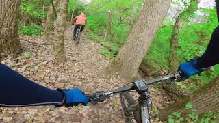
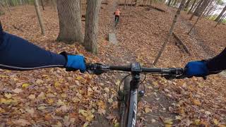
Photos of Fort Wayne Mountain Bike
Videos of Fort Wayne Mountain Bike
trail: Christmas Trail
8:54 |
663 |
Jan 2, 2021 , Fort Wayne
trail: Goshen Loop
1:7:52 |
567 |
Jan 2, 2021 , Fort Wayne
Recent Trail Reports
Activity Feed
| username | action | type | title | date |
|---|---|---|---|---|
| kayled21 | add | report | activity #96979838 and 22 more | Jun 14, 2026 @ 9:47am Jun 14, 2026 |
| XDptgv | wishlist | region | activity #96416493 | Jun 6, 2026 @ 4:56pm Jun 6, 2026 |
| rspear23 | wishlist | region | activity #96235136 | Jun 4, 2026 @ 9:49am Jun 4, 2026 |
| Inthemitten | wishlist | region | activity #93367500 | Apr 25, 2026 @ 9:57am Apr 25, 2026 |
| ClaireWl0zyZ | ridden | route | activity #90417260 | Mar 11, 2026 @ 6:11pm Mar 11, 2026 |
Recent Comments
| username | type | title | comment | date |
|---|---|---|---|---|
| trail | The southern end of Goshen is open again. Go... | Nov 18, 2024 @ 6:12am Nov 18, 2024 | ||
| trail | The most difficult (and fun) trail at Franke.... | Apr 12, 2023 @ 6:45pm Apr 12, 2023 | ||
| trail | The southern tip of Goshen Loop will be closed... | Apr 12, 2023 @ 8:27am Apr 12, 2023 |
Local Badges
-

10 Green Trails101 awarded -

10 Blue Trails102 awarded -

Epic Ride Climb 2k0 awarded -

Climbing 10k Badge18 awarded -

Climbing 100k Badge0 awarded -

Epic Ride Descent 2k0 awarded
Bike & Skill Parks
| name | type | city | rating |
|---|---|---|---|
| BMX Track | skill park | Fort Wayne |
Activity Type Stats
| activitytype | trails | distance | descent | descent distance | total vertical | rating | global rank | state rank | photos | reports | routes | ridelogs |
|---|---|---|---|---|---|---|---|---|---|---|---|---|
| Mountain Bike | 36 | 37 miles | 1,076 ft | 10 miles | 85 ft | #1,594 | #600 | 18 | 260 | 1 | 7,812 | |
| E-Bike | 29 | 11 miles | 600 ft | 3 miles | 49 ft | #5,181 | #1,616 | 254 | 66 | |||
| Hike | 41 | 37 miles | 1,076 ft | 10 miles | 85 ft | #5,651 | #1,987 | 260 | 116 | |||
| Trail Running | 41 | 37 miles | 1,076 ft | 10 miles | 85 ft | #4,903 | #1,529 | 260 | 133 |
Frequently Asked Questions About Fort Wayne
▼
What are the best places to ride in Fort Wayne?
Fort Wayne has 1 areas to explore for mountain biking. The top rated areas are:
▼
What are the highest rated mountain biking trails in Fort Wayne?
The highest rated mountain biking trails in Fort Wayne are:
- Christmas Trail (4.3/5)
- Easter (4.2/5)
- Tiger Trail (4.2/5)
- Thorny Bone (4.1/5)
- Riverside (4.1/5)
▼
What is the best time of the year to ride in Fort Wayne?
Based on ride log data, the most popular months to ride in Fort Wayne are:
- July (106 activities)
- August (99 activities)
- June (92 activities)
▼
Where can I park to ride in Fort Wayne?
There are 5 parking locations listed in Fort Wayne. The most popular parking spots are: View all parking and trailhead locations on the map to plan your visit.
Activities
- By brenthillier
 NSMBA TRAILFORKS & contributors
 - Admins: NIMBA
- #10741 - 9,223 views
- fort wayne activity log | embed map of Fort Wayne mountain bike trails | fort wayne mountain biking points of interest polygons
Downloading of trail gps tracks in kml & gpx formats is enabled for Fort Wayne.
You must login to download files.