
close
-
Layers w
- Weather Layers
- Pro
- Pro
- Pro
- Pro
- Pro
- Pro
- More Layers
- Pro
- Pro
- Pro
- Pro
-
Upgrade to

3D
Trail Conditions
- Unknown
- Snow Groomed
- Snow Packed
- Snow Covered
- Snow Cover Partial
- Freeze/thaw Cycle
- Icy
- Prevalent Mud
- Wet
- Variable
- Ideal
- Dry
- Very Dry
Trail Flow (Ridden Direction)
Trailforks scans users ridelogs to determine the most popular direction each trail is ridden. A good flowing trail network will have most trails flowing in a single direction according to their intension.
The colour categories are based on what percentage of riders are riding a trail in its intended direction.
The colour categories are based on what percentage of riders are riding a trail in its intended direction.
- > 96%
- > 90%
- > 80%
- > 70%
- > 50%
- < 50%
- bi-directional trail
- no data
Trail Last Ridden
Trailforks scans ridelogs to determine the last time a trail was ridden.
- < 2 days
- < 1 week
- < 2 weeks
- < 1 month
- < 6 months
- > 6 months
Trail Ridden Direction
The intended direction a trail should be ridden.
- Downhill Only
- Downhill Primary
- Both Directions
- Uphill Primary
- Uphill Only
- One Direction
Contribute Details
Colors indicate trail is missing specified detail.
- Description
- Photos
- Description & Photos
- Videos
Trail Popularity ?
Trailforks scans ridelogs to determine which trails are ridden the most in the last 9 months.
Trails are compared with nearby trails in the same city region with a possible 25 colour shades.
Think of this as a heatmap, more rides = more kinetic energy = warmer colors.
- most popular
- popular
- less popular
- not popular
ATV/ORV/OHV Filter
Max Vehicle Width
inches
US Cell Coverage
Legend

Radar Time
Activity Recordings
Trailforks uses anonymized public activity data.
?
Activity Recordings
Trailforks uses anonymized public activity data.
?
Personal Heatmap
▶
Activity Types
all
/
none
▶
Options
2
Date range
month
–
Winter Trails
Warning
A routing network for winter maps does not exist. Selecting trails using the winter trails layer has been disabled.
Missing Trails
Most Popular
Least Popular
Trails are colored based on popularity. The more popular a trail is, the more red. Less popular trails trend towards green.
Jump Magnitude Heatmap
Heatmap of where riders jump on trails. Zoom in to see individual jumps, click circles to view jump details.
BC Backroad Status
![map legend]()
Service Road Atlas is a free to use, community-driven service for viewing and creating reports on the numerous back-country service roads around B.C. and Alberta.

Slope Aspect
Direction the slope faces
Trails Deemphasized
Trails are shown in grey.
Only show trails with no bike usage.
Suggested Layers
Based on selected activity type
Save the current map location and zoom level as your default home location whenever this page is loaded.
SaveThis riding area is truly a tale of two sections. The smaller section, adjacent to the new Grove Street parking lot, prohibits motorized vehicles and has traditional-riding MTB singletrack on the side of a medium grade hill. The much larger section has been completely shaped and influenced by motorized vehicles, providing many unorthodox challenges for the mountain biker. The powerline signifies the boundary between the two sections.
The Franklin State Forest is one of three DCR land holdings that make up the F Gilbert Hills State Forest. The southern boundary now abuts the Southern New England Trunkline Trail. The SNETT is a national multi use recreation trail that runs from Franklin MA to Willimantic CT and beyond. The 85 mile rail trail is open to bicycles and other trail users.
The best place to start is the new Grove Street parking lot. Moto riding is prohibited on that end of the riding area, and it's a good place to warm up with some traditional New England MTB singletrack. Once you cross the powerline at the top of the riding area, you enter the much larger section of the riding area that allows motorized vehicles, and you can immediately tell that this is the case.
Unlike nearby Wrentham State Forest, moto use in Franklin State Forest has helped more than it has hurt. Avoid the two fire roads on the moto side of the map, staying off of "Spring Street Extension" as much as you can. The trails are so loaded with features and challenges, and the "moto" part of the riding area is on such a gradual hill (for the most part), that you'll easily forget where you area, and whether you are moving uphill or downhill (seriously). The miles can really add up in here. The major negative from the moto use are the deep ruts present on some of the trails - due to these ruts, this area can be unenjoyable to ride during very wet weather patterns (they fill up with deep water).
There are two prominent loops in this riding area where motos are permitted. Some of the sections of both loops are terribly eroded & loose, so please use caution in those areas.
Franklin State Forest is only about 1/2 mile from Rt. 495 and in the middle of a Boston-Providence-Worcester triangle. Early Spring will find Franklin's singletracks quite muddy. But the trails are fine for riding by the middle of May.
If you love craft beer, 67 Degrees Brewery is located very close to the bottom of the Brewery Link trail. Please check their website for operating hours. If they are open, this small brewery is very well worth a visit.
The Franklin State Forest is one of three DCR land holdings that make up the F Gilbert Hills State Forest. The southern boundary now abuts the Southern New England Trunkline Trail. The SNETT is a national multi use recreation trail that runs from Franklin MA to Willimantic CT and beyond. The 85 mile rail trail is open to bicycles and other trail users.
The best place to start is the new Grove Street parking lot. Moto riding is prohibited on that end of the riding area, and it's a good place to warm up with some traditional New England MTB singletrack. Once you cross the powerline at the top of the riding area, you enter the much larger section of the riding area that allows motorized vehicles, and you can immediately tell that this is the case.
Unlike nearby Wrentham State Forest, moto use in Franklin State Forest has helped more than it has hurt. Avoid the two fire roads on the moto side of the map, staying off of "Spring Street Extension" as much as you can. The trails are so loaded with features and challenges, and the "moto" part of the riding area is on such a gradual hill (for the most part), that you'll easily forget where you area, and whether you are moving uphill or downhill (seriously). The miles can really add up in here. The major negative from the moto use are the deep ruts present on some of the trails - due to these ruts, this area can be unenjoyable to ride during very wet weather patterns (they fill up with deep water).
There are two prominent loops in this riding area where motos are permitted. Some of the sections of both loops are terribly eroded & loose, so please use caution in those areas.
Franklin State Forest is only about 1/2 mile from Rt. 495 and in the middle of a Boston-Providence-Worcester triangle. Early Spring will find Franklin's singletracks quite muddy. But the trails are fine for riding by the middle of May.
If you love craft beer, 67 Degrees Brewery is located very close to the bottom of the Brewery Link trail. Please check their website for operating hours. If they are open, this small brewery is very well worth a visit.
source: DCR Website
Primary Trail Type: All-Mountain & Downhill
Land Status: State Forest
Land Manager: Massachusetts DCR
 google parking directions
 Access Info:
Parking is available behind the YMCA at 80 Forge Hill Rd, Franklin, MA 02038 or in the new lot off of Grove Street (see map - GPS apps do not have this lot yet).
Disclaimer:
Dirt bikes must stay on the yellow blazed trails only. Off-Highway Motorcycles (OHM) only. No ATV or Quads allowed in the State Forest. OHM trail use is allowed from May 1 - Last Sunday November.
Activities Click to view
- Mountain Bike
76 trails
- E-Bike
23 trails
- Horse
0 trails
- Hike
77 trails
- Trail Running
77 trails
- Dirtbike/Moto
23 trails
Region Details
- 6
- 2
- 31
- 34
- 3
Region Status
Caution as of Dec 31, 2025Stats
- Avg Trail Rating
- Trails (view details)
- 76
- Trails Mountain Bike
- 77
- Trails E-Bike
- 23
- Trails Hike
- 77
- Trails Trail Running
- 77
- Trails Dirtbike/Moto
- 23
- Total Distance
- 25 miles
- Total Descent Distance
- 11 miles
- Total Descent
- 1,888 ft
- Total Vertical
- 187 ft
- Highest Trailhead
- 412 ft
- Reports
- 52
- Photos
- 6
- Ridden Counter
- 1,415
Popular Franklin State Forest Mountain Biking Trails
• 95 ★ 1.0 • 4,954 ft • 43 ft • 44 •
Some areas of moto erosion, but mostly a fun trail that also serves as an important artery connecting a few of the top trails in this riding area.
• 100 ★ 0.0 • 443 ft • 0 ft • 41 •
Popular green difficulty family friendly singletrack. This multi-use trail can be used both directions and has a easy overall physical rating with a 0 ft green climb. Trail visibility is always easy to follow. On average it takes minutes to complete this trail.
• 100 ★ 0.0 • 2,346 ft • 53 ft • 36 •
Has 2 bridges. See It'll Roll for an alternative roller line.
• 100 ★ 0.0 • 1,736 ft • 0 ft • 34 •
Some rocky tech and turns. Can be a bit of a test to climb.
• 95 ★ 3.0 • 3,642 ft • 53 ft • 28 •
Advanced Intermediate trail that runs between the Franklin State Forest trail network and the Southern New England Trunkline Trail. This is now the only trail that connects the State Forest with the SNETT. Rides best downhill (and is...
• 100 ★ 0.0 • 404 ft • 0 ft • 25 •
Popular green difficulty singletrack. This multi-use trail can be used both directions and has a easy overall physical rating with a 0 ft green climb. Trail visibility is always easy to follow. On average it takes minutes to complete this trail.
Franklin State Forest Mountain Bike Routes
3 miles • 213 ft • 10 • Loop •
This is certainly not an "easy" route, but it is the easiest route of a decent length that is present in...
7 miles • 494 ft • 8 • Loop •
This loop shows off much of the best of the moto-shaped terrain in Franklin State Forest. While there is...
Videos of Franklin State Forest Mountain Bike
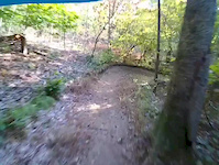
trail: Berms and Ferns
0:24 |
221 |
Oct 4, 2020
Recent Trail Reports
| status | trail | date | condition | info | user |
|---|---|---|---|---|---|
| Longway Home | Dec 31, 2025 @ 11:28am (America/Los_Angeles) Dec 31, 2025 | Freeze/thaw Cycle | FitchDrums | ||
| Old Way Up | Jun 4, 2024 @ 4:47am Jun 4, 2024 | Dry | KapitolPhoto BVNEMBA Admins | ||
| Downward Dog | Jun 4, 2024 @ 4:47am Jun 4, 2024 | Dry | KapitolPhoto BVNEMBA Admins | ||
| Non-Motorized Alt | Jun 4, 2024 @ 4:47am Jun 4, 2024 | Unknown | KapitolPhoto BVNEMBA Admins | ||
| Two sides Connector | Jun 4, 2024 @ 4:47am Jun 4, 2024 | Ideal | KapitolPhoto BVNEMBA Admins | ||
| YMCA | Jun 4, 2024 @ 4:47am Jun 4, 2024 | Unknown | KapitolPhoto BVNEMBA Admins | ||
| Camp Road | Jun 4, 2024 @ 4:47am Jun 4, 2024 | Wet | KapitolPhoto BVNEMBA Admins | ||
| Dunk to the Trunkline | Dec 27, 2023 @ 5:25pm Dec 27, 2023 | Freeze/thaw Cycle | m0unta1nclimber013 | ||
| Lengthwise | May 31, 2022 @ 2:30pm May 31, 2022 | Variable | mappermook TRAILFORKS | ||
| Grove Street Parking Access Road | May 31, 2022 @ 2:30pm May 31, 2022 | Ideal | mappermook TRAILFORKS |
Activity Feed
| username | action | type | title | date |
|---|---|---|---|---|
| dcr-regional-operations1 | update | region | activity #91583481 | Mar 30, 2026 @ 6:57am Mar 30, 2026 |
| WillieJacobsz | update | region | activity #91143302 | Mar 23, 2026 @ 7:34am Mar 23, 2026 |
| OrionSumire | ridden | trail | activity #89378098 and 1 more | Feb 22, 2026 @ 1:06pm Feb 22, 2026 |
| FitchDrums | add | report | activity #86397656 | Dec 31, 2025 @ 11:29am Dec 31, 2025 |
| JoenClZSR | wishlist | region | activity #77845243 | Aug 10, 2025 @ 10:53am Aug 10, 2025 |
Recent Comments
| username | type | title | comment | date |
|---|---|---|---|---|
| trail | Overgrown. A couple trees down. One of the... | Jul 3, 2024 @ 10:19am Jul 3, 2024 |
Nearby Areas
| name | distance | ||||
|---|---|---|---|---|---|
| Southern NE Turnpike Trail | 1.5 km | ||||
| Franklin Town Forest Recreation Area | 18 | 5 | 2.9 km | ||
| Delcarte Conservation Area | 18 | 3 | 3.2 km | ||
| Joe's Rock | 7 | 7 | 1 | 3.3 km | |
| Franklin Woods | 35 | 24 | 7 | 13 | 3.4 km |
Local Badges
-

Completionist0 awarded
Local Mountain Biking Directory
-
Bicycles PlusBike Shop
Activity Type Stats
| activitytype | trails | distance | descent | descent distance | total vertical | rating | global rank | state rank | photos | reports | routes | ridelogs |
|---|---|---|---|---|---|---|---|---|---|---|---|---|
| Mountain Bike | 76 | 25 miles | 1,886 ft | 11 miles | 187 ft | #11,806 | #4,817 | 4 | 52 | 2 | 889 | |
| E-Bike | 23 | 12 miles | 873 ft | 5 miles | 161 ft | #6,475 | #1,845 | 1 | 49 | 32 | ||
| Hike | 77 | 25 miles | 1,886 ft | 11 miles | 187 ft | #6,149 | #2,228 | 1 | 52 | 58 | ||
| Trail Running | 77 | 25 miles | 1,886 ft | 11 miles | 187 ft | #5,233 | #1,588 | 52 | 47 | |||
| Dirtbike/Moto | 23 | 12 miles | 873 ft | 5 miles | 161 ft | #921 | #398 | 1 | 29 |
Frequently Asked Questions About Franklin State Forest
▼
What are the highest rated mountain biking trails in Franklin State Forest?
The highest rated mountain biking trails in Franklin State Forest are:
- Berms and Ferns (4/5)
- Never Say Die (4/5)
- Dunk to the Trunkline (3.7/5)
- River Rats TT Loop (3.6/5)
- Moto Madness (3.6/5)
▼
What is the best time of the year to ride in Franklin State Forest?
Based on ride log data, the most popular months to ride in Franklin State Forest are:
- May (29 activities)
- June (24 activities)
- August (17 activities)
▼
Where can I park to ride in Franklin State Forest?
There are 2 parking locations listed in Franklin State Forest. The most popular parking spots are:
▼
What is the longest trail in Franklin State Forest?
The longest trail in Franklin State Forest is Moto Madness at 2.6 miles. View all trails sorted by distance.
Activities
Trails
Points of Interest
- By jbsails
 CityMills & contributors
 - Admins: Franklin, Franklin, DCR-FGHSF
- #37043 - 5,764 views
- franklin state forest activity log | embed map of Franklin State Forest mountain bike trails | franklin state forest mountain biking points of interest
Downloading of trail gps tracks in kml & gpx formats is enabled for Franklin State Forest.
You must login to download files.