close
-
Layers w
- Weather Layers
- Pro
- Pro
- Pro
- Pro
- Pro
- Pro
- More Layers
- Pro
- Pro
- Pro
- Pro
-
Upgrade to

3D
Trail Conditions
- Unknown
- Snow Groomed
- Snow Packed
- Snow Covered
- Snow Cover Partial
- Freeze/thaw Cycle
- Icy
- Prevalent Mud
- Wet
- Variable
- Ideal
- Dry
- Very Dry
Trail Flow (Ridden Direction)
Trailforks scans users ridelogs to determine the most popular direction each trail is ridden. A good flowing trail network will have most trails flowing in a single direction according to their intension.
The colour categories are based on what percentage of riders are riding a trail in its intended direction.
The colour categories are based on what percentage of riders are riding a trail in its intended direction.
- > 96%
- > 90%
- > 80%
- > 70%
- > 50%
- < 50%
- bi-directional trail
- no data
Trail Last Ridden
Trailforks scans ridelogs to determine the last time a trail was ridden.
- < 2 days
- < 1 week
- < 2 weeks
- < 1 month
- < 6 months
- > 6 months
Trail Ridden Direction
The intended direction a trail should be ridden.
- Downhill Only
- Downhill Primary
- Both Directions
- Uphill Primary
- Uphill Only
- One Direction
Contribute Details
Colors indicate trail is missing specified detail.
- Description
- Photos
- Description & Photos
- Videos
Trail Popularity ?
Trailforks scans ridelogs to determine which trails are ridden the most in the last 9 months.
Trails are compared with nearby trails in the same city region with a possible 25 colour shades.
Think of this as a heatmap, more rides = more kinetic energy = warmer colors.
- most popular
- popular
- less popular
- not popular
ATV/ORV/OHV Filter
Max Vehicle Width
inches
US Cell Coverage
Legend

Radar Time
Activity Recordings
Trailforks uses anonymized public activity data.
?
Activity Recordings
Trailforks uses anonymized public activity data.
?
Personal Heatmap
▶
Activity Types
all
/
none
▶
Options
2
Date range
month
–
Winter Trails
Warning
A routing network for winter maps does not exist. Selecting trails using the winter trails layer has been disabled.
Missing Trails
Most Popular
Least Popular
Trails are colored based on popularity. The more popular a trail is, the more red. Less popular trails trend towards green.
Jump Magnitude Heatmap
Heatmap of where riders jump on trails. Zoom in to see individual jumps, click circles to view jump details.
BC Backroad Status
![map legend]()
Service Road Atlas is a free to use, community-driven service for viewing and creating reports on the numerous back-country service roads around B.C. and Alberta.

Slope Aspect
Direction the slope faces
Trails Deemphasized
Trails are shown in grey.
Only show trails with no bike usage.
Suggested Layers
Based on selected activity type
Save the current map location and zoom level as your default home location whenever this page is loaded.
Save
No description for Fraser has been added yet!
Login or register to submit one.
Activities Click to view
- Mountain Bike
47 trails
- E-Bike
17 trails
- Gravel Bike
0 trails
- Adaptive Bike
0 trails
- Winter Fat Bike
0 trails
- Horse
12 trails
- Hike
67 trails
- Trail Running
66 trails
- Dirtbike/Moto
7 trails
- ATV/ORV/OHV
4 trails
- Snowmobile
3 trails
- Snowshoe
5 trails
- Nordic Ski
48 trails
Region Details
- 7
- 5
- 15
- 13
- 6
Region Status
Open as of Jun 21, 2026Stats
- Avg Trail Rating
- Trails (view details)
- 53
- Trails Mountain Bike
- 48
- Trails E-Bike
- 17
- Trails Horse
- 12
- Trails Hike
- 67
- Trails Trail Running
- 66
- Trails Dirtbike/Moto
- 7
- Trails ATV/ORV/OHV
- 4
- Trails Snowmobile
- 3
- Trails Snowshoe
- 5
- Trails Nordic Ski
- 48
- Total Distance
- 90 miles
- Total Descent
- 12,139 ft
- Total Vertical
- 4,424 ft
- Highest Trailhead
- 12,795 ft
- Reports
- 330
- Photos
- 57
- Ridden Counter
- 10,057
Sub Regions
-
Devil's Thumb Ranch
- 2
- 3
- 3
-
St. Louis Creek
- 3
- 1
Popular Fraser Mountain Biking Trails
• 90 ★ 3.8 • 2 miles • 17 ft • 892 •
Popular green difficulty singletrack. This mountain bike primary trail can be used both directions with a 17 ft green climb. On average it takes 16 minutes to complete this trail.
• 100 ★ 3.5 • 2 miles • 18 ft • 865 •
Mix of smooth flow trail with berms, rollers, and a few small tables. Enough flat turns to keep you on your toes. Rides great in either direction.
• 100 ★ 4.0 • 1 mile • 10 ft • 816 •
Highly rated popular blue difficulty singletrack. This mountain bike primary trail can be used both directions. It features berm. On average it takes 11 minutes to complete this trail.
• 95 ★ 3.4 • 3 miles • 409 ft • 718 •
Popular blue difficulty singletrack. This mountain bike primary trail can be used both directions. On average it takes 25 minutes to complete this trail.
• 100 ★ 3.9 • 2 miles • 271 ft • 618 •
Popular blue difficulty singletrack. This multi-use trail can be used both directions. On average it takes 18 minutes to complete this trail.
• 90 ★ 3.0 • 5,121 ft • 131 ft • 574 •
Popular green difficulty singletrack. This multi-use trail can be used both directions. On average it takes 7 minutes to complete this trail.
• 85 ★ 0.0 • 1 mile • 46 ft • 469 •
Popular green difficulty singletrack. This mountain bike primary trail can be used both directions. On average it takes 9 minutes to complete this trail.
• 85 ★ 4.4 • 2 miles • 1,010 ft • 444 •
Popular blue difficulty singletrack. This mountain bike primary trail can be used uphill primary. On average it takes 32 minutes to complete this trail.
Fraser Mountain Bike Routes
5 miles • 662 ft • 2 •
5 miles • 247 ft • 3 •
7 miles • 803 ft • 3 •
★ 2.0 • 33 miles • 3,844 ft • 25 • Point to Point •
Part 1 of Brute Squad 50 training ride. Fraser to Winter Park. Note that there was no ability to connect...
40 miles • 4,485 ft • 19 •
Icebox Mountain Ride! some of the best trails in Grand County in one go!
★ 2.0 • 2 miles • 207 ft • 2 •
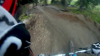
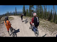
Photos of Fraser Mountain Bike
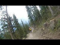
Videos of Fraser Mountain Bike
trail: Friends
25:12 |
100 |
Sep 1, 2013
trail: Friends
21:50 |
91 |
Sep 1, 2013
trail: Friends
21:52 |
93 |
Sep 1, 2013
trail: Friends
26:22 |
94 |
Sep 1, 2013
trail: Friends
24:33 |
137 |
Sep 1, 2013
trail: Friends
2:28 |
83 |
Jun 30, 2013
trail: Friends
0:39 |
240 |
Nov 2, 2012
trail: Friends
3:17 |
221 |
Aug 26, 2012
Current Trail Warnings
| status | trail | date | condition | user | info |
|---|---|---|---|---|---|
| Elk Meadow | Jun 21, 2026 @ 10:08am (America/Denver) Jun 21, 2026 | Dry | Shawnsrides |
Recent Trail Reports
| status | trail | date | condition | info | user |
|---|---|---|---|---|---|
| Upper Elk Loop | Jun 21, 2026 @ 10:08am (America/Denver) Jun 21, 2026 | Dry | Shawnsrides | ||
| Double Bit | Jun 21, 2026 @ 10:08am (America/Denver) Jun 21, 2026 | Dry | Shawnsrides | ||
| WTB (Middle) | Jun 21, 2026 @ 10:08am (America/Denver) Jun 21, 2026 | Ideal | Shawnsrides | ||
| Upper Iko | Jun 21, 2026 @ 10:08am (America/Denver) Jun 21, 2026 | Dry | Shawnsrides | ||
| Backscratch | Jun 21, 2026 @ 10:17am (America/Denver) Jun 21, 2026 | Dry | hackerssuck | ||
| Northwest Passage | Jun 7, 2026 @ 8:33pm (America/Denver) Jun 7, 2026 | Unknown | spillcoleman | ||
| Devil's Thumb Park | May 31, 2026 @ 9:39am (America/Denver) May 31, 2026 | Snow Cover Partial | EdKimmTUE | ||
| Creekside Loop | May 23, 2026 @ 11:44am (America/Denver) May 23, 2026 | Ideal | jemmons213 | ||
| Flume | May 23, 2026 @ 11:43am (America/Denver) May 23, 2026 | Ideal | jemmons213 | ||
| Broken Spade | Oct 16, 2025 @ 12:59pm (America/Denver) Oct 16, 2025 | Ideal | FkUwHS |
National Scenic Trails & Official Routes
-
Continental Divide Trail
- Mountain Bike
- Hike
- Trail Running

Activity Feed
| username | action | type | title | date |
|---|---|---|---|---|
| Shawnsrides | add | report | activity #97509382 and 4 more | Jun 21, 2026 @ 12:17pm Jun 21, 2026 |
| hackerssuck | add | report | activity #97492253 | Jun 21, 2026 @ 9:17am Jun 21, 2026 |
| hackerssuck | comment | trail | activity #97492204 | Jun 21, 2026 @ 9:17am Jun 21, 2026 |
| hackerssuck | vote | trail | activity #97492155 | Jun 21, 2026 @ 9:16am Jun 21, 2026 |
| JohnM1k27K | wishlist | trail | activity #97115349 and 2 more | Jun 16, 2026 @ 9:10am Jun 16, 2026 |
Recent Comments
| username | type | title | comment | date |
|---|---|---|---|---|
| trail | Worst "dh" trail around. Don't waste your time | Jun 21, 2026 @ 9:17am Jun 21, 2026 | ||
| trail | Still a brutal heavily rutted trail, yuck | Aug 19, 2025 @ 8:02am Aug 19, 2025 | ||
| trail | Beautiful trail not many rocks | Jun 18, 2025 @ 10:55am Jun 18, 2025 | ||
| trail | The first half of the trail is double track,... | Aug 24, 2024 @ 9:04am Aug 24, 2024 | ||
| trail | Rough trail worn out by water erosion. Tough... | Jul 9, 2024 @ 12:14pm Jul 9, 2024 |
Local Badges
-

Epic Ride Climb 2k9 awarded -

Climbing 10k Badge33 awarded -

Climbing 100k Badge0 awarded -

Epic Ride Descent 2k10 awarded -

Descent 10k Badge34 awarded -

Descent 100k Badge0 awarded
Activity Type Stats
| activitytype | trails | distance | descent | descent distance | total vertical | rating | global rank | state rank | photos | reports | routes | ridelogs |
|---|---|---|---|---|---|---|---|---|---|---|---|---|
| Mountain Bike | 47 | 62 miles | 7,904 ft | 26 miles | 3,386 ft | #2,644 | #944 | 54 | 330 | 17 | 7,729 | |
| E-Bike | 17 | 29 miles | 3,297 ft | 10 miles | 2,277 ft | #4,319 | #1,414 | 240 | 1 | 166 | ||
| Horse | 12 | 33 miles | 5,266 ft | 12 miles | 4,423 ft | #1,457 | #861 | 64 | ||||
| Hike | 67 | 90 miles | 12,139 ft | 36 miles | 4,423 ft | #2,454 | #972 | 4 | 330 | 15 | 883 | |
| Trail Running | 66 | 78 miles | 10,928 ft | 32 miles | 4,423 ft | #2,878 | #826 | 330 | 14 | 451 | ||
| Dirtbike/Moto | 7 | 19 miles | 2,438 ft | 7 miles | 2,093 ft | #978 | #366 | 66 | 7 | |||
| ATV/ORV/OHV | 4 | 16 miles | 2,106 ft | 5 miles | 1,909 ft | #789 | #344 | 61 | 2 | |||
| Snowmobile | 3 | 10 miles | 1,096 ft | 3 miles | 1,342 ft | #294 | #156 | 5 | 3 | |||
| Snowshoe | 5 | 10 miles | 1,096 ft | 3 miles | 1,667 ft | #1,061 | #534 | 5 | 10 | 69 | ||
| Nordic Ski | 48 | 7 miles | 951 ft | 2 miles | 1,667 ft | #577 | #189 | 4 | 2 | 1,715 |
Frequently Asked Questions About Fraser
▼
What are the best places to ride in Fraser?
Fraser has 3 areas to explore for mountain biking. The top rated areas are:
▼
What are the highest rated mountain biking trails in Fraser?
The highest rated mountain biking trails in Fraser are:
- Tipperary Creek (4.2/5)
- Creekside CG (East) (4.1/5)
- Creekside CG (West) (4.1/5)
- Marker Hill (4.1/5)
- D2 Green (4.1/5)
▼
What is the best time of the year to ride in Fraser?
Based on ride log data, the most popular months to ride in Fraser are:
- July (321 activities)
- August (171 activities)
- June (170 activities)
▼
Where can I park to ride in Fraser?
There are 14 parking locations listed in Fraser. The most popular parking spots are: View all parking and trailhead locations on the map to plan your visit.
Activities
Trails
- By brenthillier
 NSMBA TRAILFORKS & contributors
 - Admins: FVMTB, FVMTB
- #12417 - 9,987 views
- fraser activity log | embed map of Fraser mountain bike trails | fraser mountain biking points of interest
Downloading of trail gps tracks in kml & gpx formats is enabled for Fraser.
You must login to download files.