close
-
Layers w
- Weather Layers
- Pro
- Pro
- Pro
- Pro
- Pro
- Pro
- More Layers
- Pro
- Pro
- Pro
- Pro
-
Upgrade to

3D
Trail Conditions
- Unknown
- Snow Groomed
- Snow Packed
- Snow Covered
- Snow Cover Partial
- Freeze/thaw Cycle
- Icy
- Prevalent Mud
- Wet
- Variable
- Ideal
- Dry
- Very Dry
Trail Flow (Ridden Direction)
Trailforks scans users ridelogs to determine the most popular direction each trail is ridden. A good flowing trail network will have most trails flowing in a single direction according to their intension.
The colour categories are based on what percentage of riders are riding a trail in its intended direction.
The colour categories are based on what percentage of riders are riding a trail in its intended direction.
- > 96%
- > 90%
- > 80%
- > 70%
- > 50%
- < 50%
- bi-directional trail
- no data
Trail Last Ridden
Trailforks scans ridelogs to determine the last time a trail was ridden.
- < 2 days
- < 1 week
- < 2 weeks
- < 1 month
- < 6 months
- > 6 months
Trail Ridden Direction
The intended direction a trail should be ridden.
- Downhill Only
- Downhill Primary
- Both Directions
- Uphill Primary
- Uphill Only
- One Direction
Contribute Details
Colors indicate trail is missing specified detail.
- Description
- Photos
- Description & Photos
- Videos
Trail Popularity ?
Trailforks scans ridelogs to determine which trails are ridden the most in the last 9 months.
Trails are compared with nearby trails in the same city region with a possible 25 colour shades.
Think of this as a heatmap, more rides = more kinetic energy = warmer colors.
- most popular
- popular
- less popular
- not popular
ATV/ORV/OHV Filter
Max Vehicle Width
inches
US Cell Coverage
Legend

Radar Time
Activity Recordings
Trailforks uses anonymized public activity data.
?
Activity Recordings
Trailforks uses anonymized public activity data.
?
Personal Heatmap
▶
Activity Types
all
/
none
▶
Options
2
Date range
month
–
Winter Trails
Warning
A routing network for winter maps does not exist. Selecting trails using the winter trails layer has been disabled.
Missing Trails
Most Popular
Least Popular
Trails are colored based on popularity. The more popular a trail is, the more red. Less popular trails trend towards green.
Jump Magnitude Heatmap
Heatmap of where riders jump on trails. Zoom in to see individual jumps, click circles to view jump details.
BC Backroad Status
![map legend]()
Service Road Atlas is a free to use, community-driven service for viewing and creating reports on the numerous back-country service roads around B.C. and Alberta.

Slope Aspect
Direction the slope faces
Trails Deemphasized
Trails are shown in grey.
Only show trails with no bike usage.
Suggested Layers
Based on selected activity type
Save the current map location and zoom level as your default home location whenever this page is loaded.
Save
No description for Frazier park has been added yet!
Login or register to submit one.
Activities Click to view
- Mountain Bike
20 trails
- E-Bike
19 trails
- Hike
18 trails
- Trail Running
18 trails
- Dirtbike/Moto
16 trails
- ATV/ORV/OHV
10 trails
Region Details
- 1
- 3
- 10
- 5
- 1
Region Status
Caution as of May 20, 2026Stats
- Avg Trail Rating
- Trails (view details)
- 20
- Trails Mountain Bike
- 20
- Trails E-Bike
- 19
- Trails Hike
- 18
- Trails Trail Running
- 18
- Trails Dirtbike/Moto
- 16
- Trails ATV/ORV/OHV
- 10
- Total Distance
- 84 miles
- Total Descent Distance
- 34 miles
- Total Descent
- 15,726 ft
- Total Vertical
- 4,809 ft
- Highest Trailhead
- 8,814 ft
- Reports
- 72
- Photos
- 96
- Ridden Counter
- 628
Sub Regions
-
Frazier Mountain
- 2
- 7
- 4
- 1
-
Mt. Pinos
- 1
- 1
Popular Frazier park Mountain Biking Trails
• 95 ★ 4.5 • 8 miles • 36 ft • 211 •
Starting at the the McGill or Mount Pinos campgrounds allows for either a climb via McGill trail or take the road. Mt Pinos road is quite mild in grade and will either be a 4.5 or 6 mile climb according to where you camped. I have...
• 90 ★ 2.0 • 1,640 ft • 0 ft • 94 •
Popular green difficulty singletrack. This mountain bike primary trail can be used downhill only. On average it takes 1 minutes to complete this trail.
• 85 ★ 0.0 • 2,162 ft • 13 ft • 46 •
Popular black diamond difficulty singletrack. This mountain bike primary trail can be used both directions and has a moderate overall physical rating with a 13 ft green climb. It features rock garden. Trail visibility is always easy to follow. On average it takes 2 minutes to complete this trail.
• 80 ★ 0.0 • 4 miles • 1,775 ft • 9 • • atv
Popular green difficulty dirt/gravel road. This atv/orv/ohv primary trail can be used both directions and has a moderate overall physical rating with a 1,775 ft green climb. On average it takes 1 hour1 minutes to complete this trail.
• 70 ★ 0.0 • 1 mile • 212 ft • 7 • • atv
Popular blue difficulty doubletrack. This atv/orv/ohv primary trail can be used both directions and has a moderate overall physical rating. On average it takes 5 minutes to complete this trail.
• 75 ★ 0.0 • 9 miles • 2,377 ft • 5 • • moto
Trail has a lot of exposed sections and narrow single track. Steep ups and down sections make this a trail you don't want to ride alone. Some steep and loose rocky switch backs along with some sections that require expert skill to get...
• 65 ★ 0.0 • 6 miles • 489 ft • 4 • • moto
Fun flowy trail mostly ridden by moto. Takes you to Lockwood creek from tejon.
• 5 ★ 0.0 • 2 miles • 355 ft • 4 • • atv
Less popular green difficulty dirt/gravel road. This atv/orv/ohv primary trail can be used both directions and has a easy overall physical rating with a 355 ft green climb. On average it takes 22 minutes to complete this trail.
Frazier park Mountain Bike Routes
★ 4.4 • 15 miles • 2,329 ft • 0 • Loop •
These trails are pretty mellow and are suitable for all skill levels.
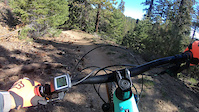
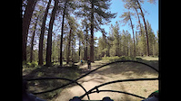
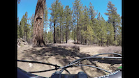
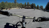
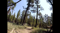
Photos of Frazier park Mountain Bike
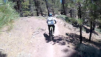
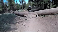
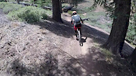
Videos of Frazier park Mountain Bike
trail: Mt Pinos via McGill Trail
5:37 |
|
Feb 21, 2023
trail: Mt Pinos via McGill Trail
3:48 |
186 |
Jun 26, 2021
trail: Mt Pinos via McGill Trail
3:09 |
65 |
Apr 22, 2021
trail: Mt Pinos via McGill Trail
11:20 |
115 |
Sep 4, 2018
trail: Mt Pinos via McGill Trail
0:57 |
167 |
Aug 14, 2018
trail: Mt Pinos via McGill Trail
2:39 |
62 |
Jul 21, 2018
trail: Mt Pinos via McGill Trail
2:20 |
88 |
Jul 21, 2018
trail: Mt Pinos via McGill Trail
3:03 |
74 |
Jul 16, 2018
Recent Trail Reports
| status | trail | date | condition | info | user |
|---|---|---|---|---|---|
| Mt Pinos via McGill Trail | Mar 19, 2026 @ 8:54am (America/Los_Angeles) Mar 19, 2026 | Variable | kpiper | ||
| Chunkster | Jul 12, 2025 @ 8:50am Jul 12, 2025 | Dry | dok1 | ||
| MT Pinos Bottom Cut | Jun 8, 2025 @ 10:52am Jun 8, 2025 | Dry | Kcampeau | ||
| Frazier Mtn OHV | Nov 6, 2024 @ 4:26pm Nov 6, 2024 | Very Dry | CoachNOTE | ||
| MT Pinos Road | Oct 18, 2024 @ 6:42am Oct 18, 2024 | Dry | jfisher1 | ||
| Lockwood Creek Road | Aug 24, 2024 @ 12:42pm Aug 24, 2024 | Very Dry | SergioYdivU2 | ||
| Piru Creek (East) | Aug 24, 2024 @ 12:42pm Aug 24, 2024 | Very Dry | SergioYdivU2 | ||
| Gold Hill Trail | Aug 24, 2024 @ 12:42pm Aug 24, 2024 | Very Dry | SergioYdivU2 | ||
| Whata Trail | Aug 24, 2024 @ 12:42pm Aug 24, 2024 | Very Dry | SergioYdivU2 | ||
| West Frazier Mine Road | Aug 24, 2024 @ 12:42pm Aug 24, 2024 | Very Dry | SergioYdivU2 |
Activity Feed
| username | action | type | title | date |
|---|---|---|---|---|
| NuckaMan | vote | trail | activity #96940311 | Jun 13, 2026 @ 11:07pm Jun 13, 2026 |
| robotmechanic | wishlist | trail | activity #93626758 | Apr 28, 2026 @ 8:44pm Apr 28, 2026 |
| CristianeAAiDP | add | photo | activity #91415981 | Mar 27, 2026 @ 10:18pm Mar 27, 2026 |
| kpiper | add | report | activity #90943324 | Mar 20, 2026 @ 2:21pm Mar 20, 2026 |
| OscarhlAhx | add | report | activity #89838630 | Mar 2, 2026 @ 7:22am Mar 2, 2026 |
Recent Comments
| username | type | title | comment | date |
|---|---|---|---|---|
| trail | Rode this trail 3 days ago. First time on it... | Jun 11, 2025 @ 8:19am Jun 11, 2025 | ||
| trail | Rode yesterday, trail is in excellent... | Jan 12, 2025 @ 10:17am Jan 12, 2025 | ||
| trail | Ridden 9/7/2024: Trail is in pretty good... | Sep 9, 2024 @ 7:57am Sep 9, 2024 | ||
| trail | On one of the videos they mention that... | May 2, 2022 @ 5:51pm May 2, 2022 | ||
| trail | I heard there is a shuttle service that runs... | Apr 19, 2022 @ 10:32am Apr 19, 2022 |
Local Badges
-

Epic Mountain Bike Climb 2k20 awarded -

Climbing 10k Badge4 awarded -

Mountain Biking 100k Badge0 awarded -

Epic Ride Descent 2k20 awarded -

Descent 10k Badge6 awarded -

Descent 100k Badge1 awarded
Activity Type Stats
| activitytype | trails | distance | descent | descent distance | total vertical | rating | global rank | state rank | photos | reports | routes | ridelogs |
|---|---|---|---|---|---|---|---|---|---|---|---|---|
| Mountain Bike | 20 | 84 miles | 15,725 ft | 34 miles | 4,810 ft | #4,611 | #1,546 | 96 | 72 | 1 | 2,645 | |
| E-Bike | 19 | 78 miles | 14,114 ft | 30 miles | 4,810 ft | #2,437 | #993 | 3 | 57 | 280 | ||
| Hike | 18 | 75 miles | 15,715 ft | 33 miles | 4,810 ft | #4,026 | #1,423 | 71 | 250 | |||
| Trail Running | 18 | 75 miles | 15,715 ft | 33 miles | 4,810 ft | #3,468 | #1,027 | 71 | 7 | |||
| Dirtbike/Moto | 16 | 67 miles | 12,776 ft | 26 miles | 3,999 ft | #605 | #205 | 2 | 15 | 6 | ||
| ATV/ORV/OHV | 10 | 39 miles | 8,186 ft | 14 miles | 3,714 ft | #569 | #213 | 6 |
Frequently Asked Questions About Frazier park
▼
What are the best places to ride in Frazier park?
Frazier park has 2 areas to explore for mountain biking. The top rated areas are:
▼
What are the highest rated mountain biking trails in Frazier park?
The highest rated mountain biking trails in Frazier park are:
- Mt Pinos via McGill Trail (4.3/5)
- MT Pinos Bottom Cut (3.7/5)
- Chunkster (0/5)
- Frazier Mtn OHV (0/5)
- Tejon Trail (0/5)
▼
What is the best time of the year to ride in Frazier park?
Based on ride log data, the most popular months to ride in Frazier park are:
- July (35 activities)
- August (28 activities)
- June (24 activities)
▼
Where can I park to ride in Frazier park?
There are 1 parking locations listed in Frazier park. The most popular parking spots are:
Activities
Trails
- By sbrdude1 & contributors
- Admins: apply
- #3414 - 4,998 views
- frazier park activity log | embed map of Frazier park mountain bike trails | frazier park mountain biking points of interest
Downloading of trail gps tracks in kml & gpx formats is enabled for Frazier park.
You must login to download files.