close
-
Layers w
- Weather Layers
- Pro
- Pro
- Pro
- Pro
- Pro
- Pro
- More Layers
- Pro
- Pro
- Pro
- Pro
-
Upgrade to

3D
Trail Conditions
- Unknown
- Snow Groomed
- Snow Packed
- Snow Covered
- Snow Cover Partial
- Freeze/thaw Cycle
- Icy
- Prevalent Mud
- Wet
- Variable
- Ideal
- Dry
- Very Dry
Trail Flow (Ridden Direction)
Trailforks scans users ridelogs to determine the most popular direction each trail is ridden. A good flowing trail network will have most trails flowing in a single direction according to their intension.
The colour categories are based on what percentage of riders are riding a trail in its intended direction.
The colour categories are based on what percentage of riders are riding a trail in its intended direction.
- > 96%
- > 90%
- > 80%
- > 70%
- > 50%
- < 50%
- bi-directional trail
- no data
Trail Last Ridden
Trailforks scans ridelogs to determine the last time a trail was ridden.
- < 2 days
- < 1 week
- < 2 weeks
- < 1 month
- < 6 months
- > 6 months
Trail Ridden Direction
The intended direction a trail should be ridden.
- Downhill Only
- Downhill Primary
- Both Directions
- Uphill Primary
- Uphill Only
- One Direction
Contribute Details
Colors indicate trail is missing specified detail.
- Description
- Photos
- Description & Photos
- Videos
Trail Popularity ?
Trailforks scans ridelogs to determine which trails are ridden the most in the last 9 months.
Trails are compared with nearby trails in the same city region with a possible 25 colour shades.
Think of this as a heatmap, more rides = more kinetic energy = warmer colors.
- most popular
- popular
- less popular
- not popular
ATV/ORV/OHV Filter
Max Vehicle Width
inches
US Cell Coverage
Legend

Radar Time
Activity Recordings
Trailforks uses anonymized public activity data.
?
Activity Recordings
Trailforks uses anonymized public activity data.
?
Personal Heatmap
▶
Activity Types
all
/
none
▶
Options
2
Date range
month
–
Winter Trails
Warning
A routing network for winter maps does not exist. Selecting trails using the winter trails layer has been disabled.
Missing Trails
Most Popular
Least Popular
Trails are colored based on popularity. The more popular a trail is, the more red. Less popular trails trend towards green.
Jump Magnitude Heatmap
Heatmap of where riders jump on trails. Zoom in to see individual jumps, click circles to view jump details.
BC Backroad Status
![map legend]()
Service Road Atlas is a free to use, community-driven service for viewing and creating reports on the numerous back-country service roads around B.C. and Alberta.

Slope Aspect
Direction the slope faces
Trails Deemphasized
Trails are shown in grey.
Only show trails with no bike usage.
Suggested Layers
Based on selected activity type
Save the current map location and zoom level as your default home location whenever this page is loaded.
Save
No description for Fredericia has been added yet!
Login or register to submit one.
Activities Click to view
- Mountain Bike
14 trails
- E-Bike
10 trails
- Adaptive Bike
0 trails
- Hike
13 trails
- Trail Running
12 trails
Stats
- Avg Trail Rating
- Trails (view details)
- 14
- Trails Mountain Bike
- 14
- Trails E-Bike
- 10
- Trails Hike
- 13
- Trails Trail Running
- 12
- Total Distance
- 15 miles
- Total Descent
- 1,308 ft
- Total Vertical
- 293 ft
- Highest Trailhead
- 301 ft
- Reports
- 17
- Photos
- 7
- Ridden Counter
- 95
Sub Regions
-
Hannerup Skov
- 5
-
Madsby MTB Paraspor
Popular Fredericia Mountain Biking Trails
• 100 ★ 2.7 • 3,675 ft • 61 ft • 43 •
Popular blue difficulty singletrack. This multi-use trail can be used one direction and has a moderate overall physical rating with a 61 ft blue climb. Exposure: Normal Injury Risk. Trail visibility is always easy to follow. On average it takes 42 minutes to complete this trail.
• 75 ★ 3.0 • 1 mile • 110 ft • 11 •
Easy green trail with access for everyone. You can take the short loop round again and again or the full trail.
• ★ 0.0 • 2,799 ft • 34 ft • 7 •
Blue difficulty singletrack. This multi-use trail can be used one direction and has a hard overall physical rating with a 34 ft blue climb. It features rock garden.
• ★ 0.0 • 2 miles • 196 ft • 7 •
Blue difficulty singletrack. This multi-use trail can be used one direction and has a hard overall physical rating with a 196 ft blue climb. It features rock garden.
• ★ 0.0 • 1 mile • 108 ft • 6 •
Blue difficulty singletrack. This multi-use trail can be used one direction and has a hard overall physical rating with a 108 ft blue climb. It features rock garden.
• ★ 0.0 • 3 miles • 236 ft • 4 •
Great little loop close to the city behind a big playground for kids. This is the playground for parents :)
• ★ 0.0 • 4 miles • 413 ft •
A hard loop with minimum technical skills.
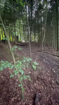
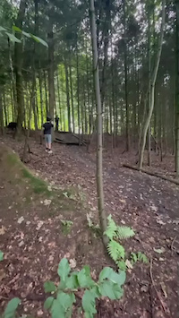
Photos of Fredericia Mountain Bike
Videos of Fredericia Mountain Bike
trail: Hannerup skov Middle S
0:07 |
87 |
Jan 21, 2024
trail: Hannerup skov Middle S
0:07 |
62 |
Jan 21, 2024
Recent Trail Reports
| status | trail | date | condition | info | user |
|---|---|---|---|---|---|
| Hannerup skov Middle N | Jun 3, 2026 @ 6:33pm (Europe/Copenhagen) Jun 3, 2026 | Variable | mandreasen TP Vejle | ||
| Hannerup skov Middle S | Sep 3, 2025 @ 9:37am Sep 3, 2025 | Ideal | REN77 | ||
| Transfer: Vejen Golfklub -> Drostrup | Jan 28, 2024 @ 2:10am Jan 28, 2024 | Wet | 3b57XE | ||
| Madsby MTB paraspor | Oct 12, 2023 @ 6:57am Oct 12, 2023 | Ideal | Rasmushovergaard |
Activity Feed
| username | action | type | title | date |
|---|---|---|---|---|
| mandreasen | ridden | trail | activity #96225434 | Jun 4, 2026 @ 7:20am Jun 4, 2026 |
| mandreasen | add | report | activity #96174058 | Jun 3, 2026 @ 12:29pm Jun 3, 2026 |
| WillieJacobsz | update | region | activity #88627062 | Feb 9, 2026 @ 8:05am Feb 9, 2026 |
| WillieJacobsz | add | trail | activity #88624786 and 4 more | Feb 9, 2026 @ 7:08am Feb 9, 2026 |
| WillieJacobsz | add | poi | activity #88624719 and 2 more | Feb 9, 2026 @ 7:06am Feb 9, 2026 |
Recent Comments
| username | type | title | comment | date |
|---|---|---|---|---|
| trail | Also for E-MTB and aMTB | Jan 29, 2026 @ 12:12pm Jan 29, 2026 | ||
| trail | A nice little loop through the woods. Some... | Sep 24, 2018 @ 5:02am Sep 24, 2018 |
Activity Type Stats
| activitytype | trails | distance | descent | descent distance | total vertical | rating | global rank | state rank | photos | reports | routes | ridelogs |
|---|---|---|---|---|---|---|---|---|---|---|---|---|
| Mountain Bike | 14 | 15 miles | 1,309 ft | 6 miles | 292 ft | #8,200 | #40 | 7 | 17 | 2,198 | ||
| E-Bike | 10 | 6 miles | 505 ft | 2 miles | 236 ft | #2,170 | #32 | 15 | 215 | |||
| Hike | 13 | 14 miles | 1,191 ft | 6 miles | 292 ft | #3,613 | #31 | 15 | 55 | |||
| Trail Running | 12 | 13 miles | 1,132 ft | 5 miles | 292 ft | #3,102 | #32 | 15 | 6 |
Frequently Asked Questions About Fredericia
▼
What are the best places to ride in Fredericia?
Fredericia has 2 areas to explore for mountain biking. The top rated areas are:
▼
What are the highest rated mountain biking trails in Fredericia?
The highest rated mountain biking trails in Fredericia are:
- Madsby MTB paraspor (3.7/5)
- Hannerup skov Middle S (3.5/5)
- Juelsminde Sporet (0/5)
- Tough Loop In Lottrup (6 km - 110 VAM) (0/5)
- Start Connector (0/5)
▼
What is the best time of the year to ride in Fredericia?
Based on ride log data, the most popular months to ride in Fredericia are:
- March (2 activities)
- June (1 activities)
- August (1 activities)
▼
Where can I park to ride in Fredericia?
There are 3 parking locations listed in Fredericia. The most popular parking spots are: View all parking and trailhead locations on the map to plan your visit.
Activities
- By trailforks
 Trailforks & contributors
 - Admins: FCC
- #24622 - 1,518 views
- fredericia activity log | embed map of Fredericia mountain bike trails | fredericia mountain biking points of interest
Downloading of trail gps tracks in kml & gpx formats is enabled for Fredericia.
You must login to download files.