close
-
Layers w
- Weather Layers
- Pro
- Pro
- Pro
- Pro
- Pro
- Pro
- More Layers
- Pro
- Pro
- Pro
- Pro
-
Upgrade to

3D
Trail Conditions
- Unknown
- Snow Groomed
- Snow Packed
- Snow Covered
- Snow Cover Partial
- Freeze/thaw Cycle
- Icy
- Prevalent Mud
- Wet
- Variable
- Ideal
- Dry
- Very Dry
Trail Flow (Ridden Direction)
Trailforks scans users ridelogs to determine the most popular direction each trail is ridden. A good flowing trail network will have most trails flowing in a single direction according to their intension.
The colour categories are based on what percentage of riders are riding a trail in its intended direction.
The colour categories are based on what percentage of riders are riding a trail in its intended direction.
- > 96%
- > 90%
- > 80%
- > 70%
- > 50%
- < 50%
- bi-directional trail
- no data
Trail Last Ridden
Trailforks scans ridelogs to determine the last time a trail was ridden.
- < 2 days
- < 1 week
- < 2 weeks
- < 1 month
- < 6 months
- > 6 months
Trail Ridden Direction
The intended direction a trail should be ridden.
- Downhill Only
- Downhill Primary
- Both Directions
- Uphill Primary
- Uphill Only
- One Direction
Contribute Details
Colors indicate trail is missing specified detail.
- Description
- Photos
- Description & Photos
- Videos
Trail Popularity ?
Trailforks scans ridelogs to determine which trails are ridden the most in the last 9 months.
Trails are compared with nearby trails in the same city region with a possible 25 colour shades.
Think of this as a heatmap, more rides = more kinetic energy = warmer colors.
- most popular
- popular
- less popular
- not popular
ATV/ORV/OHV Filter
Max Vehicle Width
inches
US Cell Coverage
Legend

Radar Time
Activity Recordings
Trailforks uses anonymized public activity data.
?
Activity Recordings
Trailforks uses anonymized public activity data.
?
Personal Heatmap
▶
Activity Types
all
/
none
▶
Options
2
Date range
month
–
Winter Trails
Warning
A routing network for winter maps does not exist. Selecting trails using the winter trails layer has been disabled.
Missing Trails
Most Popular
Least Popular
Trails are colored based on popularity. The more popular a trail is, the more red. Less popular trails trend towards green.
Jump Magnitude Heatmap
Heatmap of where riders jump on trails. Zoom in to see individual jumps, click circles to view jump details.
BC Backroad Status
![map legend]()
Service Road Atlas is a free to use, community-driven service for viewing and creating reports on the numerous back-country service roads around B.C. and Alberta.

Slope Aspect
Direction the slope faces
Trails Deemphasized
Trails are shown in grey.
Only show trails with no bike usage.
Suggested Layers
Based on selected activity type
Save the current map location and zoom level as your default home location whenever this page is loaded.
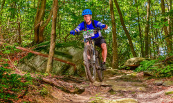
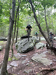
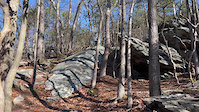
SaveThe Watershed is a treasured jewel to area mountain bikers. It has has fantastic riding opportunities but like Gambrill the trails are rocky and technical. Due to advanced terrain and unmarked, the Watershed is a poor choice for beginners.
Primary Trail Type: Cross-Country
Shuttleable: YES
Land Status: State Park
Land Manager: MD DNR
 google parking directions
 Activities Click to view
- Mountain Bike
85 trails
- E-Bike
1 trails
- Horse
5 trails
- Hike
80 trails
- Trail Running
80 trails
Region Details
- 10
- 10
- 39
- 13
- 5
Region Status
Caution as of Jun 14, 2026Stats
- Avg Trail Rating
- Trails (view details)
- 79
- Trails Mountain Bike
- 91
- Trails E-Bike
- 1
- Trails Horse
- 5
- Trails Hike
- 80
- Trails Trail Running
- 80
- Trails Dirtbike/Moto
- 2
- Trails Backcountry Ski
- 1
- Trails Nordic Ski
- 2
- Total Distance
- 90 miles
- Total Descent
- 20,024 ft
- Total Vertical
- 1,248 ft
- Highest Trailhead
- 1,839 ft
- Reports
- 1,567
- Photos
- 208
- Ridden Counter
- 28,706
Articles
Race Report: 2019 Sheduro Race Report - Frederick Watershed, Maryland
Aug 22, 2019 from pinkbike.com
One of the rockiest trail systems on the East Coast had record attendance during the 2019 Bike Doctor Sheduro
Popular Frederick Watershed Mountain Biking Trails
• 100 ★ 4.9 • 2 miles • 681 ft • 1,393 •
Machine built, bike focused, multi-use trail. Bi-directional, Opened for use in Oct. 2019. Part of a Recreation Trails Program grant project. Climbing access from the bottom of the mountain to more gravity focused trails.
• 100 ★ 3.8 • 2,028 ft • 51 ft • 1,263 •
Popular blue difficulty singletrack. This mountain bike primary trail can be used uphill primary. On average it takes 4 minutes to complete this trail.
• 100 ★ 4.7 • 1 mile • 0 ft • 1,200 •
Machine built flow trail with multiple berms, gaps and tables. Part of a Recreation Trails Program grant project. Closed when conditions are soft or wet.
• 95 ★ 4.2 • 1 mile • 121 ft • 901 •
Used to be a more difficult trail before someone cut down some of the trees in the tightest sections (curse you, tree cutter). Not to be confused with 2. Some technical sections and fun rock features. Overall a fun trail and good...
• 100 ★ 4.5 • 4,816 ft • 78 ft • 805 •
Highly rated popular blue difficulty singletrack. This mountain bike primary trail can be used downhill primary and has a moderate overall physical rating with a 78 ft green climb. It features berm and drop. On average it takes 7 minutes to complete this trail.
• 90 ★ 4.1 • 5,036 ft • 100 ft • 773 •
Highly rated popular blue difficulty singletrack. This mountain bike primary trail can be used both directions and has a moderate overall physical rating with a 100 ft blue climb. On average it takes 12 minutes to complete this trail.
• 100 ★ 3.4 • 3,018 ft • 0 ft • 744 •
Not much to say, loose and jenky chunky rocks -- pick your line and speed and blast into a creek ending...if i's hot, jump in.
• 95 ★ 4.5 • 2,005 ft • 5 ft • 734 •
Trail connecting Gambrill Park Road parking lot to the . It is technically easy with a few optional features and minimal elevation change.
Frederick Watershed Mountain Bike Routes
★ 5.0 • 6 miles • 933 ft • 5 • Loop •
This is a loop that will challenge your descending skills on Drops and , and then challenge your cardio...
7 miles • 1,089 ft • 4 •
Meet at Hamburg top lot. Still Shed newbie-friendly, but chunkier & rowdier. Must have bike handling...
7 miles • 790 ft • 7 •
Start: Hamburg Top Lot • 7 miles • 755 ft, Most Casual, must have basic bike handling skills and some...
9 miles • 1,470 ft • 6 •
Meet at Hamburg top lot. Still Shed newbie-friendly, but chunkier & rowdier. Must have bike handling...
★ 3.4 • 5 miles • 550 ft • 1 • Loop •
Short loop that starts at the Hamburg Rd lot. Includes sections of the Blue trail, Huggy Bear,...
★ 5.0 • 11 miles • 1,502 ft • 36 • Loop •
The blue zones. Hamburg lot to Volkswagon, Knucklebuster, Monarch, Huggy Bear, Lawnmower, Three Saws, and...
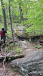
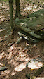
Photos of Frederick Watershed Mountain Bike
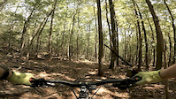
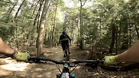
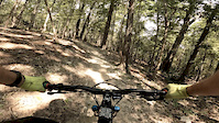
Videos of Frederick Watershed Mountain Bike
0:07 |
143 |
Aug 30, 2024
trail: Kubla Khan
0:10 |
276 |
Mar 23, 2024
trail: Lawnmower
0:05 |
224 |
Jul 17, 2023
trail: Evolution
0:08 |
492 |
May 6, 2023
trail: Kubla Khan
0:09 |
487 |
Aug 8, 2021
trail: Catoctin Trail
5:04 |
470 |
Sep 9, 2020
trail: Fun House
4:00 |
519 |
Sep 9, 2020
trail: Three Saws
0:33 |
76 |
Sep 9, 2020
Recent Trail Reports
| status | trail | date | condition | info | user |
|---|---|---|---|---|---|
| Fun House | May 19, 2026 @ 9:07am (America/New_York) May 19, 2026 | Dry | davidjg5 | ||
| Boundary Line | May 14, 2026 @ 6:49pm (America/New_York) May 14, 2026 | Ideal | basecamp-frederick | ||
| Knucklebuster | May 14, 2026 @ 6:49pm (America/New_York) May 14, 2026 | Ideal | basecamp-frederick | ||
| Three Saws | May 14, 2026 @ 6:49pm (America/New_York) May 14, 2026 | Ideal | basecamp-frederick | ||
| Volkswagon | Apr 30, 2026 @ 5:14pm (America/New_York) Apr 30, 2026 | Ideal | shellstamp | ||
| Death March | Apr 18, 2026 @ 12:12pm (America/New_York) Apr 18, 2026 | Ideal | rpenman | ||
| Good Neighbors (Catoctin Blue) | Apr 18, 2026 @ 12:12pm (America/New_York) Apr 18, 2026 | Ideal | rpenman | ||
| Rocky-Stream Bed Trail | Apr 18, 2026 @ 9:17am (America/New_York) Apr 18, 2026 | Variable | dl-nordeng | ||
| Lawnmower | Mar 21, 2026 @ 5:35pm (America/New_York) Mar 21, 2026 | Wet | Hydroponic99 | ||
| Huggy Bear | Mar 21, 2026 @ 1:18pm (America/New_York) Mar 21, 2026 | Ideal | Hydroponic99 |
Activity Feed
| username | action | type | title | date |
|---|---|---|---|---|
| TyacieCorley8S | wishlist | route | activity #97288417 | Jun 18, 2026 @ 6:23pm 1 hours |
| TyacieCorley8S | wishlist | route | activity #97242355 and 2 more | Jun 18, 2026 @ 4:15am 15 hours |
| TyacieCorley8S | ridden | trail | activity #97240897 | Jun 18, 2026 @ 3:29am 16 hours |
| TyacieCorley8S | wishlist | route | activity #97226898 and 1 more | Jun 17, 2026 @ 7:32pm 1 day |
| skniola | wishlist | trail | activity #97219789 | Jun 17, 2026 @ 5:22pm 1 day |
Recent Comments
| username | type | title | comment | date |
|---|---|---|---|---|
| trail | What's with all the branches piled up on the... | Oct 4, 2025 @ 4:35pm Oct 4, 2025 | ||
| trail | Tried several trails. All of them just... | Sep 25, 2025 @ 10:58am Sep 25, 2025 | ||
| report | F*"" nightmare. I've cried like a b** several... | Sep 25, 2025 @ 9:49am Sep 25, 2025 | ||
| trail | Most people call it Trail 4 by the signage for it | Sep 9, 2025 @ 12:41pm Sep 9, 2025 | ||
| trail | Just got done riding the new rework. All I... | Jul 31, 2025 @ 5:49am Jul 31, 2025 |
Nearby Areas
| name | distance | ||||
|---|---|---|---|---|---|
| Gambrill State Park | 10 | 5 | 2 | 3.5 km | |
| Cunningham Falls State Park | 1 | 7.4 km | |||
| Greenbrier State Park | 4 | 9 | 2 | 7.6 km | |
| Emmitsburg Watershed Trail System | 2 | 2 | 4 | 13.7 km | |
| River's Edge Trails | 11 | 3 | 5 | 15.5 km |
Local Badges
-

Completionist0 awarded
Activity Type Stats
| activitytype | trails | distance | descent | descent distance | total vertical | rating | global rank | state rank | photos | reports | routes | ridelogs |
|---|---|---|---|---|---|---|---|---|---|---|---|---|
| Mountain Bike | 85 | 77 miles | 17,851 ft | 42 miles | 1,161 ft | #343 | #122 | 211 | 1,575 | 48 | 27,158 | |
| E-Bike | 1 | #5,454 | #1,511 | 1,208 | 2 | 1,397 | ||||||
| Horse | 5 | 22 miles | 2,631 ft | 9 miles | 1,161 ft | #909 | #481 | 305 | 4 | |||
| Hike | 80 | 83 miles | 14,905 ft | 42 miles | 1,250 ft | #357 | #200 | 7 | 1,483 | 2 | 1,002 | |
| Trail Running | 80 | 83 miles | 14,905 ft | 42 miles | 1,250 ft | #1,649 | #414 | 1,483 | 10 | 334 | ||
| Dirtbike/Moto | 2 | 10 miles | 640 ft | 3 miles | 984 ft | 243 | 7 | |||||
| Backcountry Ski | 1 | 2,746 ft | 243 ft | 2,746 ft | 243 ft | |||||||
| Nordic Ski | 2 | 3 miles | 627 ft | 2 miles | 358 ft | 48 |
Frequently Asked Questions About Frederick Watershed
▼
What are the highest rated mountain biking trails in Frederick Watershed?
The highest rated mountain biking trails in Frederick Watershed are:
- Three Saws (4.7/5)
- Boundary Line (4.5/5)
- Kubla Khan (4.5/5)
- Vandal (4.5/5)
- Super Steep (4.4/5)
▼
What is the best time of the year to ride in Frederick Watershed?
Based on ride log data, the most popular months to ride in Frederick Watershed are:
- July (342 activities)
- August (290 activities)
- May (268 activities)
▼
Where can I park to ride in Frederick Watershed?
There are 11 parking locations listed in Frederick Watershed. The most popular parking spots are: View all parking and trailhead locations on the map to plan your visit.
▼
What is the longest trail in Frederick Watershed?
The longest trail in Frederick Watershed is Catoctin Trail at 12.3 miles. View all trails sorted by distance.
Activities
Trails
- Hard trails in Frederick Watershed
- Easy trails in Frederick Watershed
- Favorite trails in Frederick Watershed
- Most ridden trails in Frederick Watershed
- Singletrack in Frederick Watershed
- Viewpoint trails in Frederick Watershed
- Trails with technical features in Frederick Watershed
- Race routes in Frederick Watershed
- By Dcp584
 & contributors
 - Admins: MORE-FWS, MORE-FC
- #9607 - 106,677 views
- frederick watershed activity log | embed map of Frederick Watershed mountain bike trails | frederick watershed mountain biking points of interest
Downloading of trail gps tracks in kml & gpx formats is enabled for Frederick Watershed.
You must login to download files.