close
-
Layers w
- Weather Layers
- Pro
- Pro
- Pro
- Pro
- Pro
- Pro
- More Layers
- Pro
- Pro
- Pro
- Pro
-
Upgrade to

3D
Trail Conditions
- Unknown
- Snow Groomed
- Snow Packed
- Snow Covered
- Snow Cover Partial
- Freeze/thaw Cycle
- Icy
- Prevalent Mud
- Wet
- Variable
- Ideal
- Dry
- Very Dry
Trail Flow (Ridden Direction)
Trailforks scans users ridelogs to determine the most popular direction each trail is ridden. A good flowing trail network will have most trails flowing in a single direction according to their intension.
The colour categories are based on what percentage of riders are riding a trail in its intended direction.
The colour categories are based on what percentage of riders are riding a trail in its intended direction.
- > 96%
- > 90%
- > 80%
- > 70%
- > 50%
- < 50%
- bi-directional trail
- no data
Trail Last Ridden
Trailforks scans ridelogs to determine the last time a trail was ridden.
- < 2 days
- < 1 week
- < 2 weeks
- < 1 month
- < 6 months
- > 6 months
Trail Ridden Direction
The intended direction a trail should be ridden.
- Downhill Only
- Downhill Primary
- Both Directions
- Uphill Primary
- Uphill Only
- One Direction
Contribute Details
Colors indicate trail is missing specified detail.
- Description
- Photos
- Description & Photos
- Videos
Trail Popularity ?
Trailforks scans ridelogs to determine which trails are ridden the most in the last 9 months.
Trails are compared with nearby trails in the same city region with a possible 25 colour shades.
Think of this as a heatmap, more rides = more kinetic energy = warmer colors.
- most popular
- popular
- less popular
- not popular
ATV/ORV/OHV Filter
Max Vehicle Width
inches
US Cell Coverage
Legend

Radar Time
Activity Recordings
Trailforks uses anonymized public activity data.
?
Activity Recordings
Trailforks uses anonymized public activity data.
?
Personal Heatmap
▶
Activity Types
all
/
none
▶
Options
2
Date range
month
–
Winter Trails
Warning
A routing network for winter maps does not exist. Selecting trails using the winter trails layer has been disabled.
Missing Trails
Most Popular
Least Popular
Trails are colored based on popularity. The more popular a trail is, the more red. Less popular trails trend towards green.
Jump Magnitude Heatmap
Heatmap of where riders jump on trails. Zoom in to see individual jumps, click circles to view jump details.
BC Backroad Status
![map legend]()
Service Road Atlas is a free to use, community-driven service for viewing and creating reports on the numerous back-country service roads around B.C. and Alberta.

Slope Aspect
Direction the slope faces
Trails Deemphasized
Trails are shown in grey.
Only show trails with no bike usage.
Suggested Layers
Based on selected activity type
Save the current map location and zoom level as your default home location whenever this page is loaded.
Save
No description for Fréjus has been added yet!
Login or register to submit one.
This region uses the Uk/Euro style trail grading system.
Activities Click to view
- Mountain Bike
77 trails
- E-Bike
65 trails
- Adaptive Bike
0 trails
- Hike
77 trails
- Trail Running
76 trails
Region Details
- 23
- 10
- 30
- 10
- 3
Region Status
Open as of May 25, 2026Local Trail Association
Stats
- Avg Trail Rating
- Global Ranking
- #2,169
- State Ranking
- #49
- Trails (view details)
- 77
- Trails Mountain Bike
- 77
- Trails E-Bike
- 65
- Trails Gravel Bike
- 3
- Trails Hike
- 77
- Trails Trail Running
- 76
- Total Distance
- 65 miles
- Total Descent
- 15,291 ft
- Total Vertical
- 1,889 ft
- Highest Trailhead
- 1,904 ft
- Reports
- 189
- Photos
- 60
- Ridden Counter
- 3,596
Popular Fréjus Mountain Biking Trails
• 100 ★ 0.0 • 758 ft • 3 ft • 269 •
Popular green difficulty singletrack. This mountain bike primary trail can be used both directions and has a easy overall physical rating with a 3 ft green climb. Trail visibility is always easy to follow. On average it takes 1 minutes to complete this trail.
• 100 ★ 0.0 • 1 mile • 134 ft • 265 •
Popular blue difficulty singletrack. This mountain bike primary trail can be used both directions and has a hard overall physical rating with a 134 ft black diamond climb. On average it takes 12 minutes to complete this trail.
• 75 ★ 3.0 • 4,570 ft • 75 ft • 116 •
Popular blue difficulty singletrack. This mountain bike primary trail can be used both directions and has a hard overall physical rating with a 75 ft black diamond climb. Trail visibility is always easy to follow. On average it takes 7 minutes to complete this trail.
• 55 ★ 0.0 • 1 mile • 746 ft • 73 •
Moderately popular green difficulty mixed. This mountain bike primary trail can be used uphill primary and has a moderate overall physical rating with a 746 ft green climb. On average it takes 20 minutes to complete this trail.
• 65 ★ 5.0 • 5,164 ft • 0 ft • 68 •
Moderately popular red difficulty singletrack. This mountain bike primary trail and has a moderate overall physical rating with a 0 ft green climb. Trail visibility is sometimes hard to follow. On average it takes 5 minutes to complete this trail.
• 90 ★ 2.0 • 2 miles • 359 ft • 64 •
Popular green difficulty family friendly singletrack. This multi-use trail can be used both directions and has a moderate overall physical rating with a 359 ft green climb. Trail visibility is always easy to follow. On average it takes 14 minutes to complete this trail.
• 80 ★ 4.5 • 3,117 ft • 5 ft • 62 •
Popular blue difficulty singletrack. This mountain bike primary trail. On average it takes 4 minutes to complete this trail.
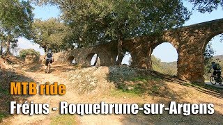
Fréjus Mountain Bike Routes
11 miles • 1,645 ft • 7 • Loop •
mainly 4x4 tracks. the very last descents are nice and technical single track, but can be avoided.
20 miles • 2,558 ft • 1 • Loop •
Randuro assez technique et physique varié pistes et singles
31 miles • 3,323 ft • 0 • Loop •
Traces gravel autour du parcours du Roc d'Azur.
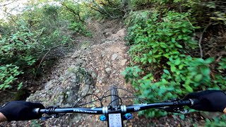
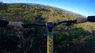
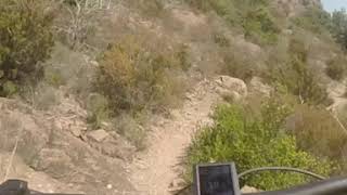
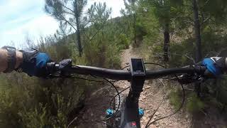
Photos of Fréjus Mountain Bike
Videos of Fréjus Mountain Bike
trail: Descente des espagnols
3:05 |
109 |
Feb 14, 2024 , Fréjus
trail: Marchand De Légumes
0:14 |
82 |
Feb 14, 2024 , Fréjus
trail: Roche Noire
0:48 |
511 |
Jun 20, 2019 , Fréjus

trail: Roche Noire
4:15 |
499 |
Jun 20, 2019 , Fréjus
trail: Colle Douce
2:42 |
672 |
Jun 20, 2019 , Fréjus
trail: Col du testanier
2:23 |
607 |
Jun 20, 2019 , Fréjus
3:21 |
404 |
May 30, 2018

trail: Mt Vinaigre Ouest
2:40 |
469 |
May 30, 2018 , Fréjus
Recent Trail Reports
| status | trail | date | condition | info | user |
|---|---|---|---|---|---|
| Col de l'Essuyadou | May 25, 2026 @ 2:13pm (Europe/Paris) May 25, 2026 | Dry | sputnik275wce | ||
| Piste De L'Essuyadou | Jan 11, 2026 @ 10:15am (Europe/Paris) Jan 11, 2026 | Dry | FannyArno | ||
| Piste Des Veyssières | Jan 11, 2026 @ 10:15am (Europe/Paris) Jan 11, 2026 | Dry | FannyArno | ||
| H71 Estarpe du Cheval | Jan 11, 2026 @ 10:15am (Europe/Paris) Jan 11, 2026 | Ideal | FannyArno | ||
| Colle d'Allons 2 | Dec 18, 2025 @ 12:10pm (Europe/Monaco) Dec 18, 2025 | Ideal | arthur-clement | ||
| Pont Du Perthus | Dec 18, 2025 @ 12:10pm (Europe/Monaco) Dec 18, 2025 | Dry | arthur-clement | ||
| DFCI H66 - Col Belle Barbe | Aug 23, 2025 @ 12:56am Aug 23, 2025 | Unknown | Faberbike | ||
| Malpey | Apr 26, 2025 @ 1:59am Apr 26, 2025 | Dry | AndyKoch | ||
| Roche Noire | Apr 26, 2025 @ 1:57am Apr 26, 2025 | Dry | AndyKoch | ||
| Colle Douce | Apr 26, 2025 @ 1:51am Apr 26, 2025 | Dry | AndyKoch |
Activity Feed
| username | action | type | title | date |
|---|---|---|---|---|
| EO5TGN | ridden | trail | activity #96740804 | Jun 11, 2026 @ 8:51am Jun 11, 2026 |
| EO5TGN | wishlist | trail | activity #96610249 and 2 more | Jun 9, 2026 @ 9:15am Jun 9, 2026 |
| crank2drop | rsvp | event | activity #96160063 | Jun 3, 2026 @ 9:10am Jun 3, 2026 |
| sputnik275wce | add | report | activity #95479372 | May 25, 2026 @ 5:13am May 25, 2026 |
| KeyserEDM64D | ridden | trail | activity #95440863 | May 24, 2026 @ 1:24pm May 24, 2026 |
Recent Comments
| username | type | title | comment | date |
|---|---|---|---|---|
| trail | Great prospect to ride 5k downhill ! Like to... | Sep 3, 2024 @ 8:12am Sep 3, 2024 | ||
| trail | Descente intéressante. Possible de démarrer... | Oct 8, 2023 @ 2:23pm Oct 8, 2023 | ||
| trail | Une des meilleures descente du secteur, si ce... | Oct 7, 2023 @ 6:11am Oct 7, 2023 | ||
| trail | Descente accessible ..... variée....devers,... | Oct 6, 2023 @ 3:58am Oct 6, 2023 | ||
| trail | Heute gefahren, üblicher Zustand,... | Aug 22, 2023 @ 12:49pm Aug 22, 2023 |
Local Badges
-

10 Blue Trails45 awarded -

Epic Ride Climb 2k77 awarded -

Climbing 10k Badge27 awarded -

Climbing 100k Badge0 awarded -

Epic Ride Descent 2k77 awarded -

Descent 10k Badge27 awarded
Activity Type Stats
| activitytype | trails | distance | descent | descent distance | total vertical | rating | global rank | state rank | photos | reports | routes | ridelogs |
|---|---|---|---|---|---|---|---|---|---|---|---|---|
| Mountain Bike | 77 | 64 miles | 14,879 ft | 37 miles | 1,890 ft | #2,169 | #49 | 60 | 187 | 4 | 3,386 | |
| E-Bike | 65 | 50 miles | 9,383 ft | 26 miles | 1,890 ft | #1,820 | #106 | 166 | 2 | 678 | ||
| Gravel Bike | 3 | #4,358 | #125 | 1 | 38 | |||||||
| Hike | 77 | 64 miles | 15,253 ft | 37 miles | 1,890 ft | #2,518 | #60 | 187 | 197 | |||
| Trail Running | 76 | 64 miles | 14,967 ft | 37 miles | 1,890 ft | #2,031 | #53 | 186 | 331 |
Frequently Asked Questions About Fréjus
▼
What are the highest rated mountain biking trails in Fréjus?
The highest rated mountain biking trails in Fréjus are:
- Descente des espagnols (4.3/5)
- Colle Douce (4.3/5)
- Roche Noire (4.2/5)
- Le Caneiret (4.1/5)
- Marchand De Légumes (4.1/5)
▼
What is the best time of the year to ride in Fréjus?
Based on ride log data, the most popular months to ride in Fréjus are:
- October (36 activities)
- July (28 activities)
- November (25 activities)
▼
Where can I park to ride in Fréjus?
There are 3 parking locations listed in Fréjus. The most popular parking spots are: View all parking and trailhead locations on the map to plan your visit.
▼
What is the longest trail in Fréjus?
The longest trail in Fréjus is Col de l'Essuyadou at 6.8 km. View all trails sorted by distance.
Activities
Trails
Points of Interest
- By hpman83
 TRAILFORKS TFFRANCE & contributors
 - Admins: apply
- #15290 - 12,705 views
- fréjus activity log | embed map of Fréjus mountain bike trails | fréjus mountain biking points of interest
Downloading of trail gps tracks in kml & gpx formats is enabled for Fréjus.
You must login to download files.