close
-
Layers w
- Weather Layers
- Pro
- Pro
- Pro
- Pro
- Pro
- Pro
- More Layers
- Pro
- Pro
- Pro
- Pro
-
Upgrade to

3D
Trail Conditions
- Unknown
- Snow Groomed
- Snow Packed
- Snow Covered
- Snow Cover Partial
- Freeze/thaw Cycle
- Icy
- Prevalent Mud
- Wet
- Variable
- Ideal
- Dry
- Very Dry
Trail Flow (Ridden Direction)
Trailforks scans users ridelogs to determine the most popular direction each trail is ridden. A good flowing trail network will have most trails flowing in a single direction according to their intension.
The colour categories are based on what percentage of riders are riding a trail in its intended direction.
The colour categories are based on what percentage of riders are riding a trail in its intended direction.
- > 96%
- > 90%
- > 80%
- > 70%
- > 50%
- < 50%
- bi-directional trail
- no data
Trail Last Ridden
Trailforks scans ridelogs to determine the last time a trail was ridden.
- < 2 days
- < 1 week
- < 2 weeks
- < 1 month
- < 6 months
- > 6 months
Trail Ridden Direction
The intended direction a trail should be ridden.
- Downhill Only
- Downhill Primary
- Both Directions
- Uphill Primary
- Uphill Only
- One Direction
Contribute Details
Colors indicate trail is missing specified detail.
- Description
- Photos
- Description & Photos
- Videos
Trail Popularity ?
Trailforks scans ridelogs to determine which trails are ridden the most in the last 9 months.
Trails are compared with nearby trails in the same city region with a possible 25 colour shades.
Think of this as a heatmap, more rides = more kinetic energy = warmer colors.
- most popular
- popular
- less popular
- not popular
ATV/ORV/OHV Filter
Max Vehicle Width
inches
US Cell Coverage
Legend

Radar Time
Activity Recordings
Trailforks uses anonymized public activity data.
?
Activity Recordings
Trailforks uses anonymized public activity data.
?
Personal Heatmap
▶
Activity Types
all
/
none
▶
Options
2
Date range
month
–
Winter Trails
Warning
A routing network for winter maps does not exist. Selecting trails using the winter trails layer has been disabled.
Missing Trails
Most Popular
Least Popular
Trails are colored based on popularity. The more popular a trail is, the more red. Less popular trails trend towards green.
Jump Magnitude Heatmap
Heatmap of where riders jump on trails. Zoom in to see individual jumps, click circles to view jump details.
BC Backroad Status
![map legend]()
Service Road Atlas is a free to use, community-driven service for viewing and creating reports on the numerous back-country service roads around B.C. and Alberta.

Slope Aspect
Direction the slope faces
Trails Deemphasized
Trails are shown in grey.
Only show trails with no bike usage.
Suggested Layers
Based on selected activity type
Save the current map location and zoom level as your default home location whenever this page is loaded.
Save
No description for Fresno has been added yet!
Login or register to submit one.
Activities Click to view
- Mountain Bike
14 trails
- E-Bike
2 trails
- Adaptive Bike
0 trails
- Horse
0 trails
- Hike
12 trails
- Trail Running
12 trails
Region Details
- 2
- 1
- 5
- 6
Region Status
Caution as of May 30, 2026Stats
- Avg Trail Rating
- Trails (view details)
- 14
- Trails Mountain Bike
- 14
- Trails E-Bike
- 2
- Trails Hike
- 12
- Trails Trail Running
- 12
- Total Distance
- 18 miles
- Total Descent
- 240 ft
- Total Vertical
- 120 ft
- Highest Trailhead
- 394 ft
- Reports
- 34
- Photos
- 4
- Ridden Counter
- 1,182
Sub Regions
-
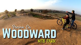
Woodward Mountain Bike Park
- 1
- 2
- 3
Popular Fresno Mountain Biking Trails
• 100 ★ 4.0 • 492 ft • 4 ft • 125 •
Popular blue difficulty singletrack. This mountain bike primary trail can be used both directions. It features a-frame, bridge and skinny. On average it takes 1 minutes to complete this trail.
• 60 ★ 5.0 • 1 mile • 54 ft • 37 •
Moderately popular white difficulty gravel path. This multi-use trail can be used both directions. On average it takes 33 minutes to complete this trail.
• 95 ★ 5.0 • 2 miles • 19 ft • 35 •
The Van Buren Trail in Madera County, California, is a 3.03 km route known for its gentle elevation changes and fast, flowing sections. With a slight downhill grade, it's popular among local cyclists aiming for speed. The trail features...
• 55 ★ 0.0 • 2,730 ft • 2 ft • 31 •
Moderately popular green difficulty singletrack. This multi-use trail can be used both directions. On average it takes 1 minutes to complete this trail.
• 90 ★ 0.0 • 2,169 ft • 0 ft • 20 • • hike
Popular blue difficulty singletrack. This hike primary trail can be used both directions.
• 35 ★ 0.0 • 3 miles • 20 ft • 18 •
Less popular green difficulty singletrack. This multi-use trail can be used both directions. On average it takes 15 minutes to complete this trail.
• 20 ★ 0.0 • 2 miles • 7 ft • 16 •
Less popular green difficulty singletrack. This multi-use trail can be used both directions. On average it takes 6 minutes to complete this trail.
Videos of Fresno Mountain Bike
trail: Air DH
0:07 |
528 |
Nov 20, 2015
8:48 |
227 |
Jan 30, 2022
Recent Trail Reports
| status | trail | date | condition | info | user |
|---|---|---|---|---|---|
| The Van Buren Trail | Oct 24, 2025 @ 10:16am (America/Los_Angeles) Oct 24, 2025 | Variable | resqd1 ERC | ||
| Air DH | Aug 31, 2025 @ 4:14pm Aug 31, 2025 | Dry | tringo | ||
| North Shore Course | May 7, 2024 @ 10:06am May 7, 2024 | Dry | javadown1969 | ||
| Return | May 7, 2024 @ 10:06am May 7, 2024 | Dry | javadown1969 | ||
| Lewis Eaton Bike Path | Oct 16, 2021 @ 2:12pm Oct 16, 2021 | Very Dry | hollymight |
Activity Feed
| username | action | type | title | date |
|---|---|---|---|---|
| MTBHill | wishlist | trail | activity #97391988 | Jun 20, 2026 @ 7:18am Jun 20, 2026 |
| actuallybiking | wishlist | region | activity #92023954 | Apr 5, 2026 @ 7:15pm Apr 5, 2026 |
| FishFly911 | ridden | trail | activity #90209757 | Mar 8, 2026 @ 10:10am Mar 8, 2026 |
| MichaelqYcEe5 | wishlist | region | activity #89876656 | Mar 2, 2026 @ 10:11pm Mar 2, 2026 |
| mattmalabanan | add | trail | activity #88660967 and 2 more | Feb 9, 2026 @ 9:57pm Feb 9, 2026 |
Recent Comments
| username | type | title | comment | date |
|---|---|---|---|---|
| trail | Little out of shape, but it’s pretty... | Dec 31, 2022 @ 8:28pm Dec 31, 2022 | ||
| trail | Still a fantastic place to have fun at, the... | Jun 13, 2021 @ 4:00pm Jun 13, 2021 | ||
| trail | Don’t ride here. Jumps are on flat ground if... | Oct 9, 2018 @ 2:54pm Oct 9, 2018 |
Local Badges
-

Epic Ride Climb 2k19 awarded -

Climbing 10k Badge20 awarded -

Climbing 100k Badge0 awarded -

Epic Ride Descent 2k19 awarded -

Descent 10k Badge20 awarded -

Descent 100k Badge0 awarded
Bike & Skill Parks
| name | type | city | rating |
|---|---|---|---|
| Woodward BMX and Jump Park | skill park | Fresno |
Activity Type Stats
| activitytype | trails | distance | descent | descent distance | total vertical | rating | global rank | state rank | photos | reports | routes | ridelogs |
|---|---|---|---|---|---|---|---|---|---|---|---|---|
| Mountain Bike | 14 | 18 miles | 240 ft | 4 miles | 121 ft | #8,321 | #2,690 | 7 | 34 | 6,244 | ||
| E-Bike | 2 | 3 miles | 148 ft | 20 ft | #7,659 | #2,307 | 29 | 407 | ||||
| Hike | 12 | 17 miles | 207 ft | 4 miles | 121 ft | #8,074 | #2,849 | 32 | 72 | |||
| Trail Running | 12 | 17 miles | 207 ft | 4 miles | 121 ft | #7,767 | #2,578 | 32 | 130 |
Frequently Asked Questions About Fresno
▼
What are the best places to ride in Fresno?
Fresno has 1 areas to explore for mountain biking. The top rated areas are:
▼
What are the highest rated mountain biking trails in Fresno?
The highest rated mountain biking trails in Fresno are:
- The Van Buren Trail (4.1/5)
- Woodward Bike Park Loop (4.1/5)
- North Shore Course (4/5)
- Air DH (3.5/5)
- Tom Macmichael Senior Trail (0/5)
▼
What is the best time of the year to ride in Fresno?
Based on ride log data, the most popular months to ride in Fresno are:
- July (28 activities)
- September (15 activities)
- November (14 activities)
▼
Where can I park to ride in Fresno?
There are 1 parking locations listed in Fresno. The most popular parking spots are:
Trails
Points of Interest
- By brenthillier
 NSMBA TRAILFORKS & contributors
 - Admins: TheAngryTomato
- #7849 - 10,166 views
- fresno activity log | embed map of Fresno mountain bike trails | fresno mountain biking points of interest
Downloading of trail gps tracks in kml & gpx formats is enabled for Fresno.
You must login to download files.