close
-
Layers w
- Weather Layers
- Pro
- Pro
- Pro
- Pro
- Pro
- Pro
- More Layers
- Pro
- Pro
- Pro
- Pro
-
Upgrade to

3D
Trail Conditions
- Unknown
- Snow Groomed
- Snow Packed
- Snow Covered
- Snow Cover Partial
- Freeze/thaw Cycle
- Icy
- Prevalent Mud
- Wet
- Variable
- Ideal
- Dry
- Very Dry
Trail Flow (Ridden Direction)
Trailforks scans users ridelogs to determine the most popular direction each trail is ridden. A good flowing trail network will have most trails flowing in a single direction according to their intension.
The colour categories are based on what percentage of riders are riding a trail in its intended direction.
The colour categories are based on what percentage of riders are riding a trail in its intended direction.
- > 96%
- > 90%
- > 80%
- > 70%
- > 50%
- < 50%
- bi-directional trail
- no data
Trail Last Ridden
Trailforks scans ridelogs to determine the last time a trail was ridden.
- < 2 days
- < 1 week
- < 2 weeks
- < 1 month
- < 6 months
- > 6 months
Trail Ridden Direction
The intended direction a trail should be ridden.
- Downhill Only
- Downhill Primary
- Both Directions
- Uphill Primary
- Uphill Only
- One Direction
Contribute Details
Colors indicate trail is missing specified detail.
- Description
- Photos
- Description & Photos
- Videos
Trail Popularity ?
Trailforks scans ridelogs to determine which trails are ridden the most in the last 9 months.
Trails are compared with nearby trails in the same city region with a possible 25 colour shades.
Think of this as a heatmap, more rides = more kinetic energy = warmer colors.
- most popular
- popular
- less popular
- not popular
ATV/ORV/OHV Filter
Max Vehicle Width
inches
US Cell Coverage
Legend

Radar Time
Activity Recordings
Trailforks uses anonymized public activity data.
?
Activity Recordings
Trailforks uses anonymized public activity data.
?
Personal Heatmap
▶
Activity Types
all
/
none
▶
Options
2
Date range
month
–
Winter Trails
Warning
A routing network for winter maps does not exist. Selecting trails using the winter trails layer has been disabled.
Missing Trails
Most Popular
Least Popular
Trails are colored based on popularity. The more popular a trail is, the more red. Less popular trails trend towards green.
Jump Magnitude Heatmap
Heatmap of where riders jump on trails. Zoom in to see individual jumps, click circles to view jump details.
BC Backroad Status
![map legend]()
Service Road Atlas is a free to use, community-driven service for viewing and creating reports on the numerous back-country service roads around B.C. and Alberta.

Slope Aspect
Direction the slope faces
Trails Deemphasized
Trails are shown in grey.
Only show trails with no bike usage.
Suggested Layers
Based on selected activity type
Save the current map location and zoom level as your default home location whenever this page is loaded.
Save
No description for Fresno County has been added yet!
Login or register to submit one.
Activities Click to view
- Mountain Bike
82 trails
- E-Bike
5 trails
- Horse
24 trails
- Hike
70 trails
- Trail Running
70 trails
- Downhill Ski
71 trails
- Nordic Ski
16 trails
Stats
- Avg Trail Rating
- Trails (view details)
- 187
- Trails Mountain Bike
- 82
- Trails E-Bike
- 5
- Trails Gravel Bike
- 3
- Trails Horse
- 24
- Trails Hike
- 70
- Trails Trail Running
- 70
- Trails Dirtbike/Moto
- 2
- Trails ATV/ORV/OHV
- 2
- Trails Downhill Ski
- 71
- Trails Nordic Ski
- 16
- Total Distance
- 264 miles
- Total Descent
- 64,716 ft
- Total Vertical
- 10,040 ft
- Highest Trailhead
- 10,299 ft
- Reports
- 672
- Photos
- 664
- Ridden Counter
- 9,027
Articles
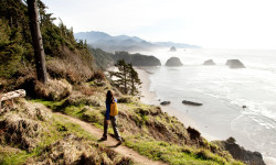
The 7 Most Beautiful Coastal Hikes in the U.S.
May 30, 2025 from outsideonline.com
The beach can be adventurous, too. Explore the best coastal hikes in the U.S., from short walks to ambitious through-hikes.
Sub Regions
- Big Creek (9)
- Ely Mountain (7)
- Coalinga (2)
- Fresno (14)
- Friant (7)
- Lakeshore (28)
- Sanger (0)
- Channel Islands (0)
- shaver lake (19)
- Shaver Lake (18)
- Upper Kings River Trails (6)
Popular Fresno County Mountain Biking Trails
• 85 ★ 4.0 • 2,552 ft • 0 ft • 343 •
Popular green difficulty singletrack. This mountain bike primary trail can be used downhill primary. On average it takes 2 minutes to complete this trail.
• 75 ★ 3.3 • 2,512 ft • 17 ft • 333 •
Popular blue difficulty singletrack. This mountain bike primary trail can be used downhill primary. On average it takes 2 minutes to complete this trail.
• 90 ★ 3.5 • 1,016 ft • 23 ft • 331 •
Popular green difficulty singletrack. This mountain bike primary trail can be used uphill primary with a 23 ft green climb. On average it takes 1 minutes to complete this trail.
• 75 ★ 4.5 • 1 mile • 20 ft • 327 •
Popular blue difficulty singletrack. This mountain bike primary trail can be used downhill primary. On average it takes 9 minutes to complete this trail.
• 100 ★ 4.0 • 4,576 ft • 23 ft • 324 •
Popular black diamond difficulty singletrack. This mountain bike primary trail can be used downhill primary. It features drop and rock face. On average it takes 7 minutes to complete this trail.
• 70 ★ 4.0 • 2,108 ft • 10 ft • 303 •
Popular green difficulty singletrack. This mountain bike primary trail can be used downhill primary. On average it takes 2 minutes to complete this trail.
• 90 ★ 4.0 • 2,059 ft • 3 ft • 282 •
Popular blue difficulty singletrack. This mountain bike primary trail can be used downhill primary. On average it takes 2 minutes to complete this trail.
• 100 ★ 4.0 • 587 ft • 0 ft • 282 •
Popular blue difficulty singletrack. This mountain bike primary trail can be used downhill primary. On average it takes minutes to complete this trail.
Fresno County Mountain Bike Routes
★ 4.5 • 5 miles • 1,320 ft • 1 • Loop •
A strenuous climb up the dogwood fire road trail is rewarded with a loamy descent down the twits, turns,...
★ 4.0 • 2 miles • 8 • Point to Point •
A fast, technical, but fun black diamond run that is a good test of skills.
★ 4.0 • 3 miles • 76 ft • 6 • Point to Point •
A fast, technical, but fun black diamond run that is a good test of skills.
10 miles • 2,258 ft • 3 • Loop •
Alpine singletrack awaits! From lakeshore pedal towards SR 168 up Kaiser Pass. Shorty into the climb keep...
★ 4.0 • 6 miles • 1,163 ft • 0 • Loop •
Starting out in a nice pine forest on an easy fire road, then up an steep loam incline to a granite dome....
Photos of Fresno County Mountain Bike
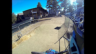
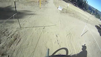
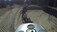
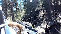
Videos of Fresno County Mountain Bike
trail: Tour de Granite
0:41 |
101 |
Oct 23, 2022
trail: Potter Creek (Lower)
6:43 |
195 |
Jul 20, 2018
trail: Air DH
0:07 |
528 |
Nov 20, 2015
trail: Westridge
9:07 |
623 |
Nov 21, 2014
trail: Westridge
9:53 |
309 |
Nov 1, 2014
trail: Westridge
3:37 |
451 |
Oct 24, 2014
trail: Westridge
0:16 |
58 |
Aug 19, 2014
trail: Westridge
0:16 |
88 |
Aug 11, 2014
Recent Trail Reports
| status | trail | date | condition | info | user |
|---|---|---|---|---|---|
| Thunderstruck Ely Mountain | May 4, 2026 @ 9:06am (America/Los_Angeles) May 4, 2026 | Variable | Luckiefrain | ||
| Easy Does It (Upper) China Peak Mountain Resort | Dec 26, 2025 @ 8:48am (America/Los_Angeles) Dec 26, 2025 | Snow Groomed | gymclasshero | ||
| The Van Buren Trail Woodward Mountain Bike Park | Oct 24, 2025 @ 10:16am (America/Los_Angeles) Oct 24, 2025 | Variable | resqd1 ERC | ||
| Air DH Woodward Mountain Bike Park | Aug 31, 2025 @ 4:14pm Aug 31, 2025 | Dry | tringo | ||
| Potter Creek Kaiser Wilderness | Aug 29, 2025 @ 4:08pm Aug 29, 2025 | Ideal | rdr22aeg | ||
| Dogwood Access to Thunderstruck Ely Mountain | May 16, 2025 @ 6:20pm May 16, 2025 | Ideal | ham-n8er | ||
| Wellbarn Road San Joaquin River Gorge | Apr 12, 2025 @ 7:40pm Apr 12, 2025 | Dry | azurezeph | ||
| Bobcat San Joaquin River Gorge | Apr 12, 2025 @ 7:40pm Apr 12, 2025 | Dry | azurezeph | ||
| Bear Wallow Trail Upper Kings River Trails | Apr 1, 2025 @ 1:58pm Apr 1, 2025 | Ideal | gabrielamadeus OTTA | ||
| Rodgers Ridge Trail Upper Kings River Trails | Apr 1, 2025 @ 9:21am Apr 1, 2025 | Unknown | gabrielamadeus OTTA |
Activity Feed
| username | action | type | title | date |
|---|---|---|---|---|
| llburkh | wishlist | trail | activity #97161963 | Jun 16, 2026 @ 9:37pm 22 hours |
| llburkh | wishlist | trail | activity #97114287 | Jun 16, 2026 @ 8:55am 1 day |
| llburkh | wishlist | trail | activity #97112934 | Jun 16, 2026 @ 8:34am 1 day |
| update | event | activity #97048435 | Jun 15, 2026 @ 9:50am 2 days | |
| iv9iBf | wishlist | route | activity #96874753 | Jun 13, 2026 @ 7:29am Jun 13, 2026 |
Recent Comments
| username | type | title | comment | date |
|---|---|---|---|---|
| trail | Love this trail. Technical CW or CCW, though I... | Jun 11, 2026 @ 12:05am Jun 11, 2026 | ||
| trail | Running ok right now thinking about doing some... | Mar 25, 2026 @ 9:42pm Mar 25, 2026 | ||
| trail | The trail is in great shape right now. | Jan 19, 2026 @ 7:32pm Jan 19, 2026 | ||
| trail | What a masterpiece. Every type of feature you... | Aug 24, 2025 @ 11:14am Aug 24, 2025 | ||
| trail | There's a single track trail around in... | May 26, 2025 @ 6:38am May 26, 2025 |
Local Badges
-

Completionist2 awarded -

Epic Mountain Bike Climb 2k0 awarded -

Top 10 Trails0 awarded -

10 Blue Trails23 awarded -

Climbing 10k Badge0 awarded -
Top 10 Trails117 awarded
Bike & Skill Parks
| name | type | city | rating |
|---|---|---|---|
| Woodward BMX and Jump Park | skill park | Fresno |
Upcoming Local Events
Local Trail Supporters
- Sierra Pacific Orthopedic
![]()
Local Trail Supporters
- Sierra Pacific Orthopedic
![]()
Activity Type Stats
| activitytype | trails | distance | descent | descent distance | total vertical | rating | global rank | state rank | photos | reports | routes | ridelogs |
|---|---|---|---|---|---|---|---|---|---|---|---|---|
| Mountain Bike | 82 | 169 miles | 34,813 ft | 77 miles | 8,711 ft | 652 | 659 | 11 | 11,891 | |||
| E-Bike | 5 | 46 miles | 2,569 ft | 11 miles | 7,051 ft | 565 | 1 | 1,083 | ||||
| Gravel Bike | 3 | 4 miles | 1,227 ft | 3 miles | 7,641 ft | 14 | 197 | |||||
| Horse | 24 | 83 miles | 16,056 ft | 41 miles | 9,734 ft | 2 | 220 | 14 | ||||
| Hike | 70 | 205 miles | 33,068 ft | 86 miles | 10,039 ft | 10 | 643 | 4 | 702 | |||
| Trail Running | 70 | 205 miles | 33,068 ft | 86 miles | 10,039 ft | 643 | 3 | 215 | ||||
| Dirtbike/Moto | 2 | 3 miles | 666 ft | 5,089 ft | 669 ft | 215 | 13 | |||||
| ATV/ORV/OHV | 2 | 3 miles | 666 ft | 5,089 ft | 669 ft | 215 | 2 | |||||
| Downhill Ski | 71 | 21 miles | 19,222 ft | 20 miles | 1,575 ft | 13 | 346 | |||||
| Nordic Ski | 16 | 14 miles | 1,365 ft | 6 miles | 627 ft | 14 | 2 |
Frequently Asked Questions About Fresno County
▼
What are the best places to ride in Fresno County?
Fresno County has 10 areas to explore for mountain biking. The top rated areas are:
▼
What are the highest rated mountain biking trails in Fresno County?
The highest rated mountain biking trails in Fresno County are:
- Thunderstruck (4.4/5)
- Cannonball Run (4.3/5)
- San Joaquin River Trail (4.3/5)
- Rancheria (4.2/5)
- Leap Loop (4.2/5)
▼
What is the best time of the year to ride in Fresno County?
Based on ride log data, the most popular months to ride in Fresno County are:
- July (101 activities)
- August (50 activities)
- June (36 activities)
▼
What is the longest trail in Fresno County?
The longest trail in Fresno County is San Joaquin River Trail at 23.6 km. View all trails sorted by distance.
Activities
Trails
Points of Interest
- By brenthillier
 NSMBA TRAILFORKS & contributors
 - Admins: jpmcghee, sanfret, brianpetry, TheAngryTomato
- #7913 - 11,700 views
- fresno county activity log | embed map of Fresno County mountain bike trails | fresno county mountain biking points of interest
Downloading of trail gps tracks in kml & gpx formats is enabled for Fresno County.
You must login to download files.