close
-
Layers w
- Weather Layers
- Pro
- Pro
- Pro
- Pro
- Pro
- Pro
- More Layers
- Pro
- Pro
- Pro
- Pro
-
Upgrade to

3D
Trail Conditions
- Unknown
- Snow Groomed
- Snow Packed
- Snow Covered
- Snow Cover Partial
- Freeze/thaw Cycle
- Icy
- Prevalent Mud
- Wet
- Variable
- Ideal
- Dry
- Very Dry
Trail Flow (Ridden Direction)
Trailforks scans users ridelogs to determine the most popular direction each trail is ridden. A good flowing trail network will have most trails flowing in a single direction according to their intension.
The colour categories are based on what percentage of riders are riding a trail in its intended direction.
The colour categories are based on what percentage of riders are riding a trail in its intended direction.
- > 96%
- > 90%
- > 80%
- > 70%
- > 50%
- < 50%
- bi-directional trail
- no data
Trail Last Ridden
Trailforks scans ridelogs to determine the last time a trail was ridden.
- < 2 days
- < 1 week
- < 2 weeks
- < 1 month
- < 6 months
- > 6 months
Trail Ridden Direction
The intended direction a trail should be ridden.
- Downhill Only
- Downhill Primary
- Both Directions
- Uphill Primary
- Uphill Only
- One Direction
Contribute Details
Colors indicate trail is missing specified detail.
- Description
- Photos
- Description & Photos
- Videos
Trail Popularity ?
Trailforks scans ridelogs to determine which trails are ridden the most in the last 9 months.
Trails are compared with nearby trails in the same city region with a possible 25 colour shades.
Think of this as a heatmap, more rides = more kinetic energy = warmer colors.
- most popular
- popular
- less popular
- not popular
ATV/ORV/OHV Filter
Max Vehicle Width
inches
US Cell Coverage
Legend

Radar Time
Activity Recordings
Trailforks uses anonymized public activity data.
?
Activity Recordings
Trailforks uses anonymized public activity data.
?
Personal Heatmap
▶
Activity Types
all
/
none
▶
Options
2
Date range
month
–
Winter Trails
Warning
A routing network for winter maps does not exist. Selecting trails using the winter trails layer has been disabled.
Missing Trails
Most Popular
Least Popular
Trails are colored based on popularity. The more popular a trail is, the more red. Less popular trails trend towards green.
Jump Magnitude Heatmap
Heatmap of where riders jump on trails. Zoom in to see individual jumps, click circles to view jump details.
BC Backroad Status
![map legend]()
Service Road Atlas is a free to use, community-driven service for viewing and creating reports on the numerous back-country service roads around B.C. and Alberta.

Slope Aspect
Direction the slope faces
Trails Deemphasized
Trails are shown in grey.
Only show trails with no bike usage.
Suggested Layers
Based on selected activity type
Save the current map location and zoom level as your default home location whenever this page is loaded.
SavePopular Trail Networks
view all areas »
No description for Front Range - North has been added yet!
Login or register to submit one.
Links
Stats
- Avg Trail Rating
- Trails (view details)
- 2,991
- Trails Mountain Bike
- 1,913
- Trails E-Bike
- 927
- Trails Gravel Bike
- 212
- Trails Adaptive Bike
- 365
- Trails Winter Fat Bike
- 53
- Trails Horse
- 612
- Trails Hike
- 2,633
- Trails Trail Running
- 2,624
- Trails Dirtbike/Moto
- 147
- Trails Observed Trials
- 10
- Trails ATV/ORV/OHV
- 130
- Trails Snowmobile
- 73
- Trails Snowshoe
- 133
- Trails Downhill Ski
- 197
- Trails Backcountry Ski
- 30
- Trails Nordic Ski
- 37
- Total Distance
- 3,611 miles
- Total Descent
- 580,128 ft
- Total Vertical
- 9,594 ft
- Highest Trailhead
- 14,244 ft
- Reports
- 33,108
- Photos
- 4,261
- Ridden Counter
- 455,203
Articles
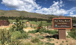
Boulder County Proposes Major Trail Restrictions for Mountain Bikers
May 11, 2026 from pinkbike.com
Access at Hall Ranch and Heil Valley is under fire. Learn how a "design problem" is being treated as a "user problem" and how you can take action.
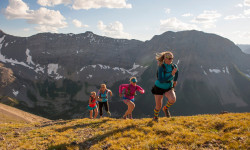
More Than Miles: Here’s How to Plan the Perfect Runcation
Aug 1, 2025 from outsideonline.com
Running trips—from Utah's desert to Patagonia's peaks—offer the most thrilling (and humbling) adventures this writer's ever experienced.
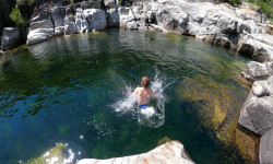
The 9 Best Swimming Holes in Our National Parks
Jun 20, 2025 from outsideonline.com
From waterfalls to deep plunge pools, here the best natural pools for cooling off this summer in national parks.
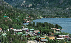
Lesser-Known Lake Escapes in the U.S.
May 22, 2025 from outsideonline.com
From turquoise gems in the Rockies to forest-fringed glacial lakes in New England, escape the crowds at these nine lakes in the U.S. where...
Sub Regions
- Boulder County (698)
- Allenspark (13)
- Taylor Mountain (9)
- Boulder (240)
- Betasso Preserve (6)
- Boulder Open Space (2)
- Boulder Valley Ranch / Boulder Reservoir (17)
- CU South Campus (11)
- Eldorado Canyon State Park (2)
- Lefthand OHV (64)
- Marshall Mesa/Doudy Draw/Flatirons Vista (22)
- Teller Farm Open Space (3)
- The People's Crossing Park (0)
- Valmont Bike Park (43)
- Walker Mountain (17)
- Walker Ranch (5)
- Erie (33)
- Erie Singletrack (20)
- Gunbarrel (24)
- Jamestown (29)
- Ceran Saint Vrain (33)
- Lafayette (13)
- Longmont (27)
- Louisville (63)
- Davidson Mesa (16)
- Lyons (18)
- Nederland (163)
- Caribou (18)
- Magnolia (89)
- Mud Lake (15)
- Sugarloaf Mountain (1)
- Tolland (9)
- Niwot (7)
- Superior (14)
- Coyote Ridge (8)
- Ward (34)
- Gold Hill (5)
- Allenspark (13)
- Broomfield (19)
- Broomfield (99)
- Anthem Community Park (16)
- McKay Lake (8)
- Rocky Flats (15)
- Standley Lake (24)
- Broomfield (99)
- Clear Creek County (154)
- Georgetown (48)
- Idaho Springs (97)
- Gilpin County (12)
- Jefferson County (680)
- Buffalo Creek (40)
- Coal Creek (38)
- Columbine (7)
- Conifer (86)
- Beaver Ranch Park (6)
- Flying J Ranch (4)
- Meyer Ranch Park (13)
- Reynolds Park (4)
- Staunton State Park (38)
- Evergreen (75)
- Alderfer Three Sisters Park (43)
- Elk Meadow Park (19)
- Maxwell Falls (6)
- Golden (125)
- Apex Park (16)
- Centennial Cone (7)
- Genesee Park (2)
- Golden Bike Park (7)
- North Table Mountain Park (21)
- South Table Mountain Park (26)
- White Ranch Park (22)
- Windy Saddle Park (8)
- Idledale (10)
- Ken Caryl (22)
- Lakewood (150)
- Addenbrooke Park (27)
- Bear Creek Lake Park (46)
- Belmar Park (16)
- Cottonwood Park (2)
- Crown Hill Park (12)
- Green Mountain (31)
- Lakewood Dry Gulch Park (2)
- O'Kane Park (4)
- Morrison (31)
- Matthews Winters Park (14)
- Mount Falcon Park (15)
- Red Rock Park (0)
- Westminster (38)
- Wheat Ridge (6)
- Buffalo Creek (40)
- Larimer County (393)
- Berthoud (42)
- Berthoud Bike Park (42)
- Estes Park (40)
- Fort Collins (179)
- Loveland (38)
- Red Feather Lakes (51)
- Windsor (8)
- Bobcat Ridge (14)
- Comanche Peak Wilderness Area (3)
- Lory State Park (28)
- State Forest State Park (27)
- Berthoud (42)
- Weld County (2)
Popular Front Range - North Mountain Biking Trails
• 85 ★ 4.6 • 1 mile • 19 ft • 4,119 •
If you were to ride one trail in the front range, this should be it. It has drops, steep technical sections, and fast bermy corners. Most bike traffic goes down . Some bikers prefer to get to the top of via Belcher. Please note; this is...
• 100 ★ 4.4 • 3,006 ft • 260 ft • 2,926 •
Highly rated popular blue difficulty singletrack. This mountain bike primary trail can be used both directions and has a moderate overall physical rating with a 260 ft blue climb. On average it takes 6 minutes to complete this trail.
• 95 ★ 4.5 • 1 mile • 58 ft • 2,698 •
As of September 10, 2020, the regulations on the trail are the following: On odd numbered days: Hiker & equestrian only On even numbered days: Biker only, with downhill direction
• 100 ★ 4.0 • 5,263 ft • 309 ft • 2,647 •
Trail is two way traffic but ridden as an up by most. Easy/moderate trail with a couple of switch backs and a short stair section to keep it interesting. Several sections are prone to have loose gravel.
• 100 ★ 3.2 • 2 miles • 90 ft • 2,618 •
Mayhoffer Singltree is another connector piece of the Dirty Bismark loop. It was one of the final sections opened. The trail has a very nice easy grade and no rocks at all! It's fantastic for beginners and young 'uns.
• 100 ★ 4.0 • 3 miles • 246 ft • 2,573 •
Popular blue difficulty singletrack. This mountain bike primary trail can be used downhill only and has a moderate overall physical rating. It features berm and rock garden. Trail visibility is always easy to follow. On average it takes 22 minutes to complete this trail.
• 95 ★ 4.0 • 1,834 ft • 57 ft • 2,558 •
Highly rated popular green difficulty singletrack. This mountain bike primary trail can be used both directions. On average it takes 3 minutes to complete this trail.
• 95 ★ 4.4 • 1 mile • 0 ft • 2,550 •
As of September 10, 2020, the lower portion of this trail is directional travel only, following the intersection with . On odd numbered days: Hiker & equestrian only On even numbered days: Biker only, with downhill direction
Front Range - North Mountain Bike Routes
Hall Ranch Technical Side Featured
★ 5.0 • 10 miles • 1,594 ft • 6 • Out & Back •
Tackling Hall Ranch up aka "The Rock Garden" bumps this intermediate/advanced area into solid double...
Hall Ranch: Intermediate Fun Featured
★ 4.4 • 7 miles • 1,191 ft • 5 • Out & Back •
This is an great alternative if you're not up to the black diamond challenge. It's primarily uphill all...
Marshall Mesa Doudy Draw Loop Featured
★ 4.0 • 12 miles • 988 ft • 14 • Loop •
This route gives a great tour of the best trails Marshall Mesa has to offer. The ride starts at the main...
The Best of Staunton Featured
★ 4.4 • 29 miles • 4,412 ft • 15 • Loop •
This route highlights the best way to get the full Staunton experience. Covering all the singletrack...
Marshall Mesa Beginner Ride Featured
★ 4.0 • 5 miles • 272 ft • 1 • Out & Back •
The Boulder Mountainbike Alliance's Recommendation for Easiest Ride at Marshall Mesa. People in Boulder...
Buchanan Waterfall out-and-back Featured
★ 5.0 • 7 miles • 824 ft • 1 • Out & Back •
Located at Camp Dick, it’s no secret this is probably one of the best singletracks around for fat...
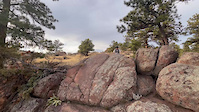
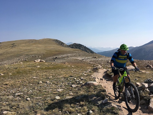
Photos of Front Range - North Mountain Bike
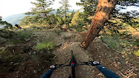
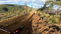
Videos of Front Range - North Mountain Bike
trail: Gauntlet Gold
0:19 |
1 |
Jun 12, 2026
trail: Eaton Dirt Jumps
0:08 |
4 |
Jun 2, 2026
trail: Eaton Dirt Jumps
0:09 |
1 |
Jun 2, 2026
trail: Eaton Dirt Jumps
0:08 |
|
Jun 2, 2026

trail: Valmont Paved Pumptrack
0:09 |
22 |
Jan 10, 2026
trail: Lower Bitterbrush
0:05 |
48 |
Jan 10, 2026
trail: Craig Lange Memorial
0:53 |
296 |
Aug 6, 2025
trail: Gauntlet Gold
4:27 |
209 |
Jul 21, 2025
Current Trail Warnings
| status | trail | date | condition | user | info |
|---|---|---|---|---|---|
| Plymouth Mountain Deer Creek Canyon Park | Jun 13, 2026 @ 2:30pm (America/Denver) Jun 13, 2026 | Ideal | Frcg | ||
| Rim Rock North Table Mountain Park | May 31, 2026 @ 4:32pm (America/Denver) May 31, 2026 | Unknown | dangitdude |
Recent Trail Reports
National Scenic Trails & Official Routes
-
Colorado Trail (Bike)
- Mountain Bike
-
Continental Divide Trail
- Mountain Bike
- Hike
- Trail Running

Activity Feed
| username | action | type | title | date |
|---|---|---|---|---|
| getvert | like | report | activity #97322567 | Jun 19, 2026 @ 9:09am 2 hours |
| nolanvanharte | add | report | activity #97310445 | Jun 19, 2026 @ 5:44am 5 hours |
| 0VlN7WpU | add | report | activity #97297794 | Jun 18, 2026 @ 10:30pm 12 hours |
| n40IVP | wishlist | region | activity #97295151 | Jun 18, 2026 @ 8:55pm 14 hours |
| johncasserole | add | video | activity #97294992 | Jun 18, 2026 @ 8:50pm 14 hours |
Recent Comments
| username | type | title | comment | date |
|---|---|---|---|---|
| trail | Best ridden after a rain, the loose gravel can... | Jun 15, 2026 @ 8:41pm Jun 15, 2026 | ||
| trail | Not sure what this used to be like, but now... | Jun 13, 2026 @ 3:08pm Jun 13, 2026 | ||
| trail | Jensen peak trail closed until the end of June... | Jun 7, 2026 @ 7:35am Jun 7, 2026 | ||
| trail | This trail has been open for over a year, it... | Jun 6, 2026 @ 4:48pm Jun 6, 2026 | ||
| trail | Gorgeous, but not a very fun trail in either... | Jun 5, 2026 @ 5:12pm Jun 5, 2026 |
Local Badges
-

Epic Mountain Bike Climb 2k1 awarded -

Top 10 Trails1 awarded -

10 Blue Trails20 awarded -

Epic Ride 50k1,328 awarded -
Epic Mountain Bike Climb 2k31 awarded -
Epic Mountain Bike Climb 2k2 awarded
Bike & Skill Parks
| name | type | city | rating |
|---|---|---|---|
| Loveland Basin | bike park | Georgetown | |
| Eldora Mountain Resort | bike park | Nederland | |
| Valmont Bike Park | skill park | Boulder | |
| Broomfield Bike Park | skill park | Broomfield | |
| Spring Canyon skillpark | skill park | Fort Collins |
Local Trail Supporters
- Overland Mountain Bike Club
![IMBA Epic]()
![Colorado Trail]()
![]()
![Outside Festival]()
![]()
- COMBA
![]()
![]()
- Renegade Trail Crew
- Orbea
![]()
![]()
![]()
Activity Type Stats
| activitytype | trails | distance | descent | descent distance | total vertical | rating | global rank | state rank | photos | reports | routes | ridelogs |
|---|---|---|---|---|---|---|---|---|---|---|---|---|
| Mountain Bike | 1,911 | 2,325 miles | 290,486 ft | 947 miles | 9,131 ft | 3,726 | 32,765 | 289 | 489,418 | |||
| E-Bike | 927 | 1,227 miles | 129,478 ft | 483 miles | 8,747 ft | 17 | 23,552 | 26 | 19,812 | |||
| Gravel Bike | 212 | 475 miles | 32,841 ft | 192 miles | 6,893 ft | 3 | 4,186 | 9 | 6,025 | |||
| Adaptive Bike | 365 | 560 miles | 39,131 ft | 228 miles | 7,126 ft | 5,147 | 2 | 24 | ||||
| Winter Fat Bike | 53 | 76 miles | 9,285 ft | 30 miles | 5,719 ft | 2,139 | 4 | 18 | ||||
| Horse | 612 | 1,089 miles | 167,513 ft | 416 miles | 9,347 ft | 5,672 | 56 | 35 | ||||
| Hike | 2,633 | 3,487 miles | 505,522 ft | 1,382 miles | 9,593 ft | 493 | 31,177 | 193 | 57,609 | |||
| Trail Running | 2,624 | 3,471 miles | 499,642 ft | 1,375 miles | 9,593 ft | 10 | 31,168 | 173 | 55,733 | |||
| Dirtbike/Moto | 147 | 307 miles | 33,238 ft | 101 miles | 6,670 ft | 4 | 4,517 | 11 | 148 | |||
| Observed Trials | 10 | 22 miles | 2,238 ft | 10 miles | 1,788 ft | 2 | 72 | 120 | ||||
| ATV/ORV/OHV | 130 | 270 miles | 27,280 ft | 88 miles | 6,670 ft | 4,516 | 11 | 23 | ||||
| Snowmobile | 73 | 133 miles | 15,289 ft | 38 miles | 4,911 ft | 23 | 11 | 13 | ||||
| Snowshoe | 133 | 209 miles | 22,382 ft | 61 miles | 8,025 ft | 229 | 110 | 581 | ||||
| Downhill Ski | 197 | 63 miles | 57,093 ft | 59 miles | 7,995 ft | 12 | 6,943 | |||||
| Backcountry Ski | 30 | 40 miles | 5,259 ft | 9 miles | 4,357 ft | 187 | 1 | 5,476 | ||||
| Nordic Ski | 37 | 26 miles | 2,369 ft | 10 miles | 1,480 ft | 221 | 11 | 2,514 |
Activities
- Front Range - North Mountain Biking Trails
- Front Range - North E-Biking Trails
- Front Range - North Gravel Biking Trails
- Front Range - North Adaptive Biking Trails
- Front Range - North Winter Fat Biking Trails
- Front Range - North Horseback Trails
- Front Range - North Hiking Trails
- Front Range - North Trail Running Trails
- Front Range - North Dirtbiking Trails
- Front Range - North Observed Trials Trails
- Front Range - North ATVing/Offroading Trails
- Front Range - North Snowmobiling Trails
- Front Range - North Snowshoeing Trails
- Front Range - North Skiing Trails
- Front Range - North Backcountry Skiing Trails
- Front Range - North Nordic Skiing Trails
Trails
- Hard trails in Front Range - North
- Easy trails in Front Range - North
- Favorite trails in Front Range - North
- Most ridden trails in Front Range - North
- Singletrack in Front Range - North
- Viewpoint trails in Front Range - North
- Trails with technical features in Front Range - North
- Race routes in Front Range - North
Points of Interest
- Pawnee Peak Summit
- Dutch Town Campsite Camping
- Lulu Mountain Summit
- Ypsilon Mountain Summit
- Mount Chiquita Summit
- Mount Chapin Summit
- Marmot Point Summit
- Lawn Lake Patrol Cabin
- Cutbank Campsite Camping
- Golden Banner Campsite Camping
- Longs Peak (14,259 ft)
- Mount Evans (14,252 ft)
- Mount Meeker (13,898 ft)
- By brenthillier
 NSMBA TRAILFORKS & contributors
 - Admins: jpmcghee, msmcfate, cmcquade
- #17163 - 19,375 views
- front range - north activity log | embed map of Front Range - North mountain bike trails | front range - north mountain biking points of interest
Downloading of trail gps tracks in kml & gpx formats is enabled for Front Range - North.
You must login to download files.