close
-
Layers w
- Weather Layers
- Pro
- Pro
- Pro
- Pro
- Pro
- Pro
- More Layers
- Pro
- Pro
- Pro
- Pro
-
Upgrade to

3D
Trail Conditions
- Unknown
- Snow Groomed
- Snow Packed
- Snow Covered
- Snow Cover Partial
- Freeze/thaw Cycle
- Icy
- Prevalent Mud
- Wet
- Variable
- Ideal
- Dry
- Very Dry
Trail Flow (Ridden Direction)
Trailforks scans users ridelogs to determine the most popular direction each trail is ridden. A good flowing trail network will have most trails flowing in a single direction according to their intension.
The colour categories are based on what percentage of riders are riding a trail in its intended direction.
The colour categories are based on what percentage of riders are riding a trail in its intended direction.
- > 96%
- > 90%
- > 80%
- > 70%
- > 50%
- < 50%
- bi-directional trail
- no data
Trail Last Ridden
Trailforks scans ridelogs to determine the last time a trail was ridden.
- < 2 days
- < 1 week
- < 2 weeks
- < 1 month
- < 6 months
- > 6 months
Trail Ridden Direction
The intended direction a trail should be ridden.
- Downhill Only
- Downhill Primary
- Both Directions
- Uphill Primary
- Uphill Only
- One Direction
Contribute Details
Colors indicate trail is missing specified detail.
- Description
- Photos
- Description & Photos
- Videos
Trail Popularity ?
Trailforks scans ridelogs to determine which trails are ridden the most in the last 9 months.
Trails are compared with nearby trails in the same city region with a possible 25 colour shades.
Think of this as a heatmap, more rides = more kinetic energy = warmer colors.
- most popular
- popular
- less popular
- not popular
ATV/ORV/OHV Filter
Max Vehicle Width
inches
US Cell Coverage
Legend

Radar Time
Activity Recordings
Trailforks uses anonymized public activity data.
?
Activity Recordings
Trailforks uses anonymized public activity data.
?
Personal Heatmap
▶
Activity Types
all
/
none
▶
Options
2
Date range
month
–
Winter Trails
Warning
A routing network for winter maps does not exist. Selecting trails using the winter trails layer has been disabled.
Missing Trails
Most Popular
Least Popular
Trails are colored based on popularity. The more popular a trail is, the more red. Less popular trails trend towards green.
Jump Magnitude Heatmap
Heatmap of where riders jump on trails. Zoom in to see individual jumps, click circles to view jump details.
BC Backroad Status
![map legend]()
Service Road Atlas is a free to use, community-driven service for viewing and creating reports on the numerous back-country service roads around B.C. and Alberta.

Slope Aspect
Direction the slope faces
Trails Deemphasized
Trails are shown in grey.
Only show trails with no bike usage.
Suggested Layers
Based on selected activity type
Save the current map location and zoom level as your default home location whenever this page is loaded.
SavePopular Trail Networks
view all areas »
No description for Frontenac County has been added yet!
Login or register to submit one.
Links
Activities Click to view
- Mountain Bike
228 trails
- E-Bike
125 trails
- Hike
291 trails
- Trail Running
290 trails
- Dirtbike/Moto
25 trails
- ATV/ORV/OHV
26 trails
- Snowmobile
3 trails
- Snowshoe
149 trails
- Nordic Ski
98 trails
Region Details
- 69
- 39
- 72
- 37
- 11
Stats
- Avg Trail Rating
- Trails (view details)
- 290
- Trails Mountain Bike
- 228
- Trails E-Bike
- 125
- Trails Hike
- 291
- Trails Trail Running
- 290
- Trails Dirtbike/Moto
- 25
- Trails ATV/ORV/OHV
- 26
- Trails Snowmobile
- 3
- Trails Snowshoe
- 149
- Trails Nordic Ski
- 98
- Total Distance
- 290 miles
- Total Descent
- 12,023 ft
- Total Vertical
- 895 ft
- Highest Trailhead
- 1,137 ft
- Reports
- 176
- Photos
- 93
- Ridden Counter
- 2,199
Sub Regions
- Central Frontenac (8)
- Kingston (149)
- North Frontenac Township (3)
- Shabomeka Lake (63)
- South Frontenac Township (23)
Popular Frontenac County Mountain Biking Trails
• 80 ★ 0.0 • 1 mile • 94 ft • 34 •
Awesome cliff and views of Little Shabomeka Lake. Some very technical rocky sections, not for the faint of heart.
• 100 ★ 0.0 • 14 miles • 402 ft • 30 •
Popular white difficulty rail trail. This multi-use trail can be used both directions. Winter use: Backcountry snow grooming.
• 85 ★ 4.0 • 1,129 ft • 6 ft • 23 •
Shabomeka Lake, connector trail between main trail #4 and flatter #2 trail group by Judyle Marsh beaver dam.
• 90 ★ 0.0 • 2,001 ft • 0 ft • 19 •
Entrance from Shabomeka Lake Rd, challenging rocky trail, good shortcut from 5 back to 1A entrance.
• 65 ★ 3.0 • 1 mile • 128 ft • 17 •
One of the main access trails fo the central part of the network. Starts off fairly open and steadily climbs, generally well maintained due to higher traffic. Excellent steep rock face drop at north end where it intersects #2.
• 85 ★ 0.0 • 2,484 ft • 31 ft • 16 •
Popular white difficulty singletrack. This multi-use trail can be used both directions. On average it takes 2 minutes to complete this trail.
Frontenac County Mountain Bike Routes
★ 5.0 • 104 miles • 2,834 ft • 0 • Loop •
Hundred mile gravel loop from The Farm. North on K&P and then gravel backroads and rail-bed, north of...
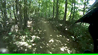
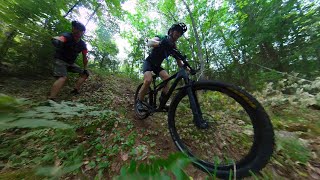
Photos of Frontenac County Mountain Bike
Videos of Frontenac County Mountain Bike
2:41 |
531 |
Sep 4, 2012
19:35 |
328 |
Oct 10, 2023
Recent Trail Reports
| status | trail | date | condition | info | user |
|---|---|---|---|---|---|
| SLP #6C Shabomeka Lake | Aug 22, 2025 @ 4:09pm Aug 22, 2025 | Ideal | deleenhe SLP | ||
| SLP #6A Greg Gulch Shabomeka Lake | Aug 22, 2025 @ 4:08pm Aug 22, 2025 | Ideal | deleenhe SLP | ||
| SLP #1B Sand Pit Access Shabomeka Lake | Aug 18, 2025 @ 10:25am Aug 18, 2025 | Wet | BethCpVIsg | ||
| Route 66 The Farm | Jun 21, 2025 @ 3:16pm Jun 21, 2025 | Ideal | davidsheaff | ||
| Collins Lake Loop - East Collins Lake Loop | Sep 6, 2024 @ 9:08am Sep 6, 2024 | Ideal | aj-biker | ||
| Pete's Loop Entrance The Farm | Aug 30, 2024 @ 9:08am Aug 30, 2024 | Ideal | aj-biker | ||
| Pete's Loop The Farm | Aug 30, 2024 @ 9:08am Aug 30, 2024 | Ideal | aj-biker | ||
| SLP #5C Shabomeka Lake | Aug 7, 2024 @ 6:37pm Aug 7, 2024 | Dry | deleenhe SLP | ||
| SLP #5 Shabomeka Lake | Aug 7, 2024 @ 6:36pm Aug 7, 2024 | Ideal | deleenhe SLP | ||
| SLP Box Canyon Bypass Shabomeka Lake | Aug 6, 2024 @ 4:39pm Aug 6, 2024 | Ideal | deleenhe SLP |
Activity Feed
| username | action | type | title | date |
|---|---|---|---|---|
| Adderley75 | wishlist | region | activity #96968243 | Jun 14, 2026 @ 7:49am Jun 14, 2026 |
| Neffg | wishlist | region | activity #95055823 | May 19, 2026 @ 11:30am May 19, 2026 |
| dodgerogers | wishlist | region | activity #93209841 | Apr 23, 2026 @ 6:42am Apr 23, 2026 |
| JamesColburn | like | directory | activity #90701354 | Mar 16, 2026 @ 11:43am Mar 16, 2026 |
| xianjw | wishlist | region | activity #87340769 | Jan 17, 2026 @ 8:09am Jan 17, 2026 |
Recent Comments
| username | type | title | comment | date |
|---|---|---|---|---|
| trail | missing the gps data | Jul 25, 2023 @ 6:40pm Jul 25, 2023 | ||
| trail | Plein d´étinérent, j´ai quitté.... lot of... | Jul 8, 2023 @ 1:31pm Jul 8, 2023 | ||
| trail | Ok trail to gain access to the good stuff.... | Sep 8, 2020 @ 8:20am Sep 8, 2020 | ||
| trail | Some land rock scapes worthy of a manicured... | Sep 8, 2020 @ 8:18am Sep 8, 2020 | ||
| report | You can enter on trail 3C or on the gravel... | Jul 24, 2019 @ 1:51pm Jul 24, 2019 |
Local Badges
-

Descent 10k Badge0 awarded -

Descent 100k Badge0 awarded -
Descent 100k Badge0 awarded -
Descent 100k Badge0 awarded -
Descent 10k Badge0 awarded -
Descent 10k Badge0 awarded
Activity Type Stats
| activitytype | trails | distance | descent | descent distance | total vertical | rating | global rank | state rank | photos | reports | routes | ridelogs |
|---|---|---|---|---|---|---|---|---|---|---|---|---|
| Mountain Bike | 228 | 209 miles | 7,592 ft | 72 miles | 896 ft | 90 | 176 | 1 | 12,618 | |||
| E-Bike | 125 | 134 miles | 3,743 ft | 48 miles | 505 ft | 106 | 1 | 144 | ||||
| Hike | 291 | 284 miles | 11,781 ft | 101 miles | 896 ft | 176 | 1 | 1,164 | ||||
| Trail Running | 290 | 283 miles | 11,752 ft | 101 miles | 896 ft | 176 | 1 | 777 | ||||
| Dirtbike/Moto | 25 | 23 miles | 925 ft | 6 miles | 656 ft | 21 | 30 | |||||
| ATV/ORV/OHV | 26 | 25 miles | 958 ft | 6 miles | 656 ft | 21 | 23 | |||||
| Snowmobile | 3 | 50 miles | 1,493 ft | 22 miles | 262 ft | 2 | ||||||
| Snowshoe | 149 | 173 miles | 7,241 ft | 65 miles | 784 ft | 8 | 120 | |||||
| Nordic Ski | 98 | 94 miles | 3,104 ft | 35 miles | 784 ft | 6 | 118 |
Frequently Asked Questions About Frontenac County
▼
What are the best places to ride in Frontenac County?
Frontenac County has 17 areas to explore for mountain biking. The top rated areas are:
▼
What are the highest rated mountain biking trails in Frontenac County?
The highest rated mountain biking trails in Frontenac County are:
- 3I (4.1/5)
- SLP #5C (4.1/5)
- SLP #6A Greg Gulch (4.1/5)
- SLP#6 (4.1/5)
- Cataraqui Trail (4.1/5)
▼
What is the best time of the year to ride in Frontenac County?
Based on ride log data, the most popular months to ride in Frontenac County are:
- June (99 activities)
- August (89 activities)
- July (89 activities)
▼
What is the longest trail in Frontenac County?
The longest trail in Frontenac County is Cataraqui Trail at 49.3 miles. View all trails sorted by distance.
Activities
Trails
- By markholloway
 Trailforks Map Team & contributors
 - Admins: Canadmos
- #10123 - 5,426 views
- frontenac county activity log | embed map of Frontenac County mountain bike trails | frontenac county mountain biking points of interest
Downloading of trail gps tracks in kml & gpx formats is enabled for Frontenac County.
You must login to download files.