close
-
Layers w
- Weather Layers
- Pro
- Pro
- Pro
- Pro
- Pro
- Pro
- More Layers
- Pro
- Pro
- Pro
- Pro
-
Upgrade to

3D
Trail Conditions
- Unknown
- Snow Groomed
- Snow Packed
- Snow Covered
- Snow Cover Partial
- Freeze/thaw Cycle
- Icy
- Prevalent Mud
- Wet
- Variable
- Ideal
- Dry
- Very Dry
Trail Flow (Ridden Direction)
Trailforks scans users ridelogs to determine the most popular direction each trail is ridden. A good flowing trail network will have most trails flowing in a single direction according to their intension.
The colour categories are based on what percentage of riders are riding a trail in its intended direction.
The colour categories are based on what percentage of riders are riding a trail in its intended direction.
- > 96%
- > 90%
- > 80%
- > 70%
- > 50%
- < 50%
- bi-directional trail
- no data
Trail Last Ridden
Trailforks scans ridelogs to determine the last time a trail was ridden.
- < 2 days
- < 1 week
- < 2 weeks
- < 1 month
- < 6 months
- > 6 months
Trail Ridden Direction
The intended direction a trail should be ridden.
- Downhill Only
- Downhill Primary
- Both Directions
- Uphill Primary
- Uphill Only
- One Direction
Contribute Details
Colors indicate trail is missing specified detail.
- Description
- Photos
- Description & Photos
- Videos
Trail Popularity ?
Trailforks scans ridelogs to determine which trails are ridden the most in the last 9 months.
Trails are compared with nearby trails in the same city region with a possible 25 colour shades.
Think of this as a heatmap, more rides = more kinetic energy = warmer colors.
- most popular
- popular
- less popular
- not popular
ATV/ORV/OHV Filter
Max Vehicle Width
inches
US Cell Coverage
Legend

Radar Time
Activity Recordings
Trailforks uses anonymized public activity data.
?
Activity Recordings
Trailforks uses anonymized public activity data.
?
Personal Heatmap
▶
Activity Types
all
/
none
▶
Options
2
Date range
month
–
Winter Trails
Warning
A routing network for winter maps does not exist. Selecting trails using the winter trails layer has been disabled.
Missing Trails
Most Popular
Least Popular
Trails are colored based on popularity. The more popular a trail is, the more red. Less popular trails trend towards green.
Jump Magnitude Heatmap
Heatmap of where riders jump on trails. Zoom in to see individual jumps, click circles to view jump details.
BC Backroad Status
![map legend]()
Service Road Atlas is a free to use, community-driven service for viewing and creating reports on the numerous back-country service roads around B.C. and Alberta.

Slope Aspect
Direction the slope faces
Trails Deemphasized
Trails are shown in grey.
Only show trails with no bike usage.
Suggested Layers
Based on selected activity type
Save the current map location and zoom level as your default home location whenever this page is loaded.
Save
No description for Frosinone has been added yet!
Login or register to submit one.
This region uses the Uk/Euro style trail grading system.
Activities Click to view
- Mountain Bike
195 trails
- E-Bike
183 trails
- Horse
33 trails
- Hike
125 trails
- Trail Running
117 trails
- Snowshoe
11 trails
- Downhill Ski
9 trails
- Backcountry Ski
9 trails
- Nordic Ski
10 trails
Region Details
- 27
- 9
- 40
- 74
- 1
Stats
- Avg Trail Rating
- Trails (view details)
- 188
- Trails Mountain Bike
- 195
- Trails E-Bike
- 183
- Trails Horse
- 33
- Trails Hike
- 125
- Trails Trail Running
- 117
- Trails Dirtbike/Moto
- 2
- Trails Snowshoe
- 11
- Trails Downhill Ski
- 9
- Trails Backcountry Ski
- 9
- Trails Nordic Ski
- 10
- Total Distance
- 233 miles
- Total Descent
- 89,163 ft
- Total Vertical
- 6,023 ft
- Highest Trailhead
- 6,369 ft
- Reports
- 1,881
- Photos
- 117
- Ridden Counter
- 2,928
Sub Regions
- Cassino (13)
- Alvito (9)
- Castelliri (2)
- Castrocielo (5)
- Cervaro (24)
- Cervaro Enduro Area (24)
- Fiuggi (125)
- Fiuggi Outdoor Area (56)
- Isola del Liri (3)
- Morolo (3)
- Valle Rotonda (16)
- Valle Rotonda (16)
- Parco Di Monte Menola (3)
- Serrone Enduro Park (15)
- Val Comino (0)
Popular Frosinone Mountain Biking Trails
• 75 ★ 4.5 • 2 miles • 0 ft • 51 •
Popular black difficulty singletrack. This mountain bike primary trail can be used downhill primary and has a hard overall physical rating with a 0 ft double black diamond climb. It features berm, drop, jump and rock garden. On average it takes 40 minutes to complete this trail.
• 90 ★ 4.3 • 4,324 ft • 0 ft • 49 •
• 50 ★ 4.0 • 1 mile • 10 ft • 43 •
Moderately popular blue difficulty singletrack. This mountain bike primary trail can be used downhill primary with a 10 ft blue climb. On average it takes 12 minutes to complete this trail.
• 90 ★ 4.0 • 4,216 ft • 6 ft • 38 •
Popular red difficulty alpine singletrack. This mountain bike primary trail can be used downhill primary. It features berm, drop and jump. On average it takes 14 minutes to complete this trail.
• 60 ★ 4.0 • 4,413 ft • 0 ft • 37 •
Moderately popular blue difficulty singletrack. This mountain bike primary trail can be used downhill primary with a 0 ft blue climb. On average it takes 6 minutes to complete this trail.
• 95 ★ 5.0 • 4,948 ft • 4 ft • 36 •
Popular green difficulty mixed. This mountain bike primary trail can be used downhill primary and has a easy overall physical rating with a 4 ft blue climb. It features wallride. On average it takes 8 minutes to complete this trail.
• 90 ★ 0.0 • 13 miles • 720 ft • 33 •
a wonderful cycle path built on the old railway Rome - Fiuggi, easy to climb, wonderful view, excellent for families
• 100 ★ 0.0 • 1 mile • 82 ft • 33 •
protected cycle path from Fiuggi To Canterno's Lake
Frosinone Mountain Bike Routes
★ 5.0 • 14 miles • 710 ft • 5 • Loop •
Percorso Facile adatto a tutti i riders che attraversa i e gira intorno il paro naturale del lago di canterno
★ 5.0 • 16 miles • 1,038 ft • 2 • Shuttled •
Lungo percorso di ritorno prevalentemente in discesa che da campocatino ritorna a fiuggi passanto per la...
3 miles • 339 ft • 1 • Loop •
Bellissimo percorso all'interno del bosco di Fiuggi, partendo dal centro cittadino, dove poter passeggiare...
31 miles • 6,762 ft • 0 • Loop •
Un bellissimo giro tra Lazio e Abruzzo partendo dal paesino di San Donato Val di Comino. Ovviamente la...
Photos of Frosinone Mountain Bike
Videos of Frosinone Mountain Bike
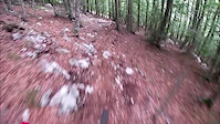
trail: Punta Della Valle
2:22 |
61 |
Aug 30, 2020
trail: Volante
3:26 |
120 |
Aug 25, 2024 , Fiuggi
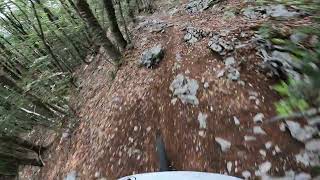
trail: Frascara Gara
3:32 |
133 |
Jul 5, 2024 , Fiuggi
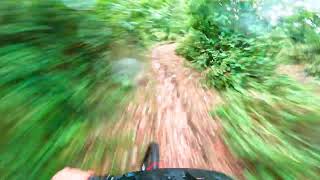
trail: Tarci
0:16 |
406 |
Oct 12, 2020 , Fiuggi
trail: Pineta Sunset
0:34 |
11 |
Sep 29, 2025
0:23 |
|
Dec 3, 2024
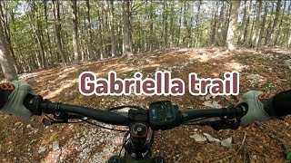
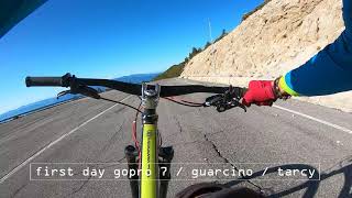
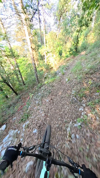
trail: Gabriella
8:38 |
145 |
Oct 30, 2023 , Fiuggi
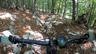
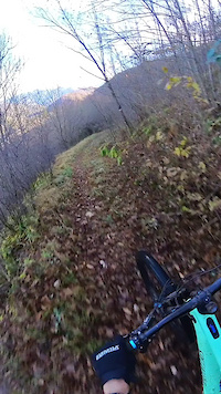
trail: Frascara
9:45 |
242 |
Oct 6, 2023 , Fiuggi
Current Trail Warnings
| status | trail | date | condition | user | info |
|---|---|---|---|---|---|
| Pineta Fiuggi Outdoor Area | Jun 17, 2026 @ 8:49am (Europe/Rome) 2 days | Dry | sp1marco | Il trail è molto rovinato perchè scavato |
Recent Trail Reports
Activity Feed
| username | action | type | title | date |
|---|---|---|---|---|
| sp1marco | add | report | activity #97165632 | Jun 16, 2026 @ 11:50pm 2 days |
| Antodg | add | report | activity #97027791 and 1 more | Jun 15, 2026 @ 1:15am Jun 15, 2026 |
| massimoMTB | ridden | trail | activity #96876699 and 3 more | Jun 13, 2026 @ 7:51am Jun 13, 2026 |
| DanieleLvHXeS | wishlist | trail | activity #96545116 and 1 more | Jun 8, 2026 @ 9:30am Jun 8, 2026 |
| DanieleLvHXeS | wishlist | trail | activity #96545052 | Jun 8, 2026 @ 9:28am Jun 8, 2026 |
Recent Comments
| username | type | title | comment | date |
|---|---|---|---|---|
| report | Perfetta.....molto natural...da gommare | Nov 12, 2025 @ 1:46pm Nov 12, 2025 | ||
| trail | Molto bello, da fare assolutamente.... | Oct 18, 2025 @ 11:41pm Oct 18, 2025 | ||
| trail | Ottimo per allenare ritmi gara , ottimo grip ,... | Sep 11, 2025 @ 10:17am Sep 11, 2025 | ||
| trail | Sentiero perfetto pulito ben curato, terreno... | Sep 11, 2025 @ 10:16am Sep 11, 2025 | ||
| trail | Divertente veloce flow Segnalerei il drop del... | May 12, 2025 @ 11:42am May 12, 2025 |
Local Badges
-

Descent 10k Badge5 awarded -

Epic Mountain Bike Climb 2k1 awarded -

Completionist0 awarded -

Epic Ride 50k33 awarded -

Descent 100k Badge0 awarded -

Mountain Biking 100k Badge0 awarded
Activity Type Stats
| activitytype | trails | distance | descent | descent distance | total vertical | rating | global rank | state rank | photos | reports | routes | ridelogs |
|---|---|---|---|---|---|---|---|---|---|---|---|---|
| Mountain Bike | 195 | 231 miles | 88,704 ft | 141 miles | 6,024 ft | 108 | 1,881 | 14 | 8,386 | |||
| E-Bike | 183 | 224 miles | 84,377 ft | 136 miles | 6,024 ft | 9 | 1,862 | 3 | 1,579 | |||
| Horse | 33 | 47 miles | 11,713 ft | 25 miles | 4,039 ft | 283 | 2 | |||||
| Hike | 125 | 148 miles | 44,144 ft | 85 miles | 4,974 ft | 1,830 | 510 | |||||
| Trail Running | 117 | 142 miles | 40,558 ft | 80 miles | 4,974 ft | 1,826 | 136 | |||||
| Dirtbike/Moto | 2 | 4 miles | 1,434 ft | 2 miles | 1,296 ft | 267 | ||||||
| Snowshoe | 11 | 8 miles | 2,100 ft | 5 miles | 1,411 ft | 1 | 4 | |||||
| Downhill Ski | 9 | 8 miles | 2,100 ft | 5 miles | 1,411 ft | 18 | ||||||
| Backcountry Ski | 9 | 8 miles | 2,100 ft | 5 miles | 1,411 ft | 55 | ||||||
| Nordic Ski | 10 | 10 miles | 3,130 ft | 7 miles | 2,897 ft | 8 |
Frequently Asked Questions About Frosinone
▼
What are the best places to ride in Frosinone?
Frosinone has 7 areas to explore for mountain biking. The top rated areas are:
▼
What are the highest rated mountain biking trails in Frosinone?
The highest rated mountain biking trails in Frosinone are:
- E1 (Monte Scalambra- Quota 800) (4.4/5)
- Patriot (4.3/5)
- MK 10 (4.2/5)
- Tagadà (4.2/5)
- Route66 (4.2/5)
▼
What is the best time of the year to ride in Frosinone?
Based on ride log data, the most popular months to ride in Frosinone are:
- October (19 activities)
- July (17 activities)
- December (14 activities)
▼
What is the longest trail in Frosinone?
The longest trail in Frosinone is Ciclabile Vecchia Ferrovia (Roma - Fiuggi) at 12.9 miles. View all trails sorted by distance.
Activities
Trails
- By denitopia
 TRAILFORKS VTA & contributors
 - Admins: denitopia, marcoangeletti, cemoorelife, yuribu
- #11735 - 3,843 views
- frosinone activity log | embed map of Frosinone mountain bike trails | frosinone mountain biking points of interest
Downloading of trail gps tracks in kml & gpx formats is enabled for Frosinone.
You must login to download files.