close
-
Layers w
- Weather Layers
- Pro
- Pro
- Pro
- Pro
- Pro
- Pro
- More Layers
- Pro
- Pro
- Pro
- Pro
-
Upgrade to

3D
Trail Conditions
- Unknown
- Snow Groomed
- Snow Packed
- Snow Covered
- Snow Cover Partial
- Freeze/thaw Cycle
- Icy
- Prevalent Mud
- Wet
- Variable
- Ideal
- Dry
- Very Dry
Trail Flow (Ridden Direction)
Trailforks scans users ridelogs to determine the most popular direction each trail is ridden. A good flowing trail network will have most trails flowing in a single direction according to their intension.
The colour categories are based on what percentage of riders are riding a trail in its intended direction.
The colour categories are based on what percentage of riders are riding a trail in its intended direction.
- > 96%
- > 90%
- > 80%
- > 70%
- > 50%
- < 50%
- bi-directional trail
- no data
Trail Last Ridden
Trailforks scans ridelogs to determine the last time a trail was ridden.
- < 2 days
- < 1 week
- < 2 weeks
- < 1 month
- < 6 months
- > 6 months
Trail Ridden Direction
The intended direction a trail should be ridden.
- Downhill Only
- Downhill Primary
- Both Directions
- Uphill Primary
- Uphill Only
- One Direction
Contribute Details
Colors indicate trail is missing specified detail.
- Description
- Photos
- Description & Photos
- Videos
Trail Popularity ?
Trailforks scans ridelogs to determine which trails are ridden the most in the last 9 months.
Trails are compared with nearby trails in the same city region with a possible 25 colour shades.
Think of this as a heatmap, more rides = more kinetic energy = warmer colors.
- most popular
- popular
- less popular
- not popular
ATV/ORV/OHV Filter
Max Vehicle Width
inches
US Cell Coverage
Legend

Radar Time
Activity Recordings
Trailforks uses anonymized public activity data.
?
Activity Recordings
Trailforks uses anonymized public activity data.
?
Personal Heatmap
▶
Activity Types
all
/
none
▶
Options
2
Date range
month
–
Winter Trails
Warning
A routing network for winter maps does not exist. Selecting trails using the winter trails layer has been disabled.
Missing Trails
Most Popular
Least Popular
Trails are colored based on popularity. The more popular a trail is, the more red. Less popular trails trend towards green.
Jump Magnitude Heatmap
Heatmap of where riders jump on trails. Zoom in to see individual jumps, click circles to view jump details.
BC Backroad Status
![map legend]()
Service Road Atlas is a free to use, community-driven service for viewing and creating reports on the numerous back-country service roads around B.C. and Alberta.

Slope Aspect
Direction the slope faces
Trails Deemphasized
Trails are shown in grey.
Only show trails with no bike usage.
Suggested Layers
Based on selected activity type
Save the current map location and zoom level as your default home location whenever this page is loaded.
Save
No description for Frösön has been added yet!
Login or register to submit one.
 google parking directions
Primary Trail Type: Cross-Country
google parking directionsThis region uses the Uk/Euro style trail grading system.
Activities Click to view
- Mountain Bike
120 trails
- E-Bike
4 trails
- Horse
5 trails
- Hike
121 trails
- Trail Running
121 trails
- Nordic Ski
13 trails
Region Details
- 24
- 29
- 50
- 14
- 1
Region Status
Open as of Jun 28, 2025Stats
- Avg Trail Rating
- Trails (view details)
- 126
- Trails Mountain Bike
- 120
- Trails E-Bike
- 4
- Trails Horse
- 5
- Trails Hike
- 121
- Trails Trail Running
- 121
- Trails Nordic Ski
- 13
- Total Distance
- 58 miles
- Total Descent
- 7,282 ft
- Total Vertical
- 554 ft
- Highest Trailhead
- 1,516 ft
- Reports
- 253
- Photos
- 15
- Ridden Counter
- 9,592
Popular Frösön Mountain Biking Trails
• 100 ★ 4.3 • 1,719 ft • 3 ft • 235 •
Popular blue difficulty machine groomed. This mountain bike primary trail and has a moderate overall physical rating. It features a-frame, berm, drop and jump. On average it takes 1 minutes to complete this trail.
• 100 ★ 4.7 • 2,635 ft • 67 ft • 190 •
Börjar vid Ladängsbackens platå. Efter några branta partier på hygget bär det av längs några hopp och går sen på !skrå nästan hela vägen ner.
• 100 ★ 3.5 • 3,307 ft • 85 ft • 159 •
Popular red difficulty singletrack. This mountain bike primary trail. It features berm, drop, gap jump and rock garden. On average it takes 2 minutes to complete this trail.
• 70 ★ 4.7 • 2,054 ft • 0 ft • 145 •
Popular black difficulty singletrack. This mountain bike primary trail. On average it takes 3 minutes to complete this trail.
Frösön Mountain Bike Routes
★ 5.0 • 19 miles • 1,823 ft • 23 • Loop •
Frösön runt is a mtb trail/route around the island Frösön. 30 km and 590 altitud meter. Nice trails...
Photos of Frösön Mountain Bike
Videos of Frösön Mountain Bike
youtuber
![On a Fear Streak | Training for ESS Östersund...]()
10:51 |
358 |
Sep 30, 2019
trail: Tornvägen Instick
9:06 |
404 |
Jul 19, 2008
youtuber
![MTB Enduro Race - ESS #3 Östersund (2018)]()
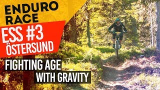
trail: Downhillbanan
10:15 |
647 |
Aug 23, 2018 , Östersund
Recent Trail Reports
| status | trail | date | condition | info | user |
|---|---|---|---|---|---|
| Birdie | Jun 28, 2025 @ 7:35am Jun 28, 2025 | Prevalent Mud | TerjeBmlM81 | ||
| Duck! | Jun 28, 2025 @ 7:35am Jun 28, 2025 | Ideal | TerjeBmlM81 | ||
| WPB | Jun 28, 2025 @ 7:35am Jun 28, 2025 | Wet | TerjeBmlM81 | ||
| Pärlann | Jun 28, 2025 @ 7:35am Jun 28, 2025 | Wet | TerjeBmlM81 | ||
| Vallaslingan | Jun 28, 2025 @ 7:35am Jun 28, 2025 | Wet | TerjeBmlM81 | ||
| Intåg I Sommarhagen | Jun 15, 2025 @ 4:23pm Jun 15, 2025 | Ideal | stenback | ||
| Aragårn | Jun 15, 2025 @ 4:23pm Jun 15, 2025 | Variable | stenback | ||
| Legolas | Jun 15, 2025 @ 4:23pm Jun 15, 2025 | Variable | stenback | ||
| Ladängsbanan | Jun 2, 2025 @ 6:18am Jun 2, 2025 | Dry | teunvandenbrink | ||
| Ladängen Light | Jun 2, 2025 @ 6:18am Jun 2, 2025 | Dry | teunvandenbrink |
Activity Feed
| username | action | type | title | date |
|---|---|---|---|---|
| afuecker | vote | trail | activity #85488079 | Dec 13, 2025 @ 3:48pm Dec 13, 2025 |
| afuecker | ridden | trail | activity #85487865 | Dec 13, 2025 @ 3:45pm Dec 13, 2025 |
| funkyfreed | wishlist | region | activity #79780442 | Sep 6, 2025 @ 12:53pm Sep 6, 2025 |
| Barberrari | ridden | trail | activity #79416610 | Sep 1, 2025 @ 9:16am Sep 1, 2025 |
| OrjanX | update | region | activity #75796440 | Jul 13, 2025 @ 2:12am Jul 13, 2025 |
Recent Comments
| username | type | title | comment | date |
|---|---|---|---|---|
| trail | SKRRT | Jun 2, 2025 @ 7:03am Jun 2, 2025 | ||
| trail | Gör en stigrapport (Trail Report) istället. | Jun 13, 2024 @ 10:27am Jun 13, 2024 | ||
| trail | Flera träd över stig samt halv igjen växt... | Jun 13, 2024 @ 7:42am Jun 13, 2024 | ||
| trail | Kul men något ojämn stig. Avslutningen är... | Sep 10, 2021 @ 12:39pm Sep 10, 2021 | ||
| trail | Har någon en video från denna bana? | Aug 13, 2021 @ 11:42am Aug 13, 2021 |
Nearby Areas
| name | distance | ||||
|---|---|---|---|---|---|
| Östersunds Skidstadion | 4 km | ||||
| Tysjöarna - Kännåsen | 1 | 6 | 4.3 km | ||
| Nifsåsen | 9 | 2 | 4.6 km | ||
| Andersön | 2 | 7 | 4.7 km | ||
| Rannåsen | 9 | 7 | 4.8 km |
Local Badges
-

Completionist0 awarded
Activity Type Stats
| activitytype | trails | distance | descent | descent distance | total vertical | rating | global rank | state rank | photos | reports | routes | ridelogs |
|---|---|---|---|---|---|---|---|---|---|---|---|---|
| Mountain Bike | 120 | 52 miles | 6,470 ft | 22 miles | 554 ft | #981 | #31 | 15 | 252 | 1 | 8,950 | |
| E-Bike | 4 | 2 miles | 69 ft | 4,301 ft | 174 ft | #2,873 | #299 | 222 | 261 | |||
| Horse | 5 | 5 miles | 407 ft | 4 miles | 197 ft | #662 | #37 | 95 | ||||
| Hike | 121 | 54 miles | 5,554 ft | 24 miles | 554 ft | #2,758 | #81 | 248 | 186 | |||
| Trail Running | 121 | 54 miles | 5,554 ft | 24 miles | 554 ft | #1,555 | #66 | 248 | 2,289 | |||
| Nordic Ski | 13 | 6 miles | 423 ft | 2 miles | 443 ft | #368 | #40 | 97 |
Frequently Asked Questions About Frösön
▼
What are the highest rated mountain biking trails in Frösön?
The highest rated mountain biking trails in Frösön are:
- Ingen Bergvägg (4.2/5)
- Skråbanan (4.2/5)
- Görans (4.2/5)
- GB-banan (4.1/5)
- Vallaslingan (4.1/5)
▼
What is the best time of the year to ride in Frösön?
Based on ride log data, the most popular months to ride in Frösön are:
- August (63 activities)
- July (61 activities)
- June (35 activities)
▼
Where can I park to ride in Frösön?
There are 3 parking locations listed in Frösön. The most popular parking spots are: View all parking and trailhead locations on the map to plan your visit.
▼
What is the longest trail in Frösön?
The longest trail in Frösön is Bynäset at 3.1 miles. View all trails sorted by distance.
Activities
- By mountain-viking
 KS & contributors
 - Admins: OrjanX, FS, cissithomasson, johnlindh
- #14803 - 8,487 views
- frösön activity log | embed map of Frösön mountain bike trails | frösön mountain biking points of interest polygons
Downloading of trail gps tracks in kml & gpx formats is enabled for Frösön.
You must login to download files.