close
-
Layers w
- Weather Layers
- Pro
- Pro
- Pro
- Pro
- Pro
- Pro
- More Layers
- Pro
- Pro
- Pro
- Pro
-
Upgrade to

3D
Trail Conditions
- Unknown
- Snow Groomed
- Snow Packed
- Snow Covered
- Snow Cover Partial
- Freeze/thaw Cycle
- Icy
- Prevalent Mud
- Wet
- Variable
- Ideal
- Dry
- Very Dry
Trail Flow (Ridden Direction)
Trailforks scans users ridelogs to determine the most popular direction each trail is ridden. A good flowing trail network will have most trails flowing in a single direction according to their intension.
The colour categories are based on what percentage of riders are riding a trail in its intended direction.
The colour categories are based on what percentage of riders are riding a trail in its intended direction.
- > 96%
- > 90%
- > 80%
- > 70%
- > 50%
- < 50%
- bi-directional trail
- no data
Trail Last Ridden
Trailforks scans ridelogs to determine the last time a trail was ridden.
- < 2 days
- < 1 week
- < 2 weeks
- < 1 month
- < 6 months
- > 6 months
Trail Ridden Direction
The intended direction a trail should be ridden.
- Downhill Only
- Downhill Primary
- Both Directions
- Uphill Primary
- Uphill Only
- One Direction
Contribute Details
Colors indicate trail is missing specified detail.
- Description
- Photos
- Description & Photos
- Videos
Trail Popularity ?
Trailforks scans ridelogs to determine which trails are ridden the most in the last 9 months.
Trails are compared with nearby trails in the same city region with a possible 25 colour shades.
Think of this as a heatmap, more rides = more kinetic energy = warmer colors.
- most popular
- popular
- less popular
- not popular
ATV/ORV/OHV Filter
Max Vehicle Width
inches
US Cell Coverage
Legend

Radar Time
Activity Recordings
Trailforks uses anonymized public activity data.
?
Activity Recordings
Trailforks uses anonymized public activity data.
?
Personal Heatmap
▶
Activity Types
all
/
none
▶
Options
2
Date range
month
–
Winter Trails
Warning
A routing network for winter maps does not exist. Selecting trails using the winter trails layer has been disabled.
Missing Trails
Most Popular
Least Popular
Trails are colored based on popularity. The more popular a trail is, the more red. Less popular trails trend towards green.
Jump Magnitude Heatmap
Heatmap of where riders jump on trails. Zoom in to see individual jumps, click circles to view jump details.
BC Backroad Status
![map legend]()
Service Road Atlas is a free to use, community-driven service for viewing and creating reports on the numerous back-country service roads around B.C. and Alberta.

Slope Aspect
Direction the slope faces
Trails Deemphasized
Trails are shown in grey.
Only show trails with no bike usage.
Suggested Layers
Based on selected activity type
Save the current map location and zoom level as your default home location whenever this page is loaded.
Save
No description for Fruit Heights has been added yet!
Login or register to submit one.
Activities Click to view
- Mountain Bike
22 trails
- Gravel Bike
0 trails
- Adaptive Bike
0 trails
- Hike
24 trails
- Trail Running
24 trails
Region Details
- 6
- 4
- 7
- 3
Region Status
Caution as of May 25, 2026Stats
- Avg Trail Rating
- Trails (view details)
- 23
- Trails Mountain Bike
- 22
- Trails E-Bike
- 1
- Trails Hike
- 24
- Trails Trail Running
- 24
- Trails Dirtbike/Moto
- 1
- Trails ATV/ORV/OHV
- 1
- Total Distance
- 23 miles
- Total Descent
- 8,351 ft
- Total Vertical
- 5,063 ft
- Highest Trailhead
- 9,457 ft
- Reports
- 415
- Photos
- 85
- Ridden Counter
- 7,793
Sub Regions
-
Fruit Loops
- 3
- 2
- 1
Popular Fruit Heights Mountain Biking Trails
• 100 ★ 3.9 • 2,986 ft • 135 ft • 1,256 •
This is an easy climbing trail to get you back to the start or continue for another loop where it connects up to the old jeep road. The climbing is very gradual, but provides a great workout if you hammer. There are a few little...
• 100 ★ 3.9 • 2,543 ft • 0 ft • 1,159 •
Intermediate flow trail that has lots of berms and really fun rollers. The rollers can be doubled up or you can just roll them like big whoops. There is a massive rock to your left right as you hit the steep rollers, so check your speed...
• 90 ★ 4.0 • 1 mile • 73 ft • 1,067 •
This is the mostly downhill flow section of the trail. The trail has some nice wide berms at the top, then drops you through some really fast and fun rollers with more berms in between. You can ride this section slow and it is easy, or...
• 80 ★ 4.1 • 1,135 ft • 0 ft • 842 •
The signage indicates that this trail is a double diamond, but most of it is not. There are several little rock drops and senders and if you hit it fast there are several small gaps, but you can roll everything. Near the bottom is one...
• 95 ★ 4.2 • 1,470 ft • 3 ft • 743 •
Intermediate downhill trail that has big whoops and some nice berms. The whoops are tall and steep and make this really fun downhill for kids and riders new to the sport.
• 60 ★ 2.4 • 91 ft • 0 ft • 568 •
This is an optional cutoff line to the Blue Fruit Loop, that takes a left turn up and over a rocky spine. The rock is white and red and can be pretty technical because the narrow rockiness of the spine and that it drops sharply to the...
• 20 ★ 3.0 • 356 ft • 0 ft • 468 •
Little connector trail to the road. The trail is short and mostly smooth, with a some short up and downs sections.
• 85 ★ 3.0 • 761 ft • 43 ft • 459 •
Nice easy singletrack that connects you to the lower cul-de-sac at the end of East Oaks Drive
Fruit Heights Mountain Bike Routes
2 miles • 218 ft • 2 • Loop •
This outside loop will get you started. Once you do a lap, you'll see which trails you want to try, or if...
2 miles • 253 ft • 3 •
5 miles • 713 ft • 6 • Loop •
Start in the circle at the end of East Oaks Drive (https://goo.gl/maps/AxDSVR22ZQuWnXH78) Ride the...
3 miles • 718 ft • 3 •
Photos of Fruit Heights Mountain Bike
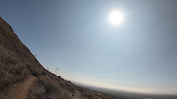
Videos of Fruit Heights Mountain Bike
trail: Fruit Loops
0:11 |
|
Mar 14, 2025
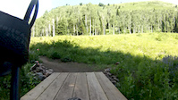
trail: Fruit Loops
0:13 |
358 |
Mar 2, 2022
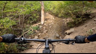
trail: Fruit Flow Intermediate
0:12 |
465 |
Nov 10, 2019

trail: Fruit Flow Expert
0:18 |
854 |
Nov 10, 2019
trail: Fruit Flow Expert
0:14 |
957 |
Apr 17, 2019
trail: Blue Whoops
0:22 |
|
Mar 17, 2019
trail: Trailhead
7:19 |
307 |
Oct 8, 2014
trail: Range Connector
23:43 |
66 |
Feb 22, 2026 , Fruit Heights
Recent Trail Reports
| status | trail | date | condition | info | user |
|---|---|---|---|---|---|
| Fruit Flow Expert | May 25, 2026 @ 9:27pm (America/Denver) May 25, 2026 | Very Dry | sterfry96 | ||
| Blue Whoops | May 25, 2026 @ 9:26pm (America/Denver) May 25, 2026 | Very Dry | sterfry96 | ||
| Fruit Loops | May 25, 2026 @ 9:24pm (America/Denver) May 25, 2026 | Dry | sterfry96 | ||
| Fruit Loops Up | May 25, 2026 @ 9:24pm (America/Denver) May 25, 2026 | Very Dry | sterfry96 | ||
| BST Lower Bair | Apr 19, 2026 @ 8:31pm (America/Denver) Apr 19, 2026 | Unknown | JamesqRH7Co | ||
| Fruit Flow Intermediate | Feb 8, 2026 @ 3:48pm (America/Boise) Feb 8, 2026 | Dry | Zargyle | ||
| East Oaks Access | Feb 8, 2026 @ 3:48pm (America/Boise) Feb 8, 2026 | Dry | Zargyle | ||
| BST Bair Connector | Sep 30, 2024 @ 6:19pm Sep 30, 2024 | Dry | HT8dpf | ||
| BST (Shepard Creek Alt) | Sep 16, 2024 @ 1:15pm Sep 16, 2024 | Dry | Rangerjoebags | ||
| Drop Out | Apr 16, 2024 @ 7:54am Apr 16, 2024 | Ideal | bisraelsen |
National Scenic Trails & Official Routes
-
Bonneville Shoreline Trail
- Mountain Bike
- E-Bike
- Horse
- Hike
- Trail Running
- Snowshoe
- Nordic Ski
-
Great Western Trail
- Mountain Bike
- E-Bike
- Horse
- Hike
- Trail Running
- Dirtbike/Moto
- ATV/ORV/OHV


Activity Feed
| username | action | type | title | date |
|---|---|---|---|---|
| HolynTf5pGk | wishlist | trail | activity #96340465 | Jun 5, 2026 @ 8:33pm Jun 5, 2026 |
| 2FUFhG | wishlist | route | activity #96208050 | Jun 3, 2026 @ 11:23pm Jun 3, 2026 |
| sterfry96 | add | report | activity #95541200 and 3 more | May 25, 2026 @ 8:24pm May 25, 2026 |
| Jason2711 | wishlist | trail | activity #95377450 | May 23, 2026 @ 8:53pm May 23, 2026 |
| Jaredp5P11l | ridden | trail | activity #95363741 | May 23, 2026 @ 4:19pm May 23, 2026 |
Recent Comments
| username | type | title | comment | date |
|---|---|---|---|---|
| trail | Most of this is now a paved street | Jun 21, 2025 @ 3:04pm Jun 21, 2025 | ||
| trail | Trail does not exist anymore. Land developers... | Jun 21, 2025 @ 2:32pm Jun 21, 2025 | ||
| trail | As of 4/3/24, trail closed for construction... | Apr 3, 2024 @ 2:19pm Apr 3, 2024 | ||
| trail | Anyone been recently? Gtg? | Dec 31, 2023 @ 11:09am Dec 31, 2023 | ||
| trail | Honestly the worst built black trail | Jun 28, 2023 @ 6:43pm Jun 28, 2023 |
Local Badges
-

Epic Ride Climb 2k2 awarded -

Climbing 10k Badge17 awarded -

Climbing 100k Badge0 awarded -

Epic Ride Descent 2k2 awarded -

Descent 10k Badge18 awarded -

Descent 100k Badge0 awarded
Activity Type Stats
| activitytype | trails | distance | descent | descent distance | total vertical | rating | global rank | state rank | photos | reports | routes | ridelogs |
|---|---|---|---|---|---|---|---|---|---|---|---|---|
| Mountain Bike | 22 | 14 miles | 3,990 ft | 9 miles | 5,062 ft | #2,874 | #1,018 | 75 | 413 | 5 | 8,279 | |
| E-Bike | 1 | 5 miles | 2,133 ft | 4 miles | 1,939 ft | 287 | 1 | 215 | ||||
| Hike | 24 | 21 miles | 7,769 ft | 11 miles | 5,062 ft | #1,276 | #583 | 12 | 381 | 9 | 137 | |
| Trail Running | 24 | 21 miles | 7,769 ft | 11 miles | 5,062 ft | #6,252 | #2,020 | 381 | 11 | 474 | ||
| Dirtbike/Moto | 1 | 5 miles | 2,133 ft | 4 miles | 1,939 ft | 18 | 2 | |||||
| ATV/ORV/OHV | 1 | 5 miles | 2,133 ft | 4 miles | 1,939 ft | 18 | 1 |
Frequently Asked Questions About Fruit Heights
▼
What are the best places to ride in Fruit Heights?
Fruit Heights has 1 areas to explore for mountain biking. The top rated areas are:
▼
What are the highest rated mountain biking trails in Fruit Heights?
The highest rated mountain biking trails in Fruit Heights are:
- Blue Whoops (4.1/5)
- Fruit Flow Expert (4/5)
- Fruit Loops (3.9/5)
- Fruit Loops Up (3.9/5)
- Fruit Flow Intermediate (3.9/5)
▼
What is the best time of the year to ride in Fruit Heights?
Based on ride log data, the most popular months to ride in Fruit Heights are:
- July (97 activities)
- June (73 activities)
- May (71 activities)
▼
Where can I park to ride in Fruit Heights?
There are 4 parking locations listed in Fruit Heights. The most popular parking spots are: View all parking and trailhead locations on the map to plan your visit.
Activities
Trails
Points of Interest
- By todd
 Trailforks & contributors
 - Admins: apply
- #27901 - 3,699 views
- fruit heights activity log | embed map of Fruit Heights mountain bike trails | fruit heights mountain biking points of interest
Downloading of trail gps tracks in kml & gpx formats is enabled for Fruit Heights.
You must login to download files.