close
-
Layers w
- Weather Layers
- Pro
- Pro
- Pro
- Pro
- Pro
- Pro
- More Layers
- Pro
- Pro
- Pro
- Pro
-
Upgrade to

3D
Trail Conditions
- Unknown
- Snow Groomed
- Snow Packed
- Snow Covered
- Snow Cover Partial
- Freeze/thaw Cycle
- Icy
- Prevalent Mud
- Wet
- Variable
- Ideal
- Dry
- Very Dry
Trail Flow (Ridden Direction)
Trailforks scans users ridelogs to determine the most popular direction each trail is ridden. A good flowing trail network will have most trails flowing in a single direction according to their intension.
The colour categories are based on what percentage of riders are riding a trail in its intended direction.
The colour categories are based on what percentage of riders are riding a trail in its intended direction.
- > 96%
- > 90%
- > 80%
- > 70%
- > 50%
- < 50%
- bi-directional trail
- no data
Trail Last Ridden
Trailforks scans ridelogs to determine the last time a trail was ridden.
- < 2 days
- < 1 week
- < 2 weeks
- < 1 month
- < 6 months
- > 6 months
Trail Ridden Direction
The intended direction a trail should be ridden.
- Downhill Only
- Downhill Primary
- Both Directions
- Uphill Primary
- Uphill Only
- One Direction
Contribute Details
Colors indicate trail is missing specified detail.
- Description
- Photos
- Description & Photos
- Videos
Trail Popularity ?
Trailforks scans ridelogs to determine which trails are ridden the most in the last 9 months.
Trails are compared with nearby trails in the same city region with a possible 25 colour shades.
Think of this as a heatmap, more rides = more kinetic energy = warmer colors.
- most popular
- popular
- less popular
- not popular
ATV/ORV/OHV Filter
Max Vehicle Width
inches
US Cell Coverage
Legend

Radar Time
Activity Recordings
Trailforks uses anonymized public activity data.
?
Activity Recordings
Trailforks uses anonymized public activity data.
?
Personal Heatmap
▶
Activity Types
all
/
none
▶
Options
2
Date range
month
–
Winter Trails
Warning
A routing network for winter maps does not exist. Selecting trails using the winter trails layer has been disabled.
Missing Trails
Most Popular
Least Popular
Trails are colored based on popularity. The more popular a trail is, the more red. Less popular trails trend towards green.
Jump Magnitude Heatmap
Heatmap of where riders jump on trails. Zoom in to see individual jumps, click circles to view jump details.
BC Backroad Status
![map legend]()
Service Road Atlas is a free to use, community-driven service for viewing and creating reports on the numerous back-country service roads around B.C. and Alberta.

Slope Aspect
Direction the slope faces
Trails Deemphasized
Trails are shown in grey.
Only show trails with no bike usage.
Suggested Layers
Based on selected activity type
Save the current map location and zoom level as your default home location whenever this page is loaded.
SaveFullerton is a city located in northern Orange County, California, United States. As of the 2010 census, the city had a total population of 135,161.[6] ...wikipedia
Activities Click to view
- Mountain Bike
10 trails
- Gravel Bike
0 trails
- Adaptive Bike
0 trails
- Hike
10 trails
- Trail Running
10 trails
Region Details
- 4
- 5
- 1
Region Status
Caution as of May 31, 2026Stats
- Avg Trail Rating
- Trails (view details)
- 10
- Trails Mountain Bike
- 10
- Trails E-Bike
- 2
- Trails Hike
- 10
- Trails Trail Running
- 10
- Trails Nordic Ski
- 1
- Total Distance
- 5 miles
- Total Descent Distance
- 2 miles
- Total Descent
- 163 ft
- Total Vertical
- 263 ft
- Highest Trailhead
- 304 ft
- Reports
- 62
- Photos
- 4
- Ridden Counter
- 13,637
Sub Regions
-
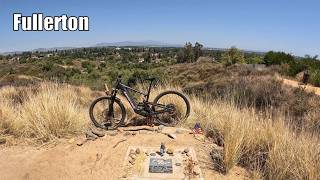
Fullerton
- 3
- 2
- 8
- 1
Popular Fullerton Mountain Biking Trails
• 100 ★ 2.0 • 5,116 ft • 200 ft • 1,190 •
Popular green difficulty mixed. This mountain bike primary trail can be used both directions and has a moderate overall physical rating with a 200 ft green climb. On average it takes 8 minutes to complete this trail.
• 95 ★ 3.0 • 3,613 ft • 118 ft • 1,155 •
Popular blue difficulty mixed. This mountain bike primary trail can be used downhill primary and has a moderate overall physical rating with a 118 ft blue climb. On average it takes 5 minutes to complete this trail.
• 95 ★ 2.4 • 3,310 ft • 45 ft • 1,128 •
Popular blue difficulty mixed. This mountain bike primary trail and has a moderate overall physical rating with a 45 ft green climb. On average it takes 5 minutes to complete this trail.
• 85 ★ 2.5 • 1 mile • 280 ft • 1,045 •
Trail Head starts from Rosecrans Ave next to Fire station #6. Trail is mixed use Hiking, Biking and .
• 90 ★ 3.4 • 2,562 ft • 23 ft • 1,020 •
Popular blue difficulty doubletrack. This mountain bike primary trail can be used downhill primary and has a moderate overall physical rating with a 23 ft green climb. On average it takes 2 minutes to complete this trail.
• 80 ★ 1.5 • 2,772 ft • 70 ft • 617 •
Popular blue difficulty mixed. This mountain bike primary trail can be used both directions and has a moderate overall physical rating with a 70 ft blue climb. On average it takes 4 minutes to complete this trail.
• 60 ★ 2.5 • 1 mile • 60 ft • 513 •
Moderately popular white difficulty family friendly gravel path. This mountain bike primary trail can be used both directions and has a easy overall physical rating with a 60 ft green climb. On average it takes 2 hours31 minutes to complete this trail.
• 40 ★ 3.4 • 5,108 ft • 13 ft • 312 •
Trail connecting Courthouse to Laguna Lake, north segment of Bastanchury to Hermosa.
Fullerton Mountain Bike Routes
11 miles • 894 ft • 12 • Loop •
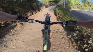
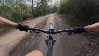
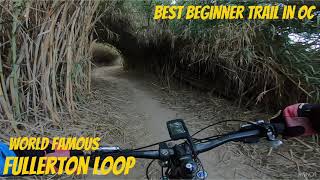
The Fullerton Loop is a great place to learn and become comfortable on your bike. It has some concrete...
Photos of Fullerton Mountain Bike
Videos of Fullerton Mountain Bike
trail: Juanita Cooke Greenbelt S
17:30 |
2 |
Jun 10, 2026 , Fullerton
16:37 |
62 |
Aug 21, 2025
1:0:40 |
48 |
Aug 21, 2025
trail: Castlewood Trail
2:08 |
130 |
Jun 29, 2025 , Fullerton

trail: Castlewood Trail
9:24 |
1030 |
Mar 3, 2019 , Fullerton
Recent Trail Reports
| status | trail | date | condition | info | user |
|---|---|---|---|---|---|
| Rosecrans Trail | May 31, 2026 @ 12:03pm (America/Los_Angeles) May 31, 2026 | Dry | smilingbear | ||
| Parks Road Trail | May 31, 2026 @ 12:03pm (America/Los_Angeles) May 31, 2026 | Dry | smilingbear | ||
| Brea Dam Trail | May 31, 2026 @ 12:03pm (America/Los_Angeles) May 31, 2026 | Dry | smilingbear | ||
| Nora Kuttner Trail | May 31, 2026 @ 12:03pm (America/Los_Angeles) May 31, 2026 | Very Dry | smilingbear | ||
| Castlewood Trail | May 31, 2026 @ 12:03pm (America/Los_Angeles) May 31, 2026 | Very Dry | smilingbear | ||
| Horse Alley | Apr 12, 2026 @ 3:22pm (America/Los_Angeles) Apr 12, 2026 | Prevalent Mud | mpodrum | ||
| Brea Dam Trail S | Aug 25, 2025 @ 8:46am Aug 25, 2025 | Dry | smilingbear | ||
| Panorama Trail | May 21, 2025 @ 12:44pm May 21, 2025 | Very Dry | DudeMotoGP | ||
| Lost Trail | May 21, 2025 @ 12:44pm May 21, 2025 | Very Dry | DudeMotoGP | ||
| West Coyote Hills Trail | Feb 9, 2025 @ 11:06am Feb 9, 2025 | Ideal | K-lane |
Activity Feed
| username | action | type | title | date |
|---|---|---|---|---|
| Louiseo | wishlist | route | activity #97562882 | Jun 22, 2026 @ 8:15am Jun 22, 2026 |
| 2oWA0I | add | photo | activity #97367499 | Jun 19, 2026 @ 10:54pm Jun 19, 2026 |
| 2oWA0I | add | photo | activity #97264474 | Jun 18, 2026 @ 11:13am Jun 18, 2026 |
| 2oWA0I | add | photo | activity #97213741 | Jun 17, 2026 @ 3:46pm Jun 17, 2026 |
| 2oWA0I | comment | trail | activity #97207036 | Jun 17, 2026 @ 1:36pm Jun 17, 2026 |
Recent Comments
| username | type | title | comment | date |
|---|---|---|---|---|
| trail | This trail is so gnarly I crashed badly on the... | Jun 17, 2026 @ 1:36pm Jun 17, 2026 | ||
| trail | Arguably the most amount of actual climbing on... | Dec 21, 2025 @ 10:04pm Dec 21, 2025 | ||
| trail | Pretty easy long stretch of single track, can... | Dec 21, 2025 @ 9:54pm Dec 21, 2025 | ||
| trail | One of the most fun segments of The Fullerton... | Dec 21, 2025 @ 9:44pm Dec 21, 2025 | ||
| trail | Fast DH. A couple of ruts at the top. 2 RR... | Apr 23, 2025 @ 5:18pm Apr 23, 2025 |
Local Badges
-

Epic Ride Climb 2k13 awarded -

Climbing 10k Badge119 awarded -

Climbing 100k Badge7 awarded -

Epic Ride Descent 2k12 awarded -

Descent 10k Badge120 awarded -

Descent 100k Badge7 awarded
Activity Type Stats
| activitytype | trails | distance | descent | descent distance | total vertical | rating | global rank | state rank | photos | reports | routes | ridelogs |
|---|---|---|---|---|---|---|---|---|---|---|---|---|
| Mountain Bike | 10 | 5 miles | 164 ft | 2 miles | 262 ft | #5,633 | #1,893 | 4 | 62 | 20,187 | ||
| E-Bike | 2 | 4 miles | 39 ft | 1 mile | 200 ft | 61 | 2,478 | |||||
| Hike | 10 | 5 miles | 164 ft | 2 miles | 262 ft | #12,202 | #4,380 | 62 | 238 | |||
| Trail Running | 10 | 5 miles | 164 ft | 2 miles | 262 ft | #11,254 | #3,897 | 62 | 385 | |||
| Nordic Ski | 1 | 3,333 ft | 49 ft | 2,060 ft | 52 ft |
Frequently Asked Questions About Fullerton
▼
What are the highest rated mountain biking trails in Fullerton?
The highest rated mountain biking trails in Fullerton are:
- Brea Dam Trail (3.8/5)
- Juanita Cooke Greenbelt N (3.8/5)
- Bud Turner Trail (3.7/5)
- Nora Kuttner Trail (3.7/5)
- Castlewood Trail (3.6/5)
▼
What is the best time of the year to ride in Fullerton?
Based on ride log data, the most popular months to ride in Fullerton are:
- May (137 activities)
- July (127 activities)
- June (120 activities)
▼
Where can I park to ride in Fullerton?
Check the Fullerton trail map for trailhead and parking information. Community members regularly update access and parking details for trails in the area.
▼
What is the longest trail in Fullerton?
The longest trail in Fullerton is Coyote Creek Bikeway at 2.7 miles. View all trails sorted by distance.
- By brenthillier
 NSMBA TRAILFORKS & contributors
 - Admins: OCMTBA
- #14570 - 5,585 views
- fullerton activity log | embed map of Fullerton mountain bike trails |
Downloading of trail gps tracks in kml & gpx formats is enabled for Fullerton.
You must login to download files.