close
-
Layers w
- Weather Layers
- Pro
- Pro
- Pro
- Pro
- Pro
- Pro
- More Layers
- Pro
- Pro
- Pro
- Pro
-
Upgrade to

3D
Trail Conditions
- Unknown
- Snow Groomed
- Snow Packed
- Snow Covered
- Snow Cover Partial
- Freeze/thaw Cycle
- Icy
- Prevalent Mud
- Wet
- Variable
- Ideal
- Dry
- Very Dry
Trail Flow (Ridden Direction)
Trailforks scans users ridelogs to determine the most popular direction each trail is ridden. A good flowing trail network will have most trails flowing in a single direction according to their intension.
The colour categories are based on what percentage of riders are riding a trail in its intended direction.
The colour categories are based on what percentage of riders are riding a trail in its intended direction.
- > 96%
- > 90%
- > 80%
- > 70%
- > 50%
- < 50%
- bi-directional trail
- no data
Trail Last Ridden
Trailforks scans ridelogs to determine the last time a trail was ridden.
- < 2 days
- < 1 week
- < 2 weeks
- < 1 month
- < 6 months
- > 6 months
Trail Ridden Direction
The intended direction a trail should be ridden.
- Downhill Only
- Downhill Primary
- Both Directions
- Uphill Primary
- Uphill Only
- One Direction
Contribute Details
Colors indicate trail is missing specified detail.
- Description
- Photos
- Description & Photos
- Videos
Trail Popularity ?
Trailforks scans ridelogs to determine which trails are ridden the most in the last 9 months.
Trails are compared with nearby trails in the same city region with a possible 25 colour shades.
Think of this as a heatmap, more rides = more kinetic energy = warmer colors.
- most popular
- popular
- less popular
- not popular
ATV/ORV/OHV Filter
Max Vehicle Width
inches
US Cell Coverage
Legend

Radar Time
Activity Recordings
Trailforks uses anonymized public activity data.
?
Activity Recordings
Trailforks uses anonymized public activity data.
?
Personal Heatmap
▶
Activity Types
all
/
none
▶
Options
2
Date range
month
–
Winter Trails
Warning
A routing network for winter maps does not exist. Selecting trails using the winter trails layer has been disabled.
Missing Trails
Most Popular
Least Popular
Trails are colored based on popularity. The more popular a trail is, the more red. Less popular trails trend towards green.
Jump Magnitude Heatmap
Heatmap of where riders jump on trails. Zoom in to see individual jumps, click circles to view jump details.
BC Backroad Status
![map legend]()
Service Road Atlas is a free to use, community-driven service for viewing and creating reports on the numerous back-country service roads around B.C. and Alberta.

Slope Aspect
Direction the slope faces
Trails Deemphasized
Trails are shown in grey.
Only show trails with no bike usage.
Suggested Layers
Based on selected activity type
Save the current map location and zoom level as your default home location whenever this page is loaded.
SaveFürther Stadtwald rund um die Alte Veste bei Zirndorf bis nach Wachendorf. Hier ist von einfachen Forstwegen bis hin zu anspruchsvollen Singletrails alles zu finden.
Primary Trail Type: Cross-Country
eBikes Allowed:
Yes
Land Status: Managed by Local Riding Association
 google parking directions
Links
This region uses the Uk/Euro style trail grading system.
Activities Click to view
- Mountain Bike
13 trails
- E-Bike
13 trails
- Horse
0 trails
- Hike
5 trails
- Trail Running
5 trails
Region Details
- 2
- 4
- 3
- 3
- 1
Region Status
Open as of Oct 18, 2025Stats
- Avg Trail Rating
- Trails (view details)
- 13
- Trails Mountain Bike
- 13
- Trails E-Bike
- 13
- Trails Hike
- 5
- Trails Trail Running
- 5
- Total Distance
- 3 miles
- Total Descent Distance
- 1 mile
- Total Descent
- 580 ft
- Total Vertical
- 187 ft
- Highest Trailhead
- 1,302 ft
- Reports
- 193
- Photos
- 49
- Ridden Counter
- 1,229
Popular Fürther Stadtwald Mountain Biking Trails
• 95 ★ 4.4 • 1,417 ft • 17 ft • 138 •
Der flowige Trail hat die Schwierigkeit "blau", bietet aber trotzdem mehrere Möglichkeiten zum springen und einen Wallride. Fahrspaß pur auf unserem Trail mit Wurzelteppichen und flowigen Sprüngen. Ideal für fortgeschrittene Fahrer...
• 80 ★ 4.4 • 1,814 ft • 13 ft • 119 •
Flowige Kurven, sanfte Wellen und nur wenige Wurzeln. Ideal für fortgeschrittene Fahrer – aber alles sicher überrollbar!
• 85 ★ 4.4 • 814 ft • 0 ft • 90 •
Er ist die schwierigere/rote Alternative zum . Anspruchsvolle Passagen mit Steinfeldern, Wurzelteppichen und Sprüngen. Schwierige Stellen lassen sich teilweise umfahren. The " " ist the second official trail maintained by...
• 90 ★ 5.0 • 751 ft • 3 ft • 83 •
Die Einfahrt teilt er sich mit dem Uschi Trail. Dann eine knackige Einfahrt mit anschließendem Drop - nach der Schlüsselstelle wird es flowiger. Freu dich auf Sprünge, Anliegerkurven und steinige Passagen – ohne...
• 70 ★ 4.3 • 1,152 ft • 6 ft • 55 •
Erlebe puren Fahrspaß auf einem naturbelassenen, kurvigen Trail mit nur wenigen Wurzeln und einer sanft abrollbaren Stufe – perfekt für Einsteiger und Genießer!
• 40 ★ 2.5 • 597 ft • 0 ft • 31 •
Moderately popular green difficulty doubletrack. This mountain bike primary trail can be used downhill primary and has a moderate overall physical rating with a 0 ft black diamond climb. Trail visibility is always easy to follow. On average it takes minutes to complete this trail.
• 60 ★ 4.0 • 1,430 ft • 14 ft • 24 •
Der Trail führt als Uphill zum Hexentanzplatz hinauf. Dort findet sich ein kleiner Drop zum üben. Ein abwechslungsreicher Trail mit spannender Mischung: Herausfordernde Uphill-Passagen, fließende Wellen und dynamische Sprünge sorgen...
Fürther Stadtwald Mountain Bike Routes
★ 5.0 • 20 miles • 1,336 ft • 3 • Loop •
DAV Ausfahrt vom Stadtwald nach Cadolzburg und zurück. Trails: Canyon und Druidenstein
Photos of Fürther Stadtwald Mountain Bike
Videos of Fürther Stadtwald Mountain Bike
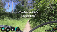
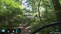
trail: Trailworks: Canyon-Trail
0:30 |
120 |
May 25, 2025
trail: Trailworks: Uschi
2:55 |
120 |
May 25, 2025
Recent Trail Reports
| status | trail | date | condition | info | user |
|---|---|---|---|---|---|
| Trailworks: Löwenbräu Trail | Oct 18, 2025 @ 12:15pm (Europe/Busingen) Oct 18, 2025 | Ideal | marcel613Gsg | ||
| Trailworks: Rock'n Duro | Oct 18, 2025 @ 12:15pm (Europe/Busingen) Oct 18, 2025 | Ideal | marcel613Gsg | ||
| Trailworks: Uschi | Oct 18, 2025 @ 12:15pm (Europe/Busingen) Oct 18, 2025 | Ideal | marcel613Gsg | ||
| Trailworks: Canyon Trail - rooty | Oct 18, 2025 @ 12:15pm (Europe/Busingen) Oct 18, 2025 | Ideal | marcel613Gsg | ||
| Wasserspeicher Uphill | Oct 18, 2025 @ 12:15pm (Europe/Busingen) Oct 18, 2025 | Ideal | marcel613Gsg | ||
| Trailworks: Canyon-Trail | Oct 18, 2025 @ 12:15pm (Europe/Busingen) Oct 18, 2025 | Ideal | marcel613Gsg | ||
| Uphill Für Uschi Und Rock'n Duro | Oct 16, 2025 @ 12:58pm (Europe/Busingen) Oct 16, 2025 | Ideal | marcel613Gsg | ||
| Trailworks: Hexenleiter | Sep 27, 2025 @ 2:08pm (Europe/Prague) Sep 27, 2025 | Variable | Yobread63 | ||
| Trailworks: Moggerla | Aug 28, 2025 @ 5:35pm Aug 28, 2025 | Ideal | Quigley8 TWF-A | ||
| Moggerla - Uphill | Aug 28, 2025 @ 5:35pm Aug 28, 2025 | Variable | Quigley8 TWF-A |
Activity Feed
| username | action | type | title | date |
|---|---|---|---|---|
| WurzelKnobi | wishlist | trail | activity #96911616 and 3 more | Jun 13, 2026 @ 1:29pm Jun 13, 2026 |
| Udo66 | wishlist | trail | activity #96282012 | Jun 5, 2026 @ 1:57am Jun 5, 2026 |
| Flix-1993 | wishlist | trail | activity #95662582 and 4 more | May 27, 2026 @ 2:48pm May 27, 2026 |
| ChrisHJBbow | wishlist | trail | activity #93807920 and 11 more | May 1, 2026 @ 1:44pm May 1, 2026 |
| Votecbike | wishlist | trail | activity #93759838 and 1 more | May 1, 2026 @ 12:25am May 1, 2026 |
Recent Comments
| username | type | title | comment | date |
|---|---|---|---|---|
| trail | Heute 6.7.25 auf Grund von Wartungsarbeiten... | Jul 6, 2025 @ 12:21am Jul 6, 2025 | ||
| trail | This Trail is closed because of the official... | Nov 17, 2024 @ 11:51pm Nov 17, 2024 | ||
| trail | Stand Ende März 2024: Der Trail wurde... | Mar 30, 2024 @ 6:18am Mar 30, 2024 | ||
| trail | Great trail. Getting to ride it fresh and... | Mar 3, 2024 @ 6:42am Mar 3, 2024 | ||
| trail | Natural trail with no built features. Just a... | Jun 11, 2023 @ 6:40am Jun 11, 2023 |
Nearby Areas
| name | distance | ||||
|---|---|---|---|---|---|
| Birkenbuehl | 9.9 km | ||||
| Schmausenbuck | 12 | 6 | 9.9 km | ||
| Meilwald | 1 | 7 | 11 km | ||
| DH Reuth | 3 | 11.1 km | |||
| Trail Paradise Woodstone | 2 | 13 | 11.7 km |
Activity Type Stats
| activitytype | trails | distance | descent | descent distance | total vertical | rating | global rank | state rank | photos | reports | routes | ridelogs |
|---|---|---|---|---|---|---|---|---|---|---|---|---|
| Mountain Bike | 13 | 3 miles | 581 ft | 1 mile | 187 ft | #3,449 | #42 | 49 | 193 | 1 | 2,718 | |
| E-Bike | 13 | 3 miles | 581 ft | 1 mile | 187 ft | #2,223 | #38 | 190 | 1 | 830 | ||
| Hike | 5 | 1 mile | 125 ft | 1,821 ft | 154 ft | #3,617 | #42 | 184 | 44 | |||
| Trail Running | 5 | 1 mile | 125 ft | 1,821 ft | 154 ft | #2,784 | #39 | 185 | 30 |
Frequently Asked Questions About Fürther Stadtwald
▼
What are the highest rated mountain biking trails in Fürther Stadtwald?
The highest rated mountain biking trails in Fürther Stadtwald are:
- Trailworks: Rock'n Duro (4.2/5)
- Trailworks: Canyon-Trail (4.2/5)
- Trailworks: Uschi (4.2/5)
- Trailworks: Canyon Trail - rooty (4.1/5)
- Trailworks: Löwenbräu Trail (4.1/5)
▼
What is the best time of the year to ride in Fürther Stadtwald?
Based on ride log data, the most popular months to ride in Fürther Stadtwald are:
- April (12 activities)
- September (8 activities)
- November (6 activities)
▼
Where can I park to ride in Fürther Stadtwald?
There are 4 parking locations listed in Fürther Stadtwald. The most popular parking spots are: View all parking and trailhead locations on the map to plan your visit.
▼
What is the longest trail in Fürther Stadtwald?
The longest trail in Fürther Stadtwald is Trailworks: Uschi at 1,814 ft. View all trails sorted by distance.
Activities
- By lightlives
 & contributors
 - Admins: TWF-A, Quigley8
- #14306 - 12,159 views
- fürther stadtwald activity log | embed map of Fürther Stadtwald mountain bike trails | fürther stadtwald mountain biking points of interest
Downloading of trail gps tracks in kml & gpx formats is enabled for Fürther Stadtwald.
You must login to download files.