close
-
Layers w
- Weather Layers
- Pro
- Pro
- Pro
- Pro
- Pro
- Pro
- More Layers
- Pro
- Pro
- Pro
- Pro
-
Upgrade to

3D
Trail Conditions
- Unknown
- Snow Groomed
- Snow Packed
- Snow Covered
- Snow Cover Partial
- Freeze/thaw Cycle
- Icy
- Prevalent Mud
- Wet
- Variable
- Ideal
- Dry
- Very Dry
Trail Flow (Ridden Direction)
Trailforks scans users ridelogs to determine the most popular direction each trail is ridden. A good flowing trail network will have most trails flowing in a single direction according to their intension.
The colour categories are based on what percentage of riders are riding a trail in its intended direction.
The colour categories are based on what percentage of riders are riding a trail in its intended direction.
- > 96%
- > 90%
- > 80%
- > 70%
- > 50%
- < 50%
- bi-directional trail
- no data
Trail Last Ridden
Trailforks scans ridelogs to determine the last time a trail was ridden.
- < 2 days
- < 1 week
- < 2 weeks
- < 1 month
- < 6 months
- > 6 months
Trail Ridden Direction
The intended direction a trail should be ridden.
- Downhill Only
- Downhill Primary
- Both Directions
- Uphill Primary
- Uphill Only
- One Direction
Contribute Details
Colors indicate trail is missing specified detail.
- Description
- Photos
- Description & Photos
- Videos
Trail Popularity ?
Trailforks scans ridelogs to determine which trails are ridden the most in the last 9 months.
Trails are compared with nearby trails in the same city region with a possible 25 colour shades.
Think of this as a heatmap, more rides = more kinetic energy = warmer colors.
- most popular
- popular
- less popular
- not popular
ATV/ORV/OHV Filter
Max Vehicle Width
inches
US Cell Coverage
Legend

Radar Time
Activity Recordings
Trailforks uses anonymized public activity data.
?
Activity Recordings
Trailforks uses anonymized public activity data.
?
Personal Heatmap
▶
Activity Types
all
/
none
▶
Options
2
Date range
month
–
Winter Trails
Warning
A routing network for winter maps does not exist. Selecting trails using the winter trails layer has been disabled.
Missing Trails
Most Popular
Least Popular
Trails are colored based on popularity. The more popular a trail is, the more red. Less popular trails trend towards green.
Jump Magnitude Heatmap
Heatmap of where riders jump on trails. Zoom in to see individual jumps, click circles to view jump details.
BC Backroad Status
![map legend]()
Service Road Atlas is a free to use, community-driven service for viewing and creating reports on the numerous back-country service roads around B.C. and Alberta.

Slope Aspect
Direction the slope faces
Trails Deemphasized
Trails are shown in grey.
Only show trails with no bike usage.
Suggested Layers
Based on selected activity type
Save the current map location and zoom level as your default home location whenever this page is loaded.
SaveCome and experience southern Ontario's largest forest. Located within an hour's drive of Toronto, straddling the Counties of Northumberland, Peterborough, Victoria and the Region of Durham, the Ganaraska Forest offers the best in outdoor recreation.
Today the forest is a living example of how the principles of integrated resource management can be used to balance many different uses of forested lands on a sustainable and ecologically sound basis. The forest is home to the Ganaraska Forest Outdoor Education Centre, which includes a public washroom and shower facilities.
With hundreds of kilometres of trails, the Ganaraska Forest provides year-round opportunities for a variety of activities. Hiking, mountain biking, horseback riding, cross-country skiing, snowshoeing and nature appreciation are popular activities throughout the Forest. Motorized activities such as off-road motorcycle riding, ATVing and snowmobiling are permitted in the West Forest and East Forest only. The Central section of the Forest is maintained as a passive use area, and is where Treetop Trekking is located. The forest is used for many special events and is a popular filming location. Please see Ganaraska Forest Centre site for more information or contact the GRCA. *NEW* for 2020: Photographers are required to complete a Ganaraska Forest Special Event Application Form.
Day passes or Ganaraska Forest Memberships are required to use the forest. Passes and memberships can be purchased online. Please call the GRCA between 8:30 am - 4:00 pm weekdays with any questions - 905.885.8173.
source: https://www.grca.on.ca/forest/
Primary Trail Type: Cross-Country
Land Status: Community Forest
Land Manager: Ganaraska Region Conservation Authority
 google parking directions
 Disclaimer:
All singletrack in the central forest is currently closed.
Links
Activities Click to view
- Mountain Bike
77 trails
- Horse
33 trails
- Hike
77 trails
- Trail Running
77 trails
- Snowshoe
38 trails
- Nordic Ski
13 trails
Region Details
- 27
- 5
- 42
- 2
Region Status
Caution as of Jun 6, 2026Stats
- Avg Trail Rating
- Trails (view details)
- 76
- Trails Mountain Bike
- 77
- Trails Horse
- 33
- Trails Hike
- 77
- Trails Trail Running
- 77
- Trails Dirtbike/Moto
- 2
- Trails ATV/ORV/OHV
- 1
- Trails Snowmobile
- 1
- Trails Snowshoe
- 38
- Trails Backcountry Ski
- 1
- Trails Nordic Ski
- 13
- Total Distance
- 57 miles
- Total Descent
- 4,904 ft
- Total Vertical
- 434 ft
- Highest Trailhead
- 1,134 ft
- Reports
- 591
- Photos
- 100
- Ridden Counter
- 4,962
Popular Ganaraska Forest - Central Forest Trails
Itchy Pitchy Permanently Closed
• 100 ★ 4.4 • 2,365 ft • 138 ft • 213 •
is the climbing for all the goods!
• 95 ★ 2.4 • 2,976 ft • 9 ft • 208 •
Popular blue difficulty singletrack. This mountain bike primary trail can be used both directions. Winter use: Backcountry snow grooming. On average it takes 6 minutes to complete this trail.
• 5 ★ 3.0 • 696 ft • 0 ft • 149 •
Less popular blue difficulty singletrack. This mountain bike primary trail can be used both directions. Winter use: Backcountry snow grooming. On average it takes 5 minutes to complete this trail.
MolehMoleh Permanently Closed
• 100 ★ 5.0 • 1,798 ft • 0 ft • 142 •
is a recommended downhill trail. Flow this well and there's no need to pedal.
• 5 ★ 4.0 • 3 miles • 190 ft • 119 •
Less popular blue difficulty singletrack. This multi-use trail can be used both directions and has a moderate overall physical rating with a 190 ft blue climb. Winter use: Backcountry snow grooming. Trail visibility is always easy to follow. On average it takes 25 minutes to complete this trail.
• 95 ★ 1.3 • 2 miles • 108 ft • 82 •
The trail passes through the middle on stone two .
Len's Loop Permanently Closed
• 5 ★ 5.0 • 2,267 ft • 41 ft • 48 •
Less popular blue difficulty closed singletrack. This mountain bike primary trail can be used downhill primary. Winter use: Backcountry snow grooming. On average it takes 3 minutes to complete this trail.
Mountain Bike Routes
26 miles • 1,269 ft • 4 • Loop •
This loop is on multi use trails and is a blend of single track, double track and fire road. Trailhead is on .
★ 1.0 • 16 miles • 1,005 ft • 0 •
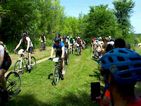
Photos of Ganaraska Forest - Central Forest Mountain Bike
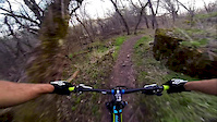
Videos of Ganaraska Forest - Central Forest Mountain Bike
trail: Creekie
0:00 |
65 |
Nov 8, 2021
trail: B+
0:09 |
103 |
May 3, 2019
trail: B+
0:11 |
30 |
May 3, 2019
trail: The Chute
5:09 |
411 |
Aug 29, 2015
trail: Solstice
2:04 |
159 |
Jul 28, 2015

trail: B+
0:34 |
245 |
May 18, 2015
trail: Chaga
3:24 |
248 |
May 2, 2015
trail: Solstice
0:23 |
50 |
Dec 30, 2014
Recent Trail Reports
| status | trail | date | condition | info | user |
|---|---|---|---|---|---|
| Orange Trail | Mar 1, 2026 @ 12:22pm (America/Toronto) Mar 1, 2026 | Snow Groomed | mclejohn0766 | ||
| Orange Trail | Mar 1, 2026 @ 12:22pm (America/Toronto) Mar 1, 2026 | Snow Groomed | mclejohn0766 | ||
| B-Loop | Mar 1, 2026 @ 12:22pm (America/Toronto) Mar 1, 2026 | Snow Groomed | mclejohn0766 | ||
| Orange Trail | Feb 15, 2026 @ 9:02am (America/Toronto) Feb 15, 2026 | Snow Groomed | mclejohn0766 | ||
| A-Loop | Feb 1, 2026 @ 3:43pm (America/Toronto) Feb 1, 2026 | Snow Groomed | mclejohn0766 | ||
| B-Loop | Jan 31, 2026 @ 1:36pm (America/Toronto) Jan 31, 2026 | Snow Groomed | mclejohn0766 | ||
| A-Loop | Jan 26, 2026 @ 11:24am (America/Toronto) Jan 26, 2026 | Snow Covered | mclejohn0766 | ||
| Green Trail | Jan 11, 2026 @ 9:45am (America/Toronto) Jan 11, 2026 | Snow Groomed | mclejohn0766 | ||
| B+ | Oct 11, 2025 @ 6:34pm (America/Toronto) Oct 11, 2025 | Unknown | Honory5EZhO | ||
| Foundations Trail | Oct 5, 2025 @ 10:18am (America/Toronto) Oct 5, 2025 | Dry | billyzeee |
Activity Feed
| username | action | type | title | date |
|---|---|---|---|---|
| Lallu619 | wishlist | route | activity #94224461 | May 7, 2026 @ 9:59am May 7, 2026 |
| rob1904 | wishlist | trail | activity #92515092 | Apr 12, 2026 @ 5:42pm Apr 12, 2026 |
| trailforks | add | video | activity #89287529 and 9 more | Feb 21, 2026 @ 9:00am Feb 21, 2026 |
| Honory5EZhO | add | report | activity #82168666 | Oct 11, 2025 @ 3:34pm Oct 11, 2025 |
| billyzeee | add | report | activity #81906116 and 3 more | Oct 7, 2025 @ 3:03pm Oct 7, 2025 |
Recent Comments
| username | type | title | comment | date |
|---|---|---|---|---|
| trail | Trails closed | Nov 5, 2023 @ 10:39am Nov 5, 2023 | ||
| report | Let's hope not but GRCA has not been very open... | Aug 20, 2023 @ 9:44am Aug 20, 2023 | ||
| report | permenantly? | Aug 19, 2023 @ 8:19pm Aug 19, 2023 | ||
| trail | Toutes les singles track sont fermé | Jun 24, 2023 @ 4:39am Jun 24, 2023 | ||
| trail | FERMÉ..CLOSE | Jun 24, 2023 @ 4:39am Jun 24, 2023 |
Nearby Areas
| name | distance | ||||
|---|---|---|---|---|---|
| Ganaraska Forest - West Forest | 25 | 18 | 10 | 2.6 km | |
| Ganaraska Forest - East Forest | 1 | 2 | 3.9 km | ||
| Millbrook Valley Trails | 5 | 10 | 2 | 4.6 km | |
| Fleetwood Creek Forest | 6 | 6 km | |||
| Ballyduff Trails | 16 | 6.8 km |
Local Badges
-

Completionist0 awarded
Activity Type Stats
| activitytype | trails | distance | descent | descent distance | total vertical | rating | global rank | state rank | photos | reports | routes | ridelogs |
|---|---|---|---|---|---|---|---|---|---|---|---|---|
| Mountain Bike | 77 | 57 miles | 4,905 ft | 23 miles | 433 ft | #2,788 | #54 | 100 | 551 | 2 | 1,584 | |
| Horse | 33 | 24 miles | 1,755 ft | 9 miles | 315 ft | #701 | #13 | 225 | 16 | |||
| Hike | 77 | 57 miles | 4,905 ft | 23 miles | 433 ft | #3,537 | #62 | 531 | 55 | |||
| Trail Running | 77 | 57 miles | 4,905 ft | 23 miles | 433 ft | #2,775 | #21 | 531 | 12 | |||
| Dirtbike/Moto | 2 | 131 ft | #6 | 215 | 43 | |||||||
| ATV/ORV/OHV | 1 | #7 | 215 | 9 | ||||||||
| Snowmobile | 1 | 2 miles | 79 ft | 3,602 ft | 197 ft | #9 | 188 | 2 | ||||
| Snowshoe | 38 | 20 miles | 1,955 ft | 8 miles | 315 ft | #407 | #32 | 197 | 12 | |||
| Backcountry Ski | 1 | 2,333 ft | 128 ft | 1,667 ft | 105 ft | 42 | ||||||
| Nordic Ski | 13 | 14 miles | 1,112 ft | 6 miles | 272 ft | #513 | #29 | 188 | 81 |
Frequently Asked Questions About Ganaraska Forest - Central Forest
▼
What are the highest rated mountain biking trails in Ganaraska Forest - Central Forest?
The highest rated mountain biking trails in Ganaraska Forest - Central Forest are:
- Creekie (4.4/5)
- Ditchpan Alley (4/5)
- B+ (4/5)
- Newton's Theory (3.8/5)
- 10th Line Bypass (3.6/5)
▼
What is the best time of the year to ride in Ganaraska Forest - Central Forest?
Based on ride log data, the most popular months to ride in Ganaraska Forest - Central Forest are:
- May (71 activities)
- August (67 activities)
- September (56 activities)
▼
Where can I park to ride in Ganaraska Forest - Central Forest?
There are 1 parking locations listed in Ganaraska Forest - Central Forest. The most popular parking spots are:
▼
What is the longest trail in Ganaraska Forest - Central Forest?
The longest trail in Ganaraska Forest - Central Forest is B+ at 2.6 miles. View all trails sorted by distance.
Activities
- Ganaraska Forest - Central Forest Mountain Biking Trails
- Ganaraska Forest - Central Forest Horseback Trails
- Ganaraska Forest - Central Forest Hiking Trails
- Ganaraska Forest - Central Forest Trail Running Trails
- Ganaraska Forest - Central Forest Snowshoeing Trails
- Ganaraska Forest - Central Forest Nordic Skiing Trails
Trails
- Hard trails in Ganaraska Forest - Central Forest
- Easy trails in Ganaraska Forest - Central Forest
- Favorite trails in Ganaraska Forest - Central Forest
- Most ridden trails in Ganaraska Forest - Central Forest
- Singletrack in Ganaraska Forest - Central Forest
- Viewpoint trails in Ganaraska Forest - Central Forest
- Trails with technical features in Ganaraska Forest - Central Forest
- By brenthillier
 NSMBA TRAILFORKS & contributors
 - Admins: PTA, GRCA, dagostdm
- #3392 - 31,742 views
- ganaraska forest - central forest activity log | embed map of Ganaraska Forest - Central Forest mountain bike trails | ganaraska forest - central forest mountain biking points of interest polygons
Downloading of trail gps tracks in kml & gpx formats is enabled for Ganaraska Forest - Central Forest.
You must login to download files.