close
-
Layers w
- Weather Layers
- Pro
- Pro
- Pro
- Pro
- Pro
- Pro
- More Layers
- Pro
- Pro
- Pro
- Pro
-
Upgrade to

3D
Trail Conditions
- Unknown
- Snow Groomed
- Snow Packed
- Snow Covered
- Snow Cover Partial
- Freeze/thaw Cycle
- Icy
- Prevalent Mud
- Wet
- Variable
- Ideal
- Dry
- Very Dry
Trail Flow (Ridden Direction)
Trailforks scans users ridelogs to determine the most popular direction each trail is ridden. A good flowing trail network will have most trails flowing in a single direction according to their intension.
The colour categories are based on what percentage of riders are riding a trail in its intended direction.
The colour categories are based on what percentage of riders are riding a trail in its intended direction.
- > 96%
- > 90%
- > 80%
- > 70%
- > 50%
- < 50%
- bi-directional trail
- no data
Trail Last Ridden
Trailforks scans ridelogs to determine the last time a trail was ridden.
- < 2 days
- < 1 week
- < 2 weeks
- < 1 month
- < 6 months
- > 6 months
Trail Ridden Direction
The intended direction a trail should be ridden.
- Downhill Only
- Downhill Primary
- Both Directions
- Uphill Primary
- Uphill Only
- One Direction
Contribute Details
Colors indicate trail is missing specified detail.
- Description
- Photos
- Description & Photos
- Videos
Trail Popularity ?
Trailforks scans ridelogs to determine which trails are ridden the most in the last 9 months.
Trails are compared with nearby trails in the same city region with a possible 25 colour shades.
Think of this as a heatmap, more rides = more kinetic energy = warmer colors.
- most popular
- popular
- less popular
- not popular
ATV/ORV/OHV Filter
Max Vehicle Width
inches
US Cell Coverage
Legend

Radar Time
Activity Recordings
Trailforks uses anonymized public activity data.
?
Activity Recordings
Trailforks uses anonymized public activity data.
?
Personal Heatmap
▶
Activity Types
all
/
none
▶
Options
2
Date range
month
–
Winter Trails
Warning
A routing network for winter maps does not exist. Selecting trails using the winter trails layer has been disabled.
Missing Trails
Most Popular
Least Popular
Trails are colored based on popularity. The more popular a trail is, the more red. Less popular trails trend towards green.
Jump Magnitude Heatmap
Heatmap of where riders jump on trails. Zoom in to see individual jumps, click circles to view jump details.
BC Backroad Status
![map legend]()
Service Road Atlas is a free to use, community-driven service for viewing and creating reports on the numerous back-country service roads around B.C. and Alberta.

Slope Aspect
Direction the slope faces
Trails Deemphasized
Trails are shown in grey.
Only show trails with no bike usage.
Suggested Layers
Based on selected activity type
Save the current map location and zoom level as your default home location whenever this page is loaded.
Save
No description for Garda has been added yet!
Login or register to submit one.
This region uses the Uk/Euro style trail grading system.
Activities Click to view
- Mountain Bike
3 trails
Region Details
- 1
Region Status
Caution as of Mar 29, 2026Stats
- Avg Trail Rating
- Global Ranking
- #4,427
- State Ranking
- #289
- Trails (view details)
- 3
- Trails Mountain Bike
- 3
- Trails E-Bike
- 3
- Trails Hike
- 2
- Trails Trail Running
- 1
- Total Distance
- 3 miles
- Total Descent Distance
- 2 miles
- Total Descent
- 1,487 ft
- Total Vertical
- 874 ft
- Highest Trailhead
- 1,338 ft
- Reports
- 54
- Photos
- 13
- Ridden Counter
- 219
Popular Garda Mountain Biking Trails
• 100 ★ 4.5 • 2 miles • 34 ft • 168 •
Discesa inserita come PS4 nella Special Enduro del Benaco del 2013.
• 70 ★ 4.5 • 4,137 ft • 55 ft • 124 •
La Rocca single track /path with stones and roots down to Garda
• 35 ★ 5.0 • 860 ft • 0 ft • 26 •
Less popular black difficulty singletrack. This mountain bike primary trail can be used both directions. On average it takes 3 minutes to complete this trail.
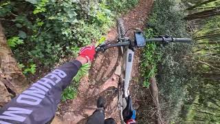
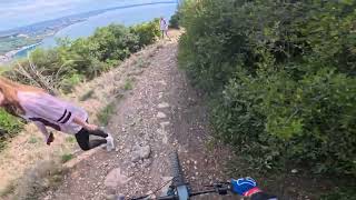
Garda Mountain Bike Routes
Videos of Garda Mountain Bike
trail: Eremo Rocca Trail
6:07 |
58 |
Apr 2, 2026 , Garda
trail: Graffiti
10:22 |
82 |
Apr 2, 2026 , Garda

trail: Graffiti Canyon
10:22 |
50 |
Apr 2, 2026 , Garda
Recent Trail Reports
| status | trail | date | condition | info | user |
|---|---|---|---|---|---|
| Graffiti Canyon | Mar 29, 2026 @ 2:35pm (Europe/Vaduz) Mar 29, 2026 | Ideal | Garru | ||
| Graffiti | Mar 29, 2026 @ 2:35pm (Europe/Vaduz) Mar 29, 2026 | Dry | Garru | ||
| Eremo Rocca Trail | Mar 29, 2026 @ 2:35pm (Europe/Vaduz) Mar 29, 2026 | Dry | Garru |
Activity Feed
| username | action | type | title | date |
|---|---|---|---|---|
| Ilike | wishlist | trail | activity #94428712 | May 10, 2026 @ 8:16am May 10, 2026 |
| magadafagada | wishlist | trail | activity #93086822 | Apr 21, 2026 @ 9:36am Apr 21, 2026 |
| Garru | add | video | activity #91748894 and 2 more | Apr 2, 2026 @ 1:33am Apr 2, 2026 |
| Garru | add | report | activity #91538671 and 2 more | Mar 29, 2026 @ 11:56am Mar 29, 2026 |
| Liuk66 | vote | trail | activity #86792308 | Jan 7, 2026 @ 5:36am Jan 7, 2026 |
Recent Comments
| username | type | title | comment | date |
|---|---|---|---|---|
| trail | Molto impegnativo con gradoni da paura, solo... | Jan 12, 2025 @ 8:27am Jan 12, 2025 | ||
| trail | Upper part of the trail mostly "blue"... | Oct 4, 2023 @ 8:50am Oct 4, 2023 | ||
| trail | Great Trail :) | May 22, 2022 @ 9:02am May 22, 2022 | ||
| trail | super trail! | Jun 6, 2020 @ 10:48am Jun 6, 2020 | ||
| trail | Trocken aber teilweise sehr eingewachsen. Man... | Jun 5, 2019 @ 6:28am Jun 5, 2019 |
Activity Type Stats
| activitytype | trails | distance | descent | descent distance | total vertical | rating | global rank | state rank | photos | reports | routes | ridelogs |
|---|---|---|---|---|---|---|---|---|---|---|---|---|
| Mountain Bike | 3 | 3 miles | 1,486 ft | 2 miles | 876 ft | #4,427 | #289 | 13 | 54 | 1 | 1,209 | |
| E-Bike | 3 | 3 miles | 1,486 ft | 2 miles | 876 ft | 45 | 1 | 136 | ||||
| Hike | 2 | 3 miles | 1,240 ft | 2 miles | 876 ft | 53 | 37 | |||||
| Trail Running | 1 | 2 miles | 906 ft | 2 miles | 876 ft | 50 | 14 |
- By Accovarius & contributors
- Admins: micheletraversi
- #40223 - 7,511 views
- garda activity log | embed map of Garda mountain bike trails |
Downloading of trail gps tracks in kml & gpx formats is enabled for Garda.
You must login to download files.