close
-
Layers w
- Weather Layers
- Pro
- Pro
- Pro
- Pro
- Pro
- Pro
- More Layers
- Pro
- Pro
- Pro
- Pro
-
Upgrade to

3D
Trail Conditions
- Unknown
- Snow Groomed
- Snow Packed
- Snow Covered
- Snow Cover Partial
- Freeze/thaw Cycle
- Icy
- Prevalent Mud
- Wet
- Variable
- Ideal
- Dry
- Very Dry
Trail Flow (Ridden Direction)
Trailforks scans users ridelogs to determine the most popular direction each trail is ridden. A good flowing trail network will have most trails flowing in a single direction according to their intension.
The colour categories are based on what percentage of riders are riding a trail in its intended direction.
The colour categories are based on what percentage of riders are riding a trail in its intended direction.
- > 96%
- > 90%
- > 80%
- > 70%
- > 50%
- < 50%
- bi-directional trail
- no data
Trail Last Ridden
Trailforks scans ridelogs to determine the last time a trail was ridden.
- < 2 days
- < 1 week
- < 2 weeks
- < 1 month
- < 6 months
- > 6 months
Trail Ridden Direction
The intended direction a trail should be ridden.
- Downhill Only
- Downhill Primary
- Both Directions
- Uphill Primary
- Uphill Only
- One Direction
Contribute Details
Colors indicate trail is missing specified detail.
- Description
- Photos
- Description & Photos
- Videos
Trail Popularity ?
Trailforks scans ridelogs to determine which trails are ridden the most in the last 9 months.
Trails are compared with nearby trails in the same city region with a possible 25 colour shades.
Think of this as a heatmap, more rides = more kinetic energy = warmer colors.
- most popular
- popular
- less popular
- not popular
ATV/ORV/OHV Filter
Max Vehicle Width
inches
US Cell Coverage
Legend

Radar Time
Activity Recordings
Trailforks uses anonymized public activity data.
?
Activity Recordings
Trailforks uses anonymized public activity data.
?
Personal Heatmap
▶
Activity Types
all
/
none
▶
Options
2
Date range
month
–
Winter Trails
Warning
A routing network for winter maps does not exist. Selecting trails using the winter trails layer has been disabled.
Missing Trails
Most Popular
Least Popular
Trails are colored based on popularity. The more popular a trail is, the more red. Less popular trails trend towards green.
Jump Magnitude Heatmap
Heatmap of where riders jump on trails. Zoom in to see individual jumps, click circles to view jump details.
BC Backroad Status
![map legend]()
Service Road Atlas is a free to use, community-driven service for viewing and creating reports on the numerous back-country service roads around B.C. and Alberta.

Slope Aspect
Direction the slope faces
Trails Deemphasized
Trails are shown in grey.
Only show trails with no bike usage.
Suggested Layers
Based on selected activity type
Save the current map location and zoom level as your default home location whenever this page is loaded.
Save
No description for Gaspé has been added yet!
Login or register to submit one.
Activities Click to view
- Mountain Bike
54 trails
- E-Bike
47 trails
- Gravel Bike
9 trails
- Adaptive Bike
11 trails
- Winter Fat Bike
13 trails
- Hike
46 trails
- Trail Running
46 trails
- Snowshoe
2 trails
- Downhill Ski
0 trails
- Nordic Ski
1 trails
Region Details
- 3
- 23
- 12
- 10
- 5
Region Status
Open as of Jun 10, 2026Local Trail Association
Stats
- Avg Trail Rating
- Trails (view details)
- 63
- Trails Mountain Bike
- 54
- Trails E-Bike
- 47
- Trails Gravel Bike
- 9
- Trails Adaptive Bike
- 11
- Trails Winter Fat Bike
- 13
- Trails Horse
- 1
- Trails Hike
- 46
- Trails Trail Running
- 46
- Trails Snowshoe
- 2
- Trails Nordic Ski
- 1
- Total Distance
- 243 miles
- Total Descent Distance
- 100 miles
- Total Descent
- 27,810 ft
- Total Vertical
- 1,869 ft
- Highest Trailhead
- 1,872 ft
- Reports
- 325
- Photos
- 161
- Ridden Counter
- 4,793
Sub Regions
-
Mont-Béchervaise
- 12
- 4
- 4
- 5
-
Parc National Forillon
- 2
- 1
-
Pudding Stone
- 4
- 6
- 5
Popular Gaspé Mountain Biking Trails
• 100 ★ 4.0 • 394 ft • 0 ft • 317 •
Cette piste vous mène directement en haut du parc d'habileté.This track takes you directly to the top of the skill park
• 95 ★ 2.0 • 2,090 ft • 0 ft • 258 •
Sentier avec du Flow pour la partie descendante. Donne accès à aux sentiers: et
• 85 ★ 5.0 • 4,833 ft • 0 ft • 206 •
Voici notre Super trail conçue par Vélosolution Canada. Flow trail, Ligne de 45 sauts. Certains de plus de 28 pieds de long. Certains sont doubles mais il est tout de même possible de les rouler. 2 Seuils d'environ 6 à 7 pieds de...
• 90 ★ 4.0 • 1,260 ft • 0 ft • 199 •
was one of the first hand-built trails built by Velocipeg cycling club. means "the pick". After digging out a trail with hand tool we were all a little injured and convinced of the need for machine built trails! is a beautiful...
• 95 ★ 4.0 • 1,752 ft • 132 ft • 198 •
Ce sentier est utilisé dans les deux sens. Une belle option pour le départ de la . Il rejoint le sentier de monté principal un peu plus loin. This was one of our first machine built trails. It is nice a large and flowy...and so fast...
• 90 ★ 4.3 • 1 mile • 6 ft • 182 •
La est un beau sentier sinueux construit d'un enchaînement de Berms et petits sauts irréguliers sur 1.4 km. Sur son tracé, vous y trouverez quelques rochers installés ici et là. Les chicken pass sont toujours au rendez-vous avec...
• 90 ★ 4.5 • 2 miles • 873 ft • 154 •
Sentier de descente facile . Possibilité de sortir après 700m pour remonter ou se rediriger dans un autre sentier ( Expert), ou rejoindre la (intermédiaire) ou pour aller rejoindre (Difficile)
• 80 ★ 4.7 • 1,512 ft • 79 ft • 153 •
avec 250 mètres de gain sur plus de 3 km. Nécessite un minimum de condition physique mais surtout un vélo approprié Les enfants de 9 ans et plus ont la capacité physique pour r.
Gaspé Mountain Bike Routes
42 miles • 4,210 ft • 1 • Point to Point •
Superbe route de Gaspé (Haldimand la plage) jusqu'à Percé. La première partie jusqu'à coin du banc...
9 miles • 2,077 ft • 0 •
Mixe of dirth road, single track with parts very narrow. Magical forest and hobbit houses. Mixe de route...
6 miles • 358 ft • 0 •
Sentiers de fatbike entretenus sur terrains privés. Il y a des motoneiges que passent dans certaines...
29 miles • 2,131 ft • 2 • Loop •
Superbe route tout autour de Gaspé près du centre-ville qui emprunte plusieurs trails. Mélange de...
• 13 miles • 2,514 ft • 18 •
• 5 miles • 962 ft • 5 •
Photos of Gaspé Mountain Bike
Videos of Gaspé Mountain Bike
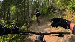
trail: Gaspé à Béchervaise
2:40 |
111 |
Oct 8, 2019
6:44 |
53 |
Sep 25, 2024
trail: Le portage
2:55 |
81 |
Sep 25, 2024 , Gaspé

4:38 |
92 |
Sep 22, 2024 , Gaspé

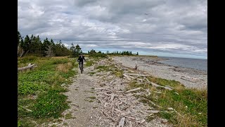
trail: Les Lacs
13:59 |
152 |
Apr 1, 2024 , Gaspé
youtuber
![Really Strange Trail = Crash? | R. Rides...]()
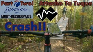
trail: Attache ta tuque
10:03 |
723 |
Apr 7, 2022 , Gaspé

trail: Le Mur
12:01 |
284 |
Apr 7, 2022 , Gaspé
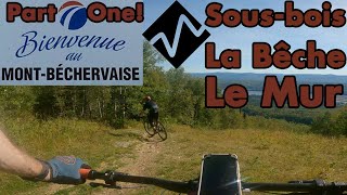
trail: La Bêche
12:01 |
371 |
Apr 7, 2022 , Gaspé
Current Trail Warnings
| status | trail | date | condition | user | info |
|---|---|---|---|---|---|
| Haut Lumbersexual | May 25, 2026 @ 9:00am (America/Toronto) May 25, 2026 | Unknown | simondub |
Recent Trail Reports
| status | trail | date | condition | info | user |
|---|---|---|---|---|---|
| zen | Jun 10, 2026 @ 8:56pm (America/Toronto) Jun 10, 2026 | Ideal | simondub | ||
| Tartocedres | Jun 10, 2026 @ 8:56pm (America/Toronto) Jun 10, 2026 | Ideal | simondub | ||
| Sous-bois | Jun 10, 2026 @ 8:56pm (America/Toronto) Jun 10, 2026 | Ideal | simondub | ||
| Sirop d'érable | Jun 10, 2026 @ 8:56pm (America/Toronto) Jun 10, 2026 | Ideal | simondub | ||
| Montée ouest | Jun 10, 2026 @ 8:56pm (America/Toronto) Jun 10, 2026 | Ideal | simondub | ||
| Le Mur | Jun 10, 2026 @ 8:56pm (America/Toronto) Jun 10, 2026 | Ideal | simondub | ||
| Le Haut Métropolitain | Jun 10, 2026 @ 8:56pm (America/Toronto) Jun 10, 2026 | Ideal | simondub | ||
| La Vieille Trail | Jun 10, 2026 @ 8:56pm (America/Toronto) Jun 10, 2026 | Ideal | simondub | ||
| La traverse | Jun 10, 2026 @ 8:56pm (America/Toronto) Jun 10, 2026 | Ideal | simondub | ||
| La Pioche | Jun 10, 2026 @ 8:56pm (America/Toronto) Jun 10, 2026 | Ideal | simondub |
Activity Feed
| username | action | type | title | date |
|---|---|---|---|---|
| simondub | update | trail | activity #96708295 | Jun 10, 2026 @ 6:00pm Jun 10, 2026 |
| simondub | add | report | activity #96708094 and 16 more | Jun 10, 2026 @ 5:56pm Jun 10, 2026 |
| simondub | add | report | activity #96662846 and 3 more | Jun 10, 2026 @ 4:06am Jun 10, 2026 |
| simondub | checkin | trail | activity #96538039 | Jun 8, 2026 @ 7:25am Jun 8, 2026 |
| simondub | ridden | trail | activity #96538038 | Jun 8, 2026 @ 7:25am Jun 8, 2026 |
Recent Comments
| username | type | title | comment | date |
|---|---|---|---|---|
| report | oo | May 25, 2026 @ 5:52am May 25, 2026 | ||
| report | Open | May 25, 2026 @ 4:19am May 25, 2026 | ||
| trail | Vraiment cool! Pour ceux qui préfèrent les... | Sep 11, 2025 @ 5:34am Sep 11, 2025 | ||
| trail | May 22, 2025....still too much snow up at top... | May 23, 2025 @ 4:21pm May 23, 2025 | ||
| report | This is just a short part. it open up very... | Sep 7, 2024 @ 2:25pm Sep 7, 2024 |
Local Badges
-

10 Green Trails67 awarded -

10 Blue Trails13 awarded -

10 Black Trails14 awarded -

Epic Ride Climb 2k11 awarded -

Climbing 10k Badge10 awarded -

Climbing 100k Badge0 awarded
Activity Type Stats
| activitytype | trails | distance | descent | descent distance | total vertical | rating | global rank | state rank | photos | reports | routes | ridelogs |
|---|---|---|---|---|---|---|---|---|---|---|---|---|
| Mountain Bike | 54 | 200 miles | 22,776 ft | 82 miles | 1,870 ft | #1,141 | #14 | 155 | 325 | 4 | 1,964 | |
| E-Bike | 47 | 176 miles | 21,699 ft | 74 miles | 1,860 ft | #933 | #10 | 2 | 318 | 2 | 221 | |
| Gravel Bike | 9 | 50 miles | 4,879 ft | 16 miles | 1,870 ft | #296 | #55 | 18 | 7 | |||
| Adaptive Bike | 11 | 60 miles | 5,696 ft | 24 miles | 1,850 ft | #249 | #71 | 31 | ||||
| Winter Fat Bike | 13 | 64 miles | 6,919 ft | 31 miles | 1,634 ft | #190 | #63 | 57 | 5 | |||
| Horse | 1 | 11 miles | 1,883 ft | 5 miles | 1,476 ft | 17 | ||||||
| Hike | 46 | 228 miles | 23,517 ft | 92 miles | 1,870 ft | #1,026 | #5 | 4 | 301 | 1 | 428 | |
| Trail Running | 46 | 204 miles | 21,693 ft | 84 miles | 1,870 ft | #884 | #4 | 301 | 1 | 195 | ||
| Snowshoe | 2 | 2 miles | 430 ft | 1 mile | 318 ft | #1,174 | #49 | 18 | 18 | |||
| Nordic Ski | 1 | 3 miles | 167 ft | 1 mile | 161 ft | #1,157 | #67 | 136 |
Frequently Asked Questions About Gaspé
▼
What are the best places to ride in Gaspé?
Gaspé has 4 areas to explore for mountain biking. The top rated areas are:
▼
What are the highest rated mountain biking trails in Gaspé?
The highest rated mountain biking trails in Gaspé are:
- 600 Volts (B) (4.6/5)
- Montée ouest (4.4/5)
- Enweillenbas (4.2/5)
- Cobra (4.1/5)
- Les Lacs (4.1/5)
▼
What is the best time of the year to ride in Gaspé?
Based on ride log data, the most popular months to ride in Gaspé are:
- July (82 activities)
- August (82 activities)
- June (53 activities)
▼
Where can I park to ride in Gaspé?
There are 10 parking locations listed in Gaspé. The most popular parking spots are: View all parking and trailhead locations on the map to plan your visit.
Activities
Trails
- By StephaneMarceau
 TRAILFORKS & contributors
 - Admins: VQ, bigjay, StephaneMarceau, Canadmos, SBM
- #9319 - 16,053 views
- gaspé activity log | embed map of Gaspé mountain bike trails | gaspé mountain biking points of interest
Downloading of trail gps tracks in kml & gpx formats is enabled for Gaspé.
You must login to download files.