close
-
Layers w
- Weather Layers
- Pro
- Pro
- Pro
- Pro
- Pro
- Pro
- More Layers
- Pro
- Pro
- Pro
- Pro
-
Upgrade to

3D
Trail Conditions
- Unknown
- Snow Groomed
- Snow Packed
- Snow Covered
- Snow Cover Partial
- Freeze/thaw Cycle
- Icy
- Prevalent Mud
- Wet
- Variable
- Ideal
- Dry
- Very Dry
Trail Flow (Ridden Direction)
Trailforks scans users ridelogs to determine the most popular direction each trail is ridden. A good flowing trail network will have most trails flowing in a single direction according to their intension.
The colour categories are based on what percentage of riders are riding a trail in its intended direction.
The colour categories are based on what percentage of riders are riding a trail in its intended direction.
- > 96%
- > 90%
- > 80%
- > 70%
- > 50%
- < 50%
- bi-directional trail
- no data
Trail Last Ridden
Trailforks scans ridelogs to determine the last time a trail was ridden.
- < 2 days
- < 1 week
- < 2 weeks
- < 1 month
- < 6 months
- > 6 months
Trail Ridden Direction
The intended direction a trail should be ridden.
- Downhill Only
- Downhill Primary
- Both Directions
- Uphill Primary
- Uphill Only
- One Direction
Contribute Details
Colors indicate trail is missing specified detail.
- Description
- Photos
- Description & Photos
- Videos
Trail Popularity ?
Trailforks scans ridelogs to determine which trails are ridden the most in the last 9 months.
Trails are compared with nearby trails in the same city region with a possible 25 colour shades.
Think of this as a heatmap, more rides = more kinetic energy = warmer colors.
- most popular
- popular
- less popular
- not popular
ATV/ORV/OHV Filter
Max Vehicle Width
inches
US Cell Coverage
Legend

Radar Time
Activity Recordings
Trailforks uses anonymized public activity data.
?
Activity Recordings
Trailforks uses anonymized public activity data.
?
Personal Heatmap
▶
Activity Types
all
/
none
▶
Options
2
Date range
month
–
Winter Trails
Warning
A routing network for winter maps does not exist. Selecting trails using the winter trails layer has been disabled.
Missing Trails
Most Popular
Least Popular
Trails are colored based on popularity. The more popular a trail is, the more red. Less popular trails trend towards green.
Jump Magnitude Heatmap
Heatmap of where riders jump on trails. Zoom in to see individual jumps, click circles to view jump details.
BC Backroad Status
![map legend]()
Service Road Atlas is a free to use, community-driven service for viewing and creating reports on the numerous back-country service roads around B.C. and Alberta.

Slope Aspect
Direction the slope faces
Trails Deemphasized
Trails are shown in grey.
Only show trails with no bike usage.
Suggested Layers
Based on selected activity type
Save the current map location and zoom level as your default home location whenever this page is loaded.
SaveActivities Click to view
- Mountain Bike
477 trails
- E-Bike
204 trails
- Gravel Bike
3 trails
- Adaptive Bike
1 trails
- Winter Fat Bike
0 trails
- Horse
1 trails
- Hike
376 trails
- Trail Running
369 trails
- Observed Trials
0 trails
- Snowshoe
2 trails
- Downhill Ski
0 trails
- Backcountry Ski
0 trails
- Nordic Ski
2 trails
Region Details
- 142
- 135
- 132
- 41
- 9
- 1
Region Status
Open as of 2 daysStats
- Avg Trail Rating
- Global Ranking
- #137
- State Ranking
- #1
- Trails (view details)
- 463
- Trails Mountain Bike
- 478
- Trails E-Bike
- 204
- Trails Gravel Bike
- 3
- Trails Adaptive Bike
- 1
- Trails Horse
- 1
- Trails Hike
- 376
- Trails Trail Running
- 369
- Trails Snowshoe
- 2
- Trails Nordic Ski
- 2
- Total Distance
- 169 miles
- Total Descent
- 29,627 ft
- Total Vertical
- 555 ft
- Highest Trailhead
- 555 ft
- Reports
- 9,160
- Photos
- 1,007
- Ridden Counter
- 49,148
Sub Regions
-
Bajkowe
-
Dolina Ewy
- 2
- 5
- 7
- 1
- 1
-
Dolina Niedźwiedzia
- 7
- 10
- 1
-
Dolina Radości
- 4
- 7
- 3
-
Dolina Samborowo
- 5
- 19
- 4
- 1
-
Dolina Strzyży
- 12
- 8
-
Dolina Zgniłych Mostów
- 4
- 4
- 1
- 1
-
Jasień PKM
- 1
- 5
- 3
-
Las Oliwski
- 24
- 21
- 4
- 1
-
Lasy Matemblewa
- 5
- 1
-
Pachołek
- 3
- 4
- 2
-
Park Jaśkowej Doliny
- 12
- 10
- 4
-
Wężowa Dolina
- 5
- 10
- 3
- 2
-
Zielona Dolina
- 5
- 10
- 2
- 1
Popular Gdańsk Mountain Biking Trails
• 100 ★ 4.9 • 4,521 ft • 32 ft • 422 •
Jedna z najważniejszych niebieskich, trójmiejskich ścieżek. Lekki rollercoaster po flowowym grzbiecie, a potem korzenna, nieco techniczna końcówka.
• 100 ★ 3.0 • 1 mile • 63 ft • 394 •
Dawniej doubletrack, obecnie 95% ścieżki jest singlem.
• 100 ★ 4.0 • 3,478 ft • 34 ft • 386 •
Trasa pozwala w łatwy sposób dotrzeć od strony południowo wschodniej do niebieskich szlaków - Niebieski, Rybaczówka, Wróblówka. Zaczyna się w istotnym, strategicznym punkcie lasu - przy skrzyżowaniu Kleszej Drogi i Szwedzkiej...
• 95 ★ 4.7 • 1 mile • 31 ft • 354 •
Trudno zachować kamienną twarz na tym singlu :-), ponieważ wymaga dobrej gimnastyki przez prawie cały przebieg. Strome ścianki podjazdowe, wąskie, kręte sekcje zjazdowe, miejscami również strome. Wycena trudności technicznych...
• 95 ★ 3.7 • 1,834 ft • 19 ft • 342 •
Popular green difficulty singletrack. This mountain bike primary trail can be used both directions with a 19 ft green climb. Trail visibility is always easy to follow. On average it takes 2 minutes to complete this trail.
• 95 ★ 4.5 • 2,156 ft • 89 ft • 312 •
Ścieżka się od ulicy Bytowskiej krótkim podjazdem. Dalej prowadzi głównie w dół lub nieznacznie w górę. Na końcu jest krótki stromy zjazd wraz ze stopniem.
• 95 ★ 4.3 • 2,031 ft • 0 ft • 309 •
Jeden z fajniejszych zielonych szlaków w okolicy. Dość trudny jak na zielony kolor. Początek stosunkowo stromy jak na zieloną ścieżkę. Dalej umiarkowana ilość niewielkich korzeni. Możliwość osiągnięcia dużej prędkości...
Gdańsk Mountain Bike Routes
★ 5.0 • 21 miles • 2,784 ft • 29 • Loop •
Jest to trasa pod rowery do cross country z droperem. Nie ma tu hopek, pionowych dropów czy gapów, ale...
21 miles • 3,086 ft • 29 • Point to Point •
Obejrzyj każdą ściankę przed zjazdem, niektóre są bardzo trudne. Enduro sprawdzi się najlepiej do...
★ 2.0 • 14 miles • 1,332 ft • 16 • Point to Point •
Trasa zaczyna się na Słowackiego w Gdańsku w okolicach Kleszej drogi, następnie prowadzi subiektywnie...
23 miles • 2,736 ft • 23 • Loop •
Moja propozcycja nowej trasy gdańskiego etapu wyścigu Garmin MTB Series. Kajetan Golicki
★ 5.0 • 46 miles • 5,848 ft • 0 • Point to Point •
Jest to trasa pod rowery do cross country lub all mountain z droperem. Wersja rozbudowana i poprawiona na...
15 miles • 1,738 ft • 8 • Loop •
Trasa finałowego wyścigu, piątego etapu maratonu MH Automatyka MTB Pomerania, który odbędzie się 13...
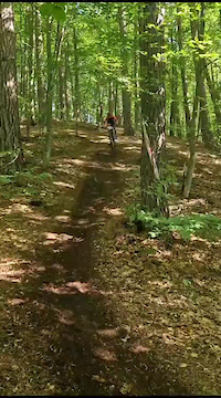
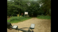
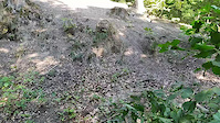
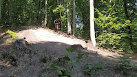
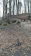
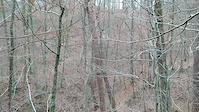
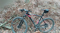
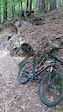
Photos of Gdańsk Mountain Bike
Videos of Gdańsk Mountain Bike
trail: Klejnot Nilu
0:07 |
29 |
Mar 14, 2024
trail: Żółwik
0:55 |
|
Aug 18, 2023
trail: Kowalski do Tablicy
4:36 |
70 |
Aug 28, 2022
trail: Kowalski do Tablicy
23:07 |
69 |
Aug 28, 2022
trail: Druciak
0:09 |
110 |
May 7, 2021
trail: Taxator
0:25 |
85 |
Dec 4, 2020
trail: Przepompownia
4:18 |
148 |
Dec 4, 2020
trail: Okop
0:35 |
136 |
Oct 4, 2020
Current Trail Warnings
| status | trail | date | condition | user | info |
|---|---|---|---|---|---|
| Rykoszet | Jun 18, 2026 @ 12:34pm (Europe/Warsaw) Jun 18, 2026 | Variable | kondemon ROWENUS | Doszedl nowy wiatrolom, dosc ciezko go... | |
| Bernardotok | Jun 6, 2026 @ 1:17pm (Europe/Warsaw) Jun 6, 2026 | Ideal | karczk | Wiatrołom, trzeba przenieść rower. | |
| Sugar Daddy | May 31, 2026 @ 2:06pm (Europe/Kaliningrad) May 31, 2026 | Dry | awro |
Recent Trail Reports
| status | trail | date | condition | info | user |
|---|---|---|---|---|---|
| Przepompownia | Jun 23, 2026 @ 9:58pm (Europe/Warsaw) 2 days | Dry | QbaXC ROWENUS | ||
| Kleszczowy | Jun 21, 2026 @ 6:33pm (Europe/Warsaw) Jun 21, 2026 | Ideal | QbaXC ROWENUS | ||
| Pniaki Access | Jun 18, 2026 @ 12:38pm (Europe/Warsaw) Jun 18, 2026 | Variable | kondemon ROWENUS | ||
| Wąskotorówka | Jun 18, 2026 @ 12:33pm (Europe/Warsaw) Jun 18, 2026 | Ideal | kondemon ROWENUS | ||
| Piekielne Czeluście | Jun 17, 2026 @ 4:48pm (Europe/Warsaw) Jun 17, 2026 | Ideal | karczk | ||
| Kaskada | Jun 16, 2026 @ 8:28pm (Europe/Warsaw) Jun 16, 2026 | Ideal | karczk | ||
| Do Kampinoskiej | Jun 14, 2026 @ 1:15pm (Europe/Kaliningrad) Jun 14, 2026 | Ideal | Marek-M | ||
| Potok Oruński | Jun 14, 2026 @ 1:15pm (Europe/Kaliningrad) Jun 14, 2026 | Ideal | Marek-M | ||
| Stare NSy | Jun 12, 2026 @ 10:26pm (Europe/Warsaw) Jun 12, 2026 | Variable | karczk | ||
| Abrahamówka | Jun 12, 2026 @ 10:24pm (Europe/Warsaw) Jun 12, 2026 | Variable | karczk |
Activity Feed
| username | action | type | title | date |
|---|---|---|---|---|
| slwwandal | comment | report | activity #97674860 | Jun 23, 2026 @ 9:41pm 1 day |
| QbaXC | add | report | activity #97647440 | Jun 23, 2026 @ 12:58pm 2 days |
| QbaXC | comment | trail | activity #97647231 | Jun 23, 2026 @ 12:54pm 2 days |
| Peramont | wishlist | route | activity #97612783 | Jun 23, 2026 @ 1:51am 2 days |
| QbaXC | add | report | activity #97493436 | Jun 21, 2026 @ 9:33am Jun 21, 2026 |
Recent Comments
| username | type | title | comment | date |
|---|---|---|---|---|
| report | Dziękuję Panu, zgłaszam do GIOŚ | Jun 23, 2026 @ 9:41pm 1 day | ||
| trail | A jednak! Drzewo na końcu zostało wycięte!... | Jun 23, 2026 @ 12:54pm 2 days | ||
| trail | Dzisiaj drugi raz się przejechałem, tym... | Jun 17, 2026 @ 7:47am Jun 17, 2026 | ||
| trail | Z nie przyciąganiem to już dawno za późno.... | Jun 11, 2026 @ 10:02am Jun 11, 2026 | ||
| trail | Cześć Sławek 24b83. Widzę, że zmieniłeś... | Jun 11, 2026 @ 9:47am Jun 11, 2026 |
Local Badges
-

Completionist0 awarded -

Epic Ride 50k3,733 awarded -

Top 10 Trails7 awarded -
Completionist1 awarded -
Completionist1 awarded -
Completionist1 awarded
Bike & Skill Parks
| name | type | city | rating |
|---|---|---|---|
| Bajkowe BFW | skill park | Gdańsk | |
| Tomac | skill park | Gdańsk | |
| Kozacza Góra | skill park | Gdańsk | |
| Måske motocrossbane ???? | skill park | Gdańsk |
Activity Type Stats
| activitytype | trails | distance | descent | descent distance | total vertical | rating | global rank | state rank | photos | reports | routes | ridelogs |
|---|---|---|---|---|---|---|---|---|---|---|---|---|
| Mountain Bike | 477 | 161 miles | 29,449 ft | 91 miles | 554 ft | #137 | #1 | 980 | 9,157 | 29 | 69,622 | |
| E-Bike | 204 | 67 miles | 10,023 ft | 34 miles | 554 ft | #215 | #256 | 4 | 7,492 | 3 | 4,586 | |
| Gravel Bike | 3 | #52 | #55 | 1 | 16 | 2,225 | ||||||
| Adaptive Bike | 1 | #87 | #86 | 13 | 1 | |||||||
| Horse | 1 | 2,428 ft | 43 ft | 1,286 ft | 89 ft | #396 | #252 | 1,023 | ||||
| Hike | 376 | 144 miles | 23,615 ft | 77 miles | 554 ft | #194 | #23 | 23 | 8,632 | 1 | 2,298 | |
| Trail Running | 369 | 141 miles | 23,084 ft | 76 miles | 554 ft | #315 | #20 | 1 | 8,603 | 1 | 4,041 | |
| Snowshoe | 2 | 1,939 ft | 72 ft | 1,450 ft | 72 ft | #202 | #26 | 1 | ||||
| Nordic Ski | 2 | 1,939 ft | 72 ft | 1,450 ft | 72 ft | #262 | #29 | 64 |
Frequently Asked Questions About Gdańsk
▼
What are the best places to ride in Gdańsk?
Gdańsk has 14 areas to explore for mountain biking. The top rated areas are:
▼
What are the highest rated mountain biking trails in Gdańsk?
The highest rated mountain biking trails in Gdańsk are:
- Wnuczki (4.6/5)
- Niebieski (4.5/5)
- Kamienna Twarz (4.5/5)
- Serolator (4.5/5)
- Dolina Strzyży (4.5/5)
▼
What is the best time of the year to ride in Gdańsk?
Based on ride log data, the most popular months to ride in Gdańsk are:
- July (447 activities)
- May (330 activities)
- August (310 activities)
▼
Where can I park to ride in Gdańsk?
There are 2 parking locations listed in Gdańsk. The most popular parking spots are:
Activities
Trails
- By micolai
 TRAILFORKS Poland & contributors
 - Admins: apply
- #11535 - 33,446 views
- gdańsk activity log | embed map of Gdańsk mountain bike trails | gdańsk mountain biking points of interest polygons
Downloading of trail gps tracks in kml & gpx formats is enabled for Gdańsk.
You must login to download files.