close
-
Layers w
- Weather Layers
- Pro
- Pro
- Pro
- Pro
- Pro
- Pro
- More Layers
- Pro
- Pro
- Pro
- Pro
-
Upgrade to

3D
Trail Conditions
- Unknown
- Snow Groomed
- Snow Packed
- Snow Covered
- Snow Cover Partial
- Freeze/thaw Cycle
- Icy
- Prevalent Mud
- Wet
- Variable
- Ideal
- Dry
- Very Dry
Trail Flow (Ridden Direction)
Trailforks scans users ridelogs to determine the most popular direction each trail is ridden. A good flowing trail network will have most trails flowing in a single direction according to their intension.
The colour categories are based on what percentage of riders are riding a trail in its intended direction.
The colour categories are based on what percentage of riders are riding a trail in its intended direction.
- > 96%
- > 90%
- > 80%
- > 70%
- > 50%
- < 50%
- bi-directional trail
- no data
Trail Last Ridden
Trailforks scans ridelogs to determine the last time a trail was ridden.
- < 2 days
- < 1 week
- < 2 weeks
- < 1 month
- < 6 months
- > 6 months
Trail Ridden Direction
The intended direction a trail should be ridden.
- Downhill Only
- Downhill Primary
- Both Directions
- Uphill Primary
- Uphill Only
- One Direction
Contribute Details
Colors indicate trail is missing specified detail.
- Description
- Photos
- Description & Photos
- Videos
Trail Popularity ?
Trailforks scans ridelogs to determine which trails are ridden the most in the last 9 months.
Trails are compared with nearby trails in the same city region with a possible 25 colour shades.
Think of this as a heatmap, more rides = more kinetic energy = warmer colors.
- most popular
- popular
- less popular
- not popular
ATV/ORV/OHV Filter
Max Vehicle Width
inches
US Cell Coverage
Legend

Radar Time
Activity Recordings
Trailforks uses anonymized public activity data.
?
Activity Recordings
Trailforks uses anonymized public activity data.
?
Personal Heatmap
▶
Activity Types
all
/
none
▶
Options
2
Date range
month
–
Winter Trails
Warning
A routing network for winter maps does not exist. Selecting trails using the winter trails layer has been disabled.
Missing Trails
Most Popular
Least Popular
Trails are colored based on popularity. The more popular a trail is, the more red. Less popular trails trend towards green.
Jump Magnitude Heatmap
Heatmap of where riders jump on trails. Zoom in to see individual jumps, click circles to view jump details.
BC Backroad Status
![map legend]()
Service Road Atlas is a free to use, community-driven service for viewing and creating reports on the numerous back-country service roads around B.C. and Alberta.

Slope Aspect
Direction the slope faces
Trails Deemphasized
Trails are shown in grey.
Only show trails with no bike usage.
Suggested Layers
Based on selected activity type
Save the current map location and zoom level as your default home location whenever this page is loaded.
Save
No description for Geelong has been added yet!
Login or register to submit one.
Activities Click to view
- Mountain Bike
57 trails
- E-Bike
42 trails
- Gravel Bike
0 trails
- Adaptive Bike
0 trails
- Winter Fat Bike
0 trails
- Hike
28 trails
- Trail Running
29 trails
Region Details
- 3
- 2
- 13
- 21
- 12
- 5
Region Status
Caution as of Jun 11, 2026Stats
- Avg Trail Rating
- Trails (view details)
- 66
- Trails Mountain Bike
- 57
- Trails E-Bike
- 42
- Trails Hike
- 28
- Trails Trail Running
- 29
- Total Distance
- 83 miles
- Total Descent
- 7,657 ft
- Total Vertical
- 1,319 ft
- Highest Trailhead
- 1,328 ft
- Reports
- 1,735
- Photos
- 571
- Ridden Counter
- 4,002
Sub Regions
-
Barwon River
-
Fyansford Common
- 1
- 2
- 1
-
Geelong Cementies
-
GFT
- 2
- 5
- 4
- 1
Popular Geelong Mountain Biking Trails
• 100 ★ 3.3 • 3,809 ft • 57 ft • 250 •
A green circle track, good for people wanting to experiment with downhills at the end. Please be careful of people on the trail slow or stopped - they shouldn't be there but it happens. Trail maintenance is needed more often so be...
• 95 ★ 4.0 • 1,726 ft • 28 ft • 124 •
This is a nice introduction to mountain biking trails. This is a short trail that is great for kids to try. May be wet at times.
• 100 ★ 5.0 • 1,509 ft • 48 ft • 124 •
A trail that is a bit harder than the other trails. Not recommended for first time mountain bikers.
• 85 ★ 0.0 • 810 ft • 0 ft • 48 •
Slippery in Winter but nice in Summer, some great jumps down the bottom.
• 60 ★ 5.0 • 585 ft • 0 ft • 32 •
Moderately popular blue difficulty singletrack. This mountain bike primary trail can be used downhill only. It features berm, jump and other. On average it takes 1 minutes to complete this trail.
• 60 ★ 0.0 • 623 ft • 0 ft • 28 •
Wet and slippery sometimes, a bit skinny and steep but pretty good.
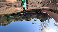
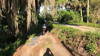
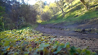
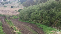
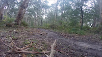
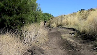
Photos of Geelong Mountain Bike
Videos of Geelong Mountain Bike
trail: Step up
0:31 |
|
Apr 5, 2024
trail: Main Line
0:14 |
175 |
May 19, 2022

trail: Barwon River Trail
0:31 |
424 |
Sep 4, 2019
trail: Barwon River Trail
0:26 |
279 |
Aug 18, 2019
trail: Moundies
0:35 |
346 |
Jul 9, 2018
trail: DH
0:49 |
202 |
Jul 30, 2017
trail: Top to Bottom
0:18 |
625 |
Jul 22, 2017
trail: Moundies
2:19 |
437 |
Mar 17, 2017
Recent Trail Reports
| status | trail | date | condition | info | user |
|---|---|---|---|---|---|
| The Hill - Upper Loop | Apr 11, 2024 @ 2:58pm Apr 11, 2024 | Ideal | optical-recluse | ||
| The Hill - Lower Loop | Apr 11, 2024 @ 2:58pm Apr 11, 2024 | Ideal | optical-recluse | ||
| The Hill - Middle Loop | Apr 11, 2024 @ 2:58pm Apr 11, 2024 | Ideal | optical-recluse | ||
| Barwon River Trail | Oct 9, 2023 @ 2:41am Oct 9, 2023 | Ideal | PolygonPoopyPooPoo | ||
| Rough Run | Oct 9, 2023 @ 2:40am Oct 9, 2023 | Ideal | PolygonPoopyPooPoo | ||
| Step Up | Feb 7, 2019 @ 10:04pm Feb 7, 2019 | Dry | Flynn-Wicks |
Activity Feed
| username | action | type | title | date |
|---|---|---|---|---|
| skipatrol01 | vote | trail | activity #91741300 | Apr 1, 2026 @ 7:25pm Apr 1, 2026 |
| Tomj0oShi | ridden | trail | activity #91637840 and 6 more | Mar 31, 2026 @ 3:52am Mar 31, 2026 |
| whisked232 | difficultyvote | trail | activity #91631377 | Mar 30, 2026 @ 11:26pm Mar 30, 2026 |
| whisked232 | ridden | trail | activity #91631038 | Mar 30, 2026 @ 11:13pm Mar 30, 2026 |
| skipatrol01 | add | video | activity #91629209 | Mar 30, 2026 @ 9:43pm Mar 30, 2026 |
Recent Comments
| username | type | title | comment | date |
|---|---|---|---|---|
| trail | Sealed... Non-sealed... Sealed... This is a... | Mar 7, 2025 @ 1:40pm Mar 7, 2025 | ||
| trail | It broken | Dec 14, 2023 @ 5:18pm Dec 14, 2023 | ||
| trail | Good little loop and not too difficult for... | Sep 27, 2022 @ 12:17am Sep 27, 2022 | ||
| trail | im heading down tomorrow its so sick 10/10 | Mar 17, 2022 @ 1:38am Mar 17, 2022 | ||
| trail | Great park for learning to ride MTB’s or... | Jun 20, 2020 @ 4:34pm Jun 20, 2020 |
Local Badges
-

Epic Ride Climb 2k20 awarded -

Climbing 10k Badge74 awarded -

Climbing 100k Badge5 awarded -

Epic Ride Descent 2k22 awarded -

Descent 10k Badge74 awarded -

Descent 100k Badge5 awarded
Bike & Skill Parks
| name | type | city | rating |
|---|---|---|---|
| The Hill Pump Tracks | skill park | Geelong | |
| Leopold Primary School Pump Track | skill park | Geelong | |
| Teesdale Bike Track | skill park | Geelong |
Activity Type Stats
| activitytype | trails | distance | descent | descent distance | total vertical | rating | global rank | state rank | photos | reports | routes | ridelogs |
|---|---|---|---|---|---|---|---|---|---|---|---|---|
| Mountain Bike | 57 | 73 miles | 6,368 ft | 31 miles | 1,319 ft | #1,714 | #86 | 564 | 1,734 | 14 | 41,984 | |
| E-Bike | 42 | 65 miles | 5,016 ft | 28 miles | 745 ft | #1,379 | #82 | 6 | 1,163 | 2 | 2,776 | |
| Hike | 28 | 48 miles | 3,199 ft | 19 miles | 1,319 ft | #2,994 | #87 | 1,579 | 404 | |||
| Trail Running | 29 | 48 miles | 3,202 ft | 19 miles | 1,319 ft | #2,411 | #67 | 1,580 | 2 | 755 |
Frequently Asked Questions About Geelong
▼
What are the best places to ride in Geelong?
Geelong has 5 areas to explore for mountain biking. The top rated areas are:
▼
What are the highest rated mountain biking trails in Geelong?
The highest rated mountain biking trails in Geelong are:
- The Hill - Upper Loop (4.2/5)
- Top to Bottom (4.1/5)
- Step Up (4.1/5)
- Rough Run (4.1/5)
- The Hill - Lower Loop (4/5)
▼
What is the best time of the year to ride in Geelong?
Based on ride log data, the most popular months to ride in Geelong are:
- December (259 activities)
- July (238 activities)
- January (232 activities)
▼
Where can I park to ride in Geelong?
There are 1 parking locations listed in Geelong. The most popular parking spots are:
Activities
- By willarblaster & contributors
- Admins: Victoria
- #9046 - 20,444 views
- geelong activity log | embed map of Geelong mountain bike trails | geelong mountain biking points of interest
Downloading of trail gps tracks in kml & gpx formats is enabled for Geelong.
You must login to download files.