close
-
Layers w
- Weather Layers
- Pro
- Pro
- Pro
- Pro
- Pro
- Pro
- More Layers
- Pro
- Pro
- Pro
- Pro
-
Upgrade to

3D
Trail Conditions
- Unknown
- Snow Groomed
- Snow Packed
- Snow Covered
- Snow Cover Partial
- Freeze/thaw Cycle
- Icy
- Prevalent Mud
- Wet
- Variable
- Ideal
- Dry
- Very Dry
Trail Flow (Ridden Direction)
Trailforks scans users ridelogs to determine the most popular direction each trail is ridden. A good flowing trail network will have most trails flowing in a single direction according to their intension.
The colour categories are based on what percentage of riders are riding a trail in its intended direction.
The colour categories are based on what percentage of riders are riding a trail in its intended direction.
- > 96%
- > 90%
- > 80%
- > 70%
- > 50%
- < 50%
- bi-directional trail
- no data
Trail Last Ridden
Trailforks scans ridelogs to determine the last time a trail was ridden.
- < 2 days
- < 1 week
- < 2 weeks
- < 1 month
- < 6 months
- > 6 months
Trail Ridden Direction
The intended direction a trail should be ridden.
- Downhill Only
- Downhill Primary
- Both Directions
- Uphill Primary
- Uphill Only
- One Direction
Contribute Details
Colors indicate trail is missing specified detail.
- Description
- Photos
- Description & Photos
- Videos
Trail Popularity ?
Trailforks scans ridelogs to determine which trails are ridden the most in the last 9 months.
Trails are compared with nearby trails in the same city region with a possible 25 colour shades.
Think of this as a heatmap, more rides = more kinetic energy = warmer colors.
- most popular
- popular
- less popular
- not popular
ATV/ORV/OHV Filter
Max Vehicle Width
inches
US Cell Coverage
Legend

Radar Time
Activity Recordings
Trailforks uses anonymized public activity data.
?
Activity Recordings
Trailforks uses anonymized public activity data.
?
Personal Heatmap
▶
Activity Types
all
/
none
▶
Options
2
Date range
month
–
Winter Trails
Warning
A routing network for winter maps does not exist. Selecting trails using the winter trails layer has been disabled.
Missing Trails
Most Popular
Least Popular
Trails are colored based on popularity. The more popular a trail is, the more red. Less popular trails trend towards green.
Jump Magnitude Heatmap
Heatmap of where riders jump on trails. Zoom in to see individual jumps, click circles to view jump details.
BC Backroad Status
![map legend]()
Service Road Atlas is a free to use, community-driven service for viewing and creating reports on the numerous back-country service roads around B.C. and Alberta.

Slope Aspect
Direction the slope faces
Trails Deemphasized
Trails are shown in grey.
Only show trails with no bike usage.
Suggested Layers
Based on selected activity type
Save the current map location and zoom level as your default home location whenever this page is loaded.
SaveGENOVA
Metropoli di mare, e città dalla gloriosa storia, Genova suscita sentimenti contrastanti e ciò e dovuto anche al fatto che essa ha duplici sfaccettature: porto sul Mediterraneo da aperto ai traffici con i paesi che vi si affacciano e città di mercanti e di banchieri, conosciuta da tutti come la città più inglese d'Italia.
Affascinanti le strette strade del Centro Storico, i famosi carruggi, i palazzi signorili che si alternano alle umili case, le belle chiese con le loro austere facciate di marmo a strisce bianche e nere oppure opulente nelle loro linee barocche.
In tutta la città è visibile il segno del periodo storico, il Seicento, in cui le grandi famiglie genovesi raggiunsero la massima ricchezza.
IL CLIMA
Il clima di Genova è complessivamente temperato marittimo, mediterraneo di transizione, influenzato sovente da influssi atlantici. Si caratterizza per scarse escursioni termiche sia giornaliere che annue.
Quando:
Il clima temperato rende abbastanza piacevole la visita della città per tutto l'anno.
Le stagioni migliori sono comunque la primavera e l'autunno, poiché non si rischia di prendere giornate troppo calde o troppo fredde.
LA BANDIERA DI GENOVA
https://digilander.libero.it/paolore2/cult_tradiz/bandea.html
Links
This region uses the Uk/Euro style trail grading system.
Activities Click to view
- Mountain Bike
1,119 trails
- E-Bike
863 trails
- Horse
46 trails
- Hike
912 trails
- Trail Running
883 trails
- Dirtbike/Moto
20 trails
- Observed Trials
4 trails
- ATV/ORV/OHV
7 trails
- Snowmobile
5 trails
- Snowshoe
6 trails
- Downhill Ski
5 trails
- Backcountry Ski
6 trails
- Nordic Ski
5 trails
Region Details
- 225
- 5
- 212
- 426
- 7
- 4
- 3
Stats
- Avg Trail Rating
- Trails (view details)
- 1,066
- Trails Mountain Bike
- 1,121
- Trails E-Bike
- 863
- Trails Gravel Bike
- 1
- Trails Adaptive Bike
- 7
- Trails Winter Fat Bike
- 2
- Trails Horse
- 46
- Trails Hike
- 912
- Trails Trail Running
- 883
- Trails Dirtbike/Moto
- 20
- Trails Observed Trials
- 4
- Trails ATV/ORV/OHV
- 7
- Trails Snowmobile
- 5
- Trails Snowshoe
- 6
- Trails Downhill Ski
- 5
- Trails Backcountry Ski
- 6
- Trails Nordic Ski
- 5
- Total Distance
- 1,108 miles
- Total Descent
- 436,129 ft
- Total Vertical
- 5,844 ft
- Highest Trailhead
- 5,845 ft
- Reports
- 14,382
- Photos
- 2,939
- Ridden Counter
- 63,098
Popular Trail Networks
view all areas »Sub Regions
- Arenzano (51)
- Campo Ligure (94)
- Campomorone (17)
- Ceranesi (49)
- Chiavari (20)
- Cogoleto (34)
- CogoletOOutdoor Area (34)
- Cravasco (4)
- Crocefieschi (26)
- Genova (404)
- Leivi (16)
- Masone (3)
- Mele (34)
- Moneglia (29)
- Montoggio (23)
- Recco (28)
- Rezzoaglio (17)
- Ronco Scrivia (33)
- Rovegno (40)
- Sant'Olcese (118)
- Santa Margherita Ligure (22)
- SAVIGNONE (14)
- Sestri Levante (84)
- Tiglieto (8)
- Torriglia (36)
- Uscio (15)
- Voltri (6)
Popular Genova Mountain Biking Trails
• 100 ★ 4.8 • 1 mile • 0 ft • 448 •
Grande classico della zona, insieme a . Super panorama sul mare. Trail da non perdere!
• 100 ★ 4.4 • 1 mile • 9 ft • 434 •
Sentiero top della zona, super panoramico, con vista sul mare. Recentemente rinnovato in occasione dell'enduro Winter Trophy. Un must da non perdere assolutamente.
• 80 ★ 4.2 • 2 miles • 185 ft • 299 •
The perfect AM/ENDURO trail. The first section with slight ups and downs is fast and very loose, The second section start with a rocky descent is one of the must demanding parts of the trail. Afterwards starts the dirt road where you...
• 75 ★ 4.2 • 5,269 ft • 4 ft • 266 •
Cani Description: The starting point is the train station of Sestri Levante. From there, head towards the hills riding along Via Antica Romana in the direction of the hospital. Past the hospital, at the traffic lights about 200 m...
• 100 ★ 3.5 • 3,540 ft • 160 ft • 256 •
Popular blue difficulty singletrack. This mountain bike primary trail can be used both directions and has a moderate overall physical rating with a 160 ft blue climb. On average it takes 9 minutes to complete this trail.
• 100 ★ 4.3 • 2,005 ft • 0 ft • 240 •
Highly rated popular green difficulty singletrack. This mountain bike primary trail can be used downhill primary. On average it takes 2 minutes to complete this trail.
• 90 ★ 2.0 • 3,560 ft • 45 ft • 234 •
Facile variante finale del trail di lungo il percorso dei
Genova Mountain Bike Routes
★ 5.0 • 43 miles • 6,471 ft • 8 • Point to Point •
Eccellente traversata all-mountain. Arrivati in treno a Rossiglione si segue la strada Berlino che poi...
★ 4.0 • 28 miles • 5,342 ft • 15 • Loop •
Beigua 1 (Cogoleto – Deserto – Faie – Prato Rotondo – M. Beigua – Trail + - Boavista Express –...
★ 4.0 • 23 miles • 4,870 ft • 4 • Loop •
Giro con arrivo e partenza da Cogoleto. La prima parte di discesa non facilissima sul popolare sentiero...
★ 4.0 • 11 miles • 2,490 ft • 10 • Loop •
Anello 1 Trails: Beuca Infermieri Maluea Vasca Cagna Garescio Curletti Uguale Rosso Sant'Anna Ponte delle...
9 miles • 2,098 ft • 6 • Point to Point •
Partenza da Apparizione, si raggiunge la vetta del Fasce pedalando su asfalto (SP67). A questo punto si...
★ 5.0 • 3 miles • 58 ft • 2 • Point to Point •
Cani Sant'Anna Description: The starting point is the train station of Sestri Levante. From there, head...
Photos of Genova Mountain Bike
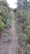
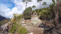
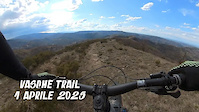
Videos of Genova Mountain Bike
trail: New Branega Express
0:47 |
5 |
Sep 26, 2025
trail: FuMaRupe
0:25 |
15 |
Apr 15, 2025
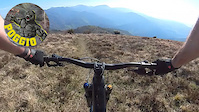
trail: Poggio
10:48 |
164 |
Apr 7, 2025
trail: Vasche
12:02 |
40 |
Apr 4, 2025

trail: stura trail
3:51 |
98 |
Apr 4, 2025
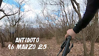
trail: Antidoto
4:32 |
80 |
Apr 1, 2025
trail: Barbanera
3:31 |
31 |
Mar 10, 2025
trail: Revenge
3:17 |
54 |
Mar 9, 2025
Current Trail Warnings
| status | trail | date | condition | user | info |
|---|---|---|---|---|---|
| Ciazze CogoletOOutdoor Area | Jun 16, 2026 @ 8:39am (Europe/Rome) Jun 15, 2026 | Dry | Gianlumorra | una giungla di felci... a tratti nn... | |
| Bassa Tensione Arenzano | Jun 15, 2026 @ 11:16am (Europe/Rome) Jun 15, 2026 | Dry | albicicloalp1991 | Un po' eroso nel primissimo tratto, poi... | |
| Camporsella Santolcese trails area | Jun 4, 2026 @ 12:18pm (Europe/Rome) Jun 4, 2026 | Dry | max90savona |
Recent Trail Reports
Activity Feed
| username | action | type | title | date |
|---|---|---|---|---|
| sergioconsi | comment | trail | activity #97548802 | Jun 22, 2026 @ 1:40am 23 hours |
| Damtb | comment | report | activity #97548486 | Jun 22, 2026 @ 1:23am 24 hours |
| Damtb | add | report | activity #97548377 | Jun 22, 2026 @ 1:19am 24 hours |
| Glaucovassallo | add | report | activity #97541502 and 3 more | Jun 21, 2026 @ 9:06pm 1 day |
| Raywan1983 | ridden | trail | activity #97511532 | Jun 21, 2026 @ 12:38pm 2 days |
Recent Comments
| username | type | title | comment | date |
|---|---|---|---|---|
| trail | Provato a salire dalla cappelletta nostra... | Jun 22, 2026 @ 1:40am 23 hours | ||
| report | ciao, il trail è percorribile ? | Jun 22, 2026 @ 1:23am 24 hours | ||
| trail | Carino. Il finale sarebbe da sistemare | May 31, 2026 @ 9:50am May 31, 2026 | ||
| trail | Trail bellissimo, imperdibile! | May 31, 2026 @ 9:48am May 31, 2026 | ||
| trail | Bel trail nel bosco, abbastanza flow (per gli... | May 31, 2026 @ 9:44am May 31, 2026 |
Local Badges
-

Epic Ride 50k122 awarded -
Epic Ride 50k439 awarded -
Epic Ride 50k197 awarded -
Epic Ride 50k8 awarded -
Epic Ride 50k224 awarded -
Epic Ride 50k103 awarded
Bike & Skill Parks
| name | type | city | rating |
|---|---|---|---|
| Pumptrack Break Bike Sestri | skill park | Sestri Levante | |
| Arenzano motocross | skill park | Arenzano |
Local Trail Supporters
- p
![]()
![]()
![]()
- Osteria Asenetto
![]()
- Cabella Salumi
- Liguria MTB Trail Building
- Brunello Mirko
- B&B Giutte
Activity Type Stats
| activitytype | trails | distance | descent | descent distance | total vertical | rating | global rank | state rank | photos | reports | routes | ridelogs |
|---|---|---|---|---|---|---|---|---|---|---|---|---|
| Mountain Bike | 1,119 | 1,092 miles | 432,546 ft | 609 miles | 5,843 ft | 2,100 | 14,378 | 87 | 70,551 | |||
| E-Bike | 863 | 829 miles | 311,539 ft | 453 miles | 5,833 ft | 773 | 13,051 | 34 | 22,402 | |||
| Gravel Bike | 1 | 50 | 3 | 88 | ||||||||
| Adaptive Bike | 7 | 15 | ||||||||||
| Winter Fat Bike | 2 | 45 | ||||||||||
| Horse | 46 | 40 miles | 10,725 ft | 20 miles | 3,816 ft | 584 | 2 | |||||
| Hike | 912 | 910 miles | 348,100 ft | 498 miles | 5,833 ft | 47 | 13,600 | 11 | 4,486 | |||
| Trail Running | 883 | 883 miles | 336,339 ft | 482 miles | 5,823 ft | 13,564 | 12 | 2,877 | ||||
| Dirtbike/Moto | 20 | 11 miles | 3,799 ft | 6 miles | 3,816 ft | 547 | 7 | |||||
| Observed Trials | 4 | 4 miles | 1,598 ft | 2 miles | 3,278 ft | 100 | 7 | |||||
| ATV/ORV/OHV | 7 | 4 miles | 2,569 ft | 3 miles | 3,412 ft | 543 | 2 | |||||
| Snowmobile | 5 | 3 miles | 997 ft | 2 miles | 1,581 ft | 10 | ||||||
| Snowshoe | 6 | 4 miles | 1,371 ft | 2 miles | 1,581 ft | 11 | 23 | |||||
| Downhill Ski | 5 | 3 miles | 997 ft | 2 miles | 1,581 ft | 10 | 67 | |||||
| Backcountry Ski | 6 | 5 miles | 1,270 ft | 3 miles | 2,274 ft | 11 | 54 | |||||
| Nordic Ski | 5 | 3 miles | 997 ft | 2 miles | 1,581 ft | 10 | 81 |
Frequently Asked Questions About Genova
▼
What are the best places to ride in Genova?
Genova has 19 areas to explore for mountain biking. The top rated areas are:
▼
What are the highest rated mountain biking trails in Genova?
The highest rated mountain biking trails in Genova are:
- Mimosa (4.6/5)
- Busseto (4.5/5)
- Bianchetta (4.5/5)
- FuMaRupe (4.5/5)
- Tagliamento Deiva (4.4/5)
▼
What is the best time of the year to ride in Genova?
Based on ride log data, the most popular months to ride in Genova are:
- May (333 activities)
- June (286 activities)
- October (274 activities)
▼
What is the longest trail in Genova?
The longest trail in Genova is Perlezzi - Pratomollo at 8.3 miles. View all trails sorted by distance.
Activities
- Genova Mountain Biking Trails
- Genova E-Biking Trails
- Genova Horseback Trails
- Genova Hiking Trails
- Genova Trail Running Trails
- Genova Dirtbiking Trails
- Genova ATVing/Offroading Trails
- Genova Snowmobiling Trails
- Genova Snowshoeing Trails
- Genova Skiing Trails
- Genova Backcountry Skiing Trails
- Genova Nordic Skiing Trails
Trails
Points of Interest
- By denitopia
 TRAILFORKS VTA & contributors
 - Admins: denitopia, marcoangeletti, cemoorelife, denitopia, linomak
- #8374 - 28,850 views
- genova activity log | embed map of Genova mountain bike trails | genova mountain biking points of interest
Downloading of trail gps tracks in kml & gpx formats is enabled for Genova.
You must login to download files.