close
-
Layers w
- Weather Layers
- Pro
- Pro
- Pro
- Pro
- Pro
- Pro
- More Layers
- Pro
- Pro
- Pro
- Pro
-
Upgrade to

3D
Trail Conditions
- Unknown
- Snow Groomed
- Snow Packed
- Snow Covered
- Snow Cover Partial
- Freeze/thaw Cycle
- Icy
- Prevalent Mud
- Wet
- Variable
- Ideal
- Dry
- Very Dry
Trail Flow (Ridden Direction)
Trailforks scans users ridelogs to determine the most popular direction each trail is ridden. A good flowing trail network will have most trails flowing in a single direction according to their intension.
The colour categories are based on what percentage of riders are riding a trail in its intended direction.
The colour categories are based on what percentage of riders are riding a trail in its intended direction.
- > 96%
- > 90%
- > 80%
- > 70%
- > 50%
- < 50%
- bi-directional trail
- no data
Trail Last Ridden
Trailforks scans ridelogs to determine the last time a trail was ridden.
- < 2 days
- < 1 week
- < 2 weeks
- < 1 month
- < 6 months
- > 6 months
Trail Ridden Direction
The intended direction a trail should be ridden.
- Downhill Only
- Downhill Primary
- Both Directions
- Uphill Primary
- Uphill Only
- One Direction
Contribute Details
Colors indicate trail is missing specified detail.
- Description
- Photos
- Description & Photos
- Videos
Trail Popularity ?
Trailforks scans ridelogs to determine which trails are ridden the most in the last 9 months.
Trails are compared with nearby trails in the same city region with a possible 25 colour shades.
Think of this as a heatmap, more rides = more kinetic energy = warmer colors.
- most popular
- popular
- less popular
- not popular
ATV/ORV/OHV Filter
Max Vehicle Width
inches
US Cell Coverage
Legend

Radar Time
Activity Recordings
Trailforks uses anonymized public activity data.
?
Activity Recordings
Trailforks uses anonymized public activity data.
?
Personal Heatmap
▶
Activity Types
all
/
none
▶
Options
2
Date range
month
–
Winter Trails
Warning
A routing network for winter maps does not exist. Selecting trails using the winter trails layer has been disabled.
Missing Trails
Most Popular
Least Popular
Trails are colored based on popularity. The more popular a trail is, the more red. Less popular trails trend towards green.
Jump Magnitude Heatmap
Heatmap of where riders jump on trails. Zoom in to see individual jumps, click circles to view jump details.
BC Backroad Status
![map legend]()
Service Road Atlas is a free to use, community-driven service for viewing and creating reports on the numerous back-country service roads around B.C. and Alberta.

Slope Aspect
Direction the slope faces
Trails Deemphasized
Trails are shown in grey.
Only show trails with no bike usage.
Suggested Layers
Based on selected activity type
Save the current map location and zoom level as your default home location whenever this page is loaded.
Save
No description for Georgia has been added yet!
Login or register to submit one.
Stats
- Avg Trail Rating
- Trails (view details)
- 163
- Trails Mountain Bike
- 162
- Trails E-Bike
- 100
- Trails Gravel Bike
- 7
- Trails Adaptive Bike
- 7
- Trails Winter Fat Bike
- 7
- Trails Horse
- 27
- Trails Hike
- 112
- Trails Trail Running
- 113
- Trails Dirtbike/Moto
- 30
- Trails Snowshoe
- 28
- Trails Downhill Ski
- 28
- Trails Backcountry Ski
- 28
- Trails Nordic Ski
- 28
- Total Distance
- 211 miles
- Total Descent
- 89,004 ft
- Total Vertical
- 8,708 ft
- Highest Trailhead
- 9,310 ft
- Reports
- 226
- Photos
- 66
- Ridden Counter
- 1,769
Sub Regions
- Abkhazia Region (0)
- Adjara Region (6)
- Batumi (7)
- Batumi (7)
- City Of Tblisi - Capital Region (111)
- Tbilisi (111)
- Tbilisi (111)
- Guria Region (0)
- Imereti Region (6)
- Baghdati Municipality (6)
- Dapenili (6)
- Baghdati Municipality (6)
- Racha‑Lechkhumi & Kvemo Svaneti Region (1)
- Samagrelo-Zemo Svaneti Region (5)
- Svaneti Region (6)
- Samtskhe‑Javakheti Region (7)
- Bakuriani (7)
- Bakuriani (7)
Popular Georgia Mountain Biking Trails
• 95 ★ 4.7 • 4,744 ft • 0 ft • 56 •
The entry level bike park trail. It's wide and fast. There are lots of berms and table top rollable jumps. The second part features even bigger jumps and a huge berm.
• 90 ★ 4.4 • 2,099 ft • 0 ft • 50 •
Popular blue difficulty singletrack. This mountain bike primary trail can be used downhill primary. On average it takes 2 minutes to complete this trail.
• 100 ★ 5.0 • 1,778 ft • 0 ft • 46 •
Pretty technical trail with one step down, few gnarly descents and a lot of turns.
• 95 ★ 3.0 • 1,713 ft • 0 ft • 37 •
Popular blue difficulty dirt/gravel road. This mountain bike primary trail can be used both directions. Trail visibility is always easy to follow. On average it takes minutes to complete this trail.
• 90 ★ 5.0 • 2 miles • 47 ft • 34 •
Trail from monastery to Tbilisi on left side of mountin ridge
• 60 ★ 3.8 • 738 ft • 0 ft • 28 •
Moderately popular blue difficulty singletrack. This mountain bike primary trail can be used downhill only. Trail visibility is always easy to follow. On average it takes minutes to complete this trail.
• 60 ★ 5.0 • 1 mile • 0 ft • 26 •
Moderately popular blue difficulty singletrack. This mountain bike primary trail can be used downhill only. Trail visibility is always easy to follow. On average it takes 10 minutes to complete this trail.
Georgia Mountain Bike Routes
33 miles • 3,297 ft • 0 • Point to Point •
Gudauri to Passanauri downhill on old military road.
Photos of Georgia Mountain Bike
Videos of Georgia Mountain Bike

trail: Kojori - Tbilisi
0:30 |
206 |
Jan 22, 2017

trail: Ferris Wheel
0:26 |
183 |
Nov 22, 2016
trail: Ferris Wheel
0:07 |
194 |
Nov 22, 2016

trail: Single
19:13 |
100 |
Feb 6, 2025 , Tbilisi

trail: Bonsai
3:38 |
167 |
Jun 27, 2024 , Tbilisi

trail: Roader
8:54 |
112 |
Jun 13, 2024 , Tbilisi

trail: Right Side
2:55 |
144 |
Jun 13, 2024 , Tbilisi
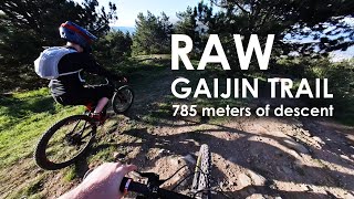
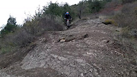
trail: Gaijin
14:23 |
151 |
Jun 13, 2024 , Tbilisi
Recent Comments
| username | type | title | comment | date |
|---|---|---|---|---|
| trail | Straight with some corners. Not much... | May 12, 2025 @ 10:59am May 12, 2025 | ||
| trail | Surface is frozen, lots of fallen leaves. | Jan 3, 2025 @ 2:46am Jan 3, 2025 | ||
| trail | What is the best way to get to the start of... | Dec 15, 2024 @ 11:28am Dec 15, 2024 | ||
| trail | It's a lovely bike park trail. You can avoid... | Nov 13, 2024 @ 10:32am Nov 13, 2024 | ||
| trail | Mostly the trail is blue. It has a very steep... | Oct 31, 2024 @ 1:16pm Oct 31, 2024 |
Activity Type Stats
| activitytype | trails | distance | descent | descent distance | total vertical | rating | global rank | state rank | photos | reports | routes | ridelogs |
|---|---|---|---|---|---|---|---|---|---|---|---|---|
| Mountain Bike | 162 | 208 miles | 88,976 ft | 136 miles | 8,707 ft | #68 | 66 | 226 | 1 | 7,448 | ||
| E-Bike | 100 | 163 miles | 64,600 ft | 102 miles | 8,707 ft | #61 | 220 | 1 | 454 | |||
| Gravel Bike | 7 | #93 | 1 | 95 | ||||||||
| Adaptive Bike | 7 | #93 | ||||||||||
| Winter Fat Bike | 7 | #93 | ||||||||||
| Horse | 27 | 46 miles | 12,359 ft | 21 miles | 5,538 ft | #55 | 9 | |||||
| Hike | 112 | 155 miles | 57,762 ft | 96 miles | 8,537 ft | #72 | 220 | 1,060 | ||||
| Trail Running | 113 | 157 miles | 58,698 ft | 98 miles | 8,537 ft | #71 | 220 | 88 | ||||
| Dirtbike/Moto | 30 | 71 miles | 22,982 ft | 40 miles | 8,537 ft | #43 | 9 | 8 | ||||
| Snowshoe | 28 | 53 miles | 13,671 ft | 26 miles | 5,538 ft | #33 | 3 | |||||
| Downhill Ski | 28 | 53 miles | 13,671 ft | 26 miles | 5,538 ft | #32 | 659 | |||||
| Backcountry Ski | 28 | 53 miles | 13,671 ft | 26 miles | 5,538 ft | #34 | 571 | |||||
| Nordic Ski | 28 | 53 miles | 13,671 ft | 26 miles | 5,538 ft | #33 | 69 |
Activities
- Georgia Mountain Biking Trails
- Georgia E-Biking Trails
- Georgia Gravel Biking Trails
- Georgia Adaptive Biking Trails
- Georgia Winter Fat Biking Trails
- Georgia Horseback Trails
- Georgia Hiking Trails
- Georgia Trail Running Trails
- Georgia Dirtbiking Trails
- Georgia Snowshoeing Trails
- Georgia Skiing Trails
- Georgia Backcountry Skiing Trails
- Georgia Nordic Skiing Trails
Trails
Points of Interest
- By canadaka
 Trailforks & contributors
 - Admins: apply
- #3262 - 7,165 views
- georgia activity log | embed map of Georgia mountain bike trails | georgia mountain biking points of interest
Downloading of trail gps tracks in kml & gpx formats is enabled for Georgia.
You must login to download files.