close
-
Layers w
- Weather Layers
- Pro
- Pro
- Pro
- Pro
- Pro
- Pro
- More Layers
- Pro
- Pro
- Pro
- Pro
-
Upgrade to

3D
Trail Conditions
- Unknown
- Snow Groomed
- Snow Packed
- Snow Covered
- Snow Cover Partial
- Freeze/thaw Cycle
- Icy
- Prevalent Mud
- Wet
- Variable
- Ideal
- Dry
- Very Dry
Trail Flow (Ridden Direction)
Trailforks scans users ridelogs to determine the most popular direction each trail is ridden. A good flowing trail network will have most trails flowing in a single direction according to their intension.
The colour categories are based on what percentage of riders are riding a trail in its intended direction.
The colour categories are based on what percentage of riders are riding a trail in its intended direction.
- > 96%
- > 90%
- > 80%
- > 70%
- > 50%
- < 50%
- bi-directional trail
- no data
Trail Last Ridden
Trailforks scans ridelogs to determine the last time a trail was ridden.
- < 2 days
- < 1 week
- < 2 weeks
- < 1 month
- < 6 months
- > 6 months
Trail Ridden Direction
The intended direction a trail should be ridden.
- Downhill Only
- Downhill Primary
- Both Directions
- Uphill Primary
- Uphill Only
- One Direction
Contribute Details
Colors indicate trail is missing specified detail.
- Description
- Photos
- Description & Photos
- Videos
Trail Popularity ?
Trailforks scans ridelogs to determine which trails are ridden the most in the last 9 months.
Trails are compared with nearby trails in the same city region with a possible 25 colour shades.
Think of this as a heatmap, more rides = more kinetic energy = warmer colors.
- most popular
- popular
- less popular
- not popular
ATV/ORV/OHV Filter
Max Vehicle Width
inches
US Cell Coverage
Legend

Radar Time
Activity Recordings
Trailforks uses anonymized public activity data.
?
Activity Recordings
Trailforks uses anonymized public activity data.
?
Personal Heatmap
▶
Activity Types
all
/
none
▶
Options
2
Date range
month
–
Winter Trails
Warning
A routing network for winter maps does not exist. Selecting trails using the winter trails layer has been disabled.
Missing Trails
Most Popular
Least Popular
Trails are colored based on popularity. The more popular a trail is, the more red. Less popular trails trend towards green.
Jump Magnitude Heatmap
Heatmap of where riders jump on trails. Zoom in to see individual jumps, click circles to view jump details.
BC Backroad Status
![map legend]()
Service Road Atlas is a free to use, community-driven service for viewing and creating reports on the numerous back-country service roads around B.C. and Alberta.

Slope Aspect
Direction the slope faces
Trails Deemphasized
Trails are shown in grey.
Only show trails with no bike usage.
Suggested Layers
Based on selected activity type
Save the current map location and zoom level as your default home location whenever this page is loaded.
Save
No description for Germantown has been added yet!
Login or register to submit one.
Activities Click to view
- Mountain Bike
20 trails
- Adaptive Bike
0 trails
- Hike
21 trails
- Trail Running
21 trails
Stats
- Avg Trail Rating
- Trails (view details)
- 19
- Trails Mountain Bike
- 20
- Trails E-Bike
- 2
- Trails Horse
- 3
- Trails Hike
- 21
- Trails Trail Running
- 21
- Total Distance
- 34 miles
- Total Descent
- 2,826 ft
- Total Vertical
- 516 ft
- Highest Trailhead
- 745 ft
- Reports
- 432
- Photos
- 39
- Ridden Counter
- 4,185
Sub Regions
-
Schaeffer Farms Mountain Bike Park
- 12
- 3
-
Seneca Creek Greenway Trail
- 2
-
South Germantown Recreation Park
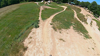
Popular Germantown Mountain Biking Trails
• 95 ★ 4.4 • 5,062 ft • 96 ft • 829 •
Popular green difficulty singletrack. This mountain bike primary trail. On average it takes 10 minutes to complete this trail.
• 95 ★ 3.9 • 3,766 ft • 95 ft • 774 •
Popular green difficulty singletrack. This mountain bike primary trail can be used downhill primary. On average it takes 5 minutes to complete this trail.
• 75 ★ 4.0 • 4,491 ft • 65 ft • 693 •
Popular green difficulty singletrack. This mountain bike primary trail. On average it takes 8 minutes to complete this trail.
• 90 ★ 4.0 • 4,106 ft • 121 ft • 675 •
Popular green difficulty singletrack. This mountain bike primary trail can be used both directions. On average it takes 9 minutes to complete this trail.
• 70 ★ 3.7 • 4 miles • 359 ft • 664 •
A very popular loop within the Schaeffer Farm trail system. several sections have recently been rerouted to improve flow and get out of wet spots. A few sustained climbs.
• 60 ★ 3.7 • 1 mile • 168 ft • 646 •
Moderately popular green difficulty singletrack. This mountain bike primary trail and has a easy overall physical rating with a 168 ft green climb. On average it takes 20 minutes to complete this trail.
• 85 ★ 3.7 • 3 miles • 259 ft • 625 •
Popular green difficulty singletrack. This mountain bike primary trail can be used both directions and has a moderate overall physical rating with a 259 ft green climb. On average it takes 21 minutes to complete this trail.
• 100 ★ 3.5 • 1,276 ft • 16 ft • 537 •
Popular blue difficulty singletrack. This mountain bike primary trail and has a moderate overall physical rating with a 16 ft blue climb. On average it takes 1 minutes to complete this trail.
Germantown Mountain Bike Routes
★ 4.5 • 9 miles • 720 ft • 4 • Loop •
This loop ties in the and the best of Schaeffer Farms.
2 miles • 206 ft • 1 • Loop •
This combination of the White and Orange Trails at Schaeffer Farm offers a short beginner-friendly loop...
★ 2.4 • 8 miles • 547 ft • 5 • Loop •
Great 8 mile ride through Schaeffrer farms trail head.
Photos of Germantown Mountain Bike
Videos of Germantown Mountain Bike
trail: Schaeffer White Loop
0:16 |
126 |
Jun 19, 2023
trail: Schaeffer White Loop
0:11 |
91 |
May 12, 2023

14:59 |
431 |
Oct 25, 2023
youtuber
![#DMVMTB #MOCOEPIC #MOCOEPIC2021 MOCO EPIC 2021]()

trail: Schaeffer White Loop
21:14 |
512 |
Oct 13, 2021 , Germantown
youtuber
![#mocoepic #mocoepic2021 #mtb #mtblife...]()

trail: Schaeffer White Loop
0:16 |
345 |
Oct 11, 2021 , Germantown
youtuber
![DJI follow me]()

trail: Schaeffer White Loop
2:44 |
341 |
Sep 7, 2021 , Germantown

trail: Schaeffer White Loop
15:27 |
1291 |
Sep 15, 2020 , Germantown

8:32 |
365 |
Sep 9, 2020
Recent Trail Reports
| status | trail | date | condition | info | user |
|---|---|---|---|---|---|
| Orange Trail (South) | Jun 19, 2026 @ 1:20pm (America/New_York) 3 hours | Ideal | ajmullis | ||
| Schaeffer White Loop | Jun 19, 2026 @ 1:20pm (America/New_York) 3 hours | Ideal | ajmullis | ||
| Orange Loop (North) | Apr 24, 2026 @ 9:53am (America/New_York) Apr 24, 2026 | Ideal | ajmullis | ||
| Green Trail | Mar 28, 2026 @ 4:48pm (America/New_York) Mar 28, 2026 | Ideal | jnguy19 | ||
| Yellow Loop | Mar 28, 2026 @ 4:47pm (America/New_York) Mar 28, 2026 | Ideal | jnguy19 | ||
| Yellow Trail | Mar 28, 2026 @ 4:46pm (America/New_York) Mar 28, 2026 | Ideal | jnguy19 | ||
| Yellow Trail | Mar 28, 2026 @ 4:45pm (America/New_York) Mar 28, 2026 | Ideal | jnguy19 | ||
| Hill Climb | Nov 26, 2025 @ 3:38pm (America/New_York) Nov 26, 2025 | Ideal | stunnanumma1 | ||
| Blue Trail | Nov 7, 2025 @ 10:42am (America/New_York) Nov 7, 2025 | Ideal | MongoDan | ||
| Near Smokey Glen | Nov 1, 2025 @ 9:21am (America/New_York) Nov 1, 2025 | Ideal | RickdqQ5Dn |
Activity Feed
| username | action | type | title | date |
|---|---|---|---|---|
| ajmullis | add | report | activity #97337121 and 1 more | Jun 19, 2026 @ 12:24pm 49 mins |
| bconnor88 | vote | route | activity #96799763 | Jun 12, 2026 @ 6:39am Jun 12, 2026 |
| David79md5B | wishlist | region | activity #96760148 | Jun 11, 2026 @ 2:01pm Jun 11, 2026 |
| Evankycuvd | wishlist | route | activity #96334032 and 1 more | Jun 5, 2026 @ 5:57pm Jun 5, 2026 |
| DanJules | wishlist | region | activity #96196623 | Jun 3, 2026 @ 6:12pm Jun 3, 2026 |
Recent Comments
| username | type | title | comment | date |
|---|---|---|---|---|
| trail | Mostly cut but a couple sections of high... | May 13, 2024 @ 7:00pm May 13, 2024 | ||
| skillpark | Amazing place | Aug 31, 2023 @ 6:53pm Aug 31, 2023 | ||
| trail | We | Oct 25, 2022 @ 4:01am Oct 25, 2022 | ||
| trail | Condition couldn't be better | Mar 22, 2021 @ 7:57am Mar 22, 2021 | ||
| trail | Mostly runs near the power lines under full... | Jul 19, 2020 @ 3:13pm Jul 19, 2020 |
Local Badges
-

10 Green Trails108 awarded -

Epic Mountain Bike Climb 2k1 awarded -

Climbing 10k Badge4 awarded -

Mountain Biking 100k Badge0 awarded -

Epic Ride Descent 2k1 awarded -

Descent 10k Badge4 awarded
Bike & Skill Parks
| name | type | city | rating |
|---|---|---|---|
| South Germantown Bike Park | skill park | Germantown |
Activity Type Stats
| activitytype | trails | distance | descent | descent distance | total vertical | rating | global rank | state rank | photos | reports | routes | ridelogs |
|---|---|---|---|---|---|---|---|---|---|---|---|---|
| Mountain Bike | 20 | 31 miles | 2,638 ft | 12 miles | 515 ft | #3,589 | #1,220 | 37 | 432 | 9 | 8,506 | |
| E-Bike | 2 | 4 miles | 184 ft | 4,469 ft | 433 ft | 393 | 151 | |||||
| Horse | 3 | 6 miles | 456 ft | 2 miles | 367 ft | 23 | ||||||
| Hike | 21 | 34 miles | 2,828 ft | 13 miles | 515 ft | #6,189 | #2,175 | 432 | 109 | |||
| Trail Running | 21 | 34 miles | 2,828 ft | 13 miles | 515 ft | #5,593 | #1,773 | 432 | 134 |
Frequently Asked Questions About Germantown
▼
What are the best places to ride in Germantown?
Germantown has 3 areas to explore for mountain biking. The top rated areas are:
▼
What are the highest rated mountain biking trails in Germantown?
The highest rated mountain biking trails in Germantown are:
- Seneca Ridge Trail Connector (4.1/5)
- Green Trail (4.1/5)
- Blue Loop (4/5)
- Orange Trail (South) (4/5)
- Orange Loop (North) (4/5)
▼
What is the best time of the year to ride in Germantown?
Based on ride log data, the most popular months to ride in Germantown are:
- October (155 activities)
- July (149 activities)
- May (139 activities)
▼
Where can I park to ride in Germantown?
Activities
- By akern2 & contributors
- Admins: MORE-MD LDRSH, kmihm100, MORE-MC, MORE-SGW
- #5413 - 3,754 views
- germantown activity log | embed map of Germantown mountain bike trails | germantown mountain biking points of interest
Downloading of trail gps tracks in kml & gpx formats is enabled for Germantown.
You must login to download files.