close
-
Layers w
- Weather Layers
- Pro
- Pro
- Pro
- Pro
- Pro
- Pro
- More Layers
- Pro
- Pro
- Pro
- Pro
-
Upgrade to

3D
Trail Conditions
- Unknown
- Snow Groomed
- Snow Packed
- Snow Covered
- Snow Cover Partial
- Freeze/thaw Cycle
- Icy
- Prevalent Mud
- Wet
- Variable
- Ideal
- Dry
- Very Dry
Trail Flow (Ridden Direction)
Trailforks scans users ridelogs to determine the most popular direction each trail is ridden. A good flowing trail network will have most trails flowing in a single direction according to their intension.
The colour categories are based on what percentage of riders are riding a trail in its intended direction.
The colour categories are based on what percentage of riders are riding a trail in its intended direction.
- > 96%
- > 90%
- > 80%
- > 70%
- > 50%
- < 50%
- bi-directional trail
- no data
Trail Last Ridden
Trailforks scans ridelogs to determine the last time a trail was ridden.
- < 2 days
- < 1 week
- < 2 weeks
- < 1 month
- < 6 months
- > 6 months
Trail Ridden Direction
The intended direction a trail should be ridden.
- Downhill Only
- Downhill Primary
- Both Directions
- Uphill Primary
- Uphill Only
- One Direction
Contribute Details
Colors indicate trail is missing specified detail.
- Description
- Photos
- Description & Photos
- Videos
Trail Popularity ?
Trailforks scans ridelogs to determine which trails are ridden the most in the last 9 months.
Trails are compared with nearby trails in the same city region with a possible 25 colour shades.
Think of this as a heatmap, more rides = more kinetic energy = warmer colors.
- most popular
- popular
- less popular
- not popular
ATV/ORV/OHV Filter
Max Vehicle Width
inches
US Cell Coverage
Legend

Radar Time
Activity Recordings
Trailforks uses anonymized public activity data.
?
Activity Recordings
Trailforks uses anonymized public activity data.
?
Personal Heatmap
▶
Activity Types
all
/
none
▶
Options
2
Date range
month
–
Winter Trails
Warning
A routing network for winter maps does not exist. Selecting trails using the winter trails layer has been disabled.
Missing Trails
Most Popular
Least Popular
Trails are colored based on popularity. The more popular a trail is, the more red. Less popular trails trend towards green.
Jump Magnitude Heatmap
Heatmap of where riders jump on trails. Zoom in to see individual jumps, click circles to view jump details.
BC Backroad Status
![map legend]()
Service Road Atlas is a free to use, community-driven service for viewing and creating reports on the numerous back-country service roads around B.C. and Alberta.

Slope Aspect
Direction the slope faces
Trails Deemphasized
Trails are shown in grey.
Only show trails with no bike usage.
Suggested Layers
Based on selected activity type
Save the current map location and zoom level as your default home location whenever this page is loaded.
SaveRegion concept for Germany
Sub Region 1: federal state (Bundesland)
Sub Region 2: official counties (Landkreise) or metropolitan areas (Stadtkreise)
Below you can choose between two options, depending on regional needs.
- stick to the official city borders of the county
OR
- create several larger riding areas incorporating multiple cities, the boundaries of a riding area should be documented in it's description
These options shouldn't be mixed, regions not matching the concept can be flagged for deletion after the content was moved to the correct area.
AKA: Deutschland
This region uses the Uk/Euro style trail grading system.
Region Details
- 1,614
- 14
- 5,577
- 4,051
- 1,148
- 410
- 107
- 1
Stats
- Avg Trail Rating
- Trails (view details)
- 13,335
- Trails Mountain Bike
- 12,975
- Trails E-Bike
- 12,526
- Trails Gravel Bike
- 403
- Trails Adaptive Bike
- 1,273
- Trails Winter Fat Bike
- 1,683
- Trails Horse
- 233
- Trails Hike
- 10,319
- Trails Trail Running
- 10,283
- Trails Dirtbike/Moto
- 38
- Trails Observed Trials
- 21
- Trails ATV/ORV/OHV
- 26
- Trails Snowmobile
- 1
- Trails Snowshoe
- 18
- Trails Downhill Ski
- 12
- Trails Backcountry Ski
- 79
- Trails Nordic Ski
- 80
- Total Distance
- 8,040 miles
- Total Descent
- 2,660,689 ft
- Total Vertical
- 9,646 ft
- Highest Trailhead
- 9,648 ft
- Reports
- 61,187
- Photos
- 14,979
- Ridden Counter
- 524,537
Articles

Race Report: Henri Kiefer & Nina Hoffmann are Crowned German Champions
Aug 17, 2025 from pinkbike.com
Dust, sunshine and enthusiastic fans made the 2025 German Nationals a memorable weekend.

Video: EDR Rider & Reigning German Champion Raphaela Richter Joins Crossworx
Jan 21, 2025 from pinkbike.com
Rephaela has a shiny new ride for 2025.

Video: Highlights from iXS Dirt Masters Festival 2023
Jun 15, 2023 from pinkbike.com
Four incredible days filled with action on and off the tracks.

Welcome to Across The Pond Beaver 2020, Another Pinkbike Virtual Trade Show
Aug 31, 2020 from pinkbike.com
Not having a fall trade show would be weird...
Popular Trail Networks
view all areas »Sub Regions
- Baden-Württemberg (3,042)
- Bayern (3,535)
- Berlin (Bundesland) (125)
- Brandenburg (58)
- Bremen (Bundesland) (0)
- Hamburg (Bundesland) (37)
- Hessen (698)
- Mecklenburg-Vorpommern (71)
- Niedersachsen (631)
- Nordrhein-Westfalen (2,076)
- Rheinland-Pfalz (1,342)
- Saarland (75)
- Sachsen (676)
- Sachsen-Anhalt (302)
- Schleswig-Holstein (216)
- Thüringen (398)
Popular Germany Mountain Biking Trails
• 95 ★ 4.4 • 1 mile • 10 ft • 1,448 •
A 1.6 km long flow trail with adjoining curves and tables for freeride beginners. But even experienced bikers can build up speed and rip properly.
• 90 ★ 3.3 • 636 ft • 17 ft • 1,418 •
Popular green difficulty doubletrack. This mountain bike primary trail can be used both directions. On average it takes 1 minutes to complete this trail.
• 70 ★ 4.0 • 2,339 ft • 11 ft • 1,388 •
Einsteiger wagen die ersten Sprünge, Fortgeschrittene den Griff in die Trickkiste. Eine schöne, griffige Strecke mit Anliegern, Tables, Doubles und Corner Jumps. Auch für weniger geübte Biker geeignet.
• 95 ★ 4.8 • 2 miles • 41 ft • 1,345 •
Der gehört zu den beliebtesten Strecken im Freiburger Wald und ist ein echtes Highlight für Mountainbiker. Mit Unterstützung kanadischer Trailbauer gebaut, bietet er ein einzigartiges Fahrerlebnis Auf rund 3,1 Kilometern schlängelt...
• 90 ★ 4.2 • 3,806 ft • 2 ft • 1,269 •
Flowiger Trail mit Step Downs, Anliegerkurven und Hip Jump.
• 60 ★ 4.3 • 2,444 ft • 0 ft • 1,255 •
Ein überwiegend naturbelassener mit allerlei Extras gespickter Kurs wartet auf euch. Rasante Turns über Stock und Stein, mit schnellen Anliegern und kniffeligen Abschnitten. Wurzelpassagen, Steinfelder, Sprünge und eine Monster...
• 95 ★ 4.5 • 2 miles • 26 ft • 1,223 •
Die wurde 2007 als erster offizieller Trail in Freiburg eröffnet. Startpunkt ist am Rosskopf, von wo aus die nach Süden ins Dreisamtal zur Jugendherberge führt. Der obere Abschnitt ist steil und technisch anspruchsvoll, gespickt mit...
• 50 ★ 4.3 • 2,119 ft • 0 ft • 1,133 •
Naturbelassener, schmaler, flowiger Trail mit kleinen und großen Wurzeln, engen Kurven und Stufen. Genau das richtige Terrain für erfahrene Enduro- und Freeridebiker.
Germany Mountain Bike Routes
★ 4.7 • 147 miles • 15,944 ft • 5 • Loop •
Die Jura-Landschaft entstammt einem riesigen Meer, das die Region vor 200 Millionen Jahren bedeckte. Nach...
★ 5.0 • 20 miles • 2,729 ft • 10 •
Bei der Rundtour "Hoch Hinaus" handelt es sich um die offiziell ausgewiesene Mountainbikestrecke des...
★ 4.3 • 27 miles • 6,262 ft • 25 •
Die Rundstrecke mit allen 12 Trails im BIKELÄND. Sie ist mit dem Logo "Eb3" beschildert. Gestartet wird...
★ 5.0 • 3 miles • 281 ft • 10 • Point to Point •
Zuerst fährt man die Falknerei, bis hinunter zum Felsenmeerweg. Variationen sind da möglich, z.B....
★ 5.0 • 4 miles • 577 ft • 7 • Point to Point •
Startpunkt ist am Weißen Stein, wo man das erste Stück Gelbe X mitnimmt (bzw. den alternativen Einstieg)...
Photos of Germany Mountain Bike
Videos of Germany Mountain Bike
trail: Willingen Downhill
0:05 |
2 |
Jun 13, 2026
trail: Baden to the Bone
7:17 |
19 |
Jun 9, 2026
trail: Schneewittchen Upper Section
0:05 |
12 |
May 9, 2026
trail: Freeride
0:20 |
100 |
Apr 29, 2026
trail: Baden to the Bone
0:06 |
41 |
Apr 26, 2026
trail: Wilde Hilde
3:17 |
6 |
Apr 18, 2026
trail: Wilde Hilde
3:21 |
2 |
Apr 18, 2026
trail: KH Downhill
0:45 |
7 |
Apr 18, 2026
Recent Comments
| username | type | title | comment | date |
|---|---|---|---|---|
| trail | Schöner Trail hat mehrere ausgewaschen... | Jun 18, 2026 @ 8:59am 2 days | ||
| trail | Full of Stairs, no ride | Jun 17, 2026 @ 7:03am 3 days | ||
| trail | Ich würde in der Region generell nichts mehr... | Jun 16, 2026 @ 1:06pm Jun 16, 2026 | ||
| trail | Was bedeutet der Kommentar? Soll der Trail... | Jun 16, 2026 @ 12:38pm Jun 16, 2026 | ||
| trail | Sensationell! | Jun 16, 2026 @ 9:37am Jun 16, 2026 |
Bike & Skill Parks
| name | type | city | rating |
|---|---|---|---|
| Bikepark Winterberg | bike park | Winterberg | |
| Green Hill Bikepark | bike park | Schmallenberg | |
| MTB Zone Bikepark Geisskopf | bike park | Bischofsmais | |
| Bikepark Samerberg | bike park | Samerberg | |
| Bikepark-Hahnenklee | bike park | Goslar |
Upcoming Local Events
Activity Type Stats
| activitytype | trails | distance | descent | descent distance | total vertical | rating | global rank | state rank | photos | reports | routes | ridelogs |
|---|---|---|---|---|---|---|---|---|---|---|---|---|
| Mountain Bike | 12,974 | 7,604 miles | 2,549,669 ft | 4,581 miles | 9,646 ft | #10 | 14,383 | 61,101 | 311 | 1,322,110 | ||
| E-Bike | 12,526 | 7,299 miles | 2,453,937 ft | 4,416 miles | 9,646 ft | #8 | 413 | 52,804 | 123 | 195,154 | ||
| Gravel Bike | 403 | 381 miles | 38,556 ft | 113 miles | 5,197 ft | #12 | 9 | 1,370 | 38 | 21,622 | ||
| Adaptive Bike | 1,273 | 1,346 miles | 150,469 ft | 442 miles | 6,749 ft | #9 | 4,080 | 19 | 25 | |||
| Winter Fat Bike | 1,683 | 980 miles | 224,177 ft | 501 miles | 5,302 ft | #7 | 4,558 | 1 | 7 | |||
| Horse | 233 | 218 miles | 22,986 ft | 76 miles | 5,285 ft | #9 | 1 | 5,383 | 2 | 84 | ||
| Hike | 10,319 | 6,638 miles | 2,061,896 ft | 3,797 miles | 9,646 ft | #12 | 48 | 54,461 | 31 | 76,803 | ||
| Trail Running | 10,283 | 6,619 miles | 2,057,244 ft | 3,788 miles | 9,646 ft | #11 | 13 | 54,489 | 30 | 25,309 | ||
| Dirtbike/Moto | 38 | 45 miles | 3,192 ft | 9 miles | 2,244 ft | #6 | 5,280 | 36 | ||||
| Observed Trials | 21 | 27 miles | 2,221 ft | 7 miles | 1,365 ft | #3 | 103 | 18 | ||||
| ATV/ORV/OHV | 26 | 40 miles | 2,392 ft | 7 miles | 1,699 ft | #4 | 5,243 | 27 | ||||
| Snowmobile | 1 | 141 ft | 7 ft | 141 ft | 10 ft | #3 | 18 | 1 | ||||
| Snowshoe | 18 | 25 miles | 2,730 ft | 5 miles | 6,755 ft | #7 | 64 | 261 | ||||
| Downhill Ski | 12 | 8 miles | 1,778 ft | 3 miles | 6,755 ft | #7 | 36 | 3,103 | ||||
| Backcountry Ski | 79 | 186 miles | 34,190 ft | 48 miles | 8,363 ft | #7 | 24 | 4,553 | ||||
| Nordic Ski | 80 | 67 miles | 6,627 ft | 30 miles | 4,393 ft | #8 | 35 | 6,153 |
Activities
- Germany Mountain Biking Trails
- Germany E-Biking Trails
- Germany Gravel Biking Trails
- Germany Adaptive Biking Trails
- Germany Winter Fat Biking Trails
- Germany Horseback Trails
- Germany Hiking Trails
- Germany Trail Running Trails
- Germany Dirtbiking Trails
- Germany Observed Trials Trails
- Germany ATVing/Offroading Trails
- Germany Snowshoeing Trails
- Germany Skiing Trails
- Germany Backcountry Skiing Trails
- Germany Nordic Skiing Trails
Trails
Points of Interest
- Schutzhütte Cabin
- Jägerstand/Hochsitz Other
- Erdrutsch TTF
- Herzogliche Fischzucht Kreuth (Fishery) Other
- Brandler Alm Cabin
- Steiner Alm Cabin
- Aussichtspunkt Burg Bornstedt Viewpoint
- Aussichtspunkt Schacht Nr. 5 Viewpoint
- Aussichtspunkt Roter Berg Viewpoint
- Aussichtpunkt auf Halle und den Petersberg Viewpoint
- Zugspitze (9,393 ft)
- Mittlere Höllentalspitze (8,888 ft)
- Äußere Höllentalspitze (8,812 ft)
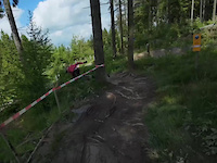
- By canadaka
 Trailforks & contributors
 - Admins: Sasse82, elreyrules, cemoorelife
- #3177 - 221,593 views
- germany activity log | embed map of Germany mountain bike trails | germany mountain biking points of interest polygons
Downloading of trail gps tracks in kml & gpx formats is enabled for Germany.
You must login to download files.