close
-
Layers w
- Weather Layers
- Pro
- Pro
- Pro
- Pro
- Pro
- Pro
- More Layers
- Pro
- Pro
- Pro
- Pro
-
Upgrade to

3D
Trail Conditions
- Unknown
- Snow Groomed
- Snow Packed
- Snow Covered
- Snow Cover Partial
- Freeze/thaw Cycle
- Icy
- Prevalent Mud
- Wet
- Variable
- Ideal
- Dry
- Very Dry
Trail Flow (Ridden Direction)
Trailforks scans users ridelogs to determine the most popular direction each trail is ridden. A good flowing trail network will have most trails flowing in a single direction according to their intension.
The colour categories are based on what percentage of riders are riding a trail in its intended direction.
The colour categories are based on what percentage of riders are riding a trail in its intended direction.
- > 96%
- > 90%
- > 80%
- > 70%
- > 50%
- < 50%
- bi-directional trail
- no data
Trail Last Ridden
Trailforks scans ridelogs to determine the last time a trail was ridden.
- < 2 days
- < 1 week
- < 2 weeks
- < 1 month
- < 6 months
- > 6 months
Trail Ridden Direction
The intended direction a trail should be ridden.
- Downhill Only
- Downhill Primary
- Both Directions
- Uphill Primary
- Uphill Only
- One Direction
Contribute Details
Colors indicate trail is missing specified detail.
- Description
- Photos
- Description & Photos
- Videos
Trail Popularity ?
Trailforks scans ridelogs to determine which trails are ridden the most in the last 9 months.
Trails are compared with nearby trails in the same city region with a possible 25 colour shades.
Think of this as a heatmap, more rides = more kinetic energy = warmer colors.
- most popular
- popular
- less popular
- not popular
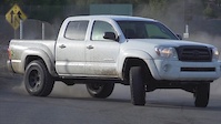
ATV/ORV/OHV Filter
Max Vehicle Width
inches
US Cell Coverage
Legend

Radar Time
Activity Recordings
Trailforks uses anonymized public activity data.
?
Activity Recordings
Trailforks uses anonymized public activity data.
?
Personal Heatmap
▶
Activity Types
all
/
none
▶
Options
2
Date range
month
–
Winter Trails
Warning
A routing network for winter maps does not exist. Selecting trails using the winter trails layer has been disabled.
Missing Trails
Most Popular
Least Popular
Trails are colored based on popularity. The more popular a trail is, the more red. Less popular trails trend towards green.
Jump Magnitude Heatmap
Heatmap of where riders jump on trails. Zoom in to see individual jumps, click circles to view jump details.
BC Backroad Status
![map legend]()
Service Road Atlas is a free to use, community-driven service for viewing and creating reports on the numerous back-country service roads around B.C. and Alberta.

Slope Aspect
Direction the slope faces
Trails Deemphasized
Trails are shown in grey.
Only show trails with no bike usage.
Suggested Layers
Based on selected activity type
Save the current map location and zoom level as your default home location whenever this page is loaded.
Save
No description for Geyserville has been added yet!
Login or register to submit one.
Activities Click to view
- Mountain Bike
25 trails
- Gravel Bike
0 trails
- Adaptive Bike
- Horse
20 trails
- Hike
27 trails
- Trail Running
27 trails
Region Details
- 1
- 9
- 14
- 1
Region Status
Open as of Aug 27, 2025Stats
- Avg Trail Rating
- Trails (view details)
- 26
- Trails Mountain Bike
- 25
- Trails Horse
- 20
- Trails Hike
- 27
- Trails Trail Running
- 27
- Total Distance
- 38 miles
- Total Descent
- 12,521 ft
- Total Vertical
- 1,056 ft
- Highest Trailhead
- 1,318 ft
- Reports
- 84
- Photos
- 49
- Ridden Counter
- 1,574
Sub Regions
-
Lake Sonoma
- 9
- 12
- 1
Popular Geyserville Mountain Biking Trails
• 75 ★ 4.0 • 3,296 ft • 142 ft • 220 •
Popular blue difficulty singletrack. This multi-use trail can be used both directions. On average it takes 4 minutes to complete this trail.
• 100 ★ 3.3 • 3,343 ft • 244 ft • 218 •
Popular blue difficulty singletrack. This multi-use trail can be used both directions. On average it takes 4 minutes to complete this trail.
• 95 ★ 4.0 • 4,730 ft • 179 ft • 187 •
Combined with , this is an easy and beautiful ride in this area. Wooded sections with an easy grade and sweeping turns transition to meadows with vistas of the lake and bridge. Watch for hikers & equestrians on weekends.
• 80 ★ 3.7 • 4,908 ft • 140 ft • 170 •
Combined with , this is an easy and beautiful ride in this area. Wooded sections with an easy grade and sweeping turns transition to meadows with vistas of the lake and bridge. Watch for hikers & equestrians on weekends.
• 70 ★ 3.5 • 2 miles • 258 ft • 148 •
Popular blue difficulty singletrack. This multi-use trail can be used both directions. On average it takes 12 minutes to complete this trail.
• 65 ★ 2.7 • 11 miles • 2,506 ft • 117 •
This is a great, flowey singletrack ride. Usual flow is clockwise. Individual climbs are not that tough, but by the end of the ride it wears you down. Also, at about mile 26 is by far the longest and toughest climb of the ride. Best to...
Photos of Geyserville Mountain Bike
Videos of Geyserville Mountain Bike


Recent Trail Reports
| status | trail | date | condition | info | user |
|---|---|---|---|---|---|
| Field Targets | May 26, 2025 @ 6:48am May 26, 2025 | Dry | cedarnfrens | ||
| Crowleys Lake Loop | Oct 20, 2024 @ 10:19pm Oct 20, 2024 | Ideal | RomanMark | ||
| Boar Scat Loop | Mar 23, 2024 @ 4:50pm Mar 23, 2024 | Wet | mtntrail | ||
| Outcrop | Mar 23, 2024 @ 4:50pm Mar 23, 2024 | Prevalent Mud | mtntrail | ||
| Half a Canoe Loop | Mar 23, 2024 @ 4:50pm Mar 23, 2024 | Prevalent Mud | mtntrail | ||
| North Slope | Mar 23, 2024 @ 4:50pm Mar 23, 2024 | Wet | mtntrail | ||
| Little Flat | Oct 14, 2023 @ 5:34am Oct 14, 2023 | Dry | MTBFTW | ||
| Wulfow Shortcut | Oct 14, 2023 @ 5:34am Oct 14, 2023 | Very Dry | MTBFTW | ||
| Cove | Oct 14, 2023 @ 5:34am Oct 14, 2023 | Dry | MTBFTW | ||
| South Lake | Apr 18, 2022 @ 8:25am Apr 18, 2022 | Prevalent Mud | jyalpert |
Activity Feed
| username | action | type | title | date |
|---|---|---|---|---|
| RFgnsuDc | ridden | trail | activity #92611116 | Apr 14, 2026 @ 11:28am Apr 14, 2026 |
| Flacofalcon | comment | trail | activity #90864213 | Mar 19, 2026 @ 9:52am Mar 19, 2026 |
| Mtb-Bayarea | wishlist | trail | activity #90606314 | Mar 15, 2026 @ 12:00am Mar 15, 2026 |
| Rowser | wishlist | region | activity #90530954 | Mar 13, 2026 @ 10:34pm Mar 13, 2026 |
| JoelCook1 | wishlist | trail | activity #84210849 | Nov 15, 2025 @ 3:23pm Nov 15, 2025 |
Recent Comments
| username | type | title | comment | date |
|---|---|---|---|---|
| trail | We | Mar 19, 2026 @ 9:52am Mar 19, 2026 | ||
| trail | This is one of the worst and most boring... | Apr 18, 2022 @ 8:24am Apr 18, 2022 | ||
| trail | I tried it last week. It faded into the tick... | Mar 28, 2022 @ 6:43am Mar 28, 2022 | ||
| trail | Horses & recent rains have made a mess of... | Nov 12, 2021 @ 11:04am Nov 12, 2021 | ||
| trail | Once you make it past the road, very nice... | May 9, 2021 @ 1:01am May 9, 2021 |
Local Badges
-

10 Blue Trails14 awarded -

Epic Mountain Bike Climb 2k44 awarded -

Climbing 10k Badge6 awarded -

Mountain Biking 100k Badge0 awarded -

Epic Ride Descent 2k44 awarded -

Descent 10k Badge6 awarded
Activity Type Stats
| activitytype | trails | distance | descent | descent distance | total vertical | rating | global rank | state rank | photos | reports | routes | ridelogs |
|---|---|---|---|---|---|---|---|---|---|---|---|---|
| Mountain Bike | 25 | 36 miles | 11,972 ft | 17 miles | 1,056 ft | #6,070 | #2,056 | 47 | 84 | 1,537 | ||
| Horse | 20 | #3,230 | #1,844 | 32 | ||||||||
| Hike | 27 | 38 miles | 12,523 ft | 18 miles | 1,056 ft | #6,046 | #2,115 | 2 | 84 | 142 | ||
| Trail Running | 27 | 38 miles | 12,523 ft | 18 miles | 1,056 ft | #5,473 | #1,729 | 84 | 170 |
Frequently Asked Questions About Geyserville
▼
What are the best places to ride in Geyserville?
Geyserville has 1 areas to explore for mountain biking. The top rated areas are:
▼
What are the highest rated mountain biking trails in Geyserville?
The highest rated mountain biking trails in Geyserville are:
- Cove (4/5)
- Crowleys Lake Loop (4/5)
- Wulfow Shortcut (4/5)
- North Slope (3.9/5)
- Oak Knoll (3.9/5)
▼
What is the best time of the year to ride in Geyserville?
Based on ride log data, the most popular months to ride in Geyserville are:
- April (15 activities)
- July (9 activities)
- May (8 activities)
▼
Where can I park to ride in Geyserville?
There are 6 parking locations listed in Geyserville. The most popular parking spots are: View all parking and trailhead locations on the map to plan your visit.
Activities
- By markholloway
 Trailforks Map Team & contributors
 - Admins: SCTC, SCRP, ninertom
- #47827 - 1,103 views
- geyserville activity log | embed map of Geyserville mountain bike trails | geyserville mountain biking points of interest
Downloading of trail gps tracks in kml & gpx formats is enabled for Geyserville.
You must login to download files.