close
-
Layers w
- Weather Layers
- Pro
- Pro
- Pro
- Pro
- Pro
- Pro
- More Layers
- Pro
- Pro
- Pro
- Pro
-
Upgrade to

3D
Trail Conditions
- Unknown
- Snow Groomed
- Snow Packed
- Snow Covered
- Snow Cover Partial
- Freeze/thaw Cycle
- Icy
- Prevalent Mud
- Wet
- Variable
- Ideal
- Dry
- Very Dry
Trail Flow (Ridden Direction)
Trailforks scans users ridelogs to determine the most popular direction each trail is ridden. A good flowing trail network will have most trails flowing in a single direction according to their intension.
The colour categories are based on what percentage of riders are riding a trail in its intended direction.
The colour categories are based on what percentage of riders are riding a trail in its intended direction.
- > 96%
- > 90%
- > 80%
- > 70%
- > 50%
- < 50%
- bi-directional trail
- no data
Trail Last Ridden
Trailforks scans ridelogs to determine the last time a trail was ridden.
- < 2 days
- < 1 week
- < 2 weeks
- < 1 month
- < 6 months
- > 6 months
Trail Ridden Direction
The intended direction a trail should be ridden.
- Downhill Only
- Downhill Primary
- Both Directions
- Uphill Primary
- Uphill Only
- One Direction
Contribute Details
Colors indicate trail is missing specified detail.
- Description
- Photos
- Description & Photos
- Videos
Trail Popularity ?
Trailforks scans ridelogs to determine which trails are ridden the most in the last 9 months.
Trails are compared with nearby trails in the same city region with a possible 25 colour shades.
Think of this as a heatmap, more rides = more kinetic energy = warmer colors.
- most popular
- popular
- less popular
- not popular
ATV/ORV/OHV Filter
Max Vehicle Width
inches
US Cell Coverage
Legend

Radar Time
Activity Recordings
Trailforks uses anonymized public activity data.
?
Activity Recordings
Trailforks uses anonymized public activity data.
?
Personal Heatmap
▶
Activity Types
all
/
none
▶
Options
2
Date range
month
–
Winter Trails
Warning
A routing network for winter maps does not exist. Selecting trails using the winter trails layer has been disabled.
Missing Trails
Most Popular
Least Popular
Trails are colored based on popularity. The more popular a trail is, the more red. Less popular trails trend towards green.
Jump Magnitude Heatmap
Heatmap of where riders jump on trails. Zoom in to see individual jumps, click circles to view jump details.
BC Backroad Status
![map legend]()
Service Road Atlas is a free to use, community-driven service for viewing and creating reports on the numerous back-country service roads around B.C. and Alberta.

Slope Aspect
Direction the slope faces
Trails Deemphasized
Trails are shown in grey.
Only show trails with no bike usage.
Suggested Layers
Based on selected activity type
Save the current map location and zoom level as your default home location whenever this page is loaded.
Save
No description for Ghala has been added yet!
Login or register to submit one.
Region Details
- 12
- 1
- 13
- 13
- 6
Stats
- Avg Trail Rating
- Trails (view details)
- 47
- Trails Mountain Bike
- 45
- Trails E-Bike
- 17
- Trails Horse
- 1
- Trails Hike
- 45
- Trails Trail Running
- 45
- Trails Dirtbike/Moto
- 2
- Total Distance
- 88 miles
- Total Descent
- 7,858 ft
- Total Vertical
- 2,071 ft
- Highest Trailhead
- 2,155 ft
- Reports
- 80
- Photos
- 88
- Ridden Counter
- 980
Popular Ghala Mountain Biking Trails
• 95 ★ 5.0 • 2 miles • 241 ft • 96 •
An undulating track around the hills of Bowsher. Enjoy views over the surrounding Wadi and sand dunes.
• 85 ★ 5.0 • 3 miles • 337 ft • 68 •
Steep climbs, steep descents, you'll always be working on this fun rollercoaster in its own little Oasis. Keep an eye out for the foxes!
• 65 ★ 5.0 • 1,594 ft • 19 ft • 51 •
The kids loop next to Trail, created for the Race
• 90 ★ 4.0 • 4,072 ft • 161 ft • 40 •
Great views of Muscat and the Bousher plantations from this old farmers' trail in the hills behind bousher. This is not a managed trail so expect some loose rocks, but generally it is a fun addition to any ride.
• 95 ★ 5.0 • 1 mile • 150 ft • 39 •
Low-tech singletrack with gentle climbs and descents. Features the bermy descent and some beginner introductions to tech.
Ghala Mountain Bike Routes
4 miles • 340 ft • 1 • Loop •
A fun singletrack loop, with some tough but short ascents and descents thrown in.
33 miles • 2,365 ft • 8 • Loop •
A tour of all the singletrack in the Bousher/Ansab area. Plenty of sharp climbs to sap your energy, but...
1 mile • 222 ft • 3 • Out & Back •
The high hiking line above the wadi - very tough climbs on a bike from the Sa'al end, you may need to walk...
12 miles • 3,869 ft • 10 • Loop •
A route to take in all the Sa'al Singletrack. A collection of tough trails and a big climb, come prepared...
1 mile • 95 ft • 1 • Loop •
The megapro route for the Races. Takes in part of the adults track and all of the kids track - a rockier...
1,562 ft • 19 ft • 6 • Loop •
The normal route for kids to take. Turn right at the split for the Megapro route.
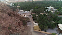
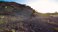
Photos of Ghala Mountain Bike
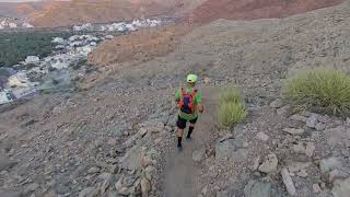
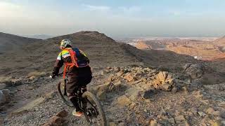
Videos of Ghala Mountain Bike
trail: Panorama Trail
0:56 |
42 |
Jun 3, 2023
0:45 |
6 |
Jun 3, 2023
trail: Al Thawarah
3:09 |
117 |
Feb 7, 2024 , Muscat
trail: Al Thawarah
10:23 |
136 |
Feb 7, 2024 , Muscat
trail: Fun-Ja
7:40 |
253 |
Jun 8, 2021 , Muscat
trail: Fun-Ja
9:03 |
246 |
Jun 1, 2021 , Muscat
Recent Trail Reports
| status | trail | date | condition | info | user |
|---|---|---|---|---|---|
| Ghalapurna Circuit Bousher | Apr 20, 2026 @ 6:32pm (Asia/Muscat) Apr 20, 2026 | Dry | amphalon | ||
| Kenji K's Ascent Bousher | Apr 20, 2026 @ 6:32pm (Asia/Muscat) Apr 20, 2026 | Dry | amphalon | ||
| Bousher Farmers' Trail Bousher | Apr 20, 2026 @ 6:32pm (Asia/Muscat) Apr 20, 2026 | Dry | amphalon | ||
| Bullet Trail Bousher | Feb 2, 2026 @ 7:01pm (Asia/Muscat) Feb 2, 2026 | Dry | amphalon | ||
| Panorama Trail Bousher | Oct 23, 2025 @ 4:27pm (Asia/Muscat) Oct 23, 2025 | Very Dry | AhsanAVAocJ | ||
| Ansab-Falaj Pipeline 2 Bousher | Oct 19, 2025 @ 5:13pm (Asia/Muscat) Oct 19, 2025 | Unknown | AhsanAVAocJ | ||
| Ansab-Falaj Pipeline Bousher | Oct 19, 2025 @ 5:13pm (Asia/Muscat) Oct 19, 2025 | Unknown | AhsanAVAocJ | ||
| Bousher Mount Everest Bousher | Sep 19, 2024 @ 9:08pm Sep 19, 2024 | Very Dry | ziadj7p7zu | ||
| The Playground Muscat Bousher | Aug 30, 2024 @ 12:59am Aug 30, 2024 | Unknown | ziadj7p7zu | ||
| Spark Entrance Bousher | Feb 6, 2024 @ 8:22am Feb 6, 2024 | Ideal | MEDC |
Activity Feed
| username | action | type | title | date |
|---|---|---|---|---|
| amphalon | add | report | activity #93059900 and 2 more | Apr 20, 2026 @ 8:53pm Apr 20, 2026 |
| AbdullahlXn7Js | wishlist | trail | activity #92970635 and 1 more | Apr 19, 2026 @ 12:16pm Apr 19, 2026 |
| SaidM | comment | report | activity #90842601 | Mar 19, 2026 @ 12:05am Mar 19, 2026 |
| amphalon | add | report | activity #90841582 | Mar 18, 2026 @ 11:23pm Mar 18, 2026 |
| danvector | like | directory | activity #90272367 | Mar 9, 2026 @ 10:06am Mar 9, 2026 |
Recent Comments
| username | type | title | comment | date |
|---|---|---|---|---|
| report | 👍 | Oct 23, 2025 @ 9:39am Oct 23, 2025 | ||
| trail | A comprehensive trail for MTB workout,... | May 9, 2025 @ 11:46pm May 9, 2025 | ||
| report | Thanks | Sep 27, 2024 @ 4:01am Sep 27, 2024 | ||
| report | thanks for your comment. the trail was built... | Sep 21, 2024 @ 1:18am Sep 21, 2024 | ||
| trail | Trail is good for kids but a little hard to hard | Jan 20, 2024 @ 10:29pm Jan 20, 2024 |
Local Badges
-

10 Green Trails63 awarded -

10 Blue Trails74 awarded -

Epic Ride Climb 2k164 awarded -

Climbing 10k Badge77 awarded -

Climbing 100k Badge13 awarded -

Epic Ride Descent 2k167 awarded
Bike & Skill Parks
| name | type | city | rating |
|---|---|---|---|
| Trailfoxes Skills Park | skill park | Muscat |
Activity Type Stats
| activitytype | trails | distance | descent | descent distance | total vertical | rating | global rank | state rank | photos | reports | routes | ridelogs |
|---|---|---|---|---|---|---|---|---|---|---|---|---|
| Mountain Bike | 45 | 78 miles | 5,778 ft | 30 miles | 1,286 ft | 85 | 79 | 14 | 11,990 | |||
| E-Bike | 17 | 22 miles | 1,191 ft | 6 miles | 1,165 ft | 1 | 52 | 2 | 47 | |||
| Horse | 1 | 2 miles | 82 ft | 3 | ||||||||
| Hike | 45 | 85 miles | 6,726 ft | 33 miles | 2,070 ft | 2 | 79 | 2 | 432 | |||
| Trail Running | 45 | 85 miles | 6,726 ft | 33 miles | 2,070 ft | 79 | 2 | 83 | ||||
| Dirtbike/Moto | 2 | 3 miles | 804 ft | 3 | 8 |
Activities
Trails
Points of Interest
- ghala activity log | embed map of Ghala mountain bike trails |
Downloading of trail gps tracks in kml & gpx formats is enabled for Ghala.
You must login to download files.