close
-
Layers w
- Weather Layers
- Pro
- Pro
- Pro
- Pro
- Pro
- Pro
- More Layers
- Pro
- Pro
- Pro
- Pro
-
Upgrade to

3D
Trail Conditions
- Unknown
- Snow Groomed
- Snow Packed
- Snow Covered
- Snow Cover Partial
- Freeze/thaw Cycle
- Icy
- Prevalent Mud
- Wet
- Variable
- Ideal
- Dry
- Very Dry
Trail Flow (Ridden Direction)
Trailforks scans users ridelogs to determine the most popular direction each trail is ridden. A good flowing trail network will have most trails flowing in a single direction according to their intension.
The colour categories are based on what percentage of riders are riding a trail in its intended direction.
The colour categories are based on what percentage of riders are riding a trail in its intended direction.
- > 96%
- > 90%
- > 80%
- > 70%
- > 50%
- < 50%
- bi-directional trail
- no data
Trail Last Ridden
Trailforks scans ridelogs to determine the last time a trail was ridden.
- < 2 days
- < 1 week
- < 2 weeks
- < 1 month
- < 6 months
- > 6 months
Trail Ridden Direction
The intended direction a trail should be ridden.
- Downhill Only
- Downhill Primary
- Both Directions
- Uphill Primary
- Uphill Only
- One Direction
Contribute Details
Colors indicate trail is missing specified detail.
- Description
- Photos
- Description & Photos
- Videos
Trail Popularity ?
Trailforks scans ridelogs to determine which trails are ridden the most in the last 9 months.
Trails are compared with nearby trails in the same city region with a possible 25 colour shades.
Think of this as a heatmap, more rides = more kinetic energy = warmer colors.
- most popular
- popular
- less popular
- not popular
ATV/ORV/OHV Filter
Max Vehicle Width
inches
US Cell Coverage
Legend

Radar Time
Activity Recordings
Trailforks uses anonymized public activity data.
?
Activity Recordings
Trailforks uses anonymized public activity data.
?
Personal Heatmap
▶
Activity Types
all
/
none
▶
Options
2
Date range
month
–
Winter Trails
Warning
A routing network for winter maps does not exist. Selecting trails using the winter trails layer has been disabled.
Missing Trails
Most Popular
Least Popular
Trails are colored based on popularity. The more popular a trail is, the more red. Less popular trails trend towards green.
Jump Magnitude Heatmap
Heatmap of where riders jump on trails. Zoom in to see individual jumps, click circles to view jump details.
BC Backroad Status
![map legend]()
Service Road Atlas is a free to use, community-driven service for viewing and creating reports on the numerous back-country service roads around B.C. and Alberta.

Slope Aspect
Direction the slope faces
Trails Deemphasized
Trails are shown in grey.
Only show trails with no bike usage.
Suggested Layers
Based on selected activity type
Save the current map location and zoom level as your default home location whenever this page is loaded.
SaveCity of Gig Harbor, "The Maritime City"
The city has multiple bike trails and hiking/jogging trails within its region.
The city has multiple bike trails and hiking/jogging trails within its region.
eBikes Allowed:
No
AKA: Gig Harbor
Links
Activities Click to view
- Mountain Bike
111 trails
- E-Bike
13 trails
- Gravel Bike
1 trails
- Adaptive Bike
1 trails
- Horse
39 trails
- Hike
97 trails
- Trail Running
96 trails
Region Details
- 9
- 1
- 34
- 21
- 3
- 2
Region Status
Open as of Jun 17, 2026Stats
- Avg Trail Rating
- Trails (view details)
- 71
- Trails Mountain Bike
- 113
- Trails E-Bike
- 13
- Trails Gravel Bike
- 1
- Trails Adaptive Bike
- 1
- Trails Horse
- 39
- Trails Hike
- 97
- Trails Trail Running
- 96
- Total Distance
- 27 miles
- Total Descent
- 2,890 ft
- Total Vertical
- 236 ft
- Highest Trailhead
- 353 ft
- Reports
- 1,983
- Photos
- 75
- Ridden Counter
- 29,995
Sub Regions
-
360 Trails
- 24
- 20
- 3
- 1
-
Key Central Forest
- 6
-
McCormick Forest Park
- 4
Popular Gig Harbor Mountain Biking Trails
• 90 ★ 4.1 • 3 miles • 286 ft • 1,566 •
Fun, flowy trail with berms, drops, doubles, and some optional skinnies/drops. A few nice punchy climbs make sure you get a workout.
• 90 ★ 4.0 • 2,159 ft • 2 ft • 1,372 •
Connector trail from the new lot at Gateway Park to 360 Trails. Two-way trail with an extra little loop that's one way downhill.
• 100 ★ 4.7 • 1,391 ft • 0 ft • 1,357 •
Fun advanced gap jump line. There are three lines at the start, this is the middle line.
• 95 ★ 5.0 • 682 ft • 4 ft • 1,224 •
Progression line. 1ft to 4ft drops, long wide landings, hip jump, shark fin hip jump.
• 100 ★ 4.6 • 1,237 ft • 0 ft • 1,218 •
Reasonably sized gap jumps. Nothing too big. There is a hip about half way down. If you can't ride the hip, stay to the right of the hip to maintain speed. There are three jump lines at the start, this is the one on the right.
• 80 ★ 4.7 • 1,869 ft • 30 ft • 1,177 •
Short but sweet... New machine-excavated trail with fun drops, berms, and tables. Mostly intermediate but with a couple bigger jumps/drops with options to ride around. Still getting groomed but it's definitely the new fun way back to...
• 85 ★ 4.5 • 4,213 ft • 118 ft • 1,124 •
A nice XC alternative to the road. Not very technical but good switchbacks and short punchy climbs to keep you on your toes.
• 95 ★ 4.6 • 1,007 ft • 0 ft • 1,120 •
When wet this is a puddle laden trail. Series of berms, small roots, and the like. Decent trail, a bit too tight to get real speed on it.
Gig Harbor Mountain Bike Routes
5 miles • 372 ft • 5 •
This is an easy-to-follow route in Key Central Forest that includes the major "descending" sections,...
★ 3.0 • 6 miles • 687 ft • 21 • Loop •
a little uphill, a little downhill with some technical xc thrown in. about 45 minutes if you're in decent...
5 miles • 444 ft • 10 • Race •
This is a tentative route for the Budu 2020 MTB race. This course was scouted and tested by volunteers,...
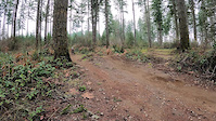
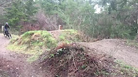
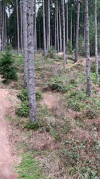
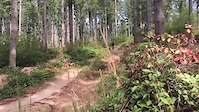
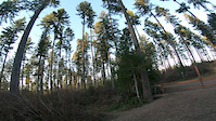
Photos of Gig Harbor Mountain Bike
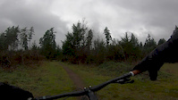
Videos of Gig Harbor Mountain Bike
trail: Juice Box
0:15 |
350 |
Feb 6, 2022

trail: Blood Pressure
0:11 |
459 |
Nov 6, 2021
trail: Blood Pressure
0:26 |
627 |
Jun 2, 2021
trail: Blood Pressure
0:27 |
500 |
Apr 8, 2021
trail: OG - Jump Line
0:08 |
314 |
Jan 16, 2021

trail: Blood Pressure
0:11 |
686 |
May 12, 2020
trail: OT (Overtime) - Jump Line
0:05 |
361 |
Feb 22, 2020
trail: Curve Ball
0:00 |
203 |
Dec 9, 2019
Recent Trail Reports
Activity Feed
| username | action | type | title | date |
|---|---|---|---|---|
| Brandonbridin | ridden | trail | activity #97274062 | Jun 18, 2026 @ 1:44pm 3 days |
| ajhall24 | add | report | activity #97204917 and 7 more | Jun 17, 2026 @ 12:59pm Jun 17, 2026 |
| Brandonbridin | add | photo | activity #97152248 and 1 more | Jun 16, 2026 @ 6:03pm Jun 16, 2026 |
| skithehill | wishlist | trail | activity #97089789 | Jun 15, 2026 @ 11:21pm Jun 15, 2026 |
| Bugbuns | add | photo | activity #96399120 | Jun 6, 2026 @ 12:49pm Jun 6, 2026 |
Recent Comments
| username | type | title | comment | date |
|---|---|---|---|---|
| trail | Just so you know half the photos arnt on... | May 30, 2026 @ 9:42pm May 30, 2026 | ||
| trail | The last gap seems to have a little more kick... | Apr 19, 2025 @ 10:40pm Apr 19, 2025 | ||
| trail | Actually easier to clean this than the blue... | Mar 26, 2025 @ 8:54pm Mar 26, 2025 | ||
| trail | Surprisingly flowy for a XC trail. Good fun | Mar 26, 2025 @ 8:53pm Mar 26, 2025 | ||
| trail | While Evergreen did a fantastic job with the... | Jan 24, 2025 @ 4:10pm Jan 24, 2025 |
Local Badges
-

10 Blue Trails591 awarded -

Epic Ride Climb 2k2 awarded -

Climbing 10k Badge44 awarded -

Climbing 100k Badge0 awarded -

Epic Ride Descent 2k2 awarded -

Descent 10k Badge44 awarded
Bike & Skill Parks
| name | type | city | rating |
|---|---|---|---|
| 360 Pump Track | skill park | Gig Harbor |
Activity Type Stats
| activitytype | trails | distance | descent | descent distance | total vertical | rating | global rank | state rank | photos | reports | routes | ridelogs |
|---|---|---|---|---|---|---|---|---|---|---|---|---|
| Mountain Bike | 111 | 26 miles | 2,874 ft | 12 miles | 236 ft | #446 | #165 | 139 | 1,984 | 6 | 14,810 | |
| E-Bike | 13 | 3,061 ft | 46 ft | 1,526 ft | 49 ft | #6,945 | #2,082 | 1,625 | 717 | |||
| Gravel Bike | 1 | #593 | #1,125 | 1 | 38 | |||||||
| Adaptive Bike | 1 | #578 | #1,866 | |||||||||
| Horse | 39 | 6 miles | 305 ft | 2 miles | 203 ft | #2,068 | #1,153 | 124 | ||||
| Hike | 97 | 23 miles | 2,195 ft | 10 miles | 236 ft | #5,128 | #1,808 | 1,915 | 2 | 471 | ||
| Trail Running | 96 | 23 miles | 2,195 ft | 10 miles | 236 ft | #4,336 | #1,326 | 1,915 | 2 | 921 |
Frequently Asked Questions About Gig Harbor
▼
What are the best places to ride in Gig Harbor?
Gig Harbor has 6 areas to explore for mountain biking. The top rated areas are:
▼
What are the highest rated mountain biking trails in Gig Harbor?
The highest rated mountain biking trails in Gig Harbor are:
- Juice Box (4.4/5)
- Quick Release (4.4/5)
- OT (Overtime) - Jump Line (4.4/5)
- OG - Jump Line (4.4/5)
- Blood Pressure (4.4/5)
▼
What is the best time of the year to ride in Gig Harbor?
Based on ride log data, the most popular months to ride in Gig Harbor are:
- July (250 activities)
- May (214 activities)
- June (198 activities)
▼
Where can I park to ride in Gig Harbor?
There are 4 parking locations listed in Gig Harbor. The most popular parking spots are:
- Mountain Biker / Hikers / Park Users Parking Lot.
- Gateway Equestrian Trailer Parking ONLY
- Parking
- Parking
Activities
Trails
Points of Interest
- By jmahler
 TRAILFORKS WMBC Amb & contributors
 - Admins: EMBA-C2S, EMBA SOSO, EMBA-C2S
- #10695 - 8,289 views
- gig harbor activity log | embed map of Gig Harbor mountain bike trails | gig harbor mountain biking points of interest polygons
Downloading of trail gps tracks in kml & gpx formats is enabled for Gig Harbor.
You must login to download files.