close
-
Layers w
- Weather Layers
- Pro
- Pro
- Pro
- Pro
- Pro
- Pro
- More Layers
- Pro
- Pro
- Pro
- Pro
-
Upgrade to

3D
Trail Conditions
- Unknown
- Snow Groomed
- Snow Packed
- Snow Covered
- Snow Cover Partial
- Freeze/thaw Cycle
- Icy
- Prevalent Mud
- Wet
- Variable
- Ideal
- Dry
- Very Dry
Trail Flow (Ridden Direction)
Trailforks scans users ridelogs to determine the most popular direction each trail is ridden. A good flowing trail network will have most trails flowing in a single direction according to their intension.
The colour categories are based on what percentage of riders are riding a trail in its intended direction.
The colour categories are based on what percentage of riders are riding a trail in its intended direction.
- > 96%
- > 90%
- > 80%
- > 70%
- > 50%
- < 50%
- bi-directional trail
- no data
Trail Last Ridden
Trailforks scans ridelogs to determine the last time a trail was ridden.
- < 2 days
- < 1 week
- < 2 weeks
- < 1 month
- < 6 months
- > 6 months
Trail Ridden Direction
The intended direction a trail should be ridden.
- Downhill Only
- Downhill Primary
- Both Directions
- Uphill Primary
- Uphill Only
- One Direction
Contribute Details
Colors indicate trail is missing specified detail.
- Description
- Photos
- Description & Photos
- Videos
Trail Popularity ?
Trailforks scans ridelogs to determine which trails are ridden the most in the last 9 months.
Trails are compared with nearby trails in the same city region with a possible 25 colour shades.
Think of this as a heatmap, more rides = more kinetic energy = warmer colors.
- most popular
- popular
- less popular
- not popular
ATV/ORV/OHV Filter
Max Vehicle Width
inches
US Cell Coverage
Legend

Radar Time
Activity Recordings
Trailforks uses anonymized public activity data.
?
Activity Recordings
Trailforks uses anonymized public activity data.
?
Personal Heatmap
▶
Activity Types
all
/
none
▶
Options
2
Date range
month
–
Winter Trails
Warning
A routing network for winter maps does not exist. Selecting trails using the winter trails layer has been disabled.
Missing Trails
Most Popular
Least Popular
Trails are colored based on popularity. The more popular a trail is, the more red. Less popular trails trend towards green.
Jump Magnitude Heatmap
Heatmap of where riders jump on trails. Zoom in to see individual jumps, click circles to view jump details.
BC Backroad Status
![map legend]()
Service Road Atlas is a free to use, community-driven service for viewing and creating reports on the numerous back-country service roads around B.C. and Alberta.

Slope Aspect
Direction the slope faces
Trails Deemphasized
Trails are shown in grey.
Only show trails with no bike usage.
Suggested Layers
Based on selected activity type
Save the current map location and zoom level as your default home location whenever this page is loaded.
SaveGigean [ ʒi.ʒɑ̃] est une commune française située dans l'est du département de l'Hérault, en région Occitanie. Depuis le 31 décembre 2002, elle fait partie de la communauté d'agglomération Sète Agglopôle Méditerranée. Gigean fait également partie de l'unité urbaine de Sète
This region uses the Uk/Euro style trail grading system.
Activities Click to view
- Mountain Bike
74 trails
- E-Bike
45 trails
- Hike
47 trails
- Trail Running
46 trails
Region Details
- 40
- 8
- 7
- 18
- 1
Region Status
Open as of Jan 3, 2026Stats
- Avg Trail Rating
- Trails (view details)
- 74
- Trails Mountain Bike
- 74
- Trails E-Bike
- 45
- Trails Gravel Bike
- 5
- Trails Adaptive Bike
- 6
- Trails Hike
- 47
- Trails Trail Running
- 46
- Total Distance
- 40 miles
- Total Descent Distance
- 17 miles
- Total Descent
- 7,957 ft
- Total Vertical
- 718 ft
- Highest Trailhead
- 737 ft
- Reports
- 42
- Photos
- 104
- Ridden Counter
- 392
Popular Gigean Mountain Biking Trails
• 90 ★ 0.0 • 1,181 ft • 0 ft • 55 •
smooth and flowy single with natural berms, roots ; feels like in the mountains :) hard to pass when returning to parking.
• 95 ★ 0.0 • 2,316 ft • 10 ft • 53 •
joli single à pente très douce dans la pinede pour rejoindre le parking
• 100 ★ 0.0 • 1,276 ft • 0 ft • 36 •
Popular red difficulty singletrack. This mountain bike primary trail can be used downhill primary. It features berm and drop. On average it takes minutes to complete this trail.
• 90 ★ 0.0 • 1,526 ft • 0 ft • 31 •
pas de danger, pas de saut sur cette ligne qui mérite d'etre en bleu en comparaison avec sa voisine "la street" qui reste rouge
• 85 ★ 0.0 • 1,004 ft • 0 ft • 27 •
small flat rocky steps ...by steps...by steps all the way down...but somehow smooth and easy. Full suspension won't feel a thing.
• 40 ★ 0.0 • 3,031 ft • 7 ft • 27 •
pente tres légere et aucun obstacle, plutot vert / crosscountry style
• 90 ★ 0.0 • 830 ft • 0 ft • 25 •
Experimental track...made with suspended bmx in mind (fingercrossbmx !!)...small but playful features for not so big bicycles :)
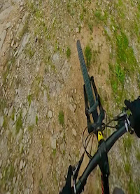
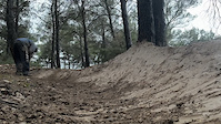
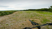
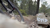
Photos of Gigean Mountain Bike
Videos of Gigean Mountain Bike
trail: La Street
0:00 |
|
Jul 27, 2023
trail: La Street
0:16 |
22 |
Jul 27, 2023
trail: La Street
0:00 |
|
Jul 27, 2023
trail: La Street
0:26 |
28 |
Jul 27, 2023
trail: Enduro
7:23 |
53 |
Dec 2, 2019
trail: Enduro
7:50 |
44 |
Dec 2, 2019

trail: Enduro
6:17 |
26 |
Dec 2, 2019

trail: Enduro
5:04 |
5 |
Dec 2, 2019
Recent Trail Reports
| status | trail | date | condition | info | user |
|---|---|---|---|---|---|
| ACCES "CRETE" | Jan 2, 2026 @ 1:41pm (Europe/Paris) Jan 2, 2026 | Unknown | Jeanchris | ||
| A75 | Jan 2, 2026 @ 1:41pm (Europe/Paris) Jan 2, 2026 | Unknown | Jeanchris | ||
| La Street | Jan 2, 2026 @ 1:41pm (Europe/Paris) Jan 2, 2026 | Unknown | Jeanchris | ||
| Little Wood | Jan 2, 2026 @ 1:41pm (Europe/Paris) Jan 2, 2026 | Dry | Jeanchris | ||
| Enduro 2 | Jan 2, 2026 @ 1:41pm (Europe/Paris) Jan 2, 2026 | Ideal | Jeanchris | ||
| LES MARCHES | Jan 2, 2026 @ 1:41pm (Europe/Paris) Jan 2, 2026 | Ideal | Jeanchris | ||
| Acces Tour de Garde | Jan 2, 2026 @ 1:41pm (Europe/Paris) Jan 2, 2026 | Ideal | Jeanchris | ||
| Blaugrund | Jun 20, 2024 @ 10:06am Jun 20, 2024 | Variable | TZI | ||
| L'Autre Finale | Feb 1, 2022 @ 1:27am Feb 1, 2022 | Ideal | Petrus3888 | ||
| La Pinède | Feb 1, 2022 @ 1:27am Feb 1, 2022 | Ideal | Petrus3888 |
Activity Feed
| username | action | type | title | date |
|---|---|---|---|---|
| freerider48 | add | poi | activity #94539895 and 8 more | May 11, 2026 @ 10:19pm May 11, 2026 |
| BluddundNaggig | wishlist | region | activity #91973669 | Apr 5, 2026 @ 6:39am Apr 5, 2026 |
| mat69 | wishlist | region | activity #90499789 | Mar 13, 2026 @ 10:39am Mar 13, 2026 |
| Jeanchris | add | report | activity #86552991 and 3 more | Jan 3, 2026 @ 3:37am Jan 3, 2026 |
| Simon5qDJxQ | wishlist | trail | activity #84093877 | Nov 13, 2025 @ 3:27pm Nov 13, 2025 |
Recent Comments
| username | type | title | comment | date |
|---|---|---|---|---|
| trail | Probably the toughest climb of la gardiole ?... | Jul 29, 2023 @ 2:54pm Jul 29, 2023 |
Local Badges
-

Epic Mountain Bike Climb 2k0 awarded -

Climbing 10k Badge0 awarded -

Mountain Biking 100k Badge0 awarded -

Epic Ride Descent 2k0 awarded -

Descent 10k Badge0 awarded -

Descent 100k Badge0 awarded
Bike & Skill Parks
| name | type | city | rating |
|---|---|---|---|
| Pumptrack Gigean | skill park | Gigean |
Activity Type Stats
| activitytype | trails | distance | descent | descent distance | total vertical | rating | global rank | state rank | photos | reports | routes | ridelogs |
|---|---|---|---|---|---|---|---|---|---|---|---|---|
| Mountain Bike | 74 | 40 miles | 7,956 ft | 17 miles | 719 ft | #3,927 | #124 | 104 | 42 | 311 | ||
| E-Bike | 45 | 29 miles | 4,823 ft | 12 miles | 719 ft | #3,743 | #214 | 37 | 87 | |||
| Gravel Bike | 5 | 1 mile | 259 ft | 2,589 ft | 423 ft | 8 | ||||||
| Adaptive Bike | 6 | 2 miles | 272 ft | 3,255 ft | 423 ft | 3 | ||||||
| Hike | 47 | 27 miles | 5,043 ft | 12 miles | 719 ft | #5,962 | #204 | 40 | 15 | |||
| Trail Running | 46 | 26 miles | 5,043 ft | 12 miles | 719 ft | #5,577 | #198 | 40 | 51 |
Frequently Asked Questions About Gigean
▼
What are the highest rated mountain biking trails in Gigean?
The highest rated mountain biking trails in Gigean are:
- TGV TeïvaGrosVélo (4.1/5)
- Abbaye Botanique (4/5)
- La Pinède (0/5)
- Enduro 2 (0/5)
- Tektonik (0/5)
▼
What is the best time of the year to ride in Gigean?
Based on ride log data, the most popular months to ride in Gigean are:
- November (5 activities)
- October (4 activities)
- July (2 activities)
▼
Where can I park to ride in Gigean?
There are 1 parking locations listed in Gigean. The most popular parking spots are:
▼
What is the longest trail in Gigean?
The longest trail in Gigean is Tektonik at 5,112 ft. View all trails sorted by distance.
Activities
Trails
- By freerider48
 TRAILFORKS TFFRANCE & contributors
 - Admins: kikou, provencemb, qfeger
- #36844 - 676 views
- gigean activity log | embed map of Gigean mountain bike trails | gigean mountain biking points of interest
Downloading of trail gps tracks in kml & gpx formats is enabled for Gigean.
You must login to download files.