close
-
Layers w
- Weather Layers
- Pro
- Pro
- Pro
- Pro
- Pro
- Pro
- More Layers
- Pro
- Pro
- Pro
- Pro
-
Upgrade to

3D
Trail Conditions
- Unknown
- Snow Groomed
- Snow Packed
- Snow Covered
- Snow Cover Partial
- Freeze/thaw Cycle
- Icy
- Prevalent Mud
- Wet
- Variable
- Ideal
- Dry
- Very Dry
Trail Flow (Ridden Direction)
Trailforks scans users ridelogs to determine the most popular direction each trail is ridden. A good flowing trail network will have most trails flowing in a single direction according to their intension.
The colour categories are based on what percentage of riders are riding a trail in its intended direction.
The colour categories are based on what percentage of riders are riding a trail in its intended direction.
- > 96%
- > 90%
- > 80%
- > 70%
- > 50%
- < 50%
- bi-directional trail
- no data
Trail Last Ridden
Trailforks scans ridelogs to determine the last time a trail was ridden.
- < 2 days
- < 1 week
- < 2 weeks
- < 1 month
- < 6 months
- > 6 months
Trail Ridden Direction
The intended direction a trail should be ridden.
- Downhill Only
- Downhill Primary
- Both Directions
- Uphill Primary
- Uphill Only
- One Direction
Contribute Details
Colors indicate trail is missing specified detail.
- Description
- Photos
- Description & Photos
- Videos
Trail Popularity ?
Trailforks scans ridelogs to determine which trails are ridden the most in the last 9 months.
Trails are compared with nearby trails in the same city region with a possible 25 colour shades.
Think of this as a heatmap, more rides = more kinetic energy = warmer colors.
- most popular
- popular
- less popular
- not popular
ATV/ORV/OHV Filter
Max Vehicle Width
inches
US Cell Coverage
Legend

Radar Time
Activity Recordings
Trailforks uses anonymized public activity data.
?
Activity Recordings
Trailforks uses anonymized public activity data.
?
Personal Heatmap
▶
Activity Types
all
/
none
▶
Options
2
Date range
month
–
Winter Trails
Warning
A routing network for winter maps does not exist. Selecting trails using the winter trails layer has been disabled.
Missing Trails
Most Popular
Least Popular
Trails are colored based on popularity. The more popular a trail is, the more red. Less popular trails trend towards green.
Jump Magnitude Heatmap
Heatmap of where riders jump on trails. Zoom in to see individual jumps, click circles to view jump details.
BC Backroad Status
![map legend]()
Service Road Atlas is a free to use, community-driven service for viewing and creating reports on the numerous back-country service roads around B.C. and Alberta.

Slope Aspect
Direction the slope faces
Trails Deemphasized
Trails are shown in grey.
Only show trails with no bike usage.
Suggested Layers
Based on selected activity type
Save the current map location and zoom level as your default home location whenever this page is loaded.
Save
No description for Gijon has been added yet!
Login or register to submit one.
This region uses the Uk/Euro style trail grading system.
Activities Click to view
- Mountain Bike
60 trails
- E-Bike
58 trails
- Gravel Bike
2 trails
- Adaptive Bike
2 trails
- Hike
60 trails
- Trail Running
60 trails
Region Details
- 8
- 2
- 18
- 18
- 9
Region Status
Caution as of Apr 5, 2026Stats
- Avg Trail Rating
- Trails (view details)
- 55
- Trails Mountain Bike
- 60
- Trails E-Bike
- 58
- Trails Gravel Bike
- 2
- Trails Adaptive Bike
- 2
- Trails Horse
- 2
- Trails Hike
- 60
- Trails Trail Running
- 60
- Total Distance
- 23 miles
- Total Descent
- 11,307 ft
- Total Vertical
- 2,083 ft
- Highest Trailhead
- 2,094 ft
- Reports
- 87
- Photos
- 28
- Ridden Counter
- 1,149
Popular Gijon Mountain Biking Trails
• 80 ★ 5.0 • 1,273 ft • 0 ft • 39 •
La nueva zona superior del 18 es sensiblemente más fácil que la segunda parte. Se parece mucho a los dubbies de la parte superior del 8 pero aún más divertida y con más flow. En el cruce con y el 8 hay que fijarse bien, porque el...
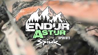
• 90 ★ 4.5 • 1 mile • 3 ft • 37 •
Circuito utilizado para competición open enduroastur , TC1los Vivales , muy entretenido se divide en 3 zonas la primera muy divertida con montículos enlazados terminando con curvas cerradas , salimos a una zona intermedia de pedaleo...
• 95 ★ 0.0 • 1,774 ft • 16 ft • 33 •
Popular blue difficulty singletrack. This multi-use trail can be used downhill primary. It features drop, rock garden and wallride. On average it takes 3 minutes to complete this trail.
• 60 ★ 5.0 • 3,917 ft • 35 ft • 30 •
Es un desvío del 8/Vivales una vez cruzada la pista forestal. Tiene tres drops de casi un metro de altura que no se pueden rodar ni evitar, aunque si caminar. Después tiene secciones con mucha pendiente. Con barro es complicado. Para...
• 90 ★ 0.0 • 5,089 ft • 34 ft • 30 •
Popular white difficulty paved path. This multi-use trail can be used both directions and has a easy overall physical rating with a 34 ft green climb. Trail visibility is always easy to follow.
Gijon Mountain Bike Routes
22 miles • 2,465 ft • 0 • Loop •
Ruta de 35 km que sube desde gijon hasta la olla, cementerio de deva, área recreativa de deva, la camocha...
Photos of Gijon Mountain Bike
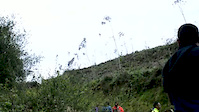
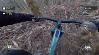
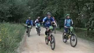
Videos of Gijon Mountain Bike
trail: Cuetos Bike
0:15 |
147 |
Jun 7, 2017
trail: El Ancla
2:20 |
143 |
Oct 16, 2023 , Gijon
trail: el 18
4:41 |
191 |
Oct 16, 2023 , Gijon
trail: La Venta
3:35 |
176 |
Oct 16, 2023 , Gijon
trail: Deku1
2:06 |
170 |
Feb 8, 2023 , Gijon
trail: Los Vivales
564 |
Mar 10, 2017 , Gijon

trail: Tablas (seccion baja)
545 |
Mar 10, 2017 , Gijon

trail: La Guarner
586 |
Mar 10, 2017 , Gijon
Recent Trail Reports
| status | trail | date | condition | info | user |
|---|---|---|---|---|---|
| El Pincho | Apr 5, 2026 @ 5:29pm (Europe/Madrid) Apr 5, 2026 | Ideal | pinheiroi | ||
| ARGAYU de Deva 2 | Dec 14, 2025 @ 9:28pm (Europe/Madrid) Dec 14, 2025 | Ideal | pinheiroi | ||
| El Ancla | Jan 12, 2025 @ 9:54am Jan 12, 2025 | Wet | Heztor | ||
| Upper 18 | Jan 12, 2025 @ 9:54am Jan 12, 2025 | Wet | Heztor | ||
| Los Vivales | Jan 12, 2025 @ 9:54am Jan 12, 2025 | Wet | Heztor | ||
| el 18 | Dec 29, 2024 @ 10:17am Dec 29, 2024 | Variable | pinheiroi | ||
| Los Troncos | Jan 2, 2025 @ 8:27am Jan 2, 2025 | Ideal | pinheiroi | ||
| Fuente Santa de Caldones | Jan 1, 2025 @ 3:31am Jan 1, 2025 | Variable | pinheiroi | ||
| La Z de Deva | Jan 1, 2025 @ 3:30am Jan 1, 2025 | Ideal | pinheiroi | ||
| Ñora B | Dec 22, 2024 @ 9:18am Dec 22, 2024 | Prevalent Mud | pinheiroi |
Activity Feed
| username | action | type | title | date |
|---|---|---|---|---|
| pinheiroi | add | trail | activity #97051899 | Jun 15, 2026 @ 10:39am Jun 15, 2026 |
| pinheiroi | add | report | activity #91981353 | Apr 5, 2026 @ 8:30am Apr 5, 2026 |
| JulioYT | wishlist | trail | activity #90692559 | Mar 16, 2026 @ 8:46am Mar 16, 2026 |
| Angelreing | update | trail | activity #89447886 and 3 more | Feb 23, 2026 @ 10:16pm Feb 23, 2026 |
| pinheiroi | add | trail | activity #89447863 | Feb 23, 2026 @ 10:14pm Feb 23, 2026 |
Recent Comments
| username | type | title | comment | date |
|---|---|---|---|---|
| trail | Muy muy cerrado de maleza, apenas se intuye el... | Aug 1, 2023 @ 2:42am Aug 1, 2023 | ||
| report | Queda por limpiar y arreglar un pequeño tramo... | Mar 9, 2021 @ 12:02pm Mar 9, 2021 | ||
| trail | Ahora mismo tras las lluvias de hace 2 semana,... | Nov 22, 2020 @ 1:58pm Nov 22, 2020 | ||
| trail | Con peraltes y un par de dubbies. Muy guapa. | Sep 18, 2020 @ 10:06am Sep 18, 2020 | ||
| trail | Para mi es negra, no azul. Los dos “muros”... | Feb 6, 2020 @ 7:19am Feb 6, 2020 |
Local Badges
-

Epic Mountain Bike Climb 2k96 awarded -

Climbing 10k Badge31 awarded -

Mountain Biking 100k Badge4 awarded -

Epic Ride Descent 2k96 awarded -

Descent 10k Badge31 awarded -

Descent 100k Badge4 awarded
Bike & Skill Parks
| name | type | city | rating |
|---|---|---|---|
| Pumptrack Gijon | skill park | Gijon | |
| Skatepark Jove | skill park | Gijon | |
| Skatepark Gijon | skill park | Gijon |
Activity Type Stats
| activitytype | trails | distance | descent | descent distance | total vertical | rating | global rank | state rank | photos | reports | routes | ridelogs |
|---|---|---|---|---|---|---|---|---|---|---|---|---|
| Mountain Bike | 60 | 23 miles | 11,306 ft | 15 miles | 2,083 ft | #3,492 | #242 | 28 | 87 | 1 | 4,795 | |
| E-Bike | 58 | 23 miles | 10,659 ft | 15 miles | 2,083 ft | #2,960 | #342 | 79 | 1 | 409 | ||
| Gravel Bike | 2 | #297 | #69 | 11 | ||||||||
| Adaptive Bike | 2 | #316 | #136 | |||||||||
| Horse | 2 | 7 | ||||||||||
| Hike | 60 | 23 miles | 11,306 ft | 15 miles | 2,083 ft | #4,805 | #318 | 80 | 383 | |||
| Trail Running | 60 | 23 miles | 11,306 ft | 15 miles | 2,083 ft | #4,206 | #309 | 80 | 61 |
Frequently Asked Questions About Gijon
▼
What are the highest rated mountain biking trails in Gijon?
The highest rated mountain biking trails in Gijon are:
- el 18 (4.3/5)
- El 9 (4.3/5)
- Tablas (seccion baja) (4.2/5)
- Cuetos Bike (4.2/5)
- La Guarner (4.2/5)
▼
What is the best time of the year to ride in Gijon?
Based on ride log data, the most popular months to ride in Gijon are:
- June (11 activities)
- April (5 activities)
- December (4 activities)
▼
Where can I park to ride in Gijon?
▼
What is the longest trail in Gijon?
The longest trail in Gijon is Los Vivales at 2.2 km. View all trails sorted by distance.
Activities
Trails
Points of Interest
- By Lolus747
 & contributors
 - Admins: apply
- #16432 - 4,913 views
- gijon activity log | embed map of Gijon mountain bike trails | gijon mountain biking points of interest
Downloading of trail gps tracks in kml & gpx formats is enabled for Gijon.
You must login to download files.