close
-
Layers w
- Weather Layers
- Pro
- Pro
- Pro
- Pro
- Pro
- Pro
- More Layers
- Pro
- Pro
- Pro
- Pro
-
Upgrade to

3D
Trail Conditions
- Unknown
- Snow Groomed
- Snow Packed
- Snow Covered
- Snow Cover Partial
- Freeze/thaw Cycle
- Icy
- Prevalent Mud
- Wet
- Variable
- Ideal
- Dry
- Very Dry
Trail Flow (Ridden Direction)
Trailforks scans users ridelogs to determine the most popular direction each trail is ridden. A good flowing trail network will have most trails flowing in a single direction according to their intension.
The colour categories are based on what percentage of riders are riding a trail in its intended direction.
The colour categories are based on what percentage of riders are riding a trail in its intended direction.
- > 96%
- > 90%
- > 80%
- > 70%
- > 50%
- < 50%
- bi-directional trail
- no data
Trail Last Ridden
Trailforks scans ridelogs to determine the last time a trail was ridden.
- < 2 days
- < 1 week
- < 2 weeks
- < 1 month
- < 6 months
- > 6 months
Trail Ridden Direction
The intended direction a trail should be ridden.
- Downhill Only
- Downhill Primary
- Both Directions
- Uphill Primary
- Uphill Only
- One Direction
Contribute Details
Colors indicate trail is missing specified detail.
- Description
- Photos
- Description & Photos
- Videos
Trail Popularity ?
Trailforks scans ridelogs to determine which trails are ridden the most in the last 9 months.
Trails are compared with nearby trails in the same city region with a possible 25 colour shades.
Think of this as a heatmap, more rides = more kinetic energy = warmer colors.
- most popular
- popular
- less popular
- not popular
ATV/ORV/OHV Filter
Max Vehicle Width
inches
US Cell Coverage
Legend

Radar Time
Activity Recordings
Trailforks uses anonymized public activity data.
?
Activity Recordings
Trailforks uses anonymized public activity data.
?
Personal Heatmap
▶
Activity Types
all
/
none
▶
Options
2
Date range
month
–
Winter Trails
Warning
A routing network for winter maps does not exist. Selecting trails using the winter trails layer has been disabled.
Missing Trails
Most Popular
Least Popular
Trails are colored based on popularity. The more popular a trail is, the more red. Less popular trails trend towards green.
Jump Magnitude Heatmap
Heatmap of where riders jump on trails. Zoom in to see individual jumps, click circles to view jump details.
BC Backroad Status
![map legend]()
Service Road Atlas is a free to use, community-driven service for viewing and creating reports on the numerous back-country service roads around B.C. and Alberta.

Slope Aspect
Direction the slope faces
Trails Deemphasized
Trails are shown in grey.
Only show trails with no bike usage.
Suggested Layers
Based on selected activity type
Save the current map location and zoom level as your default home location whenever this page is loaded.
SavePopular Trail Networks
view all areas »
No description for Gipuzkoa has been added yet!
Login or register to submit one.
This region uses the Uk/Euro style trail grading system.
Activities Click to view
- Mountain Bike
760 trails
- E-Bike
741 trails
- Horse
91 trails
- Hike
735 trails
- Trail Running
729 trails
- Dirtbike/Moto
40 trails
- Observed Trials
57 trails
Region Details
- 302
- 2
- 49
- 251
- 131
- 25
Stats
- Avg Trail Rating
- Trails (view details)
- 771
- Trails Mountain Bike
- 760
- Trails E-Bike
- 741
- Trails Gravel Bike
- 18
- Trails Adaptive Bike
- 71
- Trails Winter Fat Bike
- 17
- Trails Horse
- 91
- Trails Hike
- 735
- Trails Trail Running
- 729
- Trails Dirtbike/Moto
- 40
- Trails Observed Trials
- 57
- Trails Snowshoe
- 1
- Trails Backcountry Ski
- 1
- Trails Nordic Ski
- 1
- Total Distance
- 804 miles
- Total Descent Distance
- 365 miles
- Total Descent
- 216,760 ft
- Total Vertical
- 4,315 ft
- Highest Trailhead
- 4,319 ft
- Reports
- 5,319
- Photos
- 1,368
- Ridden Counter
- 27,814
Sub Regions
- Antzuola (7)
- Arrasate (91)
- Alto Deba (29)
- Arrasate Enduro (82)
- Azpeitia (33)
- Azpeiti - YK Riders (29)
- Bergara (9)
- Donostia/San Sebastian (61)
- Elgeta (44)
- Elgeta-Eibar (43)
- Hondarribia (43)
- Jaizkibel (41)
- Irun (154)
- Aiako Harriak (130)
- Elatzeta - Zubeltzu (12)
- SanMar (11)
- Tolosa (144)
- Alegia Mtb Enduro Zirkuitoa (37)
- Aralar Norte (67)
- Berastegi (20)
- Tolosa-Irura (19)
- Usurbil (35)
- Andatza (34)
- Zarautz (114)
- Urola Kosta (112)
- Debabarrena (8)
- Oñati Aldea (45)
Popular Gipuzkoa Mountain Biking Trails
• 100 ★ 4.7 • 3,789 ft • 0 ft • 156 •
Espectacular sendero que aprovecha el desnivel de la ladera del monte de manera magistral, con continuos subes y bajas que se pueden hacer sin dar pedales jugando con el peso del cuerpo. Muy poquitas rocas y raíces, solo en los cruces...
• 100 ★ 4.7 • 5,197 ft • 0 ft • 148 •
Bucólico sendero a través del bosque. Tiene raíces, pequeños apoyos y algún salto, pero la pendiente es controlada, por lo que la velocidad la pone cada uno.
• 100 ★ 3.6 • 4,436 ft • 88 ft • 132 •
Divertida bajada por un sendero con flow y algún repecho traicionero, sale al remonte de y antes da acceso a Artzuko Errota
• 85 ★ 3.4 • 2,536 ft • 0 ft • 128 •
Sendero plagado de raíces y rocas que baja hasta la carretera. Técnico y rápido, espectacular!
• 100 ★ 4.4 • 1,106 ft • 0 ft • 126 •
Seguramente la bajada más larga y completa de las cuatro, tiene de todo, y todo bueno. Ojo con el último tramo antes de la llegada a pista, una laja que en condiciones húmedas puede resultar complicada
• 100 ★ 4.7 • 2,021 ft • 8 ft • 120 •
Un sendero corto pero muy bonito, con el que nos evita ir por la pista hasta el fondo del valle.
Gipuzkoa Mountain Bike Routes
★ 5.0 • 23 miles • 4,497 ft • 8 • Loop •
Marcha de enduro organizada por la gente de Arrasate, con varias alternativas: una para quienes quieren...
★ 5.0 • 15 miles • 4,239 ft • 4 • Loop •
La subida hasta la cresta de Uzturre es exactamente la misma, dando un rodeo a la cumbre por el sur y...
★ 5.0 • 19 miles • 5,124 ft • 14 • Loop •
Una combinación espectacular , donde disfrutaremos de unas vistas inolvidables. Esta ruta tiene todo tipo...
★ 5.0 • 20 miles • 4,763 ft • 18 • Loop •
De nuevo el confinamiento como impulsor de una gran tarde de mountain bike. Por un lado, por la amenaza...
★ 5.0 • 18 miles • 4,856 ft • 14 • Loop •
Recorrido de la martxa de Enduro que se realiza en Elgeta correspondiente al 2026
15 miles • 4,116 ft • 8 • Loop •
Cuatro tramos de bajada: y Kurtzetxiki en el sector sur del pueblo, y las dos secretas ( y la recuperada )...
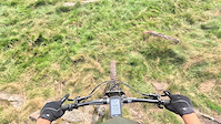
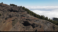
Photos of Gipuzkoa Mountain Bike
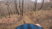
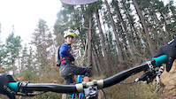
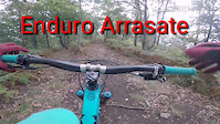
Videos of Gipuzkoa Mountain Bike
trail: Ipuliño Eutera
4:51 |
|
Sep 2, 2024
trail: Zubeltzu Clasic
0:20 |
112 |
Sep 7, 2023

trail: Okil Beltz #1
0:24 |
152 |
Jun 2, 2022
trail: MakWhistler
2:39 |
363 |
Mar 14, 2022
trail: Wild
6:09 |
68 |
Mar 20, 2021
trail: Botas
2:31 |
215 |
Apr 12, 2020
trail: Bakue trail
5:03 |
341 |
Jan 30, 2020
trail: La Niña Bonita
3:46 |
301 |
Jan 30, 2020
Current Trail Warnings
| status | trail | date | condition | user | info |
|---|---|---|---|---|---|
| Txirriskala #1 Alegia Mtb Enduro Zirkuitoa | Jun 16, 2026 @ 10:42am (Europe/Andorra) 2 days | Unknown | Manexegoitz | Pinuak bota due ta tramoren baten eskaloi... | |
| Galdaramuño Elgeta-Eibar | Jun 15, 2026 @ 8:45am (Europe/Madrid) Jun 14, 2026 | Ideal | judastxiki | Trabajos forestales | |
| Putrail Alegia Mtb Enduro Zirkuitoa | Jun 12, 2026 @ 6:57am (Europe/Madrid) Jun 11, 2026 | Unknown | manexbal | Bukaeran basoa ateratzen, bidea... |
Recent Trail Reports
| status | trail | date | condition | info | user |
|---|---|---|---|---|---|
| Azkonabitxa Goikoa Elgeta-Eibar | Jun 18, 2026 @ 7:57am (Europe/Madrid) 10 hours | Ideal | judastxiki | ||
| Sugandila Urola Kosta | Jun 17, 2026 @ 5:01am (Europe/Madrid) 2 days | Dry | andermante | ||
| Enanitos Urola Kosta | Jun 17, 2026 @ 5:00am (Europe/Madrid) 2 days | Unknown | andermante | ||
| Garate-Meagas Urola Kosta | Jun 17, 2026 @ 5:00am (Europe/Madrid) 2 days | Unknown | andermante | ||
| Okil Beltz #4 Alegia Mtb Enduro Zirkuitoa | Jun 16, 2026 @ 10:42am (Europe/Andorra) 2 days | Ideal | Manexegoitz | ||
| Okil Beltz #3 Alegia Mtb Enduro Zirkuitoa | Jun 16, 2026 @ 10:42am (Europe/Andorra) 2 days | Ideal | Manexegoitz | ||
| Okil Beltz #2 Alegia Mtb Enduro Zirkuitoa | Jun 16, 2026 @ 10:42am (Europe/Andorra) 2 days | Ideal | Manexegoitz | ||
| Okil Beltz #1 Alegia Mtb Enduro Zirkuitoa | Jun 16, 2026 @ 10:42am (Europe/Andorra) 2 days | Ideal | Manexegoitz | ||
| Muskulegi Inferior Alegia Mtb Enduro Zirkuitoa | Jun 16, 2026 @ 10:42am (Europe/Andorra) 2 days | Ideal | Manexegoitz | ||
| Muskulegi Medio Alegia Mtb Enduro Zirkuitoa | Jun 16, 2026 @ 10:42am (Europe/Andorra) 2 days | Ideal | Manexegoitz |
Activity Feed
| username | action | type | title | date |
|---|---|---|---|---|
| judastxiki | add | report | activity #97233914 | Jun 17, 2026 @ 10:57pm 10 hours |
| Ktxopo | wishlist | route | activity #97182485 | Jun 17, 2026 @ 7:35am 1 day |
| andermante | add | report | activity #97158608 and 2 more | Jun 16, 2026 @ 8:00pm 2 days |
| ipartrails | rsvp | event | activity #97137571 | Jun 16, 2026 @ 2:20pm 2 days |
| Manexegoitz | add | report | activity #97117194 and 7 more | Jun 16, 2026 @ 9:35am 2 days |
Recent Comments
| username | type | title | comment | date |
|---|---|---|---|---|
| report | está todo el puto dia poniendolos el hijo... | Jun 16, 2026 @ 1:25am 2 days | ||
| trail | Espectacular y exigente sendero de subida,... | Jun 7, 2026 @ 12:23pm Jun 7, 2026 | ||
| trail | Olvidar el anterior comentario, confundí la... | May 19, 2026 @ 6:12am May 19, 2026 | ||
| trail | Mas Negra que roja, solo para gente con nivel. | May 9, 2026 @ 12:27pm May 9, 2026 | ||
| report | Habra que ir a cortar pues | May 2, 2026 @ 2:00am May 2, 2026 |
Local Badges
-

Epic Ride 50k4 awarded -

Completionist0 awarded -

Top 10 Trails0 awarded -
Top 10 Trails0 awarded -
Epic Ride 50k480 awarded -
Epic Ride 50k79 awarded
Bike & Skill Parks
| name | type | city | rating |
|---|---|---|---|
| Irun Pumptrack | skill park | Irun | |
| Legazpi Pumptrack | skill park | Urretxu | |
| Azpeitia Jump Park | skill park | Azpeitia | |
| Pumptrack Zestoa | skill park | Zarautz | |
| PumpTrack Elgeta | skill park | Elgeta |
Upcoming Local Events
Activity Type Stats
| activitytype | trails | distance | descent | descent distance | total vertical | rating | global rank | state rank | photos | reports | routes | ridelogs |
|---|---|---|---|---|---|---|---|---|---|---|---|---|
| Mountain Bike | 760 | 795 miles | 214,885 ft | 363 miles | 4,314 ft | 1,307 | 5,319 | 46 | 36,524 | |||
| E-Bike | 741 | 782 miles | 207,635 ft | 353 miles | 4,314 ft | 34 | 4,735 | 35 | 6,959 | |||
| Gravel Bike | 18 | 21 miles | 1,798 ft | 5 miles | 3,202 ft | 44 | 1 | 253 | ||||
| Adaptive Bike | 71 | 120 miles | 9,137 ft | 31 miles | 3,465 ft | 346 | ||||||
| Winter Fat Bike | 17 | 32 miles | 4,131 ft | 10 miles | 2,762 ft | 6 | 1 | |||||
| Horse | 91 | 102 miles | 22,333 ft | 47 miles | 3,543 ft | 275 | ||||||
| Hike | 735 | 771 miles | 203,645 ft | 349 miles | 4,314 ft | 17 | 5,025 | 10 | 3,138 | |||
| Trail Running | 729 | 765 miles | 202,001 ft | 347 miles | 4,314 ft | 5,014 | 5 | 1,510 | ||||
| Dirtbike/Moto | 40 | 48 miles | 10,830 ft | 24 miles | 3,527 ft | 215 | ||||||
| Observed Trials | 57 | 57 miles | 13,235 ft | 28 miles | 2,969 ft | 78 | 1 | |||||
| Snowshoe | 1 | 5,180 ft | 364 ft | 3,022 ft | 364 ft | 361 | 2 | |||||
| Backcountry Ski | 1 | 5,180 ft | 364 ft | 3,022 ft | 364 ft | 84 | ||||||
| Nordic Ski | 1 | 5,180 ft | 364 ft | 3,022 ft | 364 ft | 361 | 8 |
Frequently Asked Questions About Gipuzkoa
▼
What are the best places to ride in Gipuzkoa?
Gipuzkoa has 18 areas to explore for mountain biking. The top rated areas are:
▼
What are the highest rated mountain biking trails in Gipuzkoa?
The highest rated mountain biking trails in Gipuzkoa are:
- Bakue trail (4.5/5)
- Sustraiak (4.4/5)
- Pagatxa (4.4/5)
- Gozadera (4.4/5)
- Kubota (4.4/5)
▼
What is the best time of the year to ride in Gipuzkoa?
Based on ride log data, the most popular months to ride in Gipuzkoa are:
- July (75 activities)
- October (67 activities)
- December (62 activities)
▼
What is the longest trail in Gipuzkoa?
The longest trail in Gipuzkoa is Canal Araotz at 7.4 miles. View all trails sorted by distance.
Activities
Trails
- By brenthillier
 NSMBA TRAILFORKS & contributors
 - Admins: Altavoz, krasty1002
- #8847 - 9,980 views
- gipuzkoa activity log | embed map of Gipuzkoa mountain bike trails | gipuzkoa mountain biking points of interest
Downloading of trail gps tracks in kml & gpx formats is enabled for Gipuzkoa.
You must login to download files.