close
-
Layers w
- Weather Layers
- Pro
- Pro
- Pro
- Pro
- Pro
- Pro
- More Layers
- Pro
- Pro
- Pro
- Pro
-
Upgrade to

3D
Trail Conditions
- Unknown
- Snow Groomed
- Snow Packed
- Snow Covered
- Snow Cover Partial
- Freeze/thaw Cycle
- Icy
- Prevalent Mud
- Wet
- Variable
- Ideal
- Dry
- Very Dry
Trail Flow (Ridden Direction)
Trailforks scans users ridelogs to determine the most popular direction each trail is ridden. A good flowing trail network will have most trails flowing in a single direction according to their intension.
The colour categories are based on what percentage of riders are riding a trail in its intended direction.
The colour categories are based on what percentage of riders are riding a trail in its intended direction.
- > 96%
- > 90%
- > 80%
- > 70%
- > 50%
- < 50%
- bi-directional trail
- no data
Trail Last Ridden
Trailforks scans ridelogs to determine the last time a trail was ridden.
- < 2 days
- < 1 week
- < 2 weeks
- < 1 month
- < 6 months
- > 6 months
Trail Ridden Direction
The intended direction a trail should be ridden.
- Downhill Only
- Downhill Primary
- Both Directions
- Uphill Primary
- Uphill Only
- One Direction
Contribute Details
Colors indicate trail is missing specified detail.
- Description
- Photos
- Description & Photos
- Videos
Trail Popularity ?
Trailforks scans ridelogs to determine which trails are ridden the most in the last 9 months.
Trails are compared with nearby trails in the same city region with a possible 25 colour shades.
Think of this as a heatmap, more rides = more kinetic energy = warmer colors.
- most popular
- popular
- less popular
- not popular
ATV/ORV/OHV Filter
Max Vehicle Width
inches
US Cell Coverage
Legend

Radar Time
Activity Recordings
Trailforks uses anonymized public activity data.
?
Activity Recordings
Trailforks uses anonymized public activity data.
?
Personal Heatmap
▶
Activity Types
all
/
none
▶
Options
2
Date range
month
–
Winter Trails
Warning
A routing network for winter maps does not exist. Selecting trails using the winter trails layer has been disabled.
Missing Trails
Most Popular
Least Popular
Trails are colored based on popularity. The more popular a trail is, the more red. Less popular trails trend towards green.
Jump Magnitude Heatmap
Heatmap of where riders jump on trails. Zoom in to see individual jumps, click circles to view jump details.
BC Backroad Status
![map legend]()
Service Road Atlas is a free to use, community-driven service for viewing and creating reports on the numerous back-country service roads around B.C. and Alberta.

Slope Aspect
Direction the slope faces
Trails Deemphasized
Trails are shown in grey.
Only show trails with no bike usage.
Suggested Layers
Based on selected activity type
Save the current map location and zoom level as your default home location whenever this page is loaded.
Save
No description for Gitwinksihlkw has been added yet!
Login or register to submit one.
Activities Click to view
- Mountain Bike
12 trails
- E-Bike
9 trails
- Hike
9 trails
- Trail Running
9 trails
Region Details
- 1
- 5
- 4
- 2
Region Status
Caution as of May 28, 2026Stats
- Avg Trail Rating
- Trails (view details)
- 12
- Trails Mountain Bike
- 12
- Trails E-Bike
- 9
- Trails Hike
- 9
- Trails Trail Running
- 9
- Trails ATV/ORV/OHV
- 1
- Total Distance
- 5 miles
- Total Descent Distance
- 3 miles
- Total Descent
- 1,147 ft
- Total Vertical
- 699 ft
- Highest Trailhead
- 830 ft
- Reports
- 183
- Photos
- 33
- Ridden Counter
- 1,369
Sub Regions
-
Saasak' Trail Network
- 4
- 3
- 2
Popular Gitwinksihlkw Mountain Biking Trails
• 85 ★ 4.7 • 3,445 ft • 314 ft • 177 •
The upper half of the Leaping Lizard climb is more challenging and leads only to advanced downhill trails. Use the short blue connector to the lower half of Leaping Lizard for intermediate riders. This section is machine build but has...
• 75 ★ 5.0 • 2,559 ft • 0 ft • 176 •
This is the flow trail northern BC has been waiting for! An advanced level, machine-built flow trail with more features than you will know what to do with. The aptly named trail (Gitwinksilkw is known as the Place of the Lizards") will...
• 95 ★ 5.0 • 3,009 ft • 0 ft • 166 •
The lower half of the Leaping Lizard downhill is a blue flow trail with slightly smaller features to try before working your way up from the top. This is a beautiful machine-built blue flow trail that is perfect for progressing your...
• 70 ★ 4.5 • 2,336 ft • 0 ft • 159 •
The (soon to be named) is the second level of progression in the Saasak' trail network. This machine-built blue flow trail has berms and small to medium table top jumps that have awesome flow. This is the perfect trail to master before...
• 60 ★ 4.8 • 3,973 ft • 325 ft • 154 •
This is the main climbing trail for the Saasak' Hill area that climbs to up to access both the downhill trails and the Saasak' Viewing Platform. This trail is uphill only for bikes, but is used bi-directionally by hikers so please...
• 100 ★ 5.0 • 607 ft • 66 ft • 145 •
Short connector to access the amazing views at the Saasak' Viewing Platform. Please expect 2-way traffic with hikers and bikers on this section. It is best to walk your bike for the final section to the platform if it's busy.
• 45 ★ 4.7 • 1 mile • 412 ft • 122 •
Climb trail to access The Leaping Lizard downhill trails. This is a machine built climb that is relatively smooth but with steeper grades than the other climbs in the network. The very start of the trail (lower section) of the trail is...
• 35 ★ 4.4 • 3,005 ft • 3 ft • 67 •
This is the easiest trail in the Saasak' trail network to develop your skills. It is a machine-built green flow trail with berms, rollers, and a few small table top jumps to develop skills before progressing onto the rest of the network.
Photos of Gitwinksihlkw Mountain Bike
Videos of Gitwinksihlkw Mountain Bike
youtuber
![Leaping Lizard is a Pristine Jump Trail -...]()
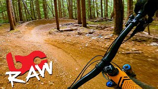
trail: The Leaping Lizard (Upper)
3:38 |
881 |
Oct 28, 2021 , Gitwinksihlkw
youtuber
![Why Is She So Good at Mountain Biking?]()

trail: The Leaping Lizard (Upper)
14:34 |
444 |
Sep 12, 2021 , Gitwinksihlkw
Recent Trail Reports
| status | trail | date | condition | info | user |
|---|---|---|---|---|---|
| [To Be Named] Blue Downhill | May 3, 2026 @ 2:39pm (America/Vancouver) May 3, 2026 | Variable | justin0DOh0w | ||
| The Leaping Lizard (Upper) | May 3, 2026 @ 2:38pm (America/Vancouver) May 3, 2026 | Variable | justin0DOh0w | ||
| Leaping Lizard Climb - Upper | May 3, 2026 @ 2:37pm (America/Vancouver) May 3, 2026 | Variable | justin0DOh0w | ||
| Saasak' Hill Climb | Sep 6, 2025 @ 4:01pm Sep 6, 2025 | Ideal | hobbit88 MORATA | ||
| [To Be Named] Green Downhill | Aug 13, 2025 @ 2:26pm Aug 13, 2025 | Ideal | wilkez TORCA | ||
| Leaping Lizard Climb - Lower | Aug 13, 2025 @ 2:25pm Aug 13, 2025 | Variable | wilkez TORCA | ||
| The Leaping Lizard (Lower) | Aug 13, 2025 @ 2:25pm Aug 13, 2025 | Ideal | wilkez TORCA | ||
| Saasak' Lookout Connector | Mar 27, 2025 @ 4:00pm Mar 27, 2025 | Ideal | SimondA6R3j | ||
| Dam Access Road | Apr 1, 2024 @ 2:46pm Apr 1, 2024 | Ideal | wilkez TORCA |
Activity Feed
| username | action | type | title | date |
|---|---|---|---|---|
| 91tommiller | add | photo | activity #97282656 | Jun 18, 2026 @ 4:34pm 1 day |
| justin0DOh0w | add | report | activity #93984831 and 2 more | May 3, 2026 @ 2:37pm May 3, 2026 |
| mtbglen | wishlist | region | activity #88181708 | Feb 1, 2026 @ 1:01pm Feb 1, 2026 |
| kyleluvsdh | comment | trail | activity #85320392 | Dec 10, 2025 @ 10:24am Dec 10, 2025 |
| eMnwb0 | wishlist | region | activity #82430524 | Oct 15, 2025 @ 10:17pm Oct 15, 2025 |
Recent Comments
| username | type | title | comment | date |
|---|---|---|---|---|
| trail | possible name: Deja Blu | Dec 10, 2025 @ 10:24am Dec 10, 2025 | ||
| trail | Scenic, very bumpy but fun | Aug 21, 2025 @ 8:27pm Aug 21, 2025 | ||
| report | all clear trail maintenance | Mar 19, 2025 @ 12:53pm Mar 19, 2025 | ||
| report | Tree down before switch backs start | Jul 21, 2024 @ 9:39am Jul 21, 2024 | ||
| trail | I’m | Jul 20, 2024 @ 9:40pm Jul 20, 2024 |
Local Badges
-

Epic Mountain Bike Climb 2k0 awarded -

Climbing 10k Badge0 awarded -

Mountain Biking 100k Badge0 awarded -

Epic Ride Descent 2k0 awarded -

Descent 10k Badge0 awarded -

Descent 100k Badge0 awarded
Activity Type Stats
| activitytype | trails | distance | descent | descent distance | total vertical | rating | global rank | state rank | photos | reports | routes | ridelogs |
|---|---|---|---|---|---|---|---|---|---|---|---|---|
| Mountain Bike | 12 | 5 miles | 1,148 ft | 3 miles | 699 ft | #4,648 | #104 | 31 | 183 | 487 | ||
| E-Bike | 9 | 5 miles | 1,148 ft | 3 miles | 699 ft | #8,122 | #131 | 2 | 157 | 10 | ||
| Hike | 9 | 4 miles | 367 ft | 1 mile | 699 ft | #12,893 | #183 | 109 | 81 | |||
| Trail Running | 9 | 4 miles | 367 ft | 1 mile | 699 ft | #12,419 | #181 | 109 | 5 | |||
| ATV/ORV/OHV | 1 | 3,386 ft | 26 ft | 1,539 ft | 26 ft | 4 | 3 |
Frequently Asked Questions About Gitwinksihlkw
▼
What are the best places to ride in Gitwinksihlkw?
Gitwinksihlkw has 1 areas to explore for mountain biking. The top rated areas are:
▼
What are the highest rated mountain biking trails in Gitwinksihlkw?
The highest rated mountain biking trails in Gitwinksihlkw are:
- The Leaping Lizard (Lower) (4.5/5)
- The Leaping Lizard (Upper) (4.5/5)
- Saasak' Hill Climb (4.3/5)
- Leaping Lizard Climb - Upper (4.2/5)
- Leaping Lizard Climb - Lower (4.2/5)
▼
What is the best time of the year to ride in Gitwinksihlkw?
Based on ride log data, the most popular months to ride in Gitwinksihlkw are:
- August (15 activities)
- July (12 activities)
- September (5 activities)
▼
Where can I park to ride in Gitwinksihlkw?
There are 2 parking locations listed in Gitwinksihlkw. The most popular parking spots are:
Activities
Trails
- By aleksa
 TORCA & contributors
 - Admins: BCBR, TrailsBC, BCORMA, DSBC, wheelmaniac3, bcpunk, NBC, PGBRS, aleksa, wilkez
- #46430 - 3,327 views
- gitwinksihlkw activity log | embed map of Gitwinksihlkw mountain bike trails | gitwinksihlkw mountain biking points of interest
Downloading of trail gps tracks in kml & gpx formats is enabled for Gitwinksihlkw.
You must login to download files.