close
-
Layers w
- Weather Layers
- Pro
- Pro
- Pro
- Pro
- Pro
- Pro
- More Layers
- Pro
- Pro
- Pro
- Pro
-
Upgrade to

3D
Trail Conditions
- Unknown
- Snow Groomed
- Snow Packed
- Snow Covered
- Snow Cover Partial
- Freeze/thaw Cycle
- Icy
- Prevalent Mud
- Wet
- Variable
- Ideal
- Dry
- Very Dry
Trail Flow (Ridden Direction)
Trailforks scans users ridelogs to determine the most popular direction each trail is ridden. A good flowing trail network will have most trails flowing in a single direction according to their intension.
The colour categories are based on what percentage of riders are riding a trail in its intended direction.
The colour categories are based on what percentage of riders are riding a trail in its intended direction.
- > 96%
- > 90%
- > 80%
- > 70%
- > 50%
- < 50%
- bi-directional trail
- no data
Trail Last Ridden
Trailforks scans ridelogs to determine the last time a trail was ridden.
- < 2 days
- < 1 week
- < 2 weeks
- < 1 month
- < 6 months
- > 6 months
Trail Ridden Direction
The intended direction a trail should be ridden.
- Downhill Only
- Downhill Primary
- Both Directions
- Uphill Primary
- Uphill Only
- One Direction
Contribute Details
Colors indicate trail is missing specified detail.
- Description
- Photos
- Description & Photos
- Videos
Trail Popularity ?
Trailforks scans ridelogs to determine which trails are ridden the most in the last 9 months.
Trails are compared with nearby trails in the same city region with a possible 25 colour shades.
Think of this as a heatmap, more rides = more kinetic energy = warmer colors.
- most popular
- popular
- less popular
- not popular
ATV/ORV/OHV Filter
Max Vehicle Width
inches
US Cell Coverage
Legend

Radar Time
Activity Recordings
Trailforks uses anonymized public activity data.
?
Activity Recordings
Trailforks uses anonymized public activity data.
?
Personal Heatmap
▶
Activity Types
all
/
none
▶
Options
2
Date range
month
–
Winter Trails
Warning
A routing network for winter maps does not exist. Selecting trails using the winter trails layer has been disabled.
Missing Trails
Most Popular
Least Popular
Trails are colored based on popularity. The more popular a trail is, the more red. Less popular trails trend towards green.
Jump Magnitude Heatmap
Heatmap of where riders jump on trails. Zoom in to see individual jumps, click circles to view jump details.
BC Backroad Status
![map legend]()
Service Road Atlas is a free to use, community-driven service for viewing and creating reports on the numerous back-country service roads around B.C. and Alberta.

Slope Aspect
Direction the slope faces
Trails Deemphasized
Trails are shown in grey.
Only show trails with no bike usage.
Suggested Layers
Based on selected activity type
Save the current map location and zoom level as your default home location whenever this page is loaded.
Save
No description for Glasgow has been added yet!
Login or register to submit one.
This region uses the Uk/Euro style trail grading system.
Activities Click to view
- Mountain Bike
283 trails
- E-Bike
263 trails
- Gravel Bike
0 trails
- Adaptive Bike
0 trails
- Winter Fat Bike
0 trails
- Hike
234 trails
- Trail Running
234 trails
Region Details
- 74
- 67
- 69
- 38
- 29
Region Status
Caution as of Jun 14, 2026Stats
- Avg Trail Rating
- Trails (view details)
- 283
- Trails Mountain Bike
- 283
- Trails E-Bike
- 263
- Trails Hike
- 234
- Trails Trail Running
- 234
- Total Distance
- 167 miles
- Total Descent
- 25,226 ft
- Total Vertical
- 1,596 ft
- Highest Trailhead
- 1,618 ft
- Reports
- 1,729
- Photos
- 431
- Ridden Counter
- 38,538
Sub Regions
-
Alexandra Park
- 6
- 1
- 2
-
Cathkin Braes
- 12
- 10
- 9
- 13
-
Dawsholm Park
- 2
-
Linn Park
-
Mugdock Park
- 5
- 30
- 10
- 4
-
Old Kilpatrick
- 8
- 18
- 12
- 9
-
Pollok Country Park
- 19
- 2
- 2
-
Seven Lochs Wetland Park
- 15
-
The Whangie
- 1
-
Waukmill Glen
- 2
- 1
- 1
Popular Glasgow Mountain Biking Trails
• 100 ★ 4.5 • 971 ft • 0 ft • 756 •
Highly rated popular red difficulty doubletrack. This mountain bike primary trail can be used one direction and has a moderate overall physical rating with a 0 ft blue climb. It features berm. Trail visibility is always easy to follow. On average it takes 3 minutes to complete this trail.
• 95 ★ 3.7 • 2,024 ft • 30 ft • 717 •
Popular blue difficulty singletrack. This mountain bike primary trail can be used downhill only. On average it takes 4 minutes to complete this trail.
• 100 ★ 1.0 • 1,670 ft • 51 ft • 714 •
Popular blue difficulty gravel path. This mountain bike primary trail can be used one direction. Trail visibility is always easy to follow. On average it takes 6 minutes to complete this trail.
• 100 ★ 3.4 • 1,808 ft • 138 ft • 694 •
Popular blue difficulty machine groomed. This mountain bike primary trail can be used uphill only and has a moderate overall physical rating with a 138 ft blue climb. On average it takes 5 minutes to complete this trail.
• 95 ★ 4.0 • 1,188 ft • 0 ft • 688 •
Highly rated popular red difficulty machine groomed. This mountain bike primary trail can be used downhill only and has a moderate overall physical rating. It features drop and rock garden. On average it takes 3 minutes to complete this trail.
• 100 ★ 3.8 • 1,801 ft • 112 ft • 676 •
Popular blue difficulty singletrack. This mountain bike primary trail can be used uphill only. On average it takes 4 minutes to complete this trail.
• 100 ★ 3.0 • 715 ft • 11 ft • 629 •
Popular green difficulty singletrack. This mountain bike primary trail can be used one direction. Trail visibility is always easy to follow. On average it takes 1 minutes to complete this trail.
• 100 ★ 3.8 • 2,585 ft • 18 ft • 622 •
Popular blue difficulty machine groomed. This mountain bike primary trail can be used downhill only and has a easy overall physical rating. It features berm. On average it takes 4 minutes to complete this trail.
Glasgow Mountain Bike Routes
★ 4.2 • 96 miles • 11,896 ft • 44 • Point to Point •
The West Highland Way (Scottish Gaelic: Slighe na Gàidhealtachd an Iar) is a linear long distance...
16 miles • 949 ft • 3 • Loop •
Starting at the Station in Milngavie. Head north out the West Highland Way. When you reach Dumgoyne...
★ 3.0 • 29 miles • 2,414 ft • 12 • Out & Back •
Starting in Clydebank, heading up the Old Kilpatrick hills, cutting across to the Carbeth Inn and...
11 miles • 1,534 ft • 4 •
NICE AND EASY ROUTE WITH FIREROAD UP TILL BURNSCRROK FROM CARBETH
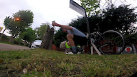
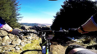
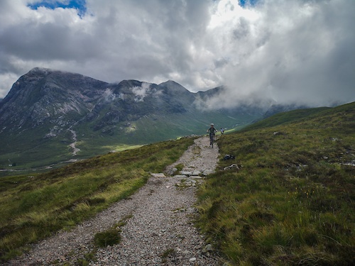
Photos of Glasgow Mountain Bike
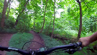
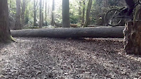
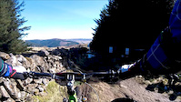
Videos of Glasgow Mountain Bike

trail: Minceurs and Tatties
0:27 |
159 |
Apr 24, 2023

trail: Lockdown
0:25 |
80 |
May 16, 2020
trail: Lockdown
3:54 |
45 |
May 4, 2020

trail: Lockdown
3:50 |
347 |
Apr 21, 2020
trail: Pollok DH
6:12 |
312 |
Jul 22, 2017
trail: Pollok DH
0:31 |
156 |
Apr 30, 2017
trail: Stage 2
11:33 |
191 |
Mar 30, 2017
trail: Stage 2
9:55 |
81 |
Mar 27, 2017
Current Trail Warnings
| status | trail | date | condition | user | info |
|---|---|---|---|---|---|
| Red Circuit | May 28, 2026 @ 8:35am (Europe/London) May 28, 2026 | Ideal | Jxroussel | Large tree still down along stone wall... |
Recent Trail Reports
| status | trail | date | condition | info | user |
|---|---|---|---|---|---|
| Sesame Street | Jun 14, 2026 @ 12:29pm (Europe/London) Jun 14, 2026 | Ideal | andrewyQkzpb | ||
| Bottom Field | Jun 14, 2026 @ 12:29pm (Europe/London) Jun 14, 2026 | Ideal | andrewyQkzpb | ||
| Switchbacks | Jun 14, 2026 @ 12:29pm (Europe/London) Jun 14, 2026 | Ideal | andrewyQkzpb | ||
| Snakey | Jun 14, 2026 @ 12:29pm (Europe/London) Jun 14, 2026 | Ideal | andrewyQkzpb | ||
| Bomber Man | Jun 14, 2026 @ 12:29pm (Europe/London) Jun 14, 2026 | Ideal | andrewyQkzpb | ||
| Minceurs and Tatties | Jun 14, 2026 @ 12:29pm (Europe/London) Jun 14, 2026 | Ideal | andrewyQkzpb | ||
| The Slacks Descent | Jun 14, 2026 @ 12:29pm (Europe/London) Jun 14, 2026 | Ideal | andrewyQkzpb | ||
| Cochno Loch Trail | Jun 14, 2026 @ 12:29pm (Europe/London) Jun 14, 2026 | Prevalent Mud | andrewyQkzpb | ||
| Double Track | May 28, 2026 @ 6:15pm (Europe/Isle_of_Man) May 28, 2026 | Dry | Grahambush | ||
| Cake Walk | May 28, 2026 @ 6:15pm (Europe/Isle_of_Man) May 28, 2026 | Ideal | Grahambush |
National Scenic Trails & Official Routes
-
West Highland Way
- Mountain Bike
- E-Bike
- Hike
- Trail Running
Activity Feed
| username | action | type | title | date |
|---|---|---|---|---|
| andrewyQkzpb | add | report | activity #96972604 and 7 more | Jun 14, 2026 @ 8:35am Jun 14, 2026 |
| Grahambush | add | report | activity #95739228 and 5 more | May 28, 2026 @ 4:09pm May 28, 2026 |
| Jxroussel | add | report | activity #95709250 and 2 more | May 28, 2026 @ 8:30am May 28, 2026 |
| Dougmax11 | add | report | activity #95001201 | May 18, 2026 @ 2:39pm May 18, 2026 |
| Craighudson | add | report | activity #93958245 | May 3, 2026 @ 9:53am May 3, 2026 |
Recent Comments
| username | type | title | comment | date |
|---|---|---|---|---|
| report | Storm Floris dropped a huge tree on it.... | Sep 28, 2025 @ 4:15am Sep 28, 2025 | ||
| trail | Tree down blocking trial | Sep 7, 2025 @ 7:20am Sep 7, 2025 | ||
| trail | Cool trail Grass needs a trim 🎉👌🏼 | Jul 20, 2025 @ 3:04am Jul 20, 2025 | ||
| trail | Cool turns Grass needs a trim | Jul 20, 2025 @ 3:04am Jul 20, 2025 | ||
| trail | Moocho fun , needs a hair cut though 👌🏼 | Jul 20, 2025 @ 3:03am Jul 20, 2025 |
Local Badges
-

Epic Ride Climb 2k156 awarded -

Climbing 10k Badge251 awarded -

Climbing 100k Badge26 awarded -

Epic Ride Descent 2k157 awarded -

Descent 10k Badge253 awarded -

Descent 100k Badge27 awarded
Bike & Skill Parks
| name | type | city | rating |
|---|---|---|---|
| Cathkin Braes Pump Track | skill park | Glasgow | |
| Bearsden BMX Track | skill park | Glasgow | |
| Glasgow BMX Track | skill park | Glasgow |
Activity Type Stats
| activitytype | trails | distance | descent | descent distance | total vertical | rating | global rank | state rank | photos | reports | routes | ridelogs |
|---|---|---|---|---|---|---|---|---|---|---|---|---|
| Mountain Bike | 283 | 165 miles | 25,079 ft | 80 miles | 1,598 ft | #278 | #9 | 418 | 1,729 | 9 | 74,856 | |
| E-Bike | 263 | 158 miles | 23,763 ft | 77 miles | 1,598 ft | #311 | #26 | 2 | 1,583 | 4 | 4,237 | |
| Hike | 234 | 154 miles | 20,686 ft | 73 miles | 1,598 ft | #621 | #21 | 5 | 1,494 | 3 | 1,357 | |
| Trail Running | 234 | 154 miles | 20,686 ft | 73 miles | 1,598 ft | #494 | #19 | 1,494 | 3 | 4,618 |
Frequently Asked Questions About Glasgow
▼
What are the best places to ride in Glasgow?
Glasgow has 10 areas to explore for mountain biking. The top rated areas are:
▼
What are the highest rated mountain biking trails in Glasgow?
The highest rated mountain biking trails in Glasgow are:
- Spexy Beast (4.4/5)
- Minceurs and Tatties (4.3/5)
- Double Dare (4.3/5)
- Air Space (4.2/5)
- Overtoun Cliff Top (4.2/5)
▼
What is the best time of the year to ride in Glasgow?
Based on ride log data, the most popular months to ride in Glasgow are:
- July (275 activities)
- May (187 activities)
- August (187 activities)
▼
Where can I park to ride in Glasgow?
There are 16 parking locations listed in Glasgow. The most popular parking spots are: View all parking and trailhead locations on the map to plan your visit.
Activities
Trails
- By brenthillier
 NSMBA TRAILFORKS & contributors
 - Admins: DMBinS, FLS
- #4462 - 22,920 views
- glasgow activity log | embed map of Glasgow mountain bike trails | glasgow mountain biking points of interest
Downloading of trail gps tracks in kml & gpx formats is enabled for Glasgow.
You must login to download files.