close
-
Layers w
- Weather Layers
- Pro
- Pro
- Pro
- Pro
- Pro
- Pro
- More Layers
- Pro
- Pro
- Pro
- Pro
-
Upgrade to

3D
Trail Conditions
- Unknown
- Snow Groomed
- Snow Packed
- Snow Covered
- Snow Cover Partial
- Freeze/thaw Cycle
- Icy
- Prevalent Mud
- Wet
- Variable
- Ideal
- Dry
- Very Dry
Trail Flow (Ridden Direction)
Trailforks scans users ridelogs to determine the most popular direction each trail is ridden. A good flowing trail network will have most trails flowing in a single direction according to their intension.
The colour categories are based on what percentage of riders are riding a trail in its intended direction.
The colour categories are based on what percentage of riders are riding a trail in its intended direction.
- > 96%
- > 90%
- > 80%
- > 70%
- > 50%
- < 50%
- bi-directional trail
- no data
Trail Last Ridden
Trailforks scans ridelogs to determine the last time a trail was ridden.
- < 2 days
- < 1 week
- < 2 weeks
- < 1 month
- < 6 months
- > 6 months
Trail Ridden Direction
The intended direction a trail should be ridden.
- Downhill Only
- Downhill Primary
- Both Directions
- Uphill Primary
- Uphill Only
- One Direction
Contribute Details
Colors indicate trail is missing specified detail.
- Description
- Photos
- Description & Photos
- Videos
Trail Popularity ?
Trailforks scans ridelogs to determine which trails are ridden the most in the last 9 months.
Trails are compared with nearby trails in the same city region with a possible 25 colour shades.
Think of this as a heatmap, more rides = more kinetic energy = warmer colors.
- most popular
- popular
- less popular
- not popular
ATV/ORV/OHV Filter
Max Vehicle Width
inches
US Cell Coverage
Legend

Radar Time
Activity Recordings
Trailforks uses anonymized public activity data.
?
Activity Recordings
Trailforks uses anonymized public activity data.
?
Personal Heatmap
▶
Activity Types
all
/
none
▶
Options
2
Date range
month
–
Winter Trails
Warning
A routing network for winter maps does not exist. Selecting trails using the winter trails layer has been disabled.
Missing Trails
Most Popular
Least Popular
Trails are colored based on popularity. The more popular a trail is, the more red. Less popular trails trend towards green.
Jump Magnitude Heatmap
Heatmap of where riders jump on trails. Zoom in to see individual jumps, click circles to view jump details.
BC Backroad Status
![map legend]()
Service Road Atlas is a free to use, community-driven service for viewing and creating reports on the numerous back-country service roads around B.C. and Alberta.

Slope Aspect
Direction the slope faces
Trails Deemphasized
Trails are shown in grey.
Only show trails with no bike usage.
Suggested Layers
Based on selected activity type
Save the current map location and zoom level as your default home location whenever this page is loaded.
SaveThis region is Unsanctioned, Ride at your own Risk!
No description for Glen Devon has been added yet! Login or register to submit one. google parking directions
This region uses the Uk/Euro style trail grading system.
Activities Click to view
- Mountain Bike
47 trails
- E-Bike
47 trails
- Hike
36 trails
- Trail Running
36 trails
Region Details
- 23
- 10
- 3
- 8
Region Status
Caution as of Nov 1, 2025Stats
- Avg Trail Rating
- Trails (view details)
- 44
- Trails Mountain Bike
- 47
- Trails E-Bike
- 47
- Trails Horse
- 2
- Trails Hike
- 36
- Trails Trail Running
- 36
- Total Distance
- 24 miles
- Total Descent
- 6,611 ft
- Total Vertical
- 1,341 ft
- Highest Trailhead
- 2,086 ft
- Reports
- 161
- Photos
- 17
- Ridden Counter
- 3,315
Popular Glen Devon Mountain Biking Trails
• 100 ★ 2.0 • 955 ft • 28 ft • 221 • • hike
Popular blue difficulty singletrack. This hike primary trail can be used both directions and has a easy overall physical rating with a 28 ft blue climb. On average it takes 2 minutes to complete this trail.
• 95 ★ 1.0 • 1,007 ft • 0 ft • 191 • • hike
Turning right off the main fire road, you start up a firebreak until you reach a gate at the end of the trees. through the gate and turn right heading up the hill towards the summit. When the trees end on your right, there is a high...
• 100 ★ 4.0 • 801 ft • 0 ft • 191 •
Popular red difficulty singletrack. This mountain bike primary trail can be used downhill primary. On average it takes 1 minutes to complete this trail.
• 85 ★ 4.0 • 1,611 ft • 6 ft • 179 •
Popular black difficulty singletrack. This mountain bike primary trail can be used downhill primary. On average it takes 3 minutes to complete this trail.
• 95 ★ 5.0 • 1,509 ft • 0 ft • 163 •
Popular black difficulty singletrack. This mountain bike primary trail can be used downhill primary. It features jump. On average it takes 3 minutes to complete this trail.
• 75 ★ 1.7 • 2,999 ft • 127 ft • 143 • • hike
Popular blue difficulty primitive. This hike primary trail can be used both directions and has a moderate overall physical rating with a 127 ft black diamond climb. Trail visibility is sometimes hard to follow. On average it takes 12 minutes to complete this trail.
• 80 ★ 3.9 • 3,766 ft • 14 ft • 134 •
Popular black difficulty singletrack. This mountain bike primary trail can be used downhill primary. On average it takes 12 minutes to complete this trail.
• 85 ★ 5.0 • 1,549 ft • 0 ft • 132 •
Popular black difficulty mixed. This mountain bike primary trail can be used downhill primary. On average it takes 5 minutes to complete this trail.
Glen Devon Mountain Bike Routes
★ 4.0 • 13 miles • 514 ft • 0 • Loop •
This is a route which takes in a variety of s, estate tracks, and a small selection of singletrack...
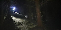
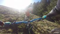
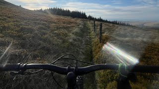
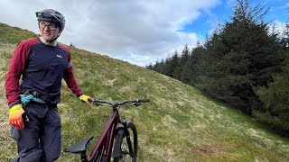
Photos of Glen Devon Mountain Bike
Videos of Glen Devon Mountain Bike
trail: Loamilicious
0:17 |
159 |
Dec 26, 2021
trail: Loamilicious
4:58 |
1132 |
Apr 24, 2017
trail: Loamilicious
3:59 |
123 |
May 7, 2025 , Muckhart
trail: The Dark Side Of The Loam
3:06 |
121 |
May 5, 2025 , Muckhart

trail: Axe breaker
4:50 |
572 |
May 6, 2021 , My City

trail: Outside Right
2:50 |
549 |
May 6, 2021 , My City
Recent Trail Reports
| status | trail | date | condition | info | user |
|---|---|---|---|---|---|
| Access Road | Sep 27, 2025 @ 7:46pm (Europe/London) Sep 27, 2025 | Ideal | Ochils | ||
| Glen Quey Access | Sep 27, 2025 @ 7:41pm (Europe/London) Sep 27, 2025 | Dry | Ochils | ||
| Path | Sep 27, 2025 @ 7:40pm (Europe/London) Sep 27, 2025 | Unknown | Ochils | ||
| Access to trails | Jul 3, 2022 @ 2:18am Jul 3, 2022 | Variable | gav-s | ||
| Dead End Trail | Aug 15, 2021 @ 1:31am Aug 15, 2021 | Variable | arthurwatt | ||
| Access Road | Aug 15, 2021 @ 1:31am Aug 15, 2021 | Variable | arthurwatt | ||
| Access Road | Aug 15, 2021 @ 1:31am Aug 15, 2021 | Ideal | arthurwatt | ||
| Stuck in the middle | Dec 12, 2020 @ 3:58am Dec 12, 2020 | Prevalent Mud | Dafthaggis | ||
| Alternative Finish | May 13, 2019 @ 10:12am May 13, 2019 | Dry | yeti-monster | ||
| Crazy 5 | May 13, 2019 @ 10:12am May 13, 2019 | Dry | yeti-monster |
Activity Feed
| username | action | type | title | date |
|---|---|---|---|---|
| VTQmAC | wishlist | region | activity #93540174 | Apr 27, 2026 @ 2:21pm Apr 27, 2026 |
| Craighudson | add | photo | activity #86964995 | Jan 10, 2026 @ 11:22am Jan 10, 2026 |
| Craighudson | add | photo | activity #86685642 | Jan 5, 2026 @ 3:59am Jan 5, 2026 |
| Craighudson | wishlist | trail | activity #86593793 | Jan 3, 2026 @ 2:01pm Jan 3, 2026 |
| jF6O0G | ridden | trail | activity #86367637 | Dec 31, 2025 @ 1:39am Dec 31, 2025 |
Recent Comments
| username | type | title | comment | date |
|---|---|---|---|---|
| trail | Severe storm damaged, had a struggle pick my... | Aug 17, 2025 @ 8:27am Aug 17, 2025 | ||
| trail | Awesome trail! That and Dollar are the best... | May 5, 2025 @ 2:50pm May 5, 2025 | ||
| report | Some big shifts you've put in up there Harry!... | Apr 12, 2025 @ 6:57am Apr 12, 2025 | ||
| report | Ah no good. Shit cutting fences. Musta been a... | Feb 3, 2025 @ 4:28pm Feb 3, 2025 | ||
| report | was running fine before December -----after 4... | Jan 28, 2025 @ 12:04pm Jan 28, 2025 |
Nearby Areas
| name | distance | ||||
|---|---|---|---|---|---|
| Hillfoot Hill | 5 | 8 | 2.4 km | ||
| Ochil Hills | 3 | 2 | 4.4 km | ||
| Devon Vale | 7 | 1 | 4.6 km | ||
| Littlerigg | 1 | 4.9 km | |||
| Woodhill wood | 1 | 3 | 5.9 km |
Local Badges
-

Completionist0 awarded
Activity Type Stats
| activitytype | trails | distance | descent | descent distance | total vertical | rating | global rank | state rank | photos | reports | routes | ridelogs |
|---|---|---|---|---|---|---|---|---|---|---|---|---|
| Mountain Bike | 47 | 24 miles | 6,611 ft | 12 miles | 1,342 ft | #6,639 | #211 | 17 | 161 | 1 | 1,441 | |
| E-Bike | 47 | 24 miles | 6,611 ft | 12 miles | 1,342 ft | #3,388 | #128 | 141 | 252 | |||
| Horse | 2 | 4,117 ft | 538 ft | 3,402 ft | 604 ft | 41 | ||||||
| Hike | 36 | 21 miles | 2,900 ft | 9 miles | 1,342 ft | #6,135 | #128 | 126 | 118 | |||
| Trail Running | 36 | 21 miles | 2,900 ft | 9 miles | 1,342 ft | #6,091 | #141 | 126 | 77 |
Frequently Asked Questions About Glen Devon
▼
What are the highest rated mountain biking trails in Glen Devon?
The highest rated mountain biking trails in Glen Devon are:
- Crazy 5 (4.2/5)
- The Dark Side Of The Loam (4.2/5)
- Outside Right (4.1/5)
- Axe breaker (4/5)
- Alternative Finish (4/5)
▼
What is the best time of the year to ride in Glen Devon?
Based on ride log data, the most popular months to ride in Glen Devon are:
- July (10 activities)
- April (7 activities)
- August (5 activities)
▼
Where can I park to ride in Glen Devon?
There are 3 parking locations listed in Glen Devon. The most popular parking spots are: View all parking and trailhead locations on the map to plan your visit.
▼
What is the longest trail in Glen Devon?
The longest trail in Glen Devon is Ben Shee Loop at 5.7 km. View all trails sorted by distance.
Activities
- By gav-s
 & contributors
 - Admins: DMBinS, FLS, TTA
- #19711 - 7,449 views
- glen devon activity log | embed map of Glen Devon mountain bike trails | glen devon mountain biking points of interest
Downloading of trail gps tracks in kml & gpx formats is enabled for Glen Devon.
You must login to download files.