close
-
Layers w
- Weather Layers
- Pro
- Pro
- Pro
- Pro
- Pro
- Pro
- More Layers
- Pro
- Pro
- Pro
- Pro
-
Upgrade to

3D
Trail Conditions
- Unknown
- Snow Groomed
- Snow Packed
- Snow Covered
- Snow Cover Partial
- Freeze/thaw Cycle
- Icy
- Prevalent Mud
- Wet
- Variable
- Ideal
- Dry
- Very Dry
Trail Flow (Ridden Direction)
Trailforks scans users ridelogs to determine the most popular direction each trail is ridden. A good flowing trail network will have most trails flowing in a single direction according to their intension.
The colour categories are based on what percentage of riders are riding a trail in its intended direction.
The colour categories are based on what percentage of riders are riding a trail in its intended direction.
- > 96%
- > 90%
- > 80%
- > 70%
- > 50%
- < 50%
- bi-directional trail
- no data
Trail Last Ridden
Trailforks scans ridelogs to determine the last time a trail was ridden.
- < 2 days
- < 1 week
- < 2 weeks
- < 1 month
- < 6 months
- > 6 months
Trail Ridden Direction
The intended direction a trail should be ridden.
- Downhill Only
- Downhill Primary
- Both Directions
- Uphill Primary
- Uphill Only
- One Direction
Contribute Details
Colors indicate trail is missing specified detail.
- Description
- Photos
- Description & Photos
- Videos
Trail Popularity ?
Trailforks scans ridelogs to determine which trails are ridden the most in the last 9 months.
Trails are compared with nearby trails in the same city region with a possible 25 colour shades.
Think of this as a heatmap, more rides = more kinetic energy = warmer colors.
- most popular
- popular
- less popular
- not popular
ATV/ORV/OHV Filter
Max Vehicle Width
inches
US Cell Coverage
Legend

Radar Time
Activity Recordings
Trailforks uses anonymized public activity data.
?
Activity Recordings
Trailforks uses anonymized public activity data.
?
Personal Heatmap
▶
Activity Types
all
/
none
▶
Options
2
Date range
month
–
Winter Trails
Warning
A routing network for winter maps does not exist. Selecting trails using the winter trails layer has been disabled.
Missing Trails
Most Popular
Least Popular
Trails are colored based on popularity. The more popular a trail is, the more red. Less popular trails trend towards green.
Jump Magnitude Heatmap
Heatmap of where riders jump on trails. Zoom in to see individual jumps, click circles to view jump details.
BC Backroad Status
![map legend]()
Service Road Atlas is a free to use, community-driven service for viewing and creating reports on the numerous back-country service roads around B.C. and Alberta.

Slope Aspect
Direction the slope faces
Trails Deemphasized
Trails are shown in grey.
Only show trails with no bike usage.
Suggested Layers
Based on selected activity type
Save the current map location and zoom level as your default home location whenever this page is loaded.
Save
No description for Glen Tilt has been added yet!
Login or register to submit one.
 google parking directions
Primary Trail Type: Cross-Country
google parking directionsThis region uses the Uk/Euro style trail grading system.
Activities Click to view
- Mountain Bike
4 trails
- Hike
4 trails
- Trail Running
4 trails
Region Details
- 1
- 2
- 1
Region Status
Open as of May 23, 2026Stats
- Avg Trail Rating
- Trails (view details)
- 4
- Trails Mountain Bike
- 4
- Trails E-Bike
- 2
- Trails Hike
- 4
- Trails Trail Running
- 4
- Total Distance
- 39 miles
- Total Descent
- 5,789 ft
- Total Vertical
- 2,603 ft
- Highest Trailhead
- 3,101 ft
- Reports
- 15
- Photos
- 42
- Ridden Counter
- 434
Popular Glen Tilt Mountain Biking Trails
• 75 ★ 3.0 • 4 miles • 2,235 ft • 81 •
Good landrover track all the way. Grassy for start of climb (heading WSW) and then rocky for main climb (heading NE). I was able to cycle about 30% of it, and pushed the rest. The track takes you to within 50m of the top of Carn a'...
• 60 ★ 3.4 • 25 miles • 3,289 ft • 79 • • hike
Moderately popular red difficulty mixed. This hike primary trail can be used both directions. On average it takes 6 hours46 minutes to complete this trail.
• 45 ★ 4.5 • 2 miles • 40 ft • 65 •
Moderately popular black difficulty singletrack. This mountain bike primary trail can be used downhill primary. Trail visibility is always easy to follow. On average it takes 33 minutes to complete this trail.
Photos of Glen Tilt Mountain Bike
Videos of Glen Tilt Mountain Bike
youtuber
![MTB Thrills in Scotland's Highlands: Ride...]()
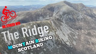
trail: Beinn a Ghlo Loop Trail
24:05 |
370 |
Jul 12, 2023 , Blair Atholl
youtuber
![Mountain biking on Scottish Mountains | Carn...]()
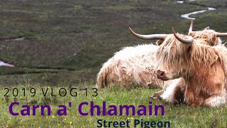
trail: Carn a' Chlarmain Descent
19:03 |
717 |
Feb 6, 2021 , Blair Atholl
Recent Trail Reports
| status | trail | date | condition | info | user |
|---|---|---|---|---|---|
| Carn a' Chlarmain Descent | May 23, 2026 @ 2:57pm (Europe/London) May 23, 2026 | Ideal | edmwillis | ||
| Carn a' Chlarmain Ascent | May 23, 2026 @ 2:57pm (Europe/London) May 23, 2026 | Ideal | edmwillis | ||
| Beinn a Ghlo Loop Trail | Jul 20, 2023 @ 10:44am Jul 20, 2023 | Ideal | fdmtbsc | ||
| Access Road | Oct 8, 2022 @ 3:15am Oct 8, 2022 | Dry | horseye |
Activity Feed
| username | action | type | title | date |
|---|---|---|---|---|
| drstumtb | ridden | trail | activity #97027506 and 1 more | Jun 15, 2026 @ 1:01am Jun 15, 2026 |
| edmwillis | add | report | activity #95477863 and 1 more | May 25, 2026 @ 4:38am May 25, 2026 |
| craigbrock0062 | wishlist | trail | activity #93667534 | Apr 29, 2026 @ 1:00pm Apr 29, 2026 |
| JOwen98 | wishlist | trail | activity #93182729 | Apr 22, 2026 @ 5:10pm Apr 22, 2026 |
| MikensoHT0 | wishlist | trail | activity #90292217 | Mar 9, 2026 @ 3:28pm Mar 9, 2026 |
Recent Comments
| username | type | title | comment | date |
|---|---|---|---|---|
| trail | Route is a better name for it. Based on the... | Jun 19, 2025 @ 7:06am Jun 19, 2025 | ||
| trail | If you are looking for a big high alpine day... | Aug 7, 2023 @ 8:18am Aug 7, 2023 | ||
| trail | In the video by Big Stoozer, 'MTB Thrills In... | Jul 12, 2023 @ 12:51pm Jul 12, 2023 | ||
| trail | A few switch backs too deep and narrow to... | Apr 16, 2022 @ 10:13am Apr 16, 2022 | ||
| report | Actually ridden on the 28th of November 2020 | Dec 15, 2020 @ 12:55am Dec 15, 2020 |
Nearby Areas
| name | distance | ||||
|---|---|---|---|---|---|
| Beinn Dearg | 5.1 km | ||||
| Glenshee | 13.9 km | ||||
| Glen Feshie and Insh | 6 | 12 | 14.9 km | ||
| Strathtay & Grandtully Wood | 4 | 15.3 km | |||
| Glassie Bike Park | 1 | 2 | 15.8 km |
Activity Type Stats
| activitytype | trails | distance | descent | descent distance | total vertical | rating | global rank | state rank | photos | reports | routes | ridelogs |
|---|---|---|---|---|---|---|---|---|---|---|---|---|
| Mountain Bike | 4 | 39 miles | 5,787 ft | 17 miles | 2,602 ft | #5,319 | #158 | 42 | 15 | 463 | ||
| E-Bike | 2 | 28 miles | 4,698 ft | 12 miles | 2,395 ft | 10 | 122 | |||||
| Hike | 4 | 39 miles | 5,787 ft | 17 miles | 2,602 ft | #5,612 | #112 | 15 | 147 | |||
| Trail Running | 4 | 39 miles | 5,787 ft | 17 miles | 2,602 ft | #4,799 | #101 | 15 | 5 |
- By gav-s
 & contributors
 - Admins: TTA
- #20410 - 8,991 views
- glen tilt activity log | embed map of Glen Tilt mountain bike trails | glen tilt mountain biking points of interest
Downloading of trail gps tracks in kml & gpx formats is enabled for Glen Tilt.
You must login to download files.