close
-
Layers w
- Weather Layers
- Pro
- Pro
- Pro
- Pro
- Pro
- Pro
- More Layers
- Pro
- Pro
- Pro
- Pro
-
Upgrade to

3D
Trail Conditions
- Unknown
- Snow Groomed
- Snow Packed
- Snow Covered
- Snow Cover Partial
- Freeze/thaw Cycle
- Icy
- Prevalent Mud
- Wet
- Variable
- Ideal
- Dry
- Very Dry
Trail Flow (Ridden Direction)
Trailforks scans users ridelogs to determine the most popular direction each trail is ridden. A good flowing trail network will have most trails flowing in a single direction according to their intension.
The colour categories are based on what percentage of riders are riding a trail in its intended direction.
The colour categories are based on what percentage of riders are riding a trail in its intended direction.
- > 96%
- > 90%
- > 80%
- > 70%
- > 50%
- < 50%
- bi-directional trail
- no data
Trail Last Ridden
Trailforks scans ridelogs to determine the last time a trail was ridden.
- < 2 days
- < 1 week
- < 2 weeks
- < 1 month
- < 6 months
- > 6 months
Trail Ridden Direction
The intended direction a trail should be ridden.
- Downhill Only
- Downhill Primary
- Both Directions
- Uphill Primary
- Uphill Only
- One Direction
Contribute Details
Colors indicate trail is missing specified detail.
- Description
- Photos
- Description & Photos
- Videos
Trail Popularity ?
Trailforks scans ridelogs to determine which trails are ridden the most in the last 9 months.
Trails are compared with nearby trails in the same city region with a possible 25 colour shades.
Think of this as a heatmap, more rides = more kinetic energy = warmer colors.
- most popular
- popular
- less popular
- not popular
ATV/ORV/OHV Filter
Max Vehicle Width
inches
US Cell Coverage
Legend

Radar Time
Activity Recordings
Trailforks uses anonymized public activity data.
?
Activity Recordings
Trailforks uses anonymized public activity data.
?
Personal Heatmap
▶
Activity Types
all
/
none
▶
Options
2
Date range
month
–
Winter Trails
Warning
A routing network for winter maps does not exist. Selecting trails using the winter trails layer has been disabled.
Missing Trails
Most Popular
Least Popular
Trails are colored based on popularity. The more popular a trail is, the more red. Less popular trails trend towards green.
Jump Magnitude Heatmap
Heatmap of where riders jump on trails. Zoom in to see individual jumps, click circles to view jump details.
BC Backroad Status
![map legend]()
Service Road Atlas is a free to use, community-driven service for viewing and creating reports on the numerous back-country service roads around B.C. and Alberta.

Slope Aspect
Direction the slope faces
Trails Deemphasized
Trails are shown in grey.
Only show trails with no bike usage.
Suggested Layers
Based on selected activity type
Save the current map location and zoom level as your default home location whenever this page is loaded.
Save
No description for Glendo has been added yet!
Login or register to submit one.
Activities Click to view
- Mountain Bike
40 trails
- E-Bike
39 trails
- Gravel Bike
0 trails
- Adaptive Bike
0 trails
- Hike
40 trails
- Trail Running
40 trails
Region Details
- 1
- 3
- 11
- 20
- 5
Region Status
Open as of Apr 24, 2026Stats
- Avg Trail Rating
- Trails (view details)
- 40
- Trails Mountain Bike
- 40
- Trails E-Bike
- 39
- Trails Hike
- 40
- Trails Trail Running
- 40
- Total Distance
- 40 miles
- Total Descent
- 5,410 ft
- Total Vertical
- 539 ft
- Highest Trailhead
- 5,045 ft
- Reports
- 194
- Photos
- 61
- Ridden Counter
- 3,732
Sub Regions
-
Glendo State Park
- 3
- 11
- 20
- 5
Popular Glendo Mountain Biking Trails
• 100 ★ 3.7 • 2 miles • 240 ft • 186 •
Popular green difficulty singletrack. This multi-use trail can be used both directions and has a hard overall physical rating with a 240 ft black diamond climb. On average it takes 14 minutes to complete this trail.
• 80 ★ 4.5 • 3,057 ft • 24 ft • 178 •
Much prefered as a Downhill route from North to South, The Rock slide is a really neat rock armored downhill. Stop and take a look if its your first time down, then get ready to ride it as it is totally doable. The rest of the trail...
• 80 ★ 3.4 • 3,125 ft • 0 ft • 176 •
This is my prefered uphill route on this side of the park, going down is fun as well but I enjoy going down the rock slide on even more. Thsi trail does gain some elevation but the turns are all fairly easy to climb and there are...
• 95 ★ 0.0 • 2,377 ft • 59 ft • 169 •
Popular blue difficulty singletrack. This multi-use trail can be used both directions and has a moderate overall physical rating with a 59 ft blue climb. On average it takes 4 minutes to complete this trail.
• 80 ★ 0.0 • 1,326 ft • 2 ft • 149 •
Popular green difficulty singletrack. This multi-use trail can be used both directions and has a easy overall physical rating with a 2 ft green climb. On average it takes 1 minutes to complete this trail.
• 60 ★ 4.0 • 3 miles • 693 ft • 134 •
Moderately popular black diamond difficulty singletrack. This multi-use trail can be used both directions and has a hard overall physical rating with a 693 ft black diamond climb. Trail visibility is always easy to follow. On average it takes 1 hour2 minutes to complete this trail.
• 70 ★ 0.0 • 1 mile • 123 ft • 128 •
Fun ride along the cliffs edge, frequently overlooking the reservoir with some rock obstacles thrown in. Great for a second ride if you are staying at the Two Moons Camprgound.
• 90 ★ 0.0 • 611 ft • 0 ft • 120 •
Popular green difficulty singletrack. This multi-use trail can be used both directions and has a easy overall physical rating with a 0 ft green climb. On average it takes minutes to complete this trail.
Glendo Mountain Bike Routes
14 miles • 1,469 ft • 10 •
This loop incorporates some of the best trails into one large loop for more advanced riders. It includes...
16 miles • 1,716 ft • 35 • Loop •
Fun tour of several Glendo trails starting from Two Moon Campground. This mix of greens, blues &...
15 miles • 1,725 ft • 35 •
This route incorporates some of the best technical descending at Glendo near the Two Moon campground. Most...
21 miles • 2,486 ft • 15 • Loop • Race •
This is the long course for the Rattlesnake Rampage at the Glendo Trails Fest.
6 miles • 546 ft • 15 • Loop • Race •
Race course for the the inaugural Two Moon 24, a 24 hour race at Glendo State Park.
• 15 miles • 1,209 ft • 2 •
Photos of Glendo Mountain Bike
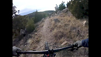
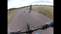
Videos of Glendo Mountain Bike
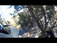
trail: Cobblestone
0:08 |
57 |
Apr 6, 2019

trail: 91 Gigawatt
3:20 |
121 |
Nov 25, 2017
trail: Barrel Roll
2:58 |
151 |
Nov 24, 2017
trail: 91 Gigawatt
3:38 |
389 |
Nov 19, 2017

trail: Root Canal
0:34 |
|
Mar 31, 2017
Recent Trail Reports
| status | trail | date | condition | info | user |
|---|---|---|---|---|---|
| Ponderosa | Apr 24, 2026 @ 10:18am (America/Denver) Apr 24, 2026 | Unknown | Josey6Ihbvh | ||
| Moon River | May 9, 2025 @ 7:02am May 9, 2025 | Ideal | wyo83 | ||
| Feather Rim | May 9, 2025 @ 7:02am May 9, 2025 | Ideal | wyo83 | ||
| Rocky Wetlands Connector | May 9, 2025 @ 7:02am May 9, 2025 | Ideal | wyo83 | ||
| Root Canal | May 9, 2025 @ 7:02am May 9, 2025 | Ideal | wyo83 | ||
| Cedar | May 9, 2025 @ 12:46pm May 9, 2025 | Ideal | wyo83 | ||
| Buffalo Run | May 9, 2025 @ 2:18pm May 9, 2025 | Ideal | wyo83 | ||
| Whiskey | May 9, 2025 @ 2:18pm May 9, 2025 | Ideal | wyo83 | ||
| Reflector Connector | May 10, 2025 @ 9:33am May 10, 2025 | Ideal | wyo83 | ||
| Rattlesnake Rim | May 10, 2025 @ 9:33am May 10, 2025 | Ideal | wyo83 |
Activity Feed
| username | action | type | title | date |
|---|---|---|---|---|
| lug-wrench | wishlist | route | activity #97314416 | Jun 19, 2026 @ 7:03am Jun 19, 2026 |
| shootymcface | wishlist | route | activity #95217021 | May 21, 2026 @ 7:08pm May 21, 2026 |
| dburbs | wishlist | trail | activity #94825901 | May 16, 2026 @ 9:35am May 16, 2026 |
| GDgh66 | wishlist | trail | activity #94437925 and 2 more | May 10, 2026 @ 10:00am May 10, 2026 |
| Josey6Ihbvh | add | report | activity #93286422 | Apr 24, 2026 @ 9:18am Apr 24, 2026 |
Recent Comments
| username | type | title | comment | date |
|---|---|---|---|---|
| trail | Rocky trail that beats up the body and bike. ... | Apr 27, 2025 @ 4:48pm Apr 27, 2025 | ||
| trail | Fun green trail with some rocks to keep it... | Apr 6, 2025 @ 2:40pm Apr 6, 2025 | ||
| trail | Looking for a way out of the river bottoms?... | Jul 6, 2024 @ 4:44pm Jul 6, 2024 | ||
| trail | An incredible ride as an out and back or... | Jul 6, 2024 @ 4:41pm Jul 6, 2024 | ||
| trail | Ride this trail from South to North. At... | Jul 6, 2024 @ 4:39pm Jul 6, 2024 |
Local Badges
-

10 Green Trails19 awarded -

10 Blue Trails31 awarded -

Epic Ride Climb 2k0 awarded -

Climbing 10k Badge1 awarded -

Climbing 100k Badge0 awarded -

Epic Ride Descent 2k0 awarded
Activity Type Stats
| activitytype | trails | distance | descent | descent distance | total vertical | rating | global rank | state rank | photos | reports | routes | ridelogs |
|---|---|---|---|---|---|---|---|---|---|---|---|---|
| Mountain Bike | 40 | 40 miles | 5,410 ft | 17 miles | 538 ft | #5,282 | #1,783 | 62 | 194 | 6 | 1,304 | |
| E-Bike | 39 | 40 miles | 5,410 ft | 17 miles | 538 ft | #3,718 | #1,273 | 1 | 180 | 1 | 15 | |
| Hike | 40 | 40 miles | 5,410 ft | 17 miles | 538 ft | #5,851 | #2,053 | 194 | 39 | |||
| Trail Running | 40 | 40 miles | 5,410 ft | 17 miles | 538 ft | #5,277 | #1,657 | 194 | 31 |
Frequently Asked Questions About Glendo
▼
What are the best places to ride in Glendo?
Glendo has 1 areas to explore for mountain biking. The top rated areas are:
▼
What are the highest rated mountain biking trails in Glendo?
The highest rated mountain biking trails in Glendo are:
- Twenty 15 (4.2/5)
- Root Canal (4.2/5)
- Ponderosa (4.1/5)
- Toadstool (4.1/5)
- Rattlesnake Rim (4.1/5)
▼
What is the best time of the year to ride in Glendo?
Based on ride log data, the most popular months to ride in Glendo are:
- May (27 activities)
- July (25 activities)
- August (24 activities)
▼
Where can I park to ride in Glendo?
There are 7 parking locations listed in Glendo. The most popular parking spots are: View all parking and trailhead locations on the map to plan your visit.
Activities
Trails
- By todd
 Trailforks & contributors
 - Admins: WP, chuktA, BIKENET, BIKENET, 30percentirish
- #6249 - 3,366 views
- glendo activity log | embed map of Glendo mountain bike trails | glendo mountain biking points of interest
Downloading of trail gps tracks in kml & gpx formats is enabled for Glendo.
You must login to download files.