close
-
Layers w
- Weather Layers
- Pro
- Pro
- Pro
- Pro
- Pro
- Pro
- More Layers
- Pro
- Pro
- Pro
- Pro
-
Upgrade to

3D
Trail Conditions
- Unknown
- Snow Groomed
- Snow Packed
- Snow Covered
- Snow Cover Partial
- Freeze/thaw Cycle
- Icy
- Prevalent Mud
- Wet
- Variable
- Ideal
- Dry
- Very Dry
Trail Flow (Ridden Direction)
Trailforks scans users ridelogs to determine the most popular direction each trail is ridden. A good flowing trail network will have most trails flowing in a single direction according to their intension.
The colour categories are based on what percentage of riders are riding a trail in its intended direction.
The colour categories are based on what percentage of riders are riding a trail in its intended direction.
- > 96%
- > 90%
- > 80%
- > 70%
- > 50%
- < 50%
- bi-directional trail
- no data
Trail Last Ridden
Trailforks scans ridelogs to determine the last time a trail was ridden.
- < 2 days
- < 1 week
- < 2 weeks
- < 1 month
- < 6 months
- > 6 months
Trail Ridden Direction
The intended direction a trail should be ridden.
- Downhill Only
- Downhill Primary
- Both Directions
- Uphill Primary
- Uphill Only
- One Direction
Contribute Details
Colors indicate trail is missing specified detail.
- Description
- Photos
- Description & Photos
- Videos
Trail Popularity ?
Trailforks scans ridelogs to determine which trails are ridden the most in the last 9 months.
Trails are compared with nearby trails in the same city region with a possible 25 colour shades.
Think of this as a heatmap, more rides = more kinetic energy = warmer colors.
- most popular
- popular
- less popular
- not popular
ATV/ORV/OHV Filter
Max Vehicle Width
inches
US Cell Coverage
Legend

Radar Time
Activity Recordings
Trailforks uses anonymized public activity data.
?
Activity Recordings
Trailforks uses anonymized public activity data.
?
Personal Heatmap
▶
Activity Types
all
/
none
▶
Options
2
Date range
month
–
Winter Trails
Warning
A routing network for winter maps does not exist. Selecting trails using the winter trails layer has been disabled.
Missing Trails
Most Popular
Least Popular
Trails are colored based on popularity. The more popular a trail is, the more red. Less popular trails trend towards green.
Jump Magnitude Heatmap
Heatmap of where riders jump on trails. Zoom in to see individual jumps, click circles to view jump details.
BC Backroad Status
![map legend]()
Service Road Atlas is a free to use, community-driven service for viewing and creating reports on the numerous back-country service roads around B.C. and Alberta.

Slope Aspect
Direction the slope faces
Trails Deemphasized
Trails are shown in grey.
Only show trails with no bike usage.
Suggested Layers
Based on selected activity type
Save the current map location and zoom level as your default home location whenever this page is loaded.
Save
No description for Gloucester has been added yet!
Login or register to submit one.
This region uses the Uk/Euro style trail grading system.
Activities Click to view
- Mountain Bike
154 trails
- E-Bike
124 trails
- Gravel Bike
0 trails
- Adaptive Bike
0 trails
- Winter Fat Bike
0 trails
- Hike
87 trails
- Trail Running
87 trails
Region Details
- 25
- 4
- 43
- 34
- 10
- 2
Region Status
Open as of 2 daysStats
- Avg Trail Rating
- Trails (view details)
- 121
- Trails Mountain Bike
- 155
- Trails E-Bike
- 124
- Trails Hike
- 87
- Trails Trail Running
- 87
- Total Distance
- 54 miles
- Total Descent
- 17,809 ft
- Total Vertical
- 763 ft
- Highest Trailhead
- 937 ft
- Reports
- 1,615
- Photos
- 2,145
- Ridden Counter
- 102,310
Articles

Race Report: 100% Mini Downhill Round 1 Forest of Dean
Feb 2, 2023 from pinkbike.com
The biggest little race of the year took place at the Forest of Dean last weekend.
Video: How the 417 Bikepark's New Progressive Jump Line Came to Life
Oct 28, 2020 from pinkbike.com
The infamous Rut Jam track is reborn in a totally new guise.

Video & Race Report: Forest of Dean Mini Downhill - Round 2
Mar 6, 2020 from pinkbike.com
Riders take on a wet and wild course in the Forest of Dean for the second round of the Mini DH series.
Video & Race Report: Round 1 Highlights of the Mini Downhill - Forest of Dean
Jan 31, 2020 from pinkbike.com
Ethan Craik and Sarah Gamsjaeger took the wins in the first round of the Ride 100% Mini Downhill.
Sub Regions
-
Ellwood
- 1
- 10
- 2
- 2
-
Flyup 417 Bike Park
- 5
- 8
- 4
- 1
-
Forest of Dean
- 4
- 28
- 24
- 6
- 1
Popular Gloucester Mountain Biking Trails
• 95 ★ 4.0 • 2,438 ft • 8 ft • 2,396 •
The first purpose built trail for 4 wheel bikes at the Forest of Dean
• 85 ★ 3.4 • 1,329 ft • 48 ft • 2,342 •
Popular blue difficulty singletrack. This mountain bike primary trail can be used one direction and has a moderate overall physical rating with a 48 ft blue climb. It features rock garden. Trail visibility is sometimes hard to follow. On average it takes 2 minutes to complete this trail.
• 100 ★ 3.7 • 807 ft • 0 ft • 2,240 •
Popular red difficulty singletrack. This mountain bike primary trail can be used one direction. On average it takes 3 minutes to complete this trail.
• 90 ★ 2.8 • 4,396 ft • 97 ft • 2,236 •
Popular blue difficulty singletrack. This mountain bike primary trail. On average it takes 7 minutes to complete this trail.
• 100 ★ 4.4 • 1,831 ft • 0 ft • 2,234 •
New red grade downhill trail called , bullt with Dean Trail Volunteers incorporating some sections of Ski and featuring newly built sections.
• 95 ★ 3.5 • 994 ft • 0 ft • 2,212 •
Popular red difficulty singletrack. This mountain bike primary trail can be used both directions. On average it takes 4 minutes to complete this trail.
• 95 ★ 3.3 • 3,730 ft • 57 ft • 2,191 •
Popular blue difficulty singletrack. This mountain bike primary trail. On average it takes 6 minutes to complete this trail.
Gloucester Mountain Bike Routes
★ 4.3 • 6 miles • 555 ft • 8 • Loop •
Trailforks route created for the Verderers marked trail (Blue). This links all 8 trails of the Verderers ,...
★ 4.5 • 10 miles • 1,777 ft • 9 • Loop •
2015 Christmas Ride - Classic short course of the best of the Dowies and Shutcastle Trails
★ 3.0 • 42 miles • 4,709 ft • 1 • Loop •
Wild Boar Loop not too technical various short cuts to other popular trails.
23 miles • 3,414 ft • 0 • Loop •
Some of the better off piste descents (some very steep and technical) all linked with logical and rideable...
• 13 miles • 1,385 ft • 19 •
• 16 miles • 2,815 ft • 46 •
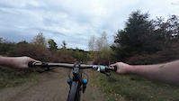
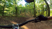
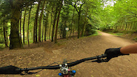
Photos of Gloucester Mountain Bike
Videos of Gloucester Mountain Bike
trail: Blue Raccoon
0:04 |
15 |
May 5, 2026

trail: Verderers - Wizards Sleeve
0:08 |
23 |
Apr 10, 2026
trail: Forest Road
0:19 |
55 |
Dec 29, 2024

0:10 |
51 |
Oct 9, 2024

trail: Cheese Roller
0:15 |
176 |
Nov 8, 2022
0:20 |
181 |
Nov 2, 2022
trail: Sheepskull Top
0:19 |
92 |
Oct 26, 2022
trail: Corkscrew
0:57 |
110 |
Sep 9, 2022
Recent Trail Reports
| status | trail | date | condition | info | user |
|---|---|---|---|---|---|
| The Good, The Bad and The Ugly | Jun 24, 2026 @ 12:12pm (Europe/London) 2 days | Very Dry | Faroon | ||
| Mr Rooty | Jun 24, 2026 @ 12:12pm (Europe/London) 2 days | Very Dry | Faroon | ||
| Endo | Jun 24, 2026 @ 12:12pm (Europe/London) 2 days | Very Dry | Faroon | ||
| The Hub | Jun 24, 2026 @ 12:12pm (Europe/London) 2 days | Very Dry | Faroon | ||
| Corkscrew | Jun 24, 2026 @ 12:12pm (Europe/London) 2 days | Very Dry | Faroon | ||
| Flatlands | Jun 24, 2026 @ 12:12pm (Europe/London) 2 days | Very Dry | Faroon | ||
| Sheep Skull | Jun 24, 2026 @ 12:12pm (Europe/London) 2 days | Very Dry | Faroon | ||
| Freeminers End | Jun 24, 2026 @ 12:12pm (Europe/London) 2 days | Very Dry | Faroon | ||
| Push Up | Jun 24, 2026 @ 12:12pm (Europe/London) 2 days | Very Dry | Faroon | ||
| Advanced Skills Drop Line | Jun 24, 2026 @ 12:12pm (Europe/London) 2 days | Very Dry | Faroon |
Activity Feed
| username | action | type | title | date |
|---|---|---|---|---|
| Faroon | add | report | activity #97715294 and 13 more | Jun 24, 2026 @ 12:05pm 2 days |
| AndyWebb1970 | wishlist | region | activity #97568116 | Jun 22, 2026 @ 9:44am Jun 22, 2026 |
| EmtbAdz | add | report | activity #97350202 | Jun 19, 2026 @ 3:51pm Jun 19, 2026 |
| trailforks | add | video | activity #97233975 and 1 more | Jun 17, 2026 @ 11:00pm Jun 17, 2026 |
| Billy192 | vote | trail | activity #97041534 and 2 more | Jun 15, 2026 @ 7:59am Jun 15, 2026 |
Recent Comments
| username | type | title | comment | date |
|---|---|---|---|---|
| trail | I wouldn't rate this as a Red. It's more like... | Sep 24, 2025 @ 10:21am Sep 24, 2025 | ||
| trail | I was wrong, it's Tight and Twisty that's... | Sep 24, 2025 @ 2:34am Sep 24, 2025 | ||
| trail | The name is appropriate. It’s signed as... | Sep 22, 2025 @ 5:39am Sep 22, 2025 | ||
| trail | Closed - awaiting rain | Aug 24, 2025 @ 12:16pm Aug 24, 2025 | ||
| skillpark | Great bike park they just need to update the... | Jul 27, 2025 @ 4:24am Jul 27, 2025 |
Local Badges
-

10 Blue Trails1,228 awarded -

10 Black Trails97 awarded -

Epic Ride Climb 2k196 awarded -

Climbing 10k Badge296 awarded -

Climbing 100k Badge19 awarded -

Epic Ride Descent 2k215 awarded
Bike & Skill Parks
| name | type | city | rating |
|---|---|---|---|
| Flyup 417 Bike Park | bike park | Gloucester | |
| Redhill | skill park | Gloucester |
Local Mountain Biking Directory
-
Fly up Forest of dean/Gawton
-
Bigfoot MBC
-
FLOWSTORE
-
Slam69 - More than a Bicycle ShopBike Shop
![Slam69 - More than a Bicycle Shop]()
-
Pedal-a-bike-awayBike Shop
-
Black8bikesBike Shop
Activity Type Stats
| activitytype | trails | distance | descent | descent distance | total vertical | rating | global rank | state rank | photos | reports | routes | ridelogs |
|---|---|---|---|---|---|---|---|---|---|---|---|---|
| Mountain Bike | 154 | 54 miles | 17,808 ft | 37 miles | 764 ft | #211 | #7 | 2,146 | 1,646 | 7 | 51,439 | |
| E-Bike | 124 | 42 miles | 12,562 ft | 27 miles | 679 ft | #466 | #31 | 1,520 | 10,226 | |||
| Hike | 87 | 32 miles | 10,827 ft | 23 miles | 764 ft | #3,643 | #78 | 1,557 | 1,423 | |||
| Trail Running | 87 | 32 miles | 10,827 ft | 23 miles | 764 ft | #3,338 | #73 | 1,557 | 603 |
Frequently Asked Questions About Gloucester
▼
What are the best places to ride in Gloucester?
Gloucester has 3 areas to explore for mountain biking. The top rated areas are:
▼
What are the highest rated mountain biking trails in Gloucester?
The highest rated mountain biking trails in Gloucester are:
- Ski Run (4.5/5)
- Blue Raccoon (4.5/5)
- Sheep Skull (4.4/5)
- Verderers - Soup Dragon (4.4/5)
- Igneous (4.4/5)
▼
What is the best time of the year to ride in Gloucester?
Based on ride log data, the most popular months to ride in Gloucester are:
- July (289 activities)
- August (255 activities)
- September (229 activities)
▼
Where can I park to ride in Gloucester?
There are 3 parking locations listed in Gloucester. The most popular parking spots are: View all parking and trailhead locations on the map to plan your visit.
Activities
- By brenthillier
 NSMBA TRAILFORKS & contributors
 - Admins: wisey, MathieuC, cemoorelife, DTV
- #6868 - 7,479 views
- gloucester activity log | embed map of Gloucester mountain bike trails | gloucester mountain biking points of interest
Downloading of trail gps tracks in kml & gpx formats is enabled for Gloucester.
You must login to download files.