close
-
Layers w
- Weather Layers
- Pro
- Pro
- Pro
- Pro
- Pro
- Pro
- More Layers
- Pro
- Pro
- Pro
- Pro
-
Upgrade to

3D
Trail Conditions
- Unknown
- Snow Groomed
- Snow Packed
- Snow Covered
- Snow Cover Partial
- Freeze/thaw Cycle
- Icy
- Prevalent Mud
- Wet
- Variable
- Ideal
- Dry
- Very Dry
Trail Flow (Ridden Direction)
Trailforks scans users ridelogs to determine the most popular direction each trail is ridden. A good flowing trail network will have most trails flowing in a single direction according to their intension.
The colour categories are based on what percentage of riders are riding a trail in its intended direction.
The colour categories are based on what percentage of riders are riding a trail in its intended direction.
- > 96%
- > 90%
- > 80%
- > 70%
- > 50%
- < 50%
- bi-directional trail
- no data
Trail Last Ridden
Trailforks scans ridelogs to determine the last time a trail was ridden.
- < 2 days
- < 1 week
- < 2 weeks
- < 1 month
- < 6 months
- > 6 months
Trail Ridden Direction
The intended direction a trail should be ridden.
- Downhill Only
- Downhill Primary
- Both Directions
- Uphill Primary
- Uphill Only
- One Direction
Contribute Details
Colors indicate trail is missing specified detail.
- Description
- Photos
- Description & Photos
- Videos
Trail Popularity ?
Trailforks scans ridelogs to determine which trails are ridden the most in the last 9 months.
Trails are compared with nearby trails in the same city region with a possible 25 colour shades.
Think of this as a heatmap, more rides = more kinetic energy = warmer colors.
- most popular
- popular
- less popular
- not popular
ATV/ORV/OHV Filter
Max Vehicle Width
inches
US Cell Coverage
Legend

Radar Time
Activity Recordings
Trailforks uses anonymized public activity data.
?
Activity Recordings
Trailforks uses anonymized public activity data.
?
Personal Heatmap
▶
Activity Types
all
/
none
▶
Options
2
Date range
month
–
Winter Trails
Warning
A routing network for winter maps does not exist. Selecting trails using the winter trails layer has been disabled.
Missing Trails
Most Popular
Least Popular
Trails are colored based on popularity. The more popular a trail is, the more red. Less popular trails trend towards green.
Jump Magnitude Heatmap
Heatmap of where riders jump on trails. Zoom in to see individual jumps, click circles to view jump details.
BC Backroad Status
![map legend]()
Service Road Atlas is a free to use, community-driven service for viewing and creating reports on the numerous back-country service roads around B.C. and Alberta.

Slope Aspect
Direction the slope faces
Trails Deemphasized
Trails are shown in grey.
Only show trails with no bike usage.
Suggested Layers
Based on selected activity type
Save the current map location and zoom level as your default home location whenever this page is loaded.
Save
No description for Gloucester has been added yet!
Login or register to submit one.
Activities Click to view
- Mountain Bike
450 trails
- E-Bike
49 trails
- Adaptive Bike
0 trails
- Winter Fat Bike
0 trails
- Hike
439 trails
- Trail Running
438 trails
- Dirtbike/Moto
35 trails
- ATV/ORV/OHV
34 trails
- Snowmobile
20 trails
- Snowshoe
105 trails
- Backcountry Ski
21 trails
- Nordic Ski
65 trails
Region Details
- 29
- 20
- 129
- 189
- 77
- 5
Region Status
Open as of Jun 5, 2026Stats
- Avg Trail Rating
- Trails (view details)
- 449
- Trails Mountain Bike
- 451
- Trails E-Bike
- 49
- Trails Horse
- 1
- Trails Hike
- 439
- Trails Trail Running
- 438
- Trails Dirtbike/Moto
- 35
- Trails ATV/ORV/OHV
- 34
- Trails Snowmobile
- 20
- Trails Snowshoe
- 105
- Trails Downhill Ski
- 1
- Trails Backcountry Ski
- 21
- Trails Nordic Ski
- 65
- Total Distance
- 108 miles
- Total Descent
- 8,214 ft
- Total Vertical
- 250 ft
- Highest Trailhead
- 266 ft
- Reports
- 206
- Photos
- 76
- Ridden Counter
- 17,005
Sub Regions
-
Dogtown
- 9
- 88
- 82
- 27
- 1
-
Haskell Pond West
- 1
- 14
- 19
- 1
-
Magnolia Woods
- 4
- 7
-
Ravenswood Park Area
- 4
- 10
- 16
- 4
-
Red Rocks and Haskell Pond East
- 2
- 7
- 8
- 10
- 1
-
Tompson Street Reservation
- 5
- 38
- 10
- 2
-
West Woods/Dykes Pond
- 1
- 18
- 23
- 4
Popular Gloucester Mountain Biking Trails
• 100 ★ 0.0 • 2,516 ft • 54 ft • 369 •
Main way in and out. Coming in, it starts off smooth but is a decent climb. Then it becomes pretty technical, but along the way the view of the pond is amazing. Even better, there is a bridge that stretches across it so you can ride...
• 100 ★ 5.0 • 3,142 ft • 65 ft • 334 •
Popular blue difficulty singletrack. This mountain bike primary trail can be used both directions and has a moderate overall physical rating with a 65 ft blue climb. It features a-frame, bridge, drop, ladder bridge, rock face and rock garden. On average it takes 13 minutes to complete this trail.
• 100 ★ 4.5 • 4,277 ft • 157 ft • 271 •
A fun and challenging trail featuring lots of rollable and climbable slab.
• 95 ★ 2.0 • 2,267 ft • 83 ft • 231 •
Popular blue difficulty singletrack. This mountain bike primary trail can be used both directions and has a easy overall physical rating with a 83 ft green climb. It features bridge, drop, jump, gap jump, rock face, rock garden and other. On average it takes 14 minutes to complete this trail.
• 100 ★ 3.7 • 2,766 ft • 37 ft • 224 •
Popular black diamond difficulty singletrack. This mountain bike primary trail can be used both directions and has a hard overall physical rating with a 37 ft blue climb. It features drop, rock face, rock garden, skinny and other. On average it takes 12 minutes to complete this trail.
• 100 ★ 5.0 • 1,985 ft • 14 ft • 206 •
Popular blue difficulty singletrack. This mountain bike primary trail can be used both directions. On average it takes 7 minutes to complete this trail.
• 100 ★ 0.0 • 2,121 ft • 67 ft • 206 •
Popular black diamond difficulty singletrack. This mountain bike primary trail can be used downhill primary and has a moderate overall physical rating with a 67 ft blue climb. It features a-frame, drop, ladder bridge, rock face, rock garden and other. On average it takes 12 minutes to complete this trail.
• 95 ★ 0.0 • 1,626 ft • 55 ft • 202 •
Popular blue difficulty singletrack. This mountain bike primary trail can be used both directions. On average it takes 3 minutes to complete this trail.
Gloucester Mountain Bike Routes
★ 5.0 • 9 miles • 1,090 ft • 11 •
All the good stuff in this region. Will be a challenge but rewarding
2 miles • 326 ft • 4 • Loop •
A loop through the awesome three black trails at Red Rocks. Start with a bit of push-a-bike until you get...
16 miles • 784 ft • 21 • Loop •
A full loop around all of Dogtown that avoids almost all road riding or hard singletrack. Good for a fast...
★ 3.0 • 28 miles • 2,797 ft • 30 • Loop •
A loop through west gloucester woods hitting a lot of tech.
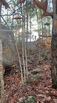
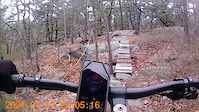
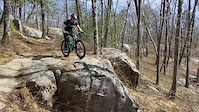
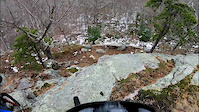
Photos of Gloucester Mountain Bike
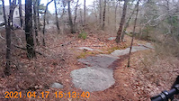
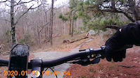
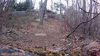
Videos of Gloucester Mountain Bike
trail: The Funnel Roll
0:11 |
144 |
Nov 14, 2021
trail: Old Tompson Road
0:13 |
88 |
Apr 26, 2021
trail: Old Tompson Road
0:11 |
57 |
Apr 26, 2021
trail: Old Tompson Road
0:09 |
64 |
Apr 26, 2021
trail: Old Tompson Road
0:39 |
115 |
Apr 26, 2021

trail: Cheese Wedge
0:11 |
104 |
Jan 18, 2021
trail: Cheese Wedge
0:15 |
829 |
Mar 25, 2019
trail: Black Coffee
6:52 |
261 |
Nov 20, 2018
Recent Trail Reports
| status | trail | date | condition | info | user |
|---|---|---|---|---|---|
| Passing Gas | Jun 5, 2026 @ 9:31am (America/New_York) Jun 5, 2026 | Ideal | amos41 | ||
| Oz | Jun 5, 2026 @ 9:31am (America/New_York) Jun 5, 2026 | Ideal | amos41 | ||
| Black Mamba | Jun 5, 2026 @ 9:31am (America/New_York) Jun 5, 2026 | Ideal | amos41 | ||
| Red Rock 5 | Jun 5, 2026 @ 9:31am (America/New_York) Jun 5, 2026 | Ideal | amos41 | ||
| Red Dawn | Jun 5, 2026 @ 9:31am (America/New_York) Jun 5, 2026 | Ideal | amos41 | ||
| Burnt Goose | Oct 9, 2025 @ 9:00pm (America/New_York) Oct 9, 2025 | Dry | j-bert MBC | ||
| Duelling Banjos | Sep 8, 2025 @ 8:56am (America/New_York) Sep 8, 2025 | Variable | mlwoodchuck | ||
| Norton Tree Farm 5 | Aug 25, 2025 @ 8:55am Aug 25, 2025 | Ideal | gayeski | ||
| Norton Tree Farm 10 | Aug 25, 2025 @ 8:55am Aug 25, 2025 | Unknown | gayeski | ||
| Brackett Creek | Aug 25, 2025 @ 8:55am Aug 25, 2025 | Ideal | gayeski |
Activity Feed
| username | action | type | title | date |
|---|---|---|---|---|
| SiamDelightRules | update | trail | activity #97451017 | Jun 20, 2026 @ 7:35pm 8 hours |
| CalebAnth | add | trail | activity #97273598 | Jun 18, 2026 @ 1:35pm 3 days |
| msmcfate | update | trail | activity #96730492 | Jun 11, 2026 @ 5:26am Jun 11, 2026 |
| SiamDelightRules | update | trail | activity #96697790 | Jun 10, 2026 @ 2:58pm Jun 10, 2026 |
| zackm103 | add | trail | activity #96697618 | Jun 10, 2026 @ 2:55pm Jun 10, 2026 |
Recent Comments
| username | type | title | comment | date |
|---|---|---|---|---|
| trail | Really fun trail with more rocks. The roller... | Sep 30, 2025 @ 5:09pm Sep 30, 2025 | ||
| trail | Very enjoyable and very beautiful trail. Up... | Sep 30, 2025 @ 5:06pm Sep 30, 2025 | ||
| trail | Rode this in early July 2025. I went from... | Jul 7, 2025 @ 4:38pm Jul 7, 2025 | ||
| trail | This trail is fading away... | Jun 9, 2025 @ 7:06pm Jun 9, 2025 | ||
| report | Area pics | Sep 28, 2024 @ 6:03pm Sep 28, 2024 |
Local Badges
-

Completionist0 awarded -

Top 10 Trails49 awarded -
Completionist0 awarded -
Completionist0 awarded -
Completionist0 awarded -
Completionist0 awarded
Activity Type Stats
| activitytype | trails | distance | descent | descent distance | total vertical | rating | global rank | state rank | photos | reports | routes | ridelogs |
|---|---|---|---|---|---|---|---|---|---|---|---|---|
| Mountain Bike | 450 | 108 miles | 8,215 ft | 41 miles | 249 ft | #903 | #355 | 71 | 206 | 13 | 8,790 | |
| E-Bike | 49 | 8 miles | 518 ft | 3 miles | 167 ft | #5,661 | #1,748 | 155 | 6 | 238 | ||
| Horse | 1 | 4,432 ft | 180 ft | 36 ft | 5 | |||||||
| Hike | 439 | 106 miles | 7,995 ft | 40 miles | 249 ft | #952 | #431 | 5 | 205 | 7 | 925 | |
| Trail Running | 438 | 106 miles | 7,995 ft | 40 miles | 249 ft | #835 | #316 | 205 | 7 | 603 | ||
| Dirtbike/Moto | 35 | 5 miles | 407 ft | 2 miles | 102 ft | #1,081 | #426 | 5 | 1 | |||
| ATV/ORV/OHV | 34 | 5 miles | 404 ft | 2 miles | 102 ft | #720 | #299 | 5 | 1 | |||
| Snowmobile | 20 | 2 miles | 164 ft | 1 mile | 102 ft | #322 | #167 | |||||
| Snowshoe | 105 | 13 miles | 1,086 ft | 5 miles | 236 ft | #572 | #218 | 1 | 5 | 29 | ||
| Downhill Ski | 1 | 1,093 ft | 36 ft | 610 ft | 36 ft | |||||||
| Backcountry Ski | 21 | 3 miles | 282 ft | 1 mile | 102 ft | #596 | #197 | 1 | 8 | |||
| Nordic Ski | 65 | 5 miles | 299 ft | 2 miles | 115 ft | #1,021 | #430 | 1 | 4 | 16 |
Frequently Asked Questions About Gloucester
▼
What are the best places to ride in Gloucester?
Gloucester has 7 areas to explore for mountain biking. The top rated areas are:
▼
What are the highest rated mountain biking trails in Gloucester?
The highest rated mountain biking trails in Gloucester are:
- Eagle Rock (4.3/5)
- Black Mamba (4.2/5)
- Passing Gas (4.2/5)
- Rock-N-Roll (4.2/5)
- Ramp O' Rama (4.1/5)
▼
What is the best time of the year to ride in Gloucester?
Based on ride log data, the most popular months to ride in Gloucester are:
- July (106 activities)
- April (96 activities)
- August (91 activities)
▼
Where can I park to ride in Gloucester?
Activities
- Gloucester Mountain Biking Trails
- Gloucester E-Biking Trails
- Gloucester Hiking Trails
- Gloucester Trail Running Trails
- Gloucester Dirtbiking Trails
- Gloucester ATVing/Offroading Trails
- Gloucester Snowmobiling Trails
- Gloucester Snowshoeing Trails
- Gloucester Backcountry Skiing Trails
- Gloucester Nordic Skiing Trails
Trails
- By j-bert MBC & contributors
- Admins: MBC, NS NEMBA, SiamDelightRules
- #7739 - 8,883 views
- gloucester activity log | embed map of Gloucester mountain bike trails | gloucester mountain biking points of interest polygons
Downloading of trail gps tracks in kml & gpx formats is enabled for Gloucester.
You must login to download files.