close
-
Layers w
- Weather Layers
- Pro
- Pro
- Pro
- Pro
- Pro
- Pro
- More Layers
- Pro
- Pro
- Pro
- Pro
-
Upgrade to

3D
Trail Conditions
- Unknown
- Snow Groomed
- Snow Packed
- Snow Covered
- Snow Cover Partial
- Freeze/thaw Cycle
- Icy
- Prevalent Mud
- Wet
- Variable
- Ideal
- Dry
- Very Dry
Trail Flow (Ridden Direction)
Trailforks scans users ridelogs to determine the most popular direction each trail is ridden. A good flowing trail network will have most trails flowing in a single direction according to their intension.
The colour categories are based on what percentage of riders are riding a trail in its intended direction.
The colour categories are based on what percentage of riders are riding a trail in its intended direction.
- > 96%
- > 90%
- > 80%
- > 70%
- > 50%
- < 50%
- bi-directional trail
- no data
Trail Last Ridden
Trailforks scans ridelogs to determine the last time a trail was ridden.
- < 2 days
- < 1 week
- < 2 weeks
- < 1 month
- < 6 months
- > 6 months
Trail Ridden Direction
The intended direction a trail should be ridden.
- Downhill Only
- Downhill Primary
- Both Directions
- Uphill Primary
- Uphill Only
- One Direction
Contribute Details
Colors indicate trail is missing specified detail.
- Description
- Photos
- Description & Photos
- Videos
Trail Popularity ?
Trailforks scans ridelogs to determine which trails are ridden the most in the last 9 months.
Trails are compared with nearby trails in the same city region with a possible 25 colour shades.
Think of this as a heatmap, more rides = more kinetic energy = warmer colors.
- most popular
- popular
- less popular
- not popular
ATV/ORV/OHV Filter
Max Vehicle Width
inches
US Cell Coverage
Legend

Radar Time
Activity Recordings
Trailforks uses anonymized public activity data.
?
Activity Recordings
Trailforks uses anonymized public activity data.
?
Personal Heatmap
▶
Activity Types
all
/
none
▶
Options
2
Date range
month
–
Winter Trails
Warning
A routing network for winter maps does not exist. Selecting trails using the winter trails layer has been disabled.
Missing Trails
Most Popular
Least Popular
Trails are colored based on popularity. The more popular a trail is, the more red. Less popular trails trend towards green.
Jump Magnitude Heatmap
Heatmap of where riders jump on trails. Zoom in to see individual jumps, click circles to view jump details.
BC Backroad Status
![map legend]()
Service Road Atlas is a free to use, community-driven service for viewing and creating reports on the numerous back-country service roads around B.C. and Alberta.

Slope Aspect
Direction the slope faces
Trails Deemphasized
Trails are shown in grey.
Only show trails with no bike usage.
Suggested Layers
Based on selected activity type
Save the current map location and zoom level as your default home location whenever this page is loaded.
SavePopular Trail Networks
view all areas »
No description for Goldfields Region has been added yet!
Login or register to submit one.
Activities Click to view
- Mountain Bike
651 trails
- E-Bike
437 trails
- Horse
33 trails
- Hike
619 trails
- Trail Running
621 trails
- Dirtbike/Moto
49 trails
- Observed Trials
4 trails
- ATV/ORV/OHV
3 trails
Region Details
- 57
- 7
- 193
- 320
- 62
- 11
Stats
- Avg Trail Rating
- Trails (view details)
- 743
- Trails Mountain Bike
- 651
- Trails E-Bike
- 437
- Trails Gravel Bike
- 30
- Trails Adaptive Bike
- 61
- Trails Winter Fat Bike
- 9
- Trails Horse
- 33
- Trails Hike
- 619
- Trails Trail Running
- 621
- Trails Dirtbike/Moto
- 49
- Trails Observed Trials
- 4
- Trails ATV/ORV/OHV
- 3
- Trails Snowmobile
- 1
- Total Distance
- 895 miles
- Total Descent
- 117,183 ft
- Total Vertical
- 2,933 ft
- Highest Trailhead
- 3,294 ft
- Reports
- 3,222
- Photos
- 807
- Ridden Counter
- 22,349
Sub Regions
- Bacchus Marsh (8)
- Ballan (75)
- Bungal State Forest (66)
- Ballarat (52)
- Black Hill Bike Park (15)
- Nerrina Trails (10)
- Woowookarung Regional Park (17)
- Beaufort (9)
- Castlemaine (176)
- Creswick (112)
- Daylesford (14)
- Gisborne (41)
- Kyneton (1)
- Macedon (34)
- Redesdale (6)
- Steiglitz (5)
- Sunbury (1)
- Vaughan (3)
- Mount Tarrengower (7)
- Wombat Forest (4)
- Wombat State Forest (169)
Popular Goldfields Region Mountain Biking Trails
• 100 ★ 4.2 • 1 mile • 151 ft • 1,030 •
Ideal for beginner cyclists and children. Enjoy a scenic ride that meanders around Picnic Gully Creek, through open woodland, large pines and the Oak Forest.
• 100 ★ 4.0 • 1 mile • 179 ft • 975 •
Once you’ve mastered (Trail 1), head to this trail for your next challenge. A gradual, undulating climb through rocky outcrops looks down on large pines and oaks in the valley below. Two huge river red gums mark the halfway point and...
• 100 ★ 3.6 • 3 miles • 483 ft • 911 •
Start with a climb up the southern knoll and be rewarded by outstanding views across the Harcourt Valley and toward the Pyrenees. The short connecting trail to Mir (Trail 8) will take you to one of the most scenic lookouts at La Larr Ba...
• 100 ★ 4.7 • 5,187 ft • 245 ft • 693 •
Cruisy climb to the start of (G10) which links to the rest of the gravity trails. This and (G4) are your climb trails for this area
• 100 ★ 3.9 • 3 miles • 499 ft • 664 •
Criss-crossing the scenic upper slopes of Mount Alexander, this trail has something for everyone and is likely to become one of the most popular trails in the Park! incorporates multiple climbs and descents with natural and hand crafted...
• 100 ★ 4.2 • 11 miles • 860 ft • 658 •
17km of well signposted, well maintained, flowing goodness. Nothing too difficult, constantly undulating, no big hills. The trail consist of a 2 loops that can be linked together. Loop 1 is approximately 11km, loop 2 is approximately an...
• 100 ★ 4.7 • 3,327 ft • 53 ft • 601 •
Two way traverse trail that forms the spine of the gravity zone, linking your climbs and descents
• 95 ★ 4.5 • 3,081 ft • 0 ft • 527 •
Popular blue difficulty singletrack. This mountain bike primary trail can be used downhill only.
Goldfields Region Mountain Bike Routes
★ 5.0 • 12 miles • 1,685 ft • 3 • Loop •
Djerri XC Loop is a fun and physically demanding loop. With technical black XC Climbs and mostly blue...
★ 4.5 • 3 miles • 375 ft • 3 • Point to Point •
Old school natural XC/Trail riding, mostly Blue Square with a few challenging Black Diamond sections. Flat...
★ 3.0 • 32 miles • 2,719 ft • 5 • Point to Point •
Australia’s first National Heritage Park, the Castlemaine Diggings National Heritage Park was created in...
5 miles • 632 ft • 5 • Loop •
The Wallaby Loop is an officially signposted loop that gives a great introduction to riding at Djuwang...
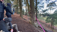
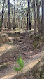
Photos of Goldfields Region Mountain Bike
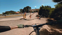
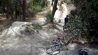
Videos of Goldfields Region Mountain Bike

trail: Alluvial
0:30 |
86 |
Aug 18, 2024
trail: Alluvial
0:30 |
37 |
Aug 18, 2024
trail: Nerrina - Yarrowee Link
0:06 |
105 |
May 3, 2023
trail: Alluvial
0:53 |
|
Feb 19, 2023
trail: Open Cut
0:08 |
964 |
Mar 21, 2020
trail: Open Cut
0:11 |
|
Nov 15, 2019
trail: Claim Jumper
0:12 |
1121 |
Jul 28, 2019
trail: Open Cut
0:00 |
473 |
Sep 5, 2018
Current Trail Warnings
| status | trail | date | condition | user | info |
|---|---|---|---|---|---|
| Green Apple Djuwang Baring | Jun 17, 2026 @ 3:03pm (Australia/Melbourne) Jun 16, 2026 | Unknown | CaraMG2CmC | Has closed sign at start of trail.... |
Recent Trail Reports
Activity Feed
| username | action | type | title | date |
|---|---|---|---|---|
| jessamie | wishlist | trail | activity #97987588 | Jun 28, 2026 @ 7:27am 7 hours |
| jessamie | wishlist | trail | activity #97987503 | Jun 28, 2026 @ 7:25am 7 hours |
| DougManning | add | report | activity #97970128 and 3 more | Jun 28, 2026 @ 2:24am 12 hours |
| dmpixel76 | wishlist | trail | activity #97891101 | Jun 27, 2026 @ 4:29am 1 day |
| MickEllis58 | ridden | trail | activity #97886785 | Jun 27, 2026 @ 2:57am 1 day |
Recent Comments
| username | type | title | comment | date |
|---|---|---|---|---|
| report | Looks like you figured it out 👍 | Jun 18, 2026 @ 9:11pm Jun 18, 2026 | ||
| report | Trying to update the status of this trail to open. | Jun 18, 2026 @ 9:00pm Jun 18, 2026 | ||
| trail | Cool old technical trail with some woodwork... | May 19, 2026 @ 2:38pm May 19, 2026 | ||
| trail | Seems perfect for beginners. Very flowey with... | Mar 4, 2026 @ 1:59am Mar 4, 2026 | ||
| trail | Tree down | Jan 14, 2026 @ 5:10pm Jan 14, 2026 |
Local Badges
-

Big Ride 30k290 awarded -

Completionist0 awarded -
Completionist0 awarded -

Top 10 Trails0 awarded -
Completionist0 awarded -
Completionist10 awarded
Bike & Skill Parks
| name | type | city | rating |
|---|---|---|---|
| Bottom Pump Track | skill park | Ballarat | |
| Top Pump Track | skill park | Ballarat | |
| Galki Wawa Skills Area | skill park | Creswick | |
| Hammon Park Pump Track | skill park | Creswick |
Activity Type Stats
| activitytype | trails | distance | descent | descent distance | total vertical | rating | global rank | state rank | photos | reports | routes | ridelogs |
|---|---|---|---|---|---|---|---|---|---|---|---|---|
| Mountain Bike | 651 | 787 miles | 96,867 ft | 362 miles | 2,927 ft | 803 | 3,221 | 36 | 63,016 | |||
| E-Bike | 437 | 584 miles | 72,228 ft | 271 miles | 2,638 ft | 2 | 2,840 | 11 | 5,690 | |||
| Gravel Bike | 30 | 30 miles | 2,129 ft | 11 miles | 1,362 ft | 68 | 2 | 812 | ||||
| Adaptive Bike | 61 | 97 miles | 7,283 ft | 49 miles | 2,172 ft | 94 | 4 | 1 | ||||
| Winter Fat Bike | 9 | 50 miles | 2,562 ft | 29 miles | 804 ft | 185 | 8 | |||||
| Horse | 33 | 24 miles | 2,772 ft | 11 miles | 2,306 ft | 574 | 1 | 10 | ||||
| Hike | 619 | 785 miles | 97,208 ft | 359 miles | 2,933 ft | 2,861 | 6 | 2,404 | ||||
| Trail Running | 621 | 785 miles | 96,663 ft | 358 miles | 2,933 ft | 1 | 2,866 | 18 | 2,332 | |||
| Dirtbike/Moto | 49 | 32 miles | 3,937 ft | 16 miles | 1,207 ft | 550 | 1 | 45 | ||||
| Observed Trials | 4 | 9 miles | 1,043 ft | 3 miles | 1,811 ft | 3 | 10 | |||||
| ATV/ORV/OHV | 3 | 7 miles | 692 ft | 3 miles | 636 ft | 538 | 22 | |||||
| Snowmobile | 1 | 5 miles | 436 ft | 2 miles | 440 ft | 103 | 4 |
Frequently Asked Questions About Goldfields Region
▼
What are the best places to ride in Goldfields Region?
Goldfields Region has 28 areas to explore for mountain biking. The top rated areas are:
▼
What are the highest rated mountain biking trails in Goldfields Region?
The highest rated mountain biking trails in Goldfields Region are:
- Murnong (4.3/5)
- Outa Gas (4.3/5)
- Crit Loop Extension (4.3/5)
- Baco (4.2/5)
- Bronzewing (4.2/5)
▼
What is the best time of the year to ride in Goldfields Region?
Based on ride log data, the most popular months to ride in Goldfields Region are:
- February (587 activities)
- October (555 activities)
- November (539 activities)
▼
What is the longest trail in Goldfields Region?
The longest trail in Goldfields Region is Ballarat - Skipton Rail Trail at 54.9 km. View all trails sorted by distance.
Activities
Trails
Points of Interest
- By trailforks
 Trailforks & contributors
 - Admins: Jake-Hannah, Addzz, Victoria
- #68331 - 1,935 views
- goldfields region activity log | embed map of Goldfields Region mountain bike trails | goldfields region mountain biking points of interest polygons
Downloading of trail gps tracks in kml & gpx formats is enabled for Goldfields Region.
You must login to download files.