close
-
Layers w
- Weather Layers
- Pro
- Pro
- Pro
- Pro
- Pro
- Pro
- More Layers
- Pro
- Pro
- Pro
- Pro
-
Upgrade to

3D
Trail Conditions
- Unknown
- Snow Groomed
- Snow Packed
- Snow Covered
- Snow Cover Partial
- Freeze/thaw Cycle
- Icy
- Prevalent Mud
- Wet
- Variable
- Ideal
- Dry
- Very Dry
Trail Flow (Ridden Direction)
Trailforks scans users ridelogs to determine the most popular direction each trail is ridden. A good flowing trail network will have most trails flowing in a single direction according to their intension.
The colour categories are based on what percentage of riders are riding a trail in its intended direction.
The colour categories are based on what percentage of riders are riding a trail in its intended direction.
- > 96%
- > 90%
- > 80%
- > 70%
- > 50%
- < 50%
- bi-directional trail
- no data
Trail Last Ridden
Trailforks scans ridelogs to determine the last time a trail was ridden.
- < 2 days
- < 1 week
- < 2 weeks
- < 1 month
- < 6 months
- > 6 months
Trail Ridden Direction
The intended direction a trail should be ridden.
- Downhill Only
- Downhill Primary
- Both Directions
- Uphill Primary
- Uphill Only
- One Direction
Contribute Details
Colors indicate trail is missing specified detail.
- Description
- Photos
- Description & Photos
- Videos
Trail Popularity ?
Trailforks scans ridelogs to determine which trails are ridden the most in the last 9 months.
Trails are compared with nearby trails in the same city region with a possible 25 colour shades.
Think of this as a heatmap, more rides = more kinetic energy = warmer colors.
- most popular
- popular
- less popular
- not popular
ATV/ORV/OHV Filter
Max Vehicle Width
inches
US Cell Coverage
Legend

Radar Time
Activity Recordings
Trailforks uses anonymized public activity data.
?
Activity Recordings
Trailforks uses anonymized public activity data.
?
Personal Heatmap
▶
Activity Types
all
/
none
▶
Options
2
Date range
month
–
Winter Trails
Warning
A routing network for winter maps does not exist. Selecting trails using the winter trails layer has been disabled.
Missing Trails
Most Popular
Least Popular
Trails are colored based on popularity. The more popular a trail is, the more red. Less popular trails trend towards green.
Jump Magnitude Heatmap
Heatmap of where riders jump on trails. Zoom in to see individual jumps, click circles to view jump details.
BC Backroad Status
![map legend]()
Service Road Atlas is a free to use, community-driven service for viewing and creating reports on the numerous back-country service roads around B.C. and Alberta.

Slope Aspect
Direction the slope faces
Trails Deemphasized
Trails are shown in grey.
Only show trails with no bike usage.
Suggested Layers
Based on selected activity type
Save the current map location and zoom level as your default home location whenever this page is loaded.
Save
No description for Gore has been added yet!
Login or register to submit one.
Activities Click to view
- Mountain Bike
12 trails
- E-Bike
11 trails
- Hike
14 trails
- Trail Running
13 trails
Region Details
- 4
- 3
- 1
- 3
Region Status
Open as of Mar 2, 2026Stats
- Avg Trail Rating
- Trails (view details)
- 22
- Trails Mountain Bike
- 12
- Trails E-Bike
- 11
- Trails Hike
- 14
- Trails Trail Running
- 13
- Total Distance
- 15 miles
- Total Descent Distance
- 8 miles
- Total Descent
- 3,311 ft
- Total Vertical
- 1,582 ft
- Highest Trailhead
- 1,594 ft
- Reports
- 197
- Photos
- 298
- Ridden Counter
- 441
Sub Regions
-
Croydon Bush/Dolamore Park
- 2
- 1
- 1
- 3
-
Hamilton Park
- 2
- 2
Popular Gore Mountain Biking Trails
• 25 ★ 4.7 • 5 miles • 615 ft • 56 •
One of the great rides in Southland. Climb through lush native bush and then wend your way around the side of one of Southland’s most iconic landscapes. You’ll encounter part of the old , before the easy descent into Dolamore Park....
• 70 ★ 5.0 • 2,900 ft • 0 ft • 46 •
Fast drops, jumps, gap jumps and berms. Most features cannot be rolled but all features include bypasses or 'B' lines. Occasionally the bypasses branch off into a different trail line for a short distance to bypass the feature....
• 65 ★ 4.5 • 984 ft • 0 ft • 34 •
Steep wee trail with roots and sharp corners. Fast in the dry, real challenging in the wet but always fun. Formerly known as .
• 55 ★ 4.0 • 3,776 ft • 292 ft • 23 •
Native single-track wet roots rocks and mud. Steep in places. Full on fun! Formerly known as
• 85 ★ 4.0 • 1,440 ft • 60 ft • 20 •
A short side trail to a with a great view of Kelvin Peak. Two way. Also gives access to Singletrack Descent Trail.
• 80 ★ 2.0 • 833 ft • 0 ft • 16 •
Short, natural, twisty singletrack. Roots are slippery when wet but still rideable. Joins onto the .
• 95 ★ 0.0 • 568 ft • 0 ft • 15 •
A short steep technical trail with a significant drop near the start and large root clusters. Can be very slippery when wet.
• 35 ★ 0.0 • 650 ft • 2 ft • 8 •
A short loop off featuring berms, rollers and elevated turns. Great for progressing skills or for something different. Halfway around there is a steep roll feature into a left a hand berm. There is a B-line (a by-pass trail) that...
Gore Mountain Bike Routes
3 miles • 502 ft • 0 • Loop •
Loop trail through the pine trees of the Waikaia Forest. Very enjoyable loop trail for all ages and...
2,966 ft • 94 ft • 0 • Point to Point •
Start point at McKee Park to link to trails in Waikaia Forest. Gentle climb and descent trail, 2 way...
• 6 miles • 1,732 ft • 8 •
• 11 miles • 2,081 ft • 8 •
• 3 miles • 863 ft • 2 •
Jump line pretty muddy and slippery, thought it might have dried out but no such luck!
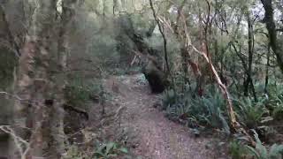
Photos of Gore Mountain Bike
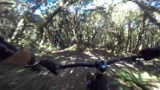
Videos of Gore Mountain Bike
trail: Jump Line
2:19 |
516 |
Sep 26, 2022 , Gore
trail: Royale with Cheese
947 |
Feb 7, 2016 , Gore

trail: Royale with Cheese
756 |
Feb 7, 2016 , Gore
Recent Trail Reports
| status | trail | date | condition | info | user |
|---|---|---|---|---|---|
| Link Trail | Jan 8, 2025 @ 8:06pm Jan 8, 2025 | Wet | nellyt123 | ||
| Pīwakawaka | Jan 8, 2025 @ 8:03pm Jan 8, 2025 | Variable | nellyt123 | ||
| Gravel Submarine | Mar 19, 2023 @ 12:12am Mar 19, 2023 | Dry | Russian659 | ||
| Hokonui Water Race Trail | Mar 19, 2023 @ 7:12am Mar 19, 2023 | Ideal | Russian659 | ||
| Lookout Trail | Dec 26, 2022 @ 2:40pm Dec 26, 2022 | Dry | Zoulours | ||
| Tāne-mahuta | Oct 7, 2022 @ 11:24am Oct 7, 2022 | Variable | Dori9393 | ||
| Jump Line | Nov 12, 2021 @ 7:18pm Nov 12, 2021 | Variable | Leaca380 | ||
| Royale with Cheese | Apr 17, 2018 @ 12:21am Apr 17, 2018 | Wet | muttongun |
Activity Feed
| username | action | type | title | date |
|---|---|---|---|---|
| the-claw | add | route | activity #97235315 and 1 more | Jun 17, 2026 @ 11:51pm Jun 17, 2026 |
| JohnRichardPotter | add | report | activity #89862277 | Mar 2, 2026 @ 3:09pm Mar 2, 2026 |
| IanJAm0G5 | wishlist | trail | activity #87115900 and 2 more | Jan 13, 2026 @ 2:10am Jan 13, 2026 |
| IanJAm0G5 | wishlist | trail | activity #87115849 | Jan 13, 2026 @ 2:08am Jan 13, 2026 |
| nellyt123 | comment | trail | activity #64296626 | Jan 8, 2025 @ 8:05pm Jan 8, 2025 |
Recent Comments
| username | type | title | comment | date |
|---|---|---|---|---|
| trail | Name is a bit of a misnomer ... look at the... | Jan 8, 2025 @ 8:05pm Jan 8, 2025 | ||
| report | Eh | Jun 24, 2020 @ 9:16am Jun 24, 2020 | ||
| trail | So good, what a gem. | May 2, 2020 @ 11:53pm May 2, 2020 | ||
| trail | Very slippery fun track, with 3 difficult... | Mar 12, 2020 @ 8:26pm Mar 12, 2020 | ||
| trail | A bit out of shape, but still really fun! I... | Mar 12, 2020 @ 8:25pm Mar 12, 2020 |
Local Badges
-

Epic Mountain Bike Climb 2k0 awarded -

Climbing 10k Badge2 awarded -

Mountain Biking 100k Badge0 awarded -

Epic Ride Descent 2k0 awarded -

Descent 10k Badge2 awarded -

Descent 100k Badge0 awarded
Bike & Skill Parks
| name | type | city | rating |
|---|---|---|---|
| Gore BMX Track | skill park | Gore | |
| Mataura Pump Track | skill park | Gore |
Activity Type Stats
| activitytype | trails | distance | descent | descent distance | total vertical | rating | global rank | state rank | photos | reports | routes | ridelogs |
|---|---|---|---|---|---|---|---|---|---|---|---|---|
| Mountain Bike | 12 | 8 miles | 2,103 ft | 4 miles | 1,348 ft | #4,225 | #67 | 244 | 196 | 2 | 2,358 | |
| E-Bike | 11 | 7 miles | 1,759 ft | 4 miles | 1,348 ft | #3,515 | #56 | 174 | 2 | 250 | ||
| Hike | 14 | 13 miles | 2,457 ft | 6 miles | 1,581 ft | #2,841 | #44 | 54 | 194 | 136 | ||
| Trail Running | 13 | 12 miles | 2,110 ft | 6 miles | 1,581 ft | #4,779 | #61 | 194 | 116 |
Frequently Asked Questions About Gore
▼
What are the best places to ride in Gore?
Gore has 2 areas to explore for mountain biking. The top rated areas are:
▼
What are the highest rated mountain biking trails in Gore?
The highest rated mountain biking trails in Gore are:
- Jump Line (4.2/5)
- Hokonui Water Race Trail (4.2/5)
- Pīwakawaka (4.1/5)
- Te Matara (4/5)
- Lookout Trail (4/5)
▼
What is the best time of the year to ride in Gore?
Based on ride log data, the most popular months to ride in Gore are:
- August (10 activities)
- April (9 activities)
- November (8 activities)
▼
Where can I park to ride in Gore?
There are 3 parking locations listed in Gore. The most popular parking spots are: View all parking and trailhead locations on the map to plan your visit.
Activities
Trails
- By muttongun
 & contributors
 - Admins: Alps2Ocean-Cycle-Trail, Hokonui MTB
- #9614 - 9,128 views
- gore activity log | embed map of Gore mountain bike trails | gore mountain biking points of interest
Downloading of trail gps tracks in kml & gpx formats is enabled for Gore.
You must login to download files.