close
-
Layers w
- Weather Layers
- Pro
- Pro
- Pro
- Pro
- Pro
- Pro
- More Layers
- Pro
- Pro
- Pro
- Pro
-
Upgrade to

3D
Trail Conditions
- Unknown
- Snow Groomed
- Snow Packed
- Snow Covered
- Snow Cover Partial
- Freeze/thaw Cycle
- Icy
- Prevalent Mud
- Wet
- Variable
- Ideal
- Dry
- Very Dry
Trail Flow (Ridden Direction)
Trailforks scans users ridelogs to determine the most popular direction each trail is ridden. A good flowing trail network will have most trails flowing in a single direction according to their intension.
The colour categories are based on what percentage of riders are riding a trail in its intended direction.
The colour categories are based on what percentage of riders are riding a trail in its intended direction.
- > 96%
- > 90%
- > 80%
- > 70%
- > 50%
- < 50%
- bi-directional trail
- no data
Trail Last Ridden
Trailforks scans ridelogs to determine the last time a trail was ridden.
- < 2 days
- < 1 week
- < 2 weeks
- < 1 month
- < 6 months
- > 6 months
Trail Ridden Direction
The intended direction a trail should be ridden.
- Downhill Only
- Downhill Primary
- Both Directions
- Uphill Primary
- Uphill Only
- One Direction
Contribute Details
Colors indicate trail is missing specified detail.
- Description
- Photos
- Description & Photos
- Videos
Trail Popularity ?
Trailforks scans ridelogs to determine which trails are ridden the most in the last 9 months.
Trails are compared with nearby trails in the same city region with a possible 25 colour shades.
Think of this as a heatmap, more rides = more kinetic energy = warmer colors.
- most popular
- popular
- less popular
- not popular
ATV/ORV/OHV Filter
Max Vehicle Width
inches
US Cell Coverage
Legend

Radar Time
Activity Recordings
Trailforks uses anonymized public activity data.
?
Activity Recordings
Trailforks uses anonymized public activity data.
?
Personal Heatmap
▶
Activity Types
all
/
none
▶
Options
2
Date range
month
–
Winter Trails
Warning
A routing network for winter maps does not exist. Selecting trails using the winter trails layer has been disabled.
Missing Trails
Most Popular
Least Popular
Trails are colored based on popularity. The more popular a trail is, the more red. Less popular trails trend towards green.
Jump Magnitude Heatmap
Heatmap of where riders jump on trails. Zoom in to see individual jumps, click circles to view jump details.
BC Backroad Status
![map legend]()
Service Road Atlas is a free to use, community-driven service for viewing and creating reports on the numerous back-country service roads around B.C. and Alberta.

Slope Aspect
Direction the slope faces
Trails Deemphasized
Trails are shown in grey.
Only show trails with no bike usage.
Suggested Layers
Based on selected activity type
Save the current map location and zoom level as your default home location whenever this page is loaded.
SaveThe Gore Trails are located in Gore, Nova Scotia on a 400 hectare block of farm land owned by Courthouse Hill Farm, one of the oldest farms in North America established in 1784. Gore is centrally located in Nova Scotia along the Rawdon Hills, half way between Truro and Windsor and 45 minutes north of Halifax. The area offers a diverse hilly terrain with lots of top soil and mature forests that create exciting conditions for mountain biking. Whether a beginner, intermediate or advanced rider, The Gore Trails offers a trail system designed for all skill levels and age groups.
A Trail Day Pass is $8 and can be purchased online. QR codes to purchase a pass are also posted at the event grounds / parking area.
A Trail Day Pass is $8 and can be purchased online. QR codes to purchase a pass are also posted at the event grounds / parking area.
Primary Trail Type: Cross-Country
eBikes Allowed:
Yes
AKA: Gore / Empire Trails
Land Status: Private Property
Land Manager: Gore Trails Association
 google parking directions
Links
Region Supporters & Maintainers
![]()
Gore Trails AssociationMaintainer
Activities Click to view
- Mountain Bike
44 trails
- E-Bike
48 trails
- Hike
41 trails
- Trail Running
39 trails
Region Details
- 4
- 11
- 14
- 5
Region Status
Open as of Jun 1, 2026Local Trail Association
Stats
- Avg Trail Rating
- Trails (view details)
- 34
- Trails Mountain Bike
- 50
- Trails E-Bike
- 48
- Trails Hike
- 41
- Trails Trail Running
- 39
- Trails ATV/ORV/OHV
- 3
- Total Distance
- 8 miles
- Total Descent Distance
- 4 miles
- Total Descent
- 813 ft
- Total Vertical
- 207 ft
- Highest Trailhead
- 353 ft
- Reports
- 915
- Photos
- 94
- Ridden Counter
- 5,711
Popular Gore Trails Mountain Biking Trails
• 90 ★ 5.0 • 2,336 ft • 10 ft • 434 •
Popular blue difficulty singletrack. This mountain bike primary trail can be used downhill primary and has a easy overall physical rating. On average it takes 3 minutes to complete this trail.
• 95 ★ 4.0 • 1,890 ft • 37 ft • 361 •
Popular blue difficulty singletrack. This mountain bike primary trail can be used uphill primary and has a moderate overall physical rating with a 37 ft blue climb. Trail visibility is always easy to follow. On average it takes 2 minutes to complete this trail.
• 30 ★ 3.4 • 1,033 ft • 0 ft • 297 •
Less popular black diamond difficulty singletrack. This mountain bike primary trail can be used downhill primary. On average it takes 1 minutes to complete this trail.
• 100 ★ 4.0 • 1,644 ft • 0 ft • 268 •
Popular blue difficulty singletrack. This mountain bike primary trail can be used downhill only. On average it takes 1 minutes to complete this trail.
• 80 ★ 4.4 • 2,772 ft • 2 ft • 255 •
The trails is a flowy and somewhat bermed downhill run. You'll still have to pedal, and there are no steep sections. This run will give you a workout and put a smile on your face at the same time. There are no difficult features on this...
• 65 ★ 4.0 • 1,821 ft • 5 ft • 239 •
Moderately popular green difficulty singletrack. This mountain bike primary trail can be used both directions. On average it takes 3 minutes to complete this trail.
• 75 ★ 3.4 • 748 ft • 6 ft • 224 •
Popular green difficulty doubletrack. This mountain bike primary trail can be used both directions and has a easy overall physical rating with a 6 ft green climb. On average it takes 2 minutes to complete this trail.
• 100 ★ 3.5 • 574 ft • 0 ft • 206 •
Popular blue difficulty singletrack. This mountain bike primary trail can be used both directions. On average it takes 2 minutes to complete this trail.
Gore Trails Mountain Bike Routes
4 miles • 386 ft • 14 •
7K tour loop through the trail system. Expect to cross bridges, riding roots and rocks, with some ups and...
2 miles • 181 ft • 7 • Loop •
Fast and flow route, getting in some smooth riding, containing some berms some roll able jumps, rocks and...
3 miles • 394 ft • 12 • Loop •
Some of the most difficult trails at Gore, start out with some berms and jumps followed by a tough rooty...
8 miles • 778 ft • 23 • Loop •
Tour de Gore Ride. Hit the most commonly used trails in the Gore network all in 1 ride.
1 mile • 24 ft • 5 • Loop •
Very Easy 2K Mountain Bike ride. Fairly flat with no difficult features. Some small roots, small rollers,...
• 21 miles • 2,185 ft • 75 •
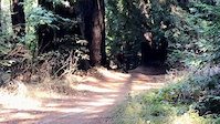
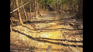
Photos of Gore Trails Mountain Bike
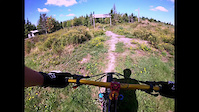
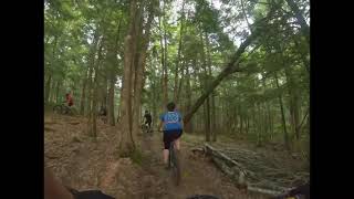
Videos of Gore Trails Mountain Bike
trail: Santa's Cruz
0:12 |
|
Nov 10, 2020
trail: Magic Carpet Ride
5:44 |
184 |
Nov 9, 2020

trail: Slick Rock
0:45 |
180 |
Sep 15, 2019

trail: Hurricane
103 |
Jun 23, 2024 , West Gore
trail: Ravine
0:54 |
488 |
May 27, 2022 , West Gore
4:45 |
438 |
Jun 30, 2021
Current Trail Warnings
| status | trail | date | condition | user | info |
|---|---|---|---|---|---|
| River Run | Jun 1, 2026 @ 12:26pm (America/Halifax) Jun 1, 2026 | Unknown | vwcabrio82 Gore Trails | Trail Closed until further notice - Trail... |
Recent Trail Reports
| status | trail | date | condition | info | user |
|---|---|---|---|---|---|
| AC-DC | May 2, 2026 @ 7:11pm (America/Halifax) May 2, 2026 | Ideal | vwcabrio82 Gore Trails | ||
| Ravine | Apr 26, 2026 @ 10:17am (America/Halifax) Apr 26, 2026 | Ideal | vwcabrio82 Gore Trails | ||
| Double D Drop Line | Apr 26, 2026 @ 10:17am (America/Halifax) Apr 26, 2026 | Ideal | vwcabrio82 Gore Trails | ||
| Metamorphosis | Apr 26, 2026 @ 10:17am (America/Halifax) Apr 26, 2026 | Ideal | vwcabrio82 Gore Trails | ||
| Passchendaele | Apr 26, 2026 @ 10:17am (America/Halifax) Apr 26, 2026 | Ideal | vwcabrio82 Gore Trails | ||
| Fever Flow | Apr 26, 2026 @ 10:17am (America/Halifax) Apr 26, 2026 | Ideal | vwcabrio82 Gore Trails | ||
| Up To Here | Apr 26, 2026 @ 10:17am (America/Halifax) Apr 26, 2026 | Ideal | vwcabrio82 Gore Trails | ||
| Bi-Hi | Apr 26, 2026 @ 10:17am (America/Halifax) Apr 26, 2026 | Ideal | vwcabrio82 Gore Trails | ||
| Up On Deuce | Apr 26, 2026 @ 10:17am (America/Halifax) Apr 26, 2026 | Ideal | vwcabrio82 Gore Trails | ||
| Do It Again | Apr 26, 2026 @ 10:17am (America/Halifax) Apr 26, 2026 | Ideal | vwcabrio82 Gore Trails |
Activity Feed
| username | action | type | title | date |
|---|---|---|---|---|
| vwcabrio82 | add | report | activity #96019190 | Jun 1, 2026 @ 8:27am Jun 1, 2026 |
| vwcabrio82 | comment | trail | activity #96019052 | Jun 1, 2026 @ 8:25am Jun 1, 2026 |
| NickdscPEj | wishlist | trail | activity #94966922 | May 18, 2026 @ 3:57am May 18, 2026 |
| vwcabrio82 | add | report | activity #93898411 | May 2, 2026 @ 3:13pm May 2, 2026 |
| vwcabrio82 | update | trail | activity #93897131 and 1 more | May 2, 2026 @ 2:58pm May 2, 2026 |
Recent Comments
| username | type | title | comment | date |
|---|---|---|---|---|
| trail | This Trail has been closed until further... | Jun 1, 2026 @ 8:25am Jun 1, 2026 | ||
| report | @bent6543: Thank You, I will keep that in mind... | Jun 18, 2023 @ 6:58am Jun 18, 2023 | ||
| report | @Zman11: you can make edits to reports you... | Jun 18, 2023 @ 6:16am Jun 18, 2023 | ||
| report | @bent6543: Thanks for correcting. I could not... | Jun 18, 2023 @ 5:35am Jun 18, 2023 | ||
| report | fixed! | Jun 17, 2023 @ 4:43pm Jun 17, 2023 |
Nearby Areas
| name | distance | ||||
|---|---|---|---|---|---|
| East Hants Wilderness | 7.8 km | ||||
| Renfrew Gold District | 10.4 km | ||||
| 9 Mile River | 4 | 2 | 10.9 km | ||
| Smileys Provincial Park | 5 | 13.9 km | |||
| Milford Community Center | 3 | 15.2 km |
Local Badges
-

Tour De Gore2 awarded -

Getting Started7 awarded -

Completionist1 awarded
Activity Type Stats
| activitytype | trails | distance | descent | descent distance | total vertical | rating | global rank | state rank | photos | reports | routes | ridelogs |
|---|---|---|---|---|---|---|---|---|---|---|---|---|
| Mountain Bike | 44 | 8 miles | 814 ft | 4 miles | 207 ft | #2,650 | #7 | 95 | 915 | 5 | 2,299 | |
| E-Bike | 48 | 8 miles | 781 ft | 4 miles | 207 ft | #5,018 | #15 | 879 | 1 | 59 | ||
| Hike | 41 | 7 miles | 502 ft | 3 miles | 207 ft | #9,947 | 874 | 1 | 26 | |||
| Trail Running | 39 | 6 miles | 436 ft | 2 miles | 177 ft | #9,508 | #35 | 874 | 22 | |||
| ATV/ORV/OHV | 3 | 2,940 ft | 131 ft | 72 | 1 |
Frequently Asked Questions About Gore Trails
▼
What are the highest rated mountain biking trails in Gore Trails?
The highest rated mountain biking trails in Gore Trails are:
- Hurricane (4.2/5)
- Slick Rock (4.2/5)
- Bi-Hi (4.2/5)
- Exodus (4.1/5)
- Green Road (4.1/5)
▼
What is the best time of the year to ride in Gore Trails?
Based on ride log data, the most popular months to ride in Gore Trails are:
- July (27 activities)
- June (27 activities)
- August (20 activities)
▼
Where can I park to ride in Gore Trails?
There are 1 parking locations listed in Gore Trails. The most popular parking spots are:
▼
What is the longest trail in Gore Trails?
The longest trail in Gore Trails is River Run at 1.1 km. View all trails sorted by distance.
Activities
Trails
- By vwcabrio82
 Gore Trails & contributors
 - Admins: Gore Trails
- #5307 - 16,514 views
- gore trails activity log | embed map of Gore Trails mountain bike trails | gore trails mountain biking points of interest polygons
Downloading of trail gps tracks in kml & gpx formats is enabled for Gore Trails.
You must login to download files.