close
-
Layers w
- Weather Layers
- Pro
- Pro
- Pro
- Pro
- Pro
- Pro
- More Layers
- Pro
- Pro
- Pro
- Pro
-
Upgrade to

3D
Trail Conditions
- Unknown
- Snow Groomed
- Snow Packed
- Snow Covered
- Snow Cover Partial
- Freeze/thaw Cycle
- Icy
- Prevalent Mud
- Wet
- Variable
- Ideal
- Dry
- Very Dry
Trail Flow (Ridden Direction)
Trailforks scans users ridelogs to determine the most popular direction each trail is ridden. A good flowing trail network will have most trails flowing in a single direction according to their intension.
The colour categories are based on what percentage of riders are riding a trail in its intended direction.
The colour categories are based on what percentage of riders are riding a trail in its intended direction.
- > 96%
- > 90%
- > 80%
- > 70%
- > 50%
- < 50%
- bi-directional trail
- no data
Trail Last Ridden
Trailforks scans ridelogs to determine the last time a trail was ridden.
- < 2 days
- < 1 week
- < 2 weeks
- < 1 month
- < 6 months
- > 6 months
Trail Ridden Direction
The intended direction a trail should be ridden.
- Downhill Only
- Downhill Primary
- Both Directions
- Uphill Primary
- Uphill Only
- One Direction
Contribute Details
Colors indicate trail is missing specified detail.
- Description
- Photos
- Description & Photos
- Videos
Trail Popularity ?
Trailforks scans ridelogs to determine which trails are ridden the most in the last 9 months.
Trails are compared with nearby trails in the same city region with a possible 25 colour shades.
Think of this as a heatmap, more rides = more kinetic energy = warmer colors.
- most popular
- popular
- less popular
- not popular
ATV/ORV/OHV Filter
Max Vehicle Width
inches
US Cell Coverage
Legend

Radar Time
Activity Recordings
Trailforks uses anonymized public activity data.
?
Activity Recordings
Trailforks uses anonymized public activity data.
?
Personal Heatmap
▶
Activity Types
all
/
none
▶
Options
2
Date range
month
–
Winter Trails
Warning
A routing network for winter maps does not exist. Selecting trails using the winter trails layer has been disabled.
Missing Trails
Most Popular
Least Popular
Trails are colored based on popularity. The more popular a trail is, the more red. Less popular trails trend towards green.
Jump Magnitude Heatmap
Heatmap of where riders jump on trails. Zoom in to see individual jumps, click circles to view jump details.
BC Backroad Status
![map legend]()
Service Road Atlas is a free to use, community-driven service for viewing and creating reports on the numerous back-country service roads around B.C. and Alberta.

Slope Aspect
Direction the slope faces
Trails Deemphasized
Trails are shown in grey.
Only show trails with no bike usage.
Suggested Layers
Based on selected activity type
Save the current map location and zoom level as your default home location whenever this page is loaded.
SaveThe region comprises the northwestern part of the Harz mountains. The Harz National Park is part of this district. The highest peak is the Wurmberg (971 m) near Braunlage, also being the highest elevation of Lower Saxony.
source: Wikipedia
This region uses the Uk/Euro style trail grading system.
Activities Click to view
- Mountain Bike
55 trails
- E-Bike
55 trails
- Adaptive Bike
0 trails
- Winter Fat Bike
0 trails
- Hike
23 trails
- Trail Running
23 trails
Region Details
- 4
- 7
- 23
- 6
- 7
Region Status
Open as of Apr 30, 2026Stats
- Avg Trail Rating
- Trails (view details)
- 47
- Trails Mountain Bike
- 55
- Trails E-Bike
- 55
- Trails Hike
- 23
- Trails Trail Running
- 23
- Total Distance
- 19 miles
- Total Descent
- 10,217 ft
- Total Vertical
- 2,495 ft
- Highest Trailhead
- 2,922 ft
- Reports
- 389
- Photos
- 21
- Ridden Counter
- 8,560
Sub Regions
-
Bikepark-Hahnenklee
- 1
- 9
- 5
- 7
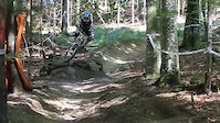
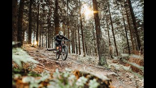
Popular Goslar Mountain Biking Trails
• 95 ★ 3.7 • 2,549 ft • 0 ft • 336 •
Flowtrail/Singeltrail in Hahnenklee, lot of berms and Tables and some Natural sections
• 100 ★ 4.4 • 994 ft • 0 ft • 332 •
middle part of flow trail. paved road with some obstacles on the left and on the right.
• 85 ★ 3.0 • 899 ft • 0 ft • 313 •
upper part of DH race, starts with a drop in to massive . you may cross back to freeride at the end
• 80 ★ 3.4 • 1,190 ft • 0 ft • 311 •
Lowest part of the Trails at Bocksberg. Mostly on the flowtrail level, second half is a little bumpy
• 90 ★ 4.0 • 722 ft • 0 ft • 281 •
A little extension to the flowtrail. You can ride the lower part much faster and with several jumps.
• 65 ★ 3.7 • 1,296 ft • 0 ft • 280 •
Middle section of the freeride trail, broad gravel road with jumps on the left and right, slightly larger obstacles.
• 55 ★ 4.0 • 1,490 ft • 0 ft • 275 •
2nd upper part of DH race, small trail filled with until the second drop in, followed by some technical cornering with smoother trails
• 60 ★ 4.0 • 1,014 ft • 3 ft • 272 •
The safer way down the iconic bridge, you can ride it as drop or drop in, Wood section ends with a rock garden
Photos of Goslar Mountain Bike
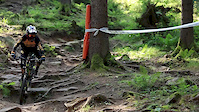
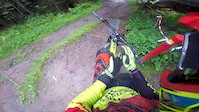
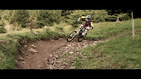
Videos of Goslar Mountain Bike
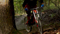
trail: Bock auf Wurzeln / Roots
2:55 |
203 |
Jan 28, 2017
trail: Bock auf Wurzeln / Roots
2:05 |
2239 |
Oct 22, 2015
trail: Bock auf Wurzeln / Roots
2:53 |
1789 |
Jul 7, 2015
trail: Bock auf Wurzeln / Roots
3:04 |
603 |
Jan 26, 2014
trail: Bock auf Wurzeln / Roots
3:40 |
2107 |
Mar 2, 2013
trail: Bock auf Wurzeln / Roots
0:16 |
393 |
Oct 3, 2011
trail: Bock auf Wurzeln / Roots
3:17 |
103 |
Mar 23, 2024 , Goslar
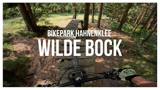
trail: Wilder Bock / ex North Shore
3:24 |
208 |
Jul 25, 2023 , Goslar
Recent Trail Reports
| status | trail | date | condition | info | user |
|---|---|---|---|---|---|
| Goldenke Trail | Oct 31, 2025 @ 2:56pm (Europe/Berlin) Oct 31, 2025 | Wet | CBHBXB | ||
| Rammelsberg-Trail | Sep 7, 2025 @ 3:44am Sep 7, 2025 | Unknown | colinridezmtb | ||
| DH middle Hahnenklee | Aug 25, 2025 @ 4:11pm Aug 25, 2025 | Dry | swsjht | ||
| DH upper Hahnenklee | Aug 25, 2025 @ 4:11pm Aug 25, 2025 | Dry | swsjht | ||
| Wildpig Enduro lower | Aug 16, 2025 @ 10:21am Aug 16, 2025 | Ideal | montogeek | ||
| Wildpig Enduro lower Middle | Aug 16, 2025 @ 10:21am Aug 16, 2025 | Ideal | montogeek | ||
| Wildpig Enduro upper middle | Aug 16, 2025 @ 10:21am Aug 16, 2025 | Ideal | montogeek | ||
| Hahnenklee DH Race Straight Jump | Aug 16, 2025 @ 10:21am Aug 16, 2025 | Ideal | montogeek | ||
| Bock auf Wurzeln / Roots | Aug 16, 2025 @ 10:21am Aug 16, 2025 | Ideal | montogeek | ||
| Hahnenklee lower Freeride to DH race | Aug 16, 2025 @ 10:21am Aug 16, 2025 | Ideal | montogeek |
Activity Feed
| username | action | type | title | date |
|---|---|---|---|---|
| HarzBikepark | add | directory | activity #96360796 | Jun 6, 2026 @ 5:50am Jun 6, 2026 |
| pauwa1 | comment | trail | activity #95785991 | May 29, 2026 @ 10:08am May 29, 2026 |
| pauwa1 | ridden | trail | activity #95785873 | May 29, 2026 @ 10:06am May 29, 2026 |
| Fcmfanswr | ridden | trail | activity #95417815 | May 24, 2026 @ 9:21am May 24, 2026 |
| mark740 | wishlist | trail | activity #94238149 | May 7, 2026 @ 1:25pm May 7, 2026 |
Recent Comments
| username | type | title | comment | date |
|---|---|---|---|---|
| trail | Park close at 17.30 pm | May 29, 2026 @ 10:08am May 29, 2026 | ||
| trail | War sehr cool, doch etwas sktechy durch den... | Nov 9, 2025 @ 10:03pm Nov 9, 2025 | ||
| trail | Momentan (Juni 25) ist der Trail nicht zu... | Jun 20, 2025 @ 8:47am Jun 20, 2025 | ||
| trail | Lower end seems to be overgrown. I couldnt... | Jun 15, 2025 @ 7:44am Jun 15, 2025 | ||
| trail | Awesome DH-ish trail, with offcamber stuff,... | Oct 25, 2024 @ 10:39am Oct 25, 2024 |
Local Badges
-

10 Blue Trails105 awarded -

10 Black Trails60 awarded -

Epic Ride Climb 2k123 awarded -

Climbing 10k Badge26 awarded -

Climbing 100k Badge0 awarded -

Epic Ride Descent 2k182 awarded
Bike & Skill Parks
| name | type | city | rating |
|---|---|---|---|
| Bikepark-Hahnenklee | bike park | Goslar | |
| Kinderpumptrack | skill park | Goslar |
Activity Type Stats
| activitytype | trails | distance | descent | descent distance | total vertical | rating | global rank | state rank | photos | reports | routes | ridelogs |
|---|---|---|---|---|---|---|---|---|---|---|---|---|
| Mountain Bike | 55 | 19 miles | 10,217 ft | 17 miles | 2,493 ft | #2,347 | #23 | 21 | 389 | 2,099 | ||
| E-Bike | 55 | 19 miles | 10,217 ft | 17 miles | 2,493 ft | #3,010 | #59 | 371 | 219 | |||
| Hike | 23 | 13 miles | 6,020 ft | 11 miles | 2,493 ft | #5,104 | #49 | 349 | 247 | |||
| Trail Running | 23 | 13 miles | 6,020 ft | 11 miles | 2,493 ft | #4,598 | #47 | 349 | 29 |
Frequently Asked Questions About Goslar
▼
What are the best places to ride in Goslar?
Goslar has 1 areas to explore for mountain biking. The top rated areas are:
▼
What are the highest rated mountain biking trails in Goslar?
The highest rated mountain biking trails in Goslar are:
- Maltermeisterturm-Trail (4.3/5)
- DH middle Hahnenklee (4.3/5)
- Wildpig Enduro upper (4.3/5)
- Steile-Wand-Trail (4.2/5)
- Wolfswarter-Fußweg-Trail (4.2/5)
▼
What is the best time of the year to ride in Goslar?
Based on ride log data, the most popular months to ride in Goslar are:
- October (31 activities)
- August (27 activities)
- June (23 activities)
▼
Where can I park to ride in Goslar?
There are 2 parking locations listed in Goslar. The most popular parking spots are:
Activities
Trails
Points of Interest
- By traukainehm & contributors
- Admins: apply
- #20745 - 4,559 views
- goslar activity log | embed map of Goslar mountain bike trails | goslar mountain biking points of interest
Downloading of trail gps tracks in kml & gpx formats is enabled for Goslar.
You must login to download files.