close
-
Layers w
- Weather Layers
- Pro
- Pro
- Pro
- Pro
- Pro
- Pro
- More Layers
- Pro
- Pro
- Pro
- Pro
-
Upgrade to

3D
Trail Conditions
- Unknown
- Snow Groomed
- Snow Packed
- Snow Covered
- Snow Cover Partial
- Freeze/thaw Cycle
- Icy
- Prevalent Mud
- Wet
- Variable
- Ideal
- Dry
- Very Dry
Trail Flow (Ridden Direction)
Trailforks scans users ridelogs to determine the most popular direction each trail is ridden. A good flowing trail network will have most trails flowing in a single direction according to their intension.
The colour categories are based on what percentage of riders are riding a trail in its intended direction.
The colour categories are based on what percentage of riders are riding a trail in its intended direction.
- > 96%
- > 90%
- > 80%
- > 70%
- > 50%
- < 50%
- bi-directional trail
- no data
Trail Last Ridden
Trailforks scans ridelogs to determine the last time a trail was ridden.
- < 2 days
- < 1 week
- < 2 weeks
- < 1 month
- < 6 months
- > 6 months
Trail Ridden Direction
The intended direction a trail should be ridden.
- Downhill Only
- Downhill Primary
- Both Directions
- Uphill Primary
- Uphill Only
- One Direction
Contribute Details
Colors indicate trail is missing specified detail.
- Description
- Photos
- Description & Photos
- Videos
Trail Popularity ?
Trailforks scans ridelogs to determine which trails are ridden the most in the last 9 months.
Trails are compared with nearby trails in the same city region with a possible 25 colour shades.
Think of this as a heatmap, more rides = more kinetic energy = warmer colors.
- most popular
- popular
- less popular
- not popular
ATV/ORV/OHV Filter
Max Vehicle Width
inches
US Cell Coverage
Legend

Radar Time
Activity Recordings
Trailforks uses anonymized public activity data.
?
Activity Recordings
Trailforks uses anonymized public activity data.
?
Personal Heatmap
▶
Activity Types
all
/
none
▶
Options
2
Date range
month
–
Winter Trails
Warning
A routing network for winter maps does not exist. Selecting trails using the winter trails layer has been disabled.
Missing Trails
Most Popular
Least Popular
Trails are colored based on popularity. The more popular a trail is, the more red. Less popular trails trend towards green.
Jump Magnitude Heatmap
Heatmap of where riders jump on trails. Zoom in to see individual jumps, click circles to view jump details.
BC Backroad Status
![map legend]()
Service Road Atlas is a free to use, community-driven service for viewing and creating reports on the numerous back-country service roads around B.C. and Alberta.

Slope Aspect
Direction the slope faces
Trails Deemphasized
Trails are shown in grey.
Only show trails with no bike usage.
Suggested Layers
Based on selected activity type
Save the current map location and zoom level as your default home location whenever this page is loaded.
Save
No description for Gothic has been added yet!
Login or register to submit one.
 google parking directions
Primary Trail Type: All-Mountain & Downhill
google parking directions Activities Click to view
- Mountain Bike
14 trails
- Hike
19 trails
- Trail Running
19 trails
Region Details
- 1
- 10
- 1
Region Status
Open as of Jun 11, 2026Stats
- Avg Trail Rating
- Trails (view details)
- 12
- Trails Mountain Bike
- 14
- Trails Horse
- 3
- Trails Hike
- 19
- Trails Trail Running
- 19
- Total Distance
- 18 miles
- Total Descent Distance
- 10 miles
- Total Descent
- 4,426 ft
- Total Vertical
- 1,886 ft
- Highest Trailhead
- 11,385 ft
- Reports
- 196
- Photos
- 264
- Ridden Counter
- 6,335
Popular Gothic Mountain Biking Trails
• 100 ★ 4.6 • 8 miles • 1,202 ft • 3,368 •
Dirt road climb to top of pass, and single track becky clive to top of 401 and great descend into gothic valley.
• 95 ★ 4.0 • 3,999 ft • 29 ft • 1,278 •
Great cross country route that winds through aspens. Seasonal closure, usually late August.
• 85 ★ 4.5 • 4 miles • 506 ft • 977 •
Highly rated popular black diamond difficulty singletrack. This multi-use trail can be used downhill primary and has a hard overall physical rating with a 506 ft black diamond climb. Exposure: Normal Injury Risk. Trail visibility is always easy to follow. On average it takes 50 minutes to complete this trail.
• 90 ★ 4.4 • 4,114 ft • 248 ft • 773 •
Easy way and singletrack way to get to beginning of . Switches in meadow of flowers and then aspens to intersect Road.
• 95 ★ 0.0 • 2 miles • 423 ft • 282 •
Popular blue difficulty singletrack. This mountain bike primary trail can be used both directions and has a moderate overall physical rating with a 423 ft blue climb.
• 90 ★ 0.0 • 1,598 ft • 55 ft • 203 •
Popular blue difficulty singletrack. This mountain bike primary trail can be used uphill primary and has a moderate overall physical rating with a 55 ft blue climb.
• 80 ★ 0.0 • 1,368 ft • 75 ft • 125 •
Popular blue difficulty singletrack. This mountain bike primary trail can be used uphill primary and has a moderate overall physical rating with a 75 ft blue climb.
Gothic Mountain Bike Routes
★ 4.0 • 14 miles • 2,283 ft • 1 •
Trail Riders 401 trail is Crested Butte's most famous trail for good reason. Lots of intermediate mountain...
22 miles • 2,961 ft • 2 • Point to Point •
Start at 403 on the Washington Gulch side, go up the groovy new singletrack start that CBMBA re-routed in...
11 miles • 2,290 ft • 1 •
★ 5.0 • 2 miles • 459 ft • 2 •
8 miles • 1,152 ft • 1 • Point to Point •
Local Tip: easily gets the most hype of any trail in Crested Butte—and it’s worthy. This trail has it...
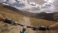
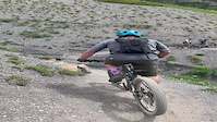
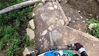
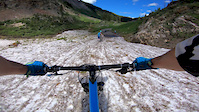
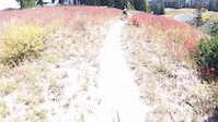
Photos of Gothic Mountain Bike
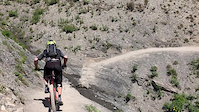
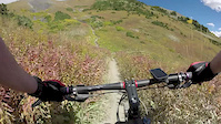
Videos of Gothic Mountain Bike
trail: Trail 401
0:08 |
58 |
Aug 14, 2022
trail: Trail 401
0:31 |
89 |
Jul 22, 2022
trail: Trail 401
0:08 |
111 |
Jan 29, 2021
trail: Trail 401
0:00 |
146 |
Aug 6, 2019
trail: Trail 401
14:20 |
41 |
Sep 27, 2018
trail: Trail 401
0:13 |
208 |
Aug 30, 2017

trail: Snodgrass
3:47 |
104 |
Jul 18, 2017
trail: Trail 401
5:40 |
231 |
Nov 19, 2016
Recent Trail Reports
| status | trail | date | condition | info | user |
|---|---|---|---|---|---|
| Trail 401 | Jun 11, 2026 @ 1:07pm (America/Denver) Jun 11, 2026 | Unknown | kkwhitson | ||
| Snodgrass | Jul 30, 2025 @ 11:16am Jul 30, 2025 | Very Dry | jacobdko | ||
| Snodgrass | Jul 30, 2025 @ 11:16am Jul 30, 2025 | Very Dry | jacobdko | ||
| Snodgrass 2 | Jul 30, 2025 @ 11:16am Jul 30, 2025 | Very Dry | jacobdko | ||
| Teddy's Trail | Jul 30, 2025 @ 11:16am Jul 30, 2025 | Very Dry | jacobdko | ||
| Teddy's Trail | Jul 30, 2025 @ 11:16am Jul 30, 2025 | Very Dry | jacobdko | ||
| Teddy's Trail | Jul 24, 2025 @ 11:35am Jul 24, 2025 | Dry | jacobdko | ||
| Snodgrass Mtn Connect | Jul 9, 2025 @ 8:25am Jul 9, 2025 | Dry | jacobdko | ||
| Trail 403 | Jul 5, 2025 @ 11:14am Jul 5, 2025 | Dry | jacobdko | ||
| Snodgrass Mtn (317) | Sep 3, 2024 @ 9:16am Sep 3, 2024 | Snow Covered | dave-cbmba CBMBA |
Activity Feed
| username | action | type | title | date |
|---|---|---|---|---|
| waltman45 | wishlist | trail | activity #97209352 | Jun 17, 2026 @ 2:22pm 13 hours |
| Aaronz37Nu4 | wishlist | route | activity #96962899 | Jun 14, 2026 @ 6:42am Jun 14, 2026 |
| Aureate | wishlist | trail | activity #96885057 | Jun 13, 2026 @ 9:07am Jun 13, 2026 |
| Tnbikerboy | wishlist | route | activity #96821943 | Jun 12, 2026 @ 12:35pm Jun 12, 2026 |
| Davidx5pJeT | wishlist | trail | activity #96782161 | Jun 11, 2026 @ 8:33pm Jun 11, 2026 |
Recent Comments
| username | type | title | comment | date |
|---|---|---|---|---|
| trail | Any thoughts on opening this year with the low... | May 5, 2026 @ 6:46pm May 5, 2026 | ||
| trail | where did you find a shuttle? | Jun 15, 2025 @ 7:41pm Jun 15, 2025 | ||
| trail | Anyone know the snow levels for 401 (early... | Jun 4, 2025 @ 10:49am Jun 4, 2025 | ||
| trail | Is this trail doable on a rigid xc bike? | Dec 7, 2024 @ 11:05pm Dec 7, 2024 | ||
| trail | Hey all - I’m in CB this week and planning... | Sep 17, 2024 @ 2:54pm Sep 17, 2024 |
Nearby Areas
| name | distance | ||||
|---|---|---|---|---|---|
| Crested Butte Town Trails | 12 | 8 | 9 | 6.7 km | |
| Crested Butte Mountain Bike Park | 11 | 13 | 7 | 3 | 7.1 km |
| Kebler Pass | 3 | 11 | 5 | 9.1 km | |
| Brush Creek | 8 | 10 | 10 km | ||
| Maroon Bells - Snowmass Wilderness Area | 10.1 km |
Activity Type Stats
| activitytype | trails | distance | descent | descent distance | total vertical | rating | global rank | state rank | photos | reports | routes | ridelogs |
|---|---|---|---|---|---|---|---|---|---|---|---|---|
| Mountain Bike | 14 | 18 miles | 4,426 ft | 10 miles | 1,886 ft | #4,540 | #1,606 | 259 | 196 | 12 | 3,468 | |
| Horse | 3 | 36 | 1 | |||||||||
| Hike | 19 | 17 miles | 4,426 ft | 10 miles | 1,886 ft | #6,828 | #2,483 | 198 | 9 | 573 | ||
| Trail Running | 19 | 17 miles | 4,426 ft | 10 miles | 1,886 ft | #6,955 | #2,274 | 1 | 198 | 9 | 91 |
Frequently Asked Questions About Gothic
▼
What are the highest rated mountain biking trails in Gothic?
The highest rated mountain biking trails in Gothic are:
- Trail 401 (4.5/5)
- Trail 403 (4.4/5)
- Snodgrass (4.2/5)
- Teddy's Trail (4.1/5)
- Snodgrass (0/5)
▼
What is the best time of the year to ride in Gothic?
Based on ride log data, the most popular months to ride in Gothic are:
- July (88 activities)
- August (43 activities)
- September (38 activities)
▼
Where can I park to ride in Gothic?
There are 5 parking locations listed in Gothic. The most popular parking spots are: View all parking and trailhead locations on the map to plan your visit.
▼
What is the longest trail in Gothic?
The longest trail in Gothic is Trail 401 at 8.1 miles. View all trails sorted by distance.
Trails
Points of Interest
- By cmcquade
 & contributors
 - Admins: CBMBA, BigMtnEnduro, dave-cbmba, teocalliridge, CBMtnBike
- #31582 - 3,391 views
- gothic activity log | embed map of Gothic mountain bike trails | gothic mountain biking points of interest polygons
Downloading of trail gps tracks in kml & gpx formats is enabled for Gothic.
You must login to download files.